| ||||||||||||||
| Hampshire County, Massachusetts | ||
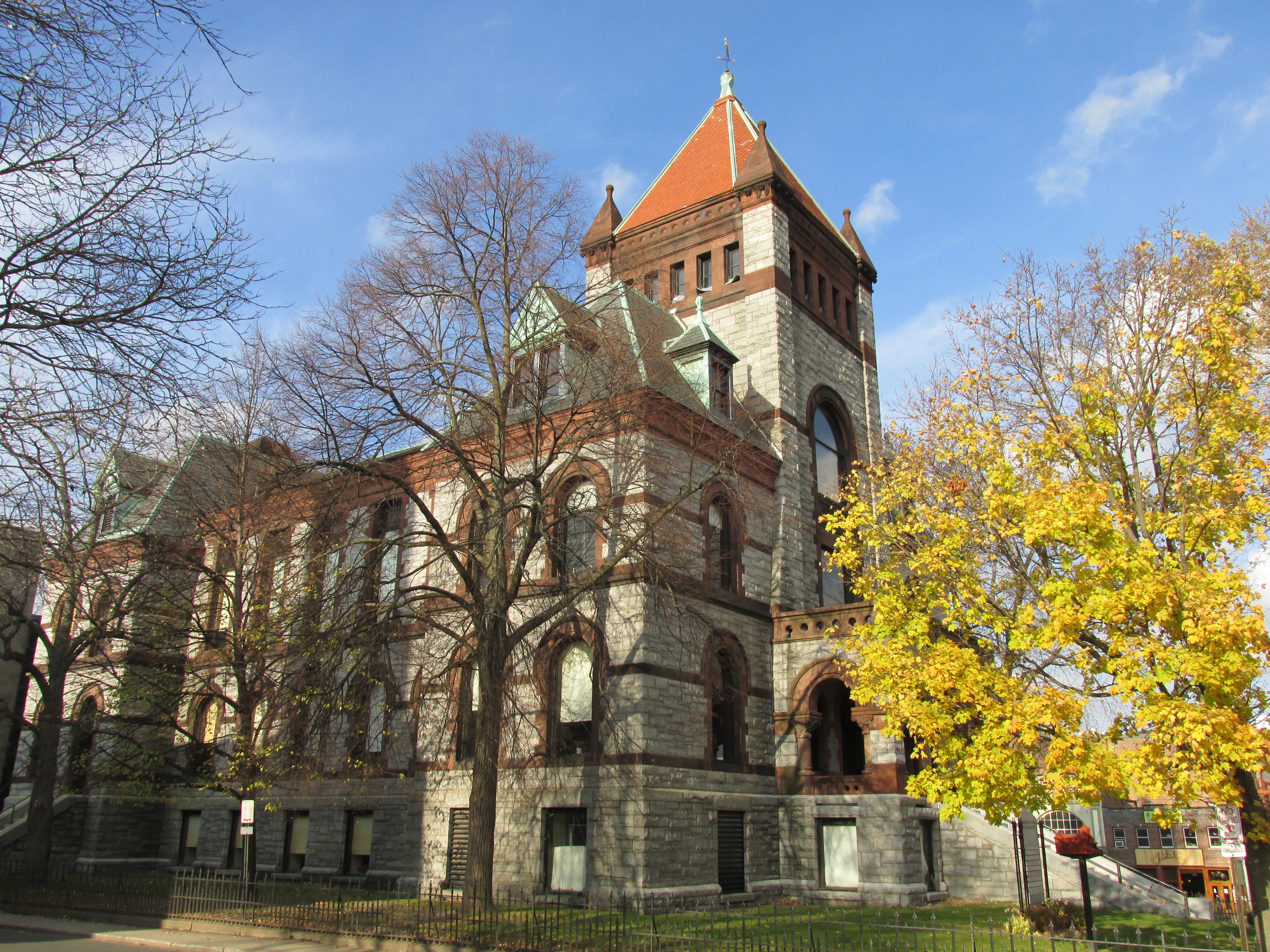 Old Hampshire County Courthouse
| ||
| ||
 Location in the state of Massachusetts | ||
 Massachusetts's location in the U.S. | ||
| Founded | 1662 | |
|---|---|---|
| Named for | Hampshire, England | |
| Seat | Northampton | |
| Largest town | Amherst | |
| Area - Total - Land - Water |
545 sq mi (1,412 km²) 527 sq mi (1,365 km²) 18 sq mi (47 km²), 3.3% | |
| Population - (2020) - Density |
162,308 308.0/sq mi (119/km²) | |
| Congressional districts | 1st, 2nd | |
| Time zone | Eastern: UTC-5/-4 | |
| Website | www.hampshirecog.org | |

Hampshire County is a historical and judicial county located in the U.S. state of Massachusetts. Following the dissolution of the county government in 1999, county affairs were managed by the Hampshire Council of Governments, which itself ceased operations in 2019, due to a "fundamentally flawed, unsustainable operational model".[1] As of the 2020 census, the population was 162,308.[2] Its most populous municipality is Amherst, its largest town in terms of landmass is Belchertown, and its traditional county seat is Northampton.[3] The county is named after the county Hampshire, in England.[4]
Hampshire County is part of the Springfield, MA Metropolitan Statistical Area.
Together with Hampden County, Hampshire County municipalities belong to the Pioneer Valley Planning Commission.[5]
History[]
Hampshire County was constituted in 1662 from previously unorganized territory comprising the entire western part of Massachusetts Bay Colony. It included the original towns of Springfield, Northampton, and Hadley. The original Hampshire County also included territory that is now in modern-day Hampden County, Franklin County, and Berkshire County, as well as small parts of modern-day Worcester County. By 1683, three new towns (Westfield (now Southwick), Suffield, and Enfield) had been incorporated south of Springfield. These towns were partly or wholly in the modern state of Connecticut at the time of their incorporation and resulted in a border dispute between the Connecticut Colony and Massachusetts Bay Colony.
In 1731, Worcester County was created, which included the original town of Brookfield (incorporated in 1718 as part of Hampshire County). More territory was lost to Worcester County in 1742 when the town of Western (now Warren) was created and added to Worcester County. Further territorial losses occurred in 1749 when the towns of Enfield, Somers (split off from Enfield in 1734), and Suffield unilaterally joined Connecticut Colony. In 1761, Berkshire County was created resulting in even more territorial loss for Hampshire County. In 1811, Franklin County was split off from the northern part of Hampshire, and in the following year, Hampden County was split off from the southern part of Hampshire.
The county government was abolished by the state in 1999 with a Hampshire Council of Governments formed in its place. With no inherent source of income, given liabilities and no regional planning function, the Council of Governments ceased operations in 2019.[5]
Politics[]
| Year | Republican | Democratic | Third party | |||
|---|---|---|---|---|---|---|
| No. | % | No. | % | No. | % | |
| 2020 | 22,281 | 25.36% | 63,362 | 72.12% | 2,211 | 2.52% |
| 2016 | 21,790 | 25.88% | 55,367 | 65.76% | 7,036 | 8.36% |
| 2012 | 21,480 | 26.32% | 57,359 | 70.27% | 2,782 | 3.41% |
| 2008 | 20,618 | 25.91% | 56,869 | 71.47% | 2,083 | 2.62% |
| 2004 | 21,315 | 28.64% | 51,680 | 69.44% | 1,427 | 1.92% |
| 2000 | 19,202 | 27.98% | 38,543 | 56.16% | 10,881 | 15.86% |
| 1996 | 14,787 | 22.64% | 41,844 | 64.07% | 8,678 | 13.29% |
| 1992 | 15,694 | 22.40% | 37,879 | 54.06% | 16,498 | 23.54% |
| 1988 | 24,331 | 37.48% | 39,834 | 61.36% | 750 | 1.16% |
| 1984 | 28,111 | 43.96% | 35,597 | 55.67% | 234 | 0.37% |
| 1980 | 21,117 | 34.99% | 27,611 | 45.75% | 11,627 | 19.26% |
| 1976 | 22,219 | 36.99% | 34,947 | 58.17% | 2,909 | 4.84% |
| 1972 | 24,529 | 45.72% | 28,572 | 53.25% | 553 | 1.03% |
| 1968 | 16,270 | 35.83% | 26,666 | 58.72% | 2,476 | 5.45% |
| 1964 | 11,385 | 26.09% | 32,058 | 73.45% | 202 | 0.46% |
| 1960 | 19,346 | 42.90% | 25,667 | 56.92% | 83 | 0.18% |
| 1956 | 26,361 | 61.93% | 16,119 | 37.87% | 84 | 0.20% |
| 1952 | 24,141 | 58.19% | 17,247 | 41.57% | 98 | 0.24% |
| 1948 | 17,331 | 48.37% | 18,012 | 50.27% | 490 | 1.37% |
| 1944 | 14,907 | 45.62% | 17,676 | 54.09% | 97 | 0.30% |
| 1940 | 15,651 | 46.42% | 17,823 | 52.86% | 241 | 0.71% |
| 1936 | 14,012 | 45.34% | 15,412 | 49.87% | 1,482 | 4.80% |
| 1932 | 13,241 | 49.28% | 12,332 | 45.90% | 1,296 | 4.82% |
| 1928 | 14,101 | 52.13% | 12,695 | 46.93% | 255 | 0.94% |
| 1924 | 13,918 | 66.23% | 5,037 | 23.97% | 2,059 | 9.80% |
| 1920 | 13,174 | 70.10% | 5,305 | 28.23% | 314 | 1.67% |
| 1916 | 5,748 | 56.15% | 4,202 | 41.05% | 286 | 2.79% |
| 1912 | 4,512 | 46.84% | 3,088 | 32.06% | 2,032 | 21.10% |
| 1908 | 5,362 | 60.97% | 2,612 | 29.70% | 821 | 9.33% |
| 1904 | 5,892 | 68.25% | 2,292 | 26.55% | 449 | 5.20% |
| 1900 | 5,550 | 66.71% | 2,392 | 28.75% | 377 | 4.53% |
| 1896 | 6,434 | 76.39% | 1,608 | 19.09% | 381 | 4.52% |
| 1892 | 4,887 | 54.61% | 3,678 | 41.10% | 384 | 4.29% |
| 1888 | 4,731 | 55.93% | 3,403 | 40.23% | 325 | 3.84% |
| 1884 | 4,013 | 53.99% | 2,730 | 36.73% | 690 | 9.28% |
| 1880 | 5,025 | 69.91% | 2,042 | 28.41% | 121 | 1.68% |
| 1876 | 5,020 | 66.68% | 2,507 | 33.30% | 2 | 0.03% |
Geography[]
According to the U.S. Census Bureau, the county has a total area of 545 square miles (1,410 km2), of which 527 square miles (1,360 km2) is land and 18 square miles (47 km2) (3.3%) is water.[7]
Hampshire County is the middle section of the Pioneer Valley, and the northern tip of the Hartford–Springfield Knowledge Corridor.
Adjacent counties[]
Hampshire County is the only county in Massachusetts surrounded in all directions by other counties of Massachusetts: all other counties in the state are adjacent to at least one other state or the open ocean.
- Franklin County (north)
- Worcester County (east)
- Hampden County (south)
- Berkshire County (west)
Demographics[]
| Historical populations | |||
|---|---|---|---|
| Census | Pop. | %± | |
| 1790 | 59,656 | ||
| 1800 | 72,432 | 21.4% | |
| 1810 | 76,275 | 5.3% | |
| 1820 | 26,487 | −65.3% | |
| 1830 | 30,254 | 14.2% | |
| 1840 | 30,897 | 2.1% | |
| 1850 | 35,732 | 15.6% | |
| 1860 | 37,823 | 5.9% | |
| 1870 | 44,388 | 17.4% | |
| 1880 | 47,232 | 6.4% | |
| 1890 | 51,859 | 9.8% | |
| 1900 | 58,820 | 13.4% | |
| 1910 | 63,327 | 7.7% | |
| 1920 | 69,599 | 9.9% | |
| 1930 | 72,801 | 4.6% | |
| 1940 | 72,461 | −0.5% | |
| 1950 | 87,594 | 20.9% | |
| 1960 | 103,229 | 17.8% | |
| 1970 | 123,981 | 20.1% | |
| 1980 | 138,813 | 12.0% | |
| 1990 | 146,568 | 5.6% | |
| 2000 | 152,251 | 3.9% | |
| 2010 | 158,080 | 3.8% | |
| U.S. Decennial Census[8] 1790–1960[9] 1900–1990[10] 1990–2000[11] 2010–2020[12] | |||
2000 census[]
At the 2000 census there were 152,251 people, 55,991 households, and 33,818 families living in the county. The population density was 288 people per square mile (111/km2). There were 58,644 housing units at an average density of 111 per square mile (43/km2). The racial makeup of the county was 91.10% White, 1.96% Black or African American, 0.19% Native American, 3.40% Asian, 0.05% Pacific Islander, 1.50% from other races, and 1.80% from two or more races. 3.42% of the population were Hispanic or Latino of any race. 14.7% were of Irish, 12.8% Polish, 9.6% English, 9.5% French, 8.5% French Canadian, 6.9% Italian and 6.4% German ancestry, 88.8% spoke English, 3.4% Spanish, 1.7% French and 1.4% Polish as their first language.[13] Of the 55,991 households 28.20% had children under the age of 18 living with them, 47.40% were married couples living together, 9.80% had a female householder with no husband present, and 39.60% were non-families. 28.60% of households were one person and 10.20% were one person aged 65 or older. The average household size was 2.39 and the average family size was 2.96.
The age distribution was 19.60% under the age of 18, 19.30% from 18 to 24, 26.80% from 25 to 44, 22.20% from 45 to 64, and 12.00% 65 or older. The median age was 34 years. For every 100 females, there were 87.40 males. For every 100 females age 18 and over, there were 83.90 males.
The median household income was $46,098 and the median family income was $57,480. Males had a median income of $39,327 versus $30,362 for females. The per capita income for the county was $21,685. About 5.10% of families and 9.40% of the population were below the poverty line, including 8.20% of those under age 18 and 6.70% of those age 65 or over.
2010 census[]
At the 2010 census, there were 158,080 people, 58,702 households, and 34,480 families living in the county.[14] The population density was 299.8 inhabitants per square mile (115.8 /km2). There were 62,603 housing units at an average density of 118.7 per square mile (45.8 /km2).[15] The racial makeup of the county was 88.7% white, 4.5% Asian, 2.5% black or African American, 0.2% American Indian, 1.5% from other races, and 2.5% from two or more races. Those of Hispanic or Latino origin made up 4.7% of the population.[14] The largest ancestry groups were:[16]
- 22.2% Irish
- 14.4% French
- 14.3% Polish
- 14.2% English
- 10.8% German
- 9.1% Italian
- 7.1% French Canadian
- 3.2% Scottish
- 2.6% American
- 2.3% Puerto Rican
- 2.3% Scotch-Irish
- 2.1% Russian
- 1.7% Chinese
- 1.5% Swedish
- 1.4% Portuguese
- 1.0% Lithuanian
- 1.0% Dutch
Of the 58,702 households, 26.4% had children under the age of 18 living with them, 44.8% were married couples living together, 10.3% had a female householder with no husband present, 41.3% were non-families, and 29.7% of households were made up of individuals. The average household size was 2.34 and the average family size was 2.89. The median age was 36.6 years.[14]
The median household income was $59,505 and the median family income was $80,891. Males had a median income of $52,686 versus $43,219 for females. The per capita income for the county was $28,367. About 6.2% of families and 11.7% of the population were below the poverty line, including 11.8% of those under age 18 and 7.8% of those age 65 or over.[17]
Demographic breakdown by town[]
Income[]
The ranking of unincorporated communities that are included on the list are reflective if the census designated locations and villages were included as cities or towns. Data is from the 2007–2011 American Community Survey 5-Year Estimates.[18][19][20]
| Rank | Town | Per capita income |
Median household income |
Median family income |
Population | Number of households | |
|---|---|---|---|---|---|---|---|
| 1 | Pelham | Town | $50,367 | $83,667 | $97,875 | 1,290 | 556 |
| 2 | Williamsburg | Town | $35,500 | $62,851 | $86,136 | 2,543 | 1,158 |
| Hatfield | CDP | $35,150 | $62,212 | $93,750 | 1,390 | 665 | |
| Massachusetts | State | $35,051 | $65,981 | $83,371 | 6,512,227 | 2,522,409 | |
| 3 | Westhampton | Town | $34,337 | $82,759 | $88,500 | 1,590 | 632 |
| Granby | CDP | $33,819 | $77,292 | $87,132 | 1,415 | 598 | |
| 4 | Hatfield | Town | $33,452 | $53,485 | $80,833 | 3,272 | 1,560 |
| 5 | Worthington | Town | $33,360 | $64,063 | $75,417 | 1,181 | 532 |
| 6 | Northampton | City | $33,175 | $54,413 | $77,998 | 28,621 | 11,853 |
| 7 | Belchertown | Town | $32,898 | $75,502 | $94,232 | 14,479 | 5,605 |
| 8 | Goshen | Town | $32,734 | $77,917 | $76,667 | 1,121 | 443 |
| 9 | Southampton | Town | $32,548 | $76,396 | $85,521 | 5,758 | 2,261 |
| 10 | Chesterfield | Town | $31,730 | $59,063 | $69,766 | 1,043 | 469 |
| 11 | Hadley | Town | $31,727 | $75,313 | $86,106 | 5,209 | 2,048 |
| 12 | Granby | Town | $31,409 | $70,362 | $82,684 | 6,232 | 2,619 |
| 13 | Middlefield | Town | $31,110 | $58,958 | $78,281 | 431 | 190 |
| 14 | Easthampton | City | $30,894 | $53,185 | $78,166 | 16,051 | 7,458 |
| 15 | Huntington | Town | $29,245 | $55,917 | $73,438 | 2,219 | 933 |
| 16 | Cummington | Town | $29,225 | $58,750 | $67,143 | 1,046 | 430 |
| Hampshire County | County | $29,113 | $60,331 | $82,999 | 157,630 | 58,921 | |
| 17 | South Hadley | Town | $29,067 | $62,532 | $80,794 | 17,493 | 6,787 |
| United States | Country | $27,915 | $52,762 | $64,293 | 306,603,772 | 114,761,359 | |
| 18 | Plainfield | Town | $27,758 | $61,719 | $66,250 | 589 | 247 |
| Belchertown | CDP | $27,133 | $47,863 | $79,135 | 2,557 | 1,160 | |
| 19 | Ware | Town | $26,910 | $50,712 | $66,287 | 9,851 | 4,369 |
| South Amherst | CDP | $23,823 | $61,250 | $95,625 | 4,760 | 1,435 | |
| Ware | CDP | $22,088 | $37,040 | $51,193 | 6,003 | 2,771 | |
| Huntington | CDP | $21,374 | $40,486 | $54,375 | 937 | 423 | |
| 20 | Amherst | Town | $21,049 | $52,281 | $100,304 | 37,611 | 8,771 |
| North Amherst | CDP | $17,167 | $33,093 | $84,083 | 7,114 | 1,953 | |
| Amherst Center | CDP | $14,017 | $44,604 | $99,087 | 19,347 | 2,715 |
Education[]
Hampshire County is notable for the presence within its borders of the "Five Colleges", comprising the University of Massachusetts flagship campus and four well-known private colleges:
- Amherst College, Amherst
- Hampshire College, Amherst
- Mount Holyoke College, South Hadley
- Smith College, Northampton
- University of Massachusetts Amherst
The Five College Consortium provides course cross-registration between the schools and funds free bus service, provided by Pioneer Valley Transit Authority, between the campuses.
Communities[]
Cities[]
- Easthampton
- Northampton (traditional county seat)
Towns[]
- Amherst
- Belchertown
- Chesterfield
- Cummington
- Goshen
- Granby
- Hadley
- Hatfield
- Huntington (formerly Norwich)
- Middlefield
- Pelham
- Plainfield
- South Hadley
- Southampton
- Ware
- Westhampton
- Williamsburg
- Worthington
Census-designated places[]
- Amherst Center
- Belchertown
- Granby
- Hatfield
- Huntington
- North Amherst
- South Amherst
- Ware
Other unincorporated communities[]
- Cushman
- Florence
- Haydenville
- Leeds
- Mount Tom
- Ringville
- South Hadley Falls
Former towns[]
The following towns were disincorporated for the creation of the Quabbin Reservoir.
- Enfield
- Greenwich
- Prescott
See also[]
- National Register of Historic Places listings in Hampshire County, Massachusetts
- Registry of Deeds (Massachusetts)
- Tofu Curtain
- USS Hampshire County (LST-819)
References[]
- ^ Russell, Jim (April 17, 2019). "Hampshire Council of Governments shutdown a 'sad but necessary event,' former councilor says". The Republican (Springfield, Mass.). https://www.masslive.com/news/2019/04/hampshire-council-of-governments-shutdown-a-sad-but-necessary-event-former-councilor-says.html.
- ^ "Census - Geography Profile: Hampshire County, Massachusetts". United States Census Bureau. https://data.census.gov/cedsci/profile?g=0500000US25015.
- ^ "Find a County". National Association of Counties. http://www.naco.org/Counties/Pages/FindACounty.aspx.
- ^ Gannett, Henry (1905). The Origin of Certain Place Names in the United States. Govt. Print. Off.. pp. 148. https://archive.org/details/bub_gb_9V1IAAAAMAAJ.
- ^ a b Kinney, Jim (April 17, 2019). "Hampshire Council of Governments plans to cease operations; hopes to sell historic Northampton courthouse" (in en). The Republican (masslive). https://www.masslive.com/news/2019/04/hampshire-council-of-governments-plans-to-cease-operations-hopes-to-sell-historic-northampton-courthouse.html.
- ^ Leip, David. "Dave Leip's Atlas of U.S. Presidential Elections". http://uselectionatlas.org/RESULTS.
- ^ "2010 Census Gazetteer Files". United States Census Bureau. August 22, 2012. https://www.census.gov/geo/maps-data/data/docs/gazetteer/counties_list_25.txt.
- ^ "U.S. Decennial Census". United States Census Bureau. https://www.census.gov/programs-surveys/decennial-census.html.
- ^ "Historical Census Browser". University of Virginia Library. http://mapserver.lib.virginia.edu.
- ^ "Population of Counties by Decennial Census: 1900 to 1990". United States Census Bureau. https://www.census.gov/population/cencounts/ma190090.txt.
- ^ "Census 2000 PHC-T-4. Ranking Tables for Counties: 1990 and 2000". United States Census Bureau. https://www.census.gov/population/www/cen2000/briefs/phc-t4/tables/tab02.pdf.
- ^ "State & County QuickFacts". United States Census Bureau. http://quickfacts.census.gov/qfd/states/25/25015.html.
- ^ "U.S. Census website". United States Census Bureau. https://www.census.gov.
- ^ a b c "DP-1 Profile of General Population and Housing Characteristics: 2010 Demographic Profile Data". United States Census Bureau. http://factfinder.census.gov/bkmk/table/1.0/en/DEC/10_DP/DPDP1/0500000US25015.
- ^ "Population, Housing Units, Area, and Density: 2010 – County". United States Census Bureau. http://factfinder.census.gov/bkmk/table/1.0/en/DEC/10_SF1/GCTPH1.CY07/0500000US25015.
- ^ "DP02 SELECTED SOCIAL CHARACTERISTICS IN THE UNITED STATES – 2006–2010 American Community Survey 5-Year Estimates". United States Census Bureau. http://factfinder.census.gov/bkmk/table/1.0/en/ACS/10_5YR/DP02/0500000US25015.
- ^ "DP03 SELECTED ECONOMIC CHARACTERISTICS – 2006–2010 American Community Survey 5-Year Estimates". United States Census Bureau. http://factfinder.census.gov/bkmk/table/1.0/en/ACS/10_5YR/DP03/0500000US25015.
- ^ "SELECTED ECONOMIC CHARACTERISTICS 2007–2011 American Community Survey 5-Year Estimates". U.S. Census Bureau. http://factfinder.census.gov/faces/tableservices/jsf/pages/productview.xhtml?pid=ACS_11_5YR_DP03&prodType=table.
- ^ "ACS DEMOGRAPHIC AND HOUSING ESTIMATES 2007–2011 American Community Survey 5-Year Estimates". U.S. Census Bureau. http://factfinder.census.gov/faces/tableservices/jsf/pages/productview.xhtml?pid=ACS_11_5YR_DP05&prodType=table.
- ^ "HOUSEHOLDS AND FAMILIES 2007–2011 American Community Survey 5-Year Estimates". U.S. Census Bureau. http://factfinder.census.gov/faces/tableservices/jsf/pages/productview.xhtml?pid=ACS_11_5YR_S1101&prodType=table.
General references[]
- Wall & Gray (1871). Atlas of Massachusetts. Map of Massachusetts. USA. New England. Counties – Berkshire, Franklin, Hampshire and Hampden, Worcester, Middlesex, Essex and Norfolk, Boston – Suffolk,Plymouth, Bristol, Barnstable and Dukes (Cape Cod). Cities – Springfield, Worcester, Lowell, Lawrence, Haverhill, Newburyport, Salem, Lynn, Taunton, Fall River. New Bedford. These 1871 maps of the Counties and Cities are useful to see the roads and rail lines.
- Beers, D. G. (1872). Atlas of Essex County Map of Massachusetts Plate 5. Click on the map for a very large image.
External links[]

|
Franklin County |
| ||
| Berkshire County | Worcester County | |||
 Hampshire County, Massachusetts | ||||
| Hampden County |
| |||||||||||||||||||

Template:Massachusetts Public High Schools
| |||||||||||||||||
|
| This page uses content from the English language Wikipedia. The original content was at Hampshire County, Massachusetts. The list of authors can be seen in the page history. As with this Familypedia wiki, the content of Wikipedia is available under the Creative Commons License. |