| ||||||||||||||
| Loudoun County, Virginia | |
| Motto: "I Byde My Time" | |
|---|---|
 Location in the state of Virginia | |
 Virginia's location in the U.S. | |
| Founded | 1757 |
| Seat | Leesburg |
| Area - Total - Land - Water |
521 sq mi (1,349 km²) 520 sq mi (1,347 km²) 1 sq mi (3 km²), 0.24% |
| Population - (2020) - Density |
420,959 600.6/sq mi (232/km²) |
| Website | www.loudoun.gov |
Loudoun County (![]() /ˈlaʊdən/ LOWD-ən) is a county located in the Commonwealth of Virginia, and is part of the Washington Metropolitan Area. As of the 2020 U.S. Census, the county is estimated to be home to 420,959 people,[1] an 84 percent increase over the 2000 figure of 169,599. That increase makes the county the fourth fastest-growing in the United States during that period. Its county seat is Leesburg.[2]
/ˈlaʊdən/ LOWD-ən) is a county located in the Commonwealth of Virginia, and is part of the Washington Metropolitan Area. As of the 2020 U.S. Census, the county is estimated to be home to 420,959 people,[1] an 84 percent increase over the 2000 figure of 169,599. That increase makes the county the fourth fastest-growing in the United States during that period. Its county seat is Leesburg.[2]
As of 2007, Loudoun County has the highest median household income of any county in the United States ($107,207), beating neighboring Fairfax County, Virginia ($105,241).[3] The two counties have been trading places as the highest-income county in the United States in recent years.
Teasing the Fish
History[]
Loudoun County was established in 1757 from Fairfax County. The county is named for John Campbell, Fourth Earl of Loudoun and Governor of Virginia from 1756–59. Western settlement began in the 1720s and 1730s with Quakers, Scots-Irish, Germans and others moving south from Pennsylvania and Maryland and by English and African slaves moving upriver from Tidewater.
By the time of the American Revolution, it was the most populous county in Virginia. During the War of 1812, important Federal documents and government archives were evacuated from Washington and stored at Leesburg for safe keeping. Local tradition holds that these documents were stored at Rokeby House and thus that Leesburg was briefly the capital of the United States.
Early in the American Civil War, the Battle of Balls Bluff took place near Leesburg on October 21, 1861. Future jurist Oliver Wendell Holmes, Jr. was critically wounded in that battle along the Potomac River. During the Gettysburg Campaign in June 1863, Confederate Major General J.E.B. Stuart and Union cavalry clashed in the battles of Aldie, Middleburg, and Upperville. Confederate partisan John S. Mosby based his operations in Loudoun and adjoining Fauquier County (for a more in-depth account of the history of Loudoun County during the Civil War, see Loudoun County in the American Civil War).

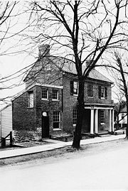
William and Sarah Nettle House, Waterford, Loudoun County
Notable people[]
James Monroe constructed and resided at Oak Hill near Aldie after his presidency. American Civil War Brigadier General Robert H. Chilton (Chief of Staff under Robert E. Lee) was a native of Loudoun County. World War II general George C. Marshall resided at Dodona Manor in Leesburg. Essayist and journalist Russell Baker grew up in Morrisonville, Virginia and his book Growing Up highlights his childhood in rural Virginia. Entertainer Arthur Godfrey lived near historic Waterford, Virginia. Loudoun County is also notable for being the birthplace of Julia Neale Jackson, mother of Stonewall Jackson, and Susan Catherine Koerner, mother of the Wright Brothers.[4][5]
Law and government[]
In the mid to late 20th century, as northerners gradually migrated to Southern suburbs, Loudoun County increasingly shifted to the Republican Party in supporting presidential candidates, and more local ones. Before the 2008 election of Barack Obama, county voters had not supported a Democratic president since Lyndon B. Johnson in 1964.
In recent years, the county's rapid growth in its eastern portion, settled by educated professionals working in or near Washington, D.C., has changed the demographics of the county, and the Democratic Party has become increasingly competitive. After giving Senator Barack Obama nearly 54% of its presidential vote in 2008, the county supported Republican Bob McDonnell in 2009, who received 61% of the gubernatorial vote. Voters also replaced two incumbent Democratic delegates, making Loudoun's state House delegation all Republican. In 2012 county voters again supported Obama, who took 51.5% of the vote, with Republican challenger Mitt Romney garnering 47%.
Democrats carried the county again in the 2016 presidential election, when Loudoun swung heavily towards Hillary Clinton, giving her 55.1% to Donald Trump's 38.2%. In 2020, Joe Biden won over 60 percent of the vote.
| Year | Republican | Democratic | Third party | |||
|---|---|---|---|---|---|---|
| No. | % | No. | % | No. | % | |
| 2020 | 82,088 | 36.51% | 138,372 | 61.54% | 4,402 | 1.96% |
| 2016 | 69,949 | 38.21% | 100,795 | 55.06% | 12,306 | 6.72% |
| 2012 | 75,292 | 47.04% | 82,479 | 51.53% | 2,289 | 1.43% |
| 2008 | 63,336 | 45.42% | 74,845 | 53.67% | 1,278 | 0.92% |
| 2004 | 60,382 | 55.69% | 47,271 | 43.60% | 777 | 0.72% |
| 2000 | 42,453 | 56.12% | 30,938 | 40.89% | 2,262 | 2.99% |
| 1996 | 25,715 | 52.13% | 19,942 | 40.43% | 3,673 | 7.45% |
| 1992 | 19,290 | 46.40% | 14,462 | 34.79% | 7,822 | 18.81% |
| 1988 | 20,448 | 66.26% | 10,101 | 32.73% | 313 | 1.01% |
| 1984 | 17,765 | 67.99% | 8,227 | 31.49% | 136 | 0.52% |
| 1980 | 12,076 | 58.93% | 6,694 | 32.67% | 1,722 | 8.40% |
| 1976 | 9,192 | 51.79% | 7,995 | 45.05% | 561 | 3.16% |
| 1972 | 9,417 | 69.46% | 3,941 | 29.07% | 199 | 1.47% |
| 1968 | 4,577 | 45.91% | 3,262 | 32.72% | 2,131 | 21.37% |
| 1964 | 2,594 | 37.72% | 4,278 | 62.21% | 5 | 0.07% |
| 1960 | 2,526 | 50.99% | 2,399 | 48.43% | 29 | 0.59% |
| 1956 | 2,489 | 53.41% | 1,960 | 42.06% | 211 | 4.53% |
| 1952 | 2,540 | 54.86% | 2,075 | 44.82% | 15 | 0.32% |
| 1948 | 1,430 | 44.07% | 1,545 | 47.61% | 270 | 8.32% |
| 1944 | 1,485 | 45.08% | 1,802 | 54.71% | 7 | 0.21% |
| 1940 | 1,061 | 32.84% | 2,156 | 66.73% | 14 | 0.43% |
| 1936 | 867 | 27.42% | 2,287 | 72.33% | 8 | 0.25% |
| 1932 | 600 | 19.54% | 2,440 | 79.45% | 31 | 1.01% |
| 1928 | 1,325 | 40.84% | 1,915 | 59.03% | 4 | 0.12% |
| 1924 | 152 | 7.48% | 1,794 | 88.33% | 85 | 4.19% |
| 1920 | 757 | 30.21% | 1,720 | 68.64% | 29 | 1.16% |
| 1916 | 404 | 21.02% | 1,490 | 77.52% | 28 | 1.46% |
| 1912 | 256 | 14.48% | 1,386 | 78.39% | 126 | 7.13% |
| 1908 | 447 | 21.37% | 1,570 | 75.05% | 75 | 3.59% |
| 1904 | 442 | 21.33% | 1,558 | 75.19% | 72 | 3.47% |
| 1900 | 1,684 | 37.43% | 2,690 | 59.79% | 125 | 2.78% |
| 1896 | 1,991 | 41.16% | 2,741 | 56.67% | 105 | 2.17% |
| 1892 | 1,738 | 37.32% | 2,719 | 58.39% | 200 | 4.29% |
| 1888 | 2,190 | 43.03% | 2,842 | 55.83% | 58 | 1.14% |
| 1884 | 1,978 | 41.22% | 2,795 | 58.24% | 26 | 0.54% |
| 1880 | 1,792 | 39.20% | 2,780 | 60.80% | 0 | 0.00% |
County Board of Supervisors[]
Like many counties in Virginia, Loudoun is locally governed by a board of supervisors, the Loudoun County Board of Supervisors. The chairman of the board is elected by county voters at-large while the remaining supervisors are elected from eight single-member districts roughly equal in population. All nine members serve concurrent terms of four years. The board handles policy issues and sets the budget; it appoints a county administrator to handle the county government's day-to-day operations.[7] As of the 2019 elections, the chairman of the board and five district supervisors are Democrats; the remaining three supervisors are Republican.
In November 2019, Democrats took over the Board of Supervisors. Voters elected Juli E. Briskman (D) in Algonkian District, with 6,763 votes (54.09%) replacing incumbent Suzanne M. Volpe (R) who polled 5,719 votes (45.74%). Juli Briskman had been fired from her job as a marketing analyst for a United States government and military subcontractor, after an AFP photo of her flipping off the motorcade of Donald Trump went viral on social media in 2017.[8]
| Position | Name | Party | First Elected | District | |
|---|---|---|---|---|---|
| Chair | Phyllis Randall | Democratic | 2015 | At-Large | |
| Vice-Chair | Koran Saines | Democratic | 2015 | Sterling | |
| Supervisor | Juli Briskman | Democratic | 2019 | Algonkian | |
| Supervisor | Michael Turner | Democratic | 2019 | Ashburn | |
| Supervisor | Tony Buffington | Republican | 2015 | Blue Ridge | |
| Supervisor | Sylvia Glass | Democratic | 2019 | Broad Run | |
| Supervisor | Caleb Kershner | Republican | 2019 | Catoctin | |
| Supervisor | Matthew Letourneau | Republican | 2011 | Dulles | |
| Supervisor | Kristen Umstattd | Democratic | 2015 | Leesburg | |
| Position | Name | Party | First Election | |
|---|---|---|---|---|
| Clerk of the Circuit Court | Gary Clemens | Republican | 1999 | |
| Commissioner of the Revenue | Robert Wertz | Republican | 2003 | |
| Commonwealth's Attorney | Buta Biberaj | Democratic | 2019 | |
| Sheriff | Michael Chapman | Republican | 2011 | |
| Treasurer | Roger Zurn | Republican | 1995 | |
| Position | Name | Party | First Elected | District | |
|---|---|---|---|---|---|
| Chair | Brenda Sheridan | Democratic | 2011 | Sterling | |
| Vice-Chair | Atoosa Reaser | Democratic | 2019 | Algonkian | |
| Member | Denise Corbo | Democratic | 2019 | At-Large | |
| Member | Harris Mahedavi | Democratic | 2019 | Ashburn | |
| Member | Ian Serotkin | Democratic | 2019 | Blue Ridge | |
| style="background-color:Template:Independent (United States)/meta/color" | | Member | Andrew Hoyler | Independent | Appointed 2021 | Broad Run |
| Member | John Beatty | Republican | 2019 | Catoctin | |
| Member | Jeffrey Morse | Republican | 2011 | Dulles | |
| Member | Elizabeth Barts | Democratic | 2019 | Leesburg | |
| Position | Name | Party | First Elected | District | |
|---|---|---|---|---|---|
| Senator | John Bell | Democratic | 2019 | 13 | |
| Senator | Jill Vogel | Republican | 2007 | 27 | |
| Senator | Barbara Favola | Democratic | 2011 | 31 | |
| Senator | Jennifer Boysko | Democratic | 2019 | 33 | |
| Position | Name | Party | First Elected | District | |
|---|---|---|---|---|---|
| Delegate | Wendy Gooditis | Democratic | 2017 | 10 | |
| Delegate | David Reid | Democratic | 2017 | 32 | |
| Delegate | Dave LaRock | Republican | 2013 | 33 | |
| Delegate | Kathleen Murphy | Democratic | 2015 | 34 | |
| Delegate | Karrie Delaney | Democratic | 2017 | 67 | |
| Delegate | Ibraheem Samirah | Democratic | 2019 | 86 | |
| Delegate | Suhas Subramanyam | Democratic | 2019 | 87 | |
Geography[]
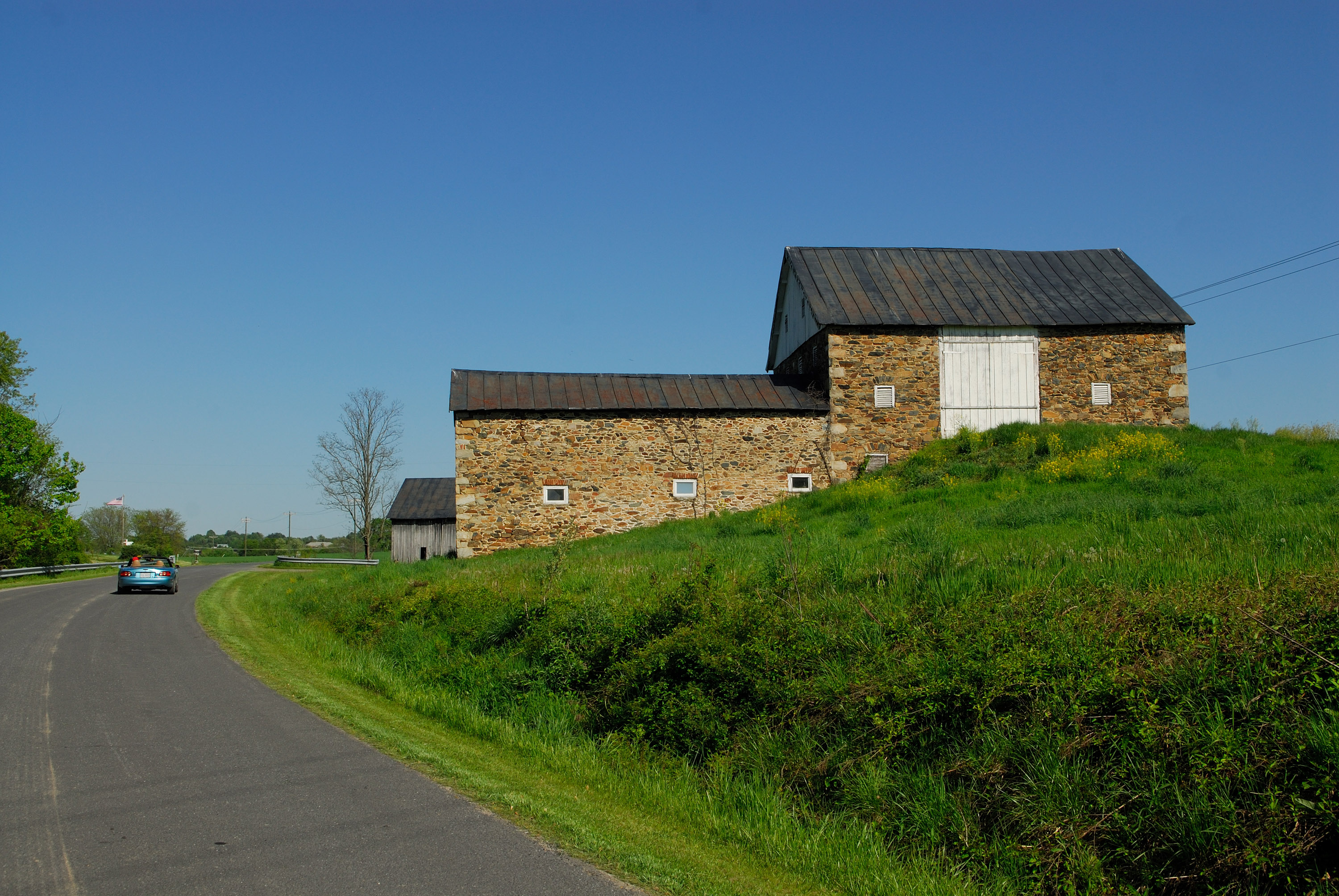

The scenic byways of Loudoun County are spotted with historical structures dating back to before the American Civil War.
According to the U.S. Census Bureau, Loudoun County has a total area of 521 square miles (1,350 km²), of which 520 square miles (1,346 km²) is land and 1 square mile (3 km²) (0.24%) is water. It is bounded on the North by the Potomac River; across the river are Frederick and Montgomery counties in Maryland; it is bounded on the south by Prince William and Fauquier counties, on the west by watershed of the Blue Ridge Mountains across which are Jefferson County, West Virginia and Clarke County, and on the east by Fairfax County. The Bull Run Mountains and Catoctin Mountain bisect the county. To the west of the range is the Loudoun Valley. Bisecting the Loudoun Valley from Hillsboro to the Potomac River is Short Hill Mountain.
Street addresses[]
Block numbers in the unincorporated areas of Loudoun County, with the exception of older Sterling Park and the community of CountrySide, are assigned in the following manner: on north-south streets, block numbers increase from north to south and range from 10000 to 29900; on east-west streets, block numbers increase from west to east and range from 30000 to 49900.
Adjacent counties[]
- Fairfax County (east)
- Prince William County (southeast)
- Fauquier County (south)
- Jefferson County, West Virginia (west)
- Clarke County (west)
- Washington County, Maryland (northwest, across the Potomac River)
- Frederick County, Maryland (north, across the Potomac River)
- Montgomery County, Maryland (east, across the Potomac River)
Major highways[]
 U.S. Route 15
- U.S. Route 50
- State Route 7
- State Route 28
- State Route 267 (Dulles Greenway)
- Loudoun County Parkway
National protected area[]
- Harpers Ferry National Historical Park (part)
Economy[]
Traditionally a rural county, Loudoun's population has grown dramatically since the 1980s. Having undergone heavy suburbanization since 1990, Loudoun has a full-fledged service economy. It is home to world headquarters for several Internet-related and high tech companies, including Verizon Business, Telos Corporation, Orbital Sciences Corporation, and Paxfire. Like Fairfax County's Dulles Corridor, Loudoun County has economically benefited from the existence of Washington Dulles International Airport, the majority of which is located in the county along its border with Fairfax. Loudoun does retain a strong rural economy in the western part of the county. The equine industry has an estimated revenue of $78 Million. It is home to the Morven Park International Equestrian Center which hosts national horse trials. In addition, the county's growing wine industry has produced several internationally recognized wines. Loudoun now has 22 wineries[14] and over 25 active farms. Loudoun has rich soil and was in the late 19th century the fourth-largest wheat producer in the U.S.[15]
MCI, Inc. (formerly WorldCom) is headquartered in Ashburn, Loudoun County. It announced that it would move its headquarters to Ashburn in 2003.[16][17] AOL had its headquarters at 22000 AOL Way in Dulles in unincorporated Loudoun County.[18] In 2007 AOL announced that it would move its headquarters from Loudoun County to New York City; it would continue to operate its Virginia offices.[19] Orbital Sciences Corporation has its headquarters in Dulles.[20]
Before its dissolution, Independence Air (originally Atlantic Coast Airlines) was headquartered in Dulles.[21][22] At one time Atlantic Coast Airlines had its headquarters in Sterling.[23] Prior to its dissolution, MAXjet Airways was headquartered on the grounds of Washington-Dulles International Airport and in Dulles.[24]
Top employers[]
According to the County's 2009 Comprehensive Annual Financial Report,[25] the top employers in the county are:
| # | Employer | # of Employees |
|---|---|---|
| 1 | Loudoun County Public Schools | 10,533 |
| 2 | County of Loudoun | 3,304 |
| 3 | AOL | 1,000-5,000 |
| 4 | MCI | 1,000-5,000 |
| 5 | M. C. Dean | 1,000-5,000 |
| 6 | United States Department of Homeland Security | 1,000-5,000 |
| 7 | United Airlines | 1,000-5,000 |
| 8 | Loudoun Hospital Center | 1,000-5,000 |
| 9 | Orbital Sciences Corporation | 1,000-5,000 |
| 10 | United States Postal Service | 1,000-5,000 |
Demographics[]
| Historical populations | |||
|---|---|---|---|
| Census | Pop. | %± | |
| 1790 | 18,962 | ||
| 1800 | 20,523 | 8.2% | |
| 1810 | 21,338 | 4.0% | |
| 1820 | 22,702 | 6.4% | |
| 1830 | 21,939 | −3.4% | |
| 1840 | 20,431 | −6.9% | |
| 1850 | 22,079 | 8.1% | |
| 1860 | 21,774 | −1.4% | |
| 1870 | 20,929 | −3.9% | |
| 1880 | 23,634 | 12.9% | |
| 1890 | 23,274 | −1.5% | |
| 1900 | 21,948 | −5.7% | |
| 1910 | 21,167 | −3.6% | |
| 1920 | 20,577 | −2.8% | |
| 1930 | 19,852 | −3.5% | |
| 1940 | 20,291 | 2.2% | |
| 1950 | 21,147 | 4.2% | |
| 1960 | 24,549 | 16.1% | |
| 1970 | 37,150 | 51.3% | |
| 1980 | 57,427 | 54.6% | |
| 1990 | 86,129 | 50.0% | |
| 2000 | 169,599 | 96.9% | |
| 2010 | 312,311 | 84.1% | |
As of the census[26] of 2000, there were 169,599 people, 59,900 households, and 45,044 families residing in the county. The population density was 326 people per square mile (126/km²). There were 62,160 housing units at an average density of 120 per square mile (46/km²). The racial makeup of the county was 82.79% White, 6.89% Black or African American, 5.35% Asian, 0.21% Native American, 0.06% Pacific Islander, 2.26% from other races, and 2.44% from two or more races. 5.95% of the population were Hispanic or Latino of any race. 15.0% were of German, 11.8% Irish, 10.9% English, 9.0% American and 6.6% Italian ancestry according to Census 2000.
According to the 2006 American Community Survey 72.0% of Loudoun County's population was white; 7.6% of the population was African-American. 0.1% were Native Americans; Asians were 13.1%. 4.9% of the population was of some other race and 2.3% of people reported being of two or more races. Latinos of any race were 9.7% of the population. 21.0% of the population was foreign born, up from 11.27% in 2000 and 5.67% in 1990.
As of 2000 there were 59,900 households out of which 43.10% had children under the age of 18 living with them, 64.30% were married couples living together, 7.80% had a female householder with no husband present, and 24.80% were non-families. 18.40% of all households were made up of individuals and 3.70% had someone living alone who was 65 years of age or older. The average household size was 2.82 and the average family size was 3.24.
In the county, the population was spread out with 29.80% under the age of 18, 5.70% from 18 to 24, 38.90% from 25 to 44, 20.00% from 45 to 64, and 5.60% who were 65 years of age or older. The median age was 34 years. For every 100 females there were 97.80 males. For every 100 females age 18 and over, there were 95.50 males.
In August 2008, Census survey data concluded that Loudoun County has the highest median income in the country at just over $107,000.[3] A 2007 estimate indicated that the median income for a household was $104,612, and the median income for a family was $125,381[27]
Government and infrastructure[]
The National Transportation Safety Board operates the Ashburn Aviation Field Office in Ashburn, an unincorporated area of Loudoun County.[28]
Fire and Rescue services are provided by the Loudoun County Fire and Rescue Department.
Towns[]
Incorporated towns[]
|
Unincorporated communities[]
|
|
|
|
|
Transportation[]
Bus[]
Loudoun County operates its own bus public transit system, known as Loudoun County Commuter Bus.
Education[]
The county is served by Loudoun County Public Schools (LCPS). LCPS currently serves over 50,000 students from Kindergarten through 12th grade and is currently the fifth largest school system in Virginia.[29][30] While there is a growing trend towards home schooling in the county, the vast majority of school age children in Loudoun County attend LCPS schools. Loudoun County schools recently ranked 11th in the United States in terms of educational achievement versus funds spent.[31] Loudoun County also sends students to Thomas Jefferson High School for Science and Technology, a Virginia Governor's School in Alexandria, Virginia.
Loudoun County is home to nine private schools: Loudoun Country Day School, a Pre-K–8 independent school located in Leesburg; Notre Dame Academy, an independent non-denominational day high school in Middleburg; the Foxcroft School, a boarding school for girls located in Middleburg; Dominion Academy, a Non-denominational Christian school, K–8 located in Leesburg; Leesburg Christian School, a K–12 school located in Leesburg; St. Theresa School, a K–8 Roman Catholic school located in Ashburn; Village Montessori School at Bluemont, an accredited Pre-K through Elementary Montessori school located in Bluemont; Christian Faith & Fellowship School, a PreK–12 non-denominational Christian school and Loudoun County's only private school accredited by the Association of Christian Schools International; and Ideal Schools High School, an independent non-demoninational school in Ashburn.
In terms of post-secondary education, Loudoun County is home to a variety of colleges and universities, including: Patrick Henry College; a branch of Northern Virginia Community College in Sterling; George Washington University (satellite campus); George Mason University (satellite campus); Marymount University (satellite campus); Shenandoah University (satellite campus); and Strayer University (satellite campus).[32] Loudoun is also home to the Janelia Farm Research Campus of the Howard Hughes Medical Institute.
Sports[]
| Club | League | Venue | Established | Championships |
|---|---|---|---|---|
| Loudoun Hounds | ALPB Baseball | The Dog Yard | 2012 |
Notable residents[]
- James Monroe (1758–1831) – 5th President of the United States
- Charles F. Mercer (1788–1858) – Founded village of Aldie; U.S. Congressman from Virginia
- John L. Dagg (1794–1884) – Baptist theologian, pastor, educator, and president of Mercer University, GA (1844–54)[33][34]
- John Janney (1798–1872) – Member of the Virginia General Assembly and officer of the Virginia Secession Convention of 1861
- Stevens T. Mason (1811–1843) – First governor of Michigan (Democrat, 1837–40)[35]
- Richard Henry Dulany (1820–1906) – Colonel of the 7th Virginia Cavalry during the Civil War
- Lucien Whiting Powell (1846–1930) – Renowned landscape artist
- Westmoreland Davis (1859–1942) – Governor of Virginia
- Billy Mitchell (1879–1936) – Controversial Army officer and military aviation pioneer
- George Marshall (1880–1959) – General of the Army (5 star), U.S. Secretary of State and author of the "Marshall Plan"
- Joe Gibbs (1940- ) – Lived just west of Leesburg while coaching the Washington Redskins
- Arthur Godfrey (1903–1983) – Popular national radio and television personality
- Pamela Harriman (1920–1997) Daughter-in-law of Sir Winston Churchill and U.S. Ambassador to France
- Russell Baker (1925- ) – Pulitzer Prize-winning author of Growing Up (1983, Autobiography)[36]
- Madeleine Albright (1937- ) – U.S. Secretary of State in Clinton Administration
- Fred Hetzel (1942- ) – Former professional basketball player
- Oliver North (1943- ) – Former USMC Officer and figure in the Iran-Contra scandal; commentator and host on the Fox network
- Sheila Johnson (1949- ) – Entertainment and sports entrepreneur and philanthropist.
- Sandra Lerner (c1953- ) – Entrepreneur and philanthropist
- Geraldine Brooks (writer) (1955- ) – Pulitzer Prize winning author; moved from Waterford to Martha's Vineyard where she and husband Tony Horowitz currently reside
- Mark Levin (1957-) – Neoconservative Talk radio host
- Tony Horwitz (1958- ) – Pulitzer Prize winning author
- Darrell Green (1960- ) – Former Washington Redskin and inductee to the NFL Pro Football Hall of Fame
- Patton Oswalt (1969- ) – American stand-up comedian, writer and actor
See also[]
- Loudoun County Sheriff's Office
- Loudoun County Fire and Rescue Department
- National Register of Historic Places listings in Loudoun County, Virginia
References[]
- ^ [1]. 2010 U.S. Census Data: Virginia. Retrieved February 16, 2011
- ^ "Find a County". National Association of Counties. http://www.naco.org/Counties/Pages/FindACounty.aspx. Retrieved 2011-06-07.
- ^ a b Income, Earnings, and Poverty Data From the 2007 American Community Survey
- ^ Virginia Military Institute Archives, Jackson Genealogy
- ^ "Happy Mother's Day, Ms Wright", Aircraft Owners and Pilots Association
- ^ Leip, David. "Dave Leip's Atlas of U.S. Presidential Elections". http://uselectionatlas.org/RESULTS.
- ^ "Loudoun County Board of Supervisors Operations Manual". https://www.loudoun.gov/DocumentCenter/View/117084.
- ^ "Woman who was fired for flipping off Trump wins election in Virginia". CBS News. November 7, 2019. https://www.cbsnews.com/news/woman-who-flipped-off-trump-juli-briskman-cyclist-finger-president-motorcade-wins-virginia-election-loudoun-county/.
- ^ a b c d "Loudoun County November 5, 2019 General Election Results". https://www.loudoun.gov/ArchiveCenter/ViewFile/Item/8989.
- ^ "School Board | Loudoun County Public Schools". Loudoun County Public Schools. https://www.lcps.org/Page/226240.
- ^ "Loudoun County November 5, 2019 General Election Results". https://www.loudoun.gov/ArchiveCenter/ViewFile/Item/8989.
- ^ "Democratic Elected Officials – Loudoun County Democratic Committee" (in en-US). https://loudoundemocrats.org/who-we-are-3/elected-officals/.
- ^ "Local Republican Elected Officials | Loudoun County Republican Committee". https://www.loudoungop.com/about/republicans.php.
- ^ DC's Wine Country, Visit Loudoun
- ^ "Early 19th-Century Milling and Wheat Farming", Loudoun History
- ^ "MCI Inc - SC 13D/A - LCC International Inc ." Securities and Exchange Commission. March 14, 2003. Retrieved on September 25, 2009.
- ^ "WorldCom to emerge from collapse." CNN. Monday April 14, 2003. Retrieved on September 25, 2009.
- ^ "Company Overview." AOL. February 8, 2008. Retrieved on May 7, 2009.
- ^ Goldfarb, Zachary and Sam Diaz. "Washington Post - AOL Moving Executives, Headquarters to New York." The Washington Post. Tuesday September 18, 2007. A01. Retrieved on May 7, 2009.
- ^ "Contact Information." Orbital Sciences Corporation. Retrieved on September 25, 2009.
- ^ "Company Information." Atlantic Coast Airlines. Retrieved on September 25, 2009.
- ^ "Independence Air, Inc." Businessweek. Retrieved on September 25, 2009.
- ^ Standard & Poor's Register of Corporations, Directors and Executives, Volume 2. Standard & Poor's Corp., 1998. 1012. Retrieved on January 31, 2011. "Atlantic Coast Airlines Inc., One Export Dr.. Sterling, VA 20164"
- ^ "Contact Us." MAXjet Airways. February 18, 2007. Retrieved on September 25, 2009.
- ^ County of Loudoun CAFR
- ^ "American FactFinder". United States Census Bureau. http://factfinder.census.gov. Retrieved 2008-01-31.
- ^ http://factfinder.census.gov/servlet/ACSSAFFFacts?_event=Search&geo_id=05000US51059&_geoContext=01000US%7C04000US51%7C05000US51059&_street=&_county=loudoun&_cityTown=loudoun&_state=04000US51&_zip=&_lang=en&_sse=on&ActiveGeoDiv=geoSelect&_useEV=&pctxt=fph&pgsl=050&_submenuId=factsheet_1&ds_name=ACS_2007_3YR_SAFF&_ci_nbr=null&qr_name=null®=null%3Anull&_keyword=&_industry= Census Factfinder: Loudoun County
- ^ "Regional Offices: Aviation." National Transportation Safety Board. Retrieved on May 15, 2010.
- ^ About Loudoun County Public Schools, Loudoun County Public Schools
- ^ 2005 Triennial school census, Virginia Department of Education
- ^ "Best And Worst School Districts For The Buck". Forbes. 07.05.07. http://www.forbes.com/2007/07/05/schools-taxes-education-biz-beltway_cz_cs_0705schools_2.html. Retrieved 2008-07-17.
- ^ "Loudoun Guide 2006: Higher Education at Your Fingertips". The Washington Post. 2006. http://www.washingtonpost.com/wp-srv/metro/usersguides/loudoun/HighEd.html.
- ^ "Biographical Sketch of John L. Dagg"
- ^ "John Leadley Dagg 1844-1854 Mercer University Presidents"
- ^ "Stevens Thomson Mason Biography (1811–43)"
- ^ "Pulitzer Prize Winners 1983"
External links[]
- Loudoun County Government Site
- Loudoun County Public Schools
- Loudoun County Public Library
- Loudoun County Chamber of Commerce
- Travel Information: Loudoun Convention & Visitors Association
- Loudoun Valleys Office of Rural Economic Development
- African American Communities of Loudoun County
- Loudoun Heritage Farm Museum
- Loudoun's Neighborhood and Real Estate Source
- Loudoun County Real Estate Statistics and News
- Western Loudoun County's Oldest Newspaper
- History and Comprehensive Description of Loudoun County, Virginia, by James W. Head, 1908 at Project Gutenberg
- Loudoun Museum


| |||||||||||||||||

| This page uses content from the English language Wikipedia. The original content was at Loudoun County, Virginia. The list of authors can be seen in the page history. As with this Familypedia wiki, the content of Wikipedia is available under the Creative Commons License. |