| Main | Births etc |
|---|
| Garforth | |
 Entering from the West on the A63 road |
|
Garforth | |
| Population | 15,394 (2001) |
|---|---|
| OS grid reference | |
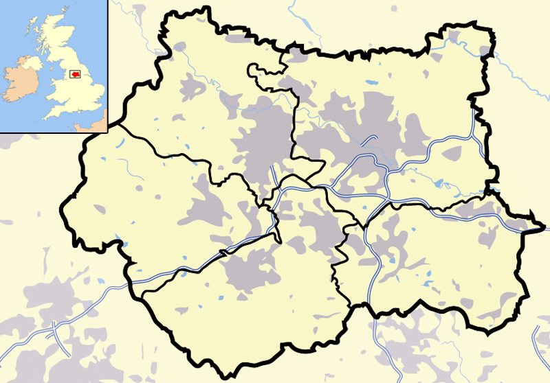
| Metropolitan borough | City of Leeds |
| Metropolitan county | West Yorkshire |
| Region | Yorkshire and the Humber |
| Country | England |
| Sovereign state | United Kingdom |
| Post town | LEEDS |
| Postcode district | LS25 |
| Dialling code | 0113 |
| Police | West Yorkshire |
| Fire | West Yorkshire |
| Ambulance | Yorkshire |
| EU Parliament | Yorkshire and the Humber |
| UK Parliament | Elmet and Rothwell |
| List of places: UK • England • Yorkshire | |
Garforth is a town within the City of Leeds metropolitan borough, in West Yorkshire, England. The 2001 Census lists 23,892 residents in the Garforth and Swillington ward - 80.57% of which are homeowners, 20% more than the average for Leeds. Garforth itself has 15,394 of those people.[1] Garforth was in the parliamentary constituency of Elmet until the 2010 general election, when it was incorporated into the new constituency of Elmet and Rothwell.
History[]


St Mary's church
It owes its size to expansion in the 17th and 18th centuries during which the local land-owning Gascoigne family ran several coalmines in the area. The surrounding settlements of Micklefield, Kippax, Swillington, Methley and Allerton Bywater are all villages that prospered and grew as a result of the coal industry. Nowadays manufacturing and motor-vehicle repair account for more than a third of the workforce in the area
More recent expansion can also be traced to a combination of overall economic success in Leeds, and the fact that Garforth is well served by transport links. The A1 and M1 are minutes away, and both have recently been linked by an extension of the M1 which passes to the West and North of the town, with two nearby access points at Junctions 46 and 47. The M1 extension has led to rapid development of commercial, light industrial and residential sites clustered around Junctions 46 and 47. There are two railway stations, Garforth and East Garforth, both on the mainline route between Leeds, York, and North Eastern England to Scotland, and between Leeds, Selby and Hull and the Yorkshire coastal resorts. Effectively, people can commute to or visit a wide variety of destinations quite easily and still live in a self-contained township surrounded by open countryside, woodlands and rural villages.
WasteCare Plant fire[]
On 1 July 2010, a fire broke out in the buildings of the Garforth WasteCare site just after midnight.[2] WasteCare recycles hazardous materials and chemical waste, along with other items such as oils and fluorescent tubes.[3] The extent of the fire meant that West Yorkshire Police, along with West Yorkshire Fire Service and the Environment Agency had to close three major roads, a section of the M1, A63 and A642[4] in the area and evacuate a nearby street and a Holiday Inn hotel. These closures caused a lot of disruption to Garforth, as well as to a lot of City of Leeds. Damage caused by the fire and explosions at the site has also caused the temporary closure of the Royal Mail delivery office,[5] which has caused further disruption for local residents.
People[]
Some famous residents and ex-residents of Garforth include, Chris Silverwood, Dave Seaman and Andrew White, of the Kaiser Chiefs. The town was also the birthplace of Second World War hero, Sir Augustus Walker of the Royal Air Force.
Transport[]
Garforth is situated on the A63, which links it with the M1 and the A1(M), the M62 also lies close by to the South of the town. Garforth has two railway stations, Garforth railway station lies to the North of the town centre, whist East Garforth railway station which opened in the 1980s lies to the East of the town. Here the town is linked to Leeds, York, Selby, Kingston upon Hull, Manchester, Newcastle Upon Tyne, Liverpool and Blackpool via the rail links. The town rail link to Kippax and Castleford was closed under the Beeching Axe of the 1960s. Garforth's bus services are provided by First Leeds and Arriva.
Schools in Garforth[]


Garforth Community College
Home to one secondary school and five primary schools.
Garforth Community College, a secondary school and sixth form for pupils aged 11–18 is located on Lidgett Lane in Garforth. The school itself has over 2000 students and staff. It is also one of the pioneering schools behind fingerprint-based lunch payment systems. Furthermore, Garforth Community Arts School (situated in Garforth Community College) runs the Garforth Arts Festival, which is a display of artistic talent.
Over the street from Garforth Community College is the newly refurbished Strawberry Fields Primary school, formerly known as West Garforth Primary School. As well as Strawberry Fields, Garforth is home to Ninelands Lane Primary School, Green Lane Primary School, East Garforth Primary School and St Benedict's Primary School, which is a Catholic school.
Sport[]

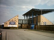
Genix Healthcare Stadium
Local football teams are Garforth Town, Garforth A.F.C., Garforth W.M.C. A.F.C and Garforth Rangers A.F.C.
There are two rugby clubs in Garforth: Garforth RUFC,[6] and Garforth Tigers ARLFC,[7]
There are also two cricket clubs [8] and a Squash and Leisure Centre.[9][10]
Garforth Golf Club has a course designed by Alister MacKenzie.[11]
Economy[]
Originally a coal mining area, the collieries of much of East Leeds and surrounding areas closed in the 1960s, although further South mining was still strong in the 1990s and is still prevalent to some degree today. Garforth has increasingly become a commuter town of Leeds There is a light industrial estate to the North of the town which provides some employment, while the neighbouring Thorpe Business Park in Colton also provides employment. Garforth's rail connections and access to the M1, A1(M) and M62 have made it a desirable area for commuters to live.
Amenities[]
Garforth offers less amenities than other towns in the City of Leeds, such as Otley and Wetherby. The town centre now resembles a local centre rather than a town centre. Garforth has a Tesco supermarket, several pubs in the town centre, a Co-operative, and several other shops such as newsagents, charity shops, travel agents and banks. There is also a large ex-catalogue shop. Garforth also has civic amenities such as a library and a One Stop Centre run by Leeds City Council. A relatively new appearance on Garforth Main Street is the Baraka Coffee House, which gives all of its profits back to projects in the town, functioning as a Social Enterprise.
")
")
")
References in literature[]
The book The Modfather was set in Garforth in the late 1970s and early 1980s detailing David Lines adolescence in the town and his obsession with Paul Weller.[12]
Location grid[]

|
Barwick-in-Elmet |
| ||
| Austhorpe | Micklefield | |||
 Garforth | ||||
| Kippax |
See also[]
- Garforth Town A.F.C.
References[]
- ^ Office for National Statistics : Census 2001 : Urban Areas : Table KS01 : Usual Resident Population Retrieved 2009-08-26
- ^ [1]
- ^ [2]
- ^ [3]
- ^ [4]
- ^ Garforth RUFC
- ^ http://www.pitchero.com/clubs/garforthtigers/
- ^ Garforth Parish Church Cricket Club
- ^ Garforth Squash and Leisure Centre
- ^ Garforth Today
- ^ Garforth Golf Club
- ^ ISBN 978-0-09-947659-7
External links[]
- Garforth Community College
- Garforth's Website
- YEP Garforth Today Community Website
- Garforth Town
- Garforth Jets Badminton Club
- Garforth Rangers
- Garforth Art Festival
- LS25 Community Web site
- 1st Garforth Scout Group
- Baraka Garforth
- "The Ancient Parish of Garforth". GENUKI. http://www.genuki.org.uk/big/eng/YKS/WRY/Garforth/index.html. Historical and genealogical resource
| |||||||||||||||||
| ||||||||||||||
| This page uses content from the English language Wikipedia. The original content was at Garforth. The list of authors can be seen in the page history. As with this Familypedia wiki, the content of Wikipedia is available under the Creative Commons License. |