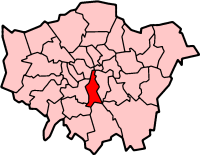
| London Borough of Lambeth | |||
|---|---|---|---|
| — London borough — | |||
|
|||
 |
|||
| Sovereign state | United Kingdom | ||
| Constituent country | England | ||
| Region | London | ||
| Ceremonial county | Greater London | ||
| Status | London borough | ||
| Admin HQ | Brixton | ||
| Incorporated | 1 April 1965 | ||
| Government | |||
| • Type | London borough council | ||
| • Body | Lambeth London Borough Council | ||
| • Leadership | Leader & Cabinet (Labour) | ||
| • Mayor | None (vacant) | ||
| • MPs | Kate Hoey (Lab) Tessa Jowell (Lab) Chuka Umunna (Lab) |
||
| • London Assembly | Valerie Shawcross (Lab) AM for Lambeth and Southwark | ||
| • EU Parliament | London | ||
| Area | |||
| • Total | 10.36 sq mi (26.82 km2) | ||
| Area rank | 313th (of 326) | ||
| Population (2006 est.) | |||
| • Total | 304,500 | ||
| • Rank | 32nd (of 326) | ||
| • Ethnicity[1] | 54.0% White British 2.7% White Irish 9.0% Other White 1.8% White & Black Caribbean 0.7% White & Black African 0.9% White & Asian 1.2% Other Mixed 2.3% Indian 1.1% Pakistani 1.0% Bangladeshi 0.9% Other Asian 10.2% Black Caribbean 9.6% Black African 1.8% Other Black 1.3% Chinese 1.3% Other |
||
| Time zone | GMT (UTC0) | ||
| • Summer (DST) | BST (UTC+1) | ||
| Postcodes | SE , SW | ||
| Area code(s) | 020 | ||
| Police force | Metropolitan Police | ||
| Website | lambeth.gov.uk | ||
The London Borough of Lambeth ( /ˈlæmbɪθ/) is a London borough in south London, England and forms part of Inner London. See Lambeth London Borough Council.
History[]
For history 1900 to 1965, see Lambeth Metropolitan Borough Council.
Origins[]
The name is recorded in 1062 as Lambehitha, meaning 'landing place for lambs', and in 1255 as Lambeth. Lambeth Marsh was drained in the 18th century but is remembered in the Lower Marsh street name.
Lambeth was part of the large ancient parish of Lambeth St Mary, the site of the archepiscopal Lambeth Palace, in the hundred of Brixton in the county of Surrey.[2] It was an elongated north-south parish with a two-mile River Thames frontage opposite the cities of London and Westminster. Lambeth became part of the Metropolitan Police District in 1829. It continued as a single parish for Poor Law purposes after the Poor Law Amendment Act 1834 and a single parish governed by a vestry after the introduction of the Metropolitan Board of Works in 1855.[2]
Borough origins[]
Until 1889, the county of Surrey included the present-day London borough of Lambeth, when drawing up boundaries for the London Boroughs, the Government had initially suggested that Metropolitan Borough of Lambeth and the Metropolitan Borough of Southwark should be merged to form a new borough, with the southern and eastern section of the Metropolitan Borough of Wandsworth (including Clapham, Streatham and Tooting) forming another. The Town Clerk of South Shields, R.S. Young, was commissioned to make final recommendations to the Government on the shape of the future London boroughs, and he noted that Wandsworth council opposed partition of their borough. However Wandsworth's suggestion of merging Lambeth with the Metropolitan Borough of Battersea was rejected by both of the councils involved. Young held that in Clapham and Streatham, people must be more familiar with Brixton than with Wandsworth, and therefore recommended that a new borough be formed from the Metropolitan Borough of Lambeth together with six wards and parts of two others from the Metropolitan Borough of Wandsworth.[3]
Political events[]
In 1979 the administration of Edward "Red Ted" Knight organised the borough's first public demonstration against the Thatcher government.[4][5] In 1985, the left-wing Labour administration of Ted Knight was subjected to 'rate-capping' with its budget restricted by the Government. Knight and most of the Labour councillors protested by refusing to set any budget. This protest resulted in 32 councillors being ordered to repay to the council the interest the council had lost as a result of budgeting delays, and also being disqualified from office.
1991 saw Joan Twelves's regime both failed to collect the poll tax and openly opposed the war in the Persian Gulf.[4][5] Joan Twelves, and 12 other councillors were subsequently suspended from the Labour Party's local group by regional officials for advocating non-payment of the poll tax and other radical ideas in 1992.[4][6] Twelves's equally militant deputy leader in this era was John Harrison.[7]
Between 1978 and 2002, the council comprised 64 members elected in 20 three-member and 2 two-member wards. Prior to this, the council had 60 members elected in 20 three-member wards. Immediately prior to the 2010 election, the political balance of the council was 37 Labour members, 18 Liberal Democrats, 7 Conservatives and 1 Green, giving a Labour majority of eleven. At the 2010 Lambeth Council election, Labour gained seats, and the Liberal Democrats, Conservatives and Greens lost seats.
Geography[]
Lambeth is a long, thin borough (approximately 3 miles (4.8 km) wide and 7 miles (11 km) long). Brixton is the civic centre of the borough and there are other town centres. The largest shopping areas are (in order of size) Streatham, Brixton, Vauxhall, Clapham and West Norwood.
In the northern end of the borough are the central London districts of the South Bank, Vauxhall and Lambeth while at the very south of the borough are the leafy suburbs of Gipsy Hill, Tulse Hill, West Dulwich and West Norwood. In between the two are built-up and inner-city districts of Brixton, Brixton Hill, Streatham Hill, Clapham, Clapham Park, Herne Hill, Stockwell and Kennington which are each at different stages of gentrification and have elements of suburban and urban settlement while Vauxhall and South Lambeth are central districts being redeveloped with high density business and residential properties. Streatham sits somewhere between suburban London and inner-city Brixton with the partly suburban and partly built-up areas of Streatham, Streatham Hill and Streatham Vale.
Parks and green spaces[]
Despite the Borough's high population density, it contains some open spaces of Metropolitan importance including Brockwell Park and Brockwell Lido, Streatham Common, half of Clapham Common, and West Norwood Cemetery. Other spaces include Archbishop's Park, Vauxhall Pleasure Gardens, Ruskin Park and Kennington Park.
Landmarks[]
Along and around the South Bank a tourist area has developed around the former GLC headquarters of County Hall and the Southbank Centre and National Theatre. Also on the river is the London Eye and Shell Centre. Nearby is St Thomas' Hospital, Lambeth Palace and the Florence Nightingale Museum. Lambeth Town Hall is a landmark in Brixton.
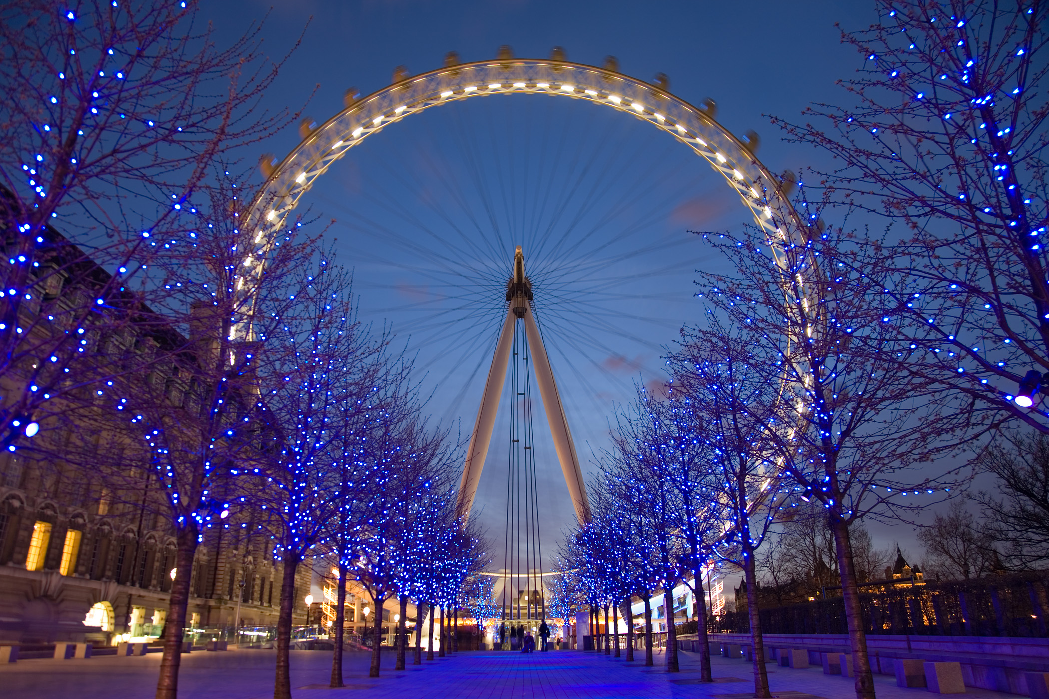

The London Eye
Landmark church buildings include:
- St Mary Lambeth (now home to the Garden Museum)
- the four "Waterloo Churches" within the former Lambeth Parish:
- St Matthew, Brixton (now also home to Mass nightclub)
- St Mark, Kennington
- St Luke, West Norwood
- St John, Waterloo
- Holy Trinity, Clapham
- St Leonard, Streatham
- Christ Church, Streatham Hill
- Christ Church, Brixton Road, North Brixton
- All Saints' Church, West Dulwich
- Holy Trinity, Trinity Rise, Tulse Hill
- St John the Divine, Vassall Road


St John the Divine, on Vassall Road, SW9
The Oval cricket ground, Kennington is the home of Surrey County Cricket.
Districts within the Borough of Lambeth[]
See here for a complete list of Districts within the Borough boundaries.
Education[]
Arts[]
- South London Theatre a busy community theatre in West Norwood
- National Theatre
- Southbank Centre
- Old Vic Theatre
- Young Vic Theatre
- ballet Rambert
- British Film Institute
- Black Cultural Archives
Lambeth is also the birthplace of famous talent scout Simon Cowell.
Civic affairs[]
Borough Council[]
Since 2002, Lambeth Borough Council has had 63 members elected in 21 three-member wards, by means of a plurality bloc voting system. Since 22 May 2014 Labour hold 59 seats, the Conservative Party 3 seats and the Green Party 1 seat.
The wards are Bishop's, Brixton Hill, Clapham Common, Clapham Town, Coldharbour, Ferndale, Gipsy Hill, Herne Hill, Knight's Hill, Larkhall, Oval, Prince's, St Leonard's, Stockwell, Streatham Hill, Streatham South, Streatham Wells, Thornton, Thurlow Park, Tulse Hill, Vassall.
Mayor[]
Lambeth is unusual in that since 1994 the Mayor of Lambeth has been elected unanimously by their fellow councillors with each of the three political parties supplying a candidate in rotation. The Lambeth Borough website states this underlines the apolitical nature of the mayor's role and enables them to represent all the citizens of the borough however some have criticised this arrangement as the council ignoring the political mandate of the voters.
Executive and Opposition The council is run by a Leader and Cabinet, chaired by council leader Cllr Lib Peck. All members of the Cabinet are from the ruling Labour Party. The Leader of the Opposition is Cllr Alex Davies (Liberal Democrat), and the Leader of the Conservative Opposition is Cllr John Whelan. The chief executive is Derrick Anderson CBE, formerly chief executive at Wolverhampton Council.
Councillor Mark Bennett became Mayor in March 2013, but died in February 2014.[8] The mayoralty remains vacant, and the Deputy Mayor, Councillor Adedamola Aminu, will be covering all civic duties until further notice.[9]
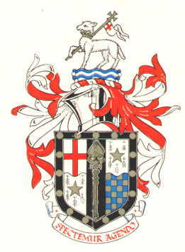
Coat of arms[]
The coat of arms is that of the former Metropolitan Borough of Lambeth with the addition of two gold stars (mullets) in the second and third quarters of the shield to indicate the addition of the parishes of Clapham and Streatham. The motto is Spectemur agendo.
Westminster Parliament[]
The borough is covered by three parliamentary constituencies:
- Dulwich and West Norwood (shared with London Borough of Southwark)
- Streatham
- Vauxhall
Twinning[]
The former Metropolitan Borough of Lambeth and its successor have been twinned with the Vincennes district of Paris in France since 1955. Lambeth also has twinning arrangements with Bluefields in Nicaragua; Moskvoretsky in Russia (although this is abeyance since changes to the city government of Moscow); Brooklyn, New York in the United States; Shinjuku in Japan; and Spanish Town in Jamaica.
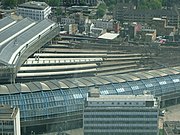
Transport[]
London Waterloo railway station, Waterloo tube station network and until 2007 the London terminus for Eurostar.
National Rail services in Lambeth are operated by South West Trains, Southeastern, Southern, First Capital Connect and London Overground.
Bridges and tunnels[]
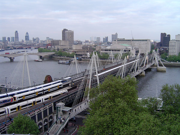

Hungerford Bridge and Golden Jubilee Bridges, seen from the north
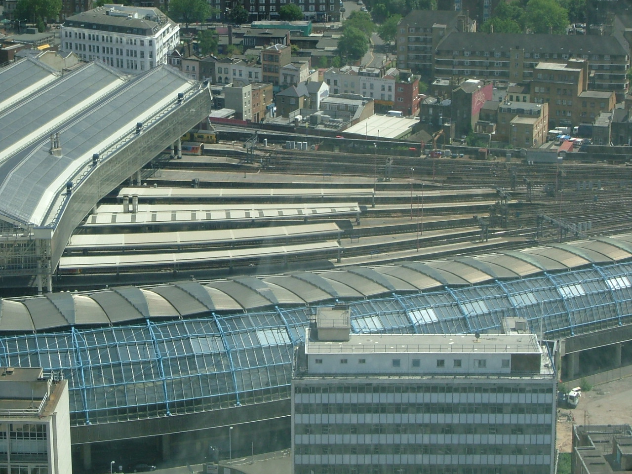
Waterloo station from the London Eye.


Stockwell war memorial and shelter
- Waterloo Bridge incorporating the NFT
- Hungerford Bridge and the two accompanying pedestrian spans known as the Golden Jubilee Bridges.
- Lambeth Bridge
- Westminster Bridge
- Vauxhall Bridge
Railway stations[]
- Brixton railway station
- Gipsy Hill railway station
- Herne Hill railway station
- Loughborough Junction railway station
- Streatham railway station
- Streatham Common railway station
- Streatham Hill railway station
- Tulse Hill railway station
- Vauxhall station
- Waterloo station
- Waterloo East station
- West Norwood railway station
London Overground stations[]
- Clapham High Street railway station
- Wandsworth Road railway station
Tube stations[]
- Brixton tube station
- Clapham Common tube station
- Clapham North tube station
- Lambeth North tube station
- Oval tube station
- Stockwell tube station
- Vauxhall station
- Waterloo station
Travel to work[]
In March 2011, the main forms of transport that residents used to travel to work were: the London Underground, metro, light rail, tram, 21.4% of all residents aged 16–74; bus, minibus or coach, 10.0%; train, 10.0%; driving a car or van, 8.6%; bicycle, 5.7%; on foot, 5.4%; work mainly at or from home, 3.2%.[10]
References[]
- ^ Data Management and Analysis Group, Greater London Authority, Demography Update October 2007, (2007)
- ^ a b Youngs, Frederic (1979). Guide to the Local Administrative Units of England. I: Southern England. London: Royal Historical Society. ISBN 0-901050-67-9.
- ^ "London Government: The London Boroughs", Ministry of Housing and Local Government, HMSO, 1962. See in particular paragraphs 51–57.
- ^ a b c http://www.independent.co.uk/news/the-rise-and-fall-of-red-teds-loony-lefties-1593657.html
- ^ a b Kate Hoey MP and Lambeth Labour Party – Brian Deer investigates. Briandeer.com (8 August 1993). Retrieved on 17 July 2013.
- ^ Bennett, Will (29 July 1995). "The rise and fall of Red Ted's loony lefties". The Independent. http://www.independent.co.uk/news/the-rise-and-fall-of-red-teds-loony-lefties-1593657.html.
- ^ GLATUC News. Glatuc.org.uk. Retrieved on 17 July 2013.
- ^ De Peyer, Robin. "Tributes flood in for Lambeth Mayor Mark Bennett, who has died suddenly aged 44". London Evening Standard. 5 February 2014. Retrieved 22 April 2014.
- ^ "The Mayor, the leader of the Council and Cabinet members – guide". Lambeth Council. 17 March 2014. Retrieved 22 April 2014.
- ^ "2011 Census: QS701EW Method of travel to work, local authorities in England and Wales". Office for National Statistics. http://www.ons.gov.uk/ons/rel/census/2011-census/key-statistics-and-quick-statistics-for-wards-and-output-areas-in-england-and-wales/rft-qs701ew.xls. Retrieved 23 November 2013. Percentages are of all residents aged 16–74 including those not in employment. Respondents could only pick one mode, specified as the journey's longest part by distance.
External links[]
| Wikivoyage has a travel guide for Lambeth. |
- Lambeth.gov.uk London Borough of Lambeth Official Website
- electionmemory.com Independent Lambeth Council Elections Forum
- General information on Lambeth parks and green spaces
- Community Police Consultative Group for Lambeth Independent forum for community and statutory agencies to address community safety and policing issues.
- Lambeth Freecycle
| ||||||||||||||||||||||
| |||||||||||||||||
| This page uses content from the English language Wikipedia. The original content was at London Borough of Lambeth. The list of authors can be seen in the page history. As with this Familypedia wiki, the content of Wikipedia is available under the Creative Commons License. |