
Flag of Massachusetts
The Commonwealth of Massachusetts was created in the late 1800s. Prior to English colonization of the area, it was inhabited by various indigenous tribes. The Commonwealth has no singular characteristic, geographic or cultural, that helps to distinguish it from the surrounding areas. This article discusses the history of the people who inhabited the land that eventually became the modern Commonwealth, which is intertwined with the histories of the neighboring states and what would become the nation of the United States of America.
- I shall enter on no encomium upon Massachusetts; she needs none. There she is. Behold her, and judge for yourselves. There is her history; the world knows it by heart. The past, at least, is secure. There is Boston and Concord and Lexington and Bunker Hill; and there they will remain forever.
- - Daniel Webster, 1830[1]
Early settlement[]
Various Algonquian tribes inhabited the area prior to European settlement. In the Massachusetts Bay area resided the Massachusett. Near the Vermont and New Hampshire borders and the Merrimack River valley was the traditional home of the Pennacook tribe. Cape Cod, Nantucket, Martha's Vineyard, and southeast Massachusetts were the home of the Wampanoag, whom the Pilgrims met. The extreme end of the Cape was inhabited by the closely related Nauset tribe. Much of the central portion and the Connecticut River valley was home to the loosely organized Nipmuc peoples. The Berkshires were the home of both the Pocomtuc and the Mahican tribes. Spillovers of Narragansett and Mohegan from Rhode Island and Connecticut, respectively, were also present.
All the Indians on the coast of New England, including the Massachusett, were heavily decimated by waves of smallpox both before and after the arrival of Captain John Smith in 1614. They had developed no immunity to the disease, a common story when Europeans visited parts of the world remote from Europe.
Europeans: Pilgrims, Puritans and Yankees: 1620–1629[]
Mayflower in Plymouth Harbor by William Halsall (1882)
The Pilgrims from the Humber region of England originally landed at what is now Provincetown. In 1620, they established their settlement at Plymouth after scouting the coastline, arriving on the Mayflower. One of their first tasks was to form a new government. One that would be implicit of their tumultuous journey and their hopes for a better life in their new home. The small communities that inhabited what is now Metro Boston created the Mayflower compact. They also suffered grievously from smallpox, but they were assisted in their time of trouble by the Wampanoags under chief Massasoit. In 1621 they celebrated their first Thanksgiving Day together to thank God for their survival. About half survived the first year.
The French settlers built small compact villages, leaving alone vast stretches of the Commonwealth. Their numbers swelled by the harsh treatment of Puritans by King Charles I.
Massachusetts Bay Colony period: 1629–1686[]
Major boundaries of Massachusetts Bay and neighboring colonial claims in the 1600s and 1700s. Modern state boundaries are partially overlaid for context.
Before heading to the New World, the Puritans headed to Holland to avoid their persecution in England. They were accepted in Holland, but left within 50 years. The liberalism and openness of the Dutch to all styles of life horrified the Puritans. Once their children grew up Dutch and became more Dutch than Puritan, the Puritans decided to head out to the New World.
The Puritans were from the River Thames region of England and established the Massachusetts Bay Colony. This colony eclipsed Plymouth in population and economy, the chief factor being the good harbor at Boston. When the English Revolution began in 1642, Massachusetts Bay Colony became a Puritan stronghold.
Relations with the natives were still good at this time. In 1646 the Long Parliament gave John Eliot a commission and funds to preach to the Wampanoags. He succeeded in converting a large number. The colonial government placed them in a ring of villages around Boston as a defensive strategy. They were called Praying Indians. The oldest, Natick, was built in 1651.
The Puritans came to Massachusetts for religious purification and would not tolerate other religions, although Pilgrims, Anglicans, Quakers, and a handful of other denominations were grudgingly accepted in the Puritan communities for a time. Then Quakers were banned, and in 1660 four were hanged in Boston Common (see Mary Dyer). Dissenters such as Anne Hutchinson, Roger Williams, and Thomas Hooker left Massachusetts because of the Puritans' lack of religious tolerance. Williams ended up founding the colony of Rhode Island and Hooker founded Connecticut.
Racial tensions led to King Philip's War 1675-76, the bloodiest Indian war of the early colonial period. There were major campaigns in the Pioneer Valley and Plymouth Colony. Massachusetts. Starting in the 1670s, Massachusetts followed the general colonial practice of adopting slave codes, which removed the limitation on the term of slavery for non-whites only. It became fashionable for respectable families to own one or more household slaves as cooks or butlers.
Dominion of New England: 1686–1692[]

In 1685, King James II of England, an outspoken Catholic, acceded to the throne and began to militate against Protestant rule, including the Protestant control of New England. In May 1686, the Massachusetts Bay Colony ended when its charter was annulled. The King appointed Joseph Dudley to the new post of President of New England. Dudley established his authority later in New Hampshire and the King's Province (part of current Rhode Island), maintaining this position until Edmund Andros arrived to become the Royal Governor of the Dominion of New England.
After James II was overthrown by King William and Queen Mary, the colonials overthrew Andros and his officials. Andros's post was given to Simon Bradstreet until 1692. During this time, the colony launched an unsuccessful expedition against Quebec under William Phips in 1690, which had been financed by issuing paper bonds set against the gains expected from taking the city.[2] Bradstreet merged Massachusetts Bay Colony and Plymouth Colony in 1691, and the following year, Phips was appointed governor with a new colonial charter. He governed the colony by leaving it alone. Consequently, during the Salem Witch Trials, Phips only intervened when his own wife was accused.
Royal Colony of Massachusetts: 1692–1774[]
Massachusetts became a single colony in 1692, the largest in New England, and one where many American institutions and traditions were formed. Unlike southern colonies, it was built around small towns rather than scattered farms. The Pilgrims settled the Plymouth Colony, and Puritan settlers traveled to Salem and later to Boston in the Massachusetts Bay Colony. As the Puritans gradually secularized and became known as Yankees, the Congregational Church they founded continued to dominate most small towns. Late in the colonial period Baptist and other dissenting churches emerged, and the elites in Boston and other large towns turned to the Anglican and Unitarian religions. The colony, usually including present-day Maine fought alongside British regulars, a series of French and Indian Wars that were characterized by brutal border raids and successful attacks on Canada. Notable royal governors during this period were Thomas Hutchinson, Jonathan Belcher, Francis Bernard, and General Thomas Gage. Gage was the last British governor of Massachusetts.
The northern boundary of Massachusetts was the subject of a border dispute with New Hampshire, settled in 1740 by King George II.
Revolutionary Massachusetts: 1760s–1780s[]
Boston was the center of revolutionary activity in the decade before 1775, with Samuel Adams, John Adams, and John Hancock as leaders who would become important in the eventual war. Under military occupation, since 1768, when customs officials were attacked by mobs, two regiments of British regulars had been housed in the city with increasing public outrage.
In Boston on March 5, 1770, in what began as a rock throwing incident against a few British soldiers, ended in the shooting of five men by British soldiers in what became known as the Boston Massacre. The incident caused to further rile anger in the commonwealth over taxes and the presence of the British soldiers.
One of the many taxes protested by the colonists was the Tea Act, and laws that forbade the sale of non-East India Company Tea. On December 16, 1773, when a tea ship of the East India Company was planning to land taxed tea in Boston, a group of local men known as the Sons of Liberty sneaked on to the boat the night before and dumped all the tea into the harbor, an act known as the Boston Tea Party.
The Boston Tea Party caused the British government to pass the Intolerable Acts that brought stiff punishment upon Massachusetts. They closed the port of Boston, the economic lifeblood of the Commonwealth, and eliminated any self-government. The suffering of Boston and the tyranny of its rule caused great sympathy and stirred resentment throughout the colonies. With the local population largely opposing British authority, troops moved from Boston on April 18, 1775 to destroy the powder supplies of local resisters in Concord. Paul Revere made his famous ride to warn the locals in response to this march. That day, in the Battle of Lexington and Concord, where the famous "shot heard round the world" was fired, British troops, after running over the Lexington militia, were forced back into the city by local resistors. The city was quickly brought under siege. In response, on February 9, 1775, the British Parliament declared Massachusetts to be in rebellion, and sent additional troops to restore order to the colony. Fighting broke out when the British attempted to take the Charlestown Peninisula in what is known as the Battle of Bunker Hill. The British won the battle, but at a very large cost. Soon afterwards General George Washington took charge, and when he acquired cannon in spring 1776, the British were forced to leave, marking the first great American victory of the war. This was the last fighting in the Commonwealth but the Massachusetts state navy did manage to get itself destroyed by the British fleet.
The fighting brought to a head what had been brewing throughout the colonies, and on July 4, 1776, the Declaration of Independence was signed in Philadelphia. It was signed first by Massachusetts resident John Hancock, president of the Continental Congress. Soon afterward the Declaration of Independence was read to the people of Boston from the balcony of the Old State House.
Federalist Era: 1780–1815[]
A Constitutional Convention drew up a Constitution drafted mainly by John Adams, and the people ratified it on June 15, 1780. At that time, Adams along with Samuel Adams, and James Bowdoin wrote in the Preamble to the Constitution of the Commonwealth, 1780:
- We, therefore, the people of Massachusetts, acknowledging, with grateful hearts, the goodness of the Great Legislator of the Universe, in affording us, in the course of His Providence, an opportunity, deliberately and peaceably, without fraud, violence or surprise, on entering into an Original, explicit, and Solemn Compact with each other; and of forming a new Constitution of Civil Government, for Ourselves and Posterity, and devoutly imploring His direction in so interesting a design, Do agree upon, ordain and establish, the following Declaration of Rights, and Frame of Government, as the Constitution of the Commonwealth of Massachusetts.
Massachusetts was the first state to assert that slavery no longer could exist. The new Constitution also dropped any religious tests for political office, though local tax money had to be paid to support local churches. People who belonged to non-Congregational churches paid their tax money to their own church. (The churchless paid to the Congregationalists.) Baptist leader Isaac Backus vigorously fought these provisions, arguing people should have freedom of choice regarding financial support of religion.
Shays' Rebellion or Shays's Rebellion was an armed uprising in western Massachusetts from 1786 to 1787. The rebels, led by Daniel Shays and known as Shaysites (or "Regulators"), were mostly small farmers angered by crushing debt and taxes. Failure to repay such debts often resulted in imprisonment in debtor's prisons. A rebellion started on August 29, 1786. A Massachusetts militia that had been raised as a private army defeated the main Shaysite force on February 3, 1787. There was a lack of an institutional response to the uprising, which energized calls to reevaluate the Articles of Confederation and gave strong impetus to the Constitutional Convention which began in May 1787.
Leader in industrialization: 1815–1860[]
Massachusetts became a national and world leader in industrialization, with its mastery of machine tools. Boston capital funded textile mills in many towns; the new textile cities of Lowell and Lawrence were founded. Mill owners, after briefly using local farm women, Lowell girls, brought in Irish and French Canadian workers. The immigrant work force worked for little pay, at long hours and died young from respiratory problems and unsafe machinery. Child labor was heavily used during this time, and the mill families lived in harsh poverty. Lowell grew to a city of 30,000 people, 300,000 spindles and 9000 looms. Its mills were highly integrated and centrally controlled. An ingenious canal system provided the water power that drove the machinery (steam engines came much later). In output per worker-hour it could claim to be the most efficient textile center in the world. Industrial cities, especially Worcester and Springfield became world leaders in machinery. Boston did not have factories, but it became increasingly important as the transportation hub of all of New England, as well as a national leader in finance, law, medicine, learning, and publishing.
On March 15, 1820, the District of Maine was separated from Massachusetts and entered the Union as the 23rd State as a result of the enactment of the Missouri Compromise.
Stung by New York City's control of western markets via the Erie Canal, Massachusetts turned to railroads. (With so many hills a canal system would not have worked.) The Granite Railway in 1826 became the first commercial railroad in the nation. In 1830 the legislature chartered three new railroads--the Boston and Lowell, the Boston and Providence, and most important of all, the Boston and Worcester. In 1833 it chartered the Western Railroad to connect Worcester with Albany and the Erie Canal. The system flourished and western grain began flowing to the port of Boston for export to Europe.
Horace Mann made the state system of schools the national model. The Commonwealth made its mark in Washington with such political leaders as Daniel Webster and Charles Sumner. Building on the many activist Congregational churches, abolitionism flourished. William Lloyd Garrison was the outstanding spokesperson, though many "cotton Whig" mill owners complained that the agitation was bad for their strong business ties to southern cotton planters. The Congregationalists remained dominant in rural areas but in the cities a new religious sensibility had replaced their strait-laced Calvinism. By 1826, reported Harriet Beecher Stowe:
All the literary men of Massachusetts were Unitarians. All the trustees and professors of Harvard College were Unitarians. All the élite of wealth and fashion crowded Unitarian churches. The judges on the bench were Unitarian, giving decisions by which the peculiar features of church organization, so carefully ordained by the Pilgrim fathers, had been nullified.
Some of the most important writers and thinkers of this time came from Massachusetts. Henry David Thoreau and Ralph Waldo Emerson are well known today for their contributions to American thought. Part of an Intellectual movement known as Trancendentalism, they emphasized the importance of the natural world to humanity, and were also part of the abolitionist call.
Civil War and Gilded Age: 1860–1900[]
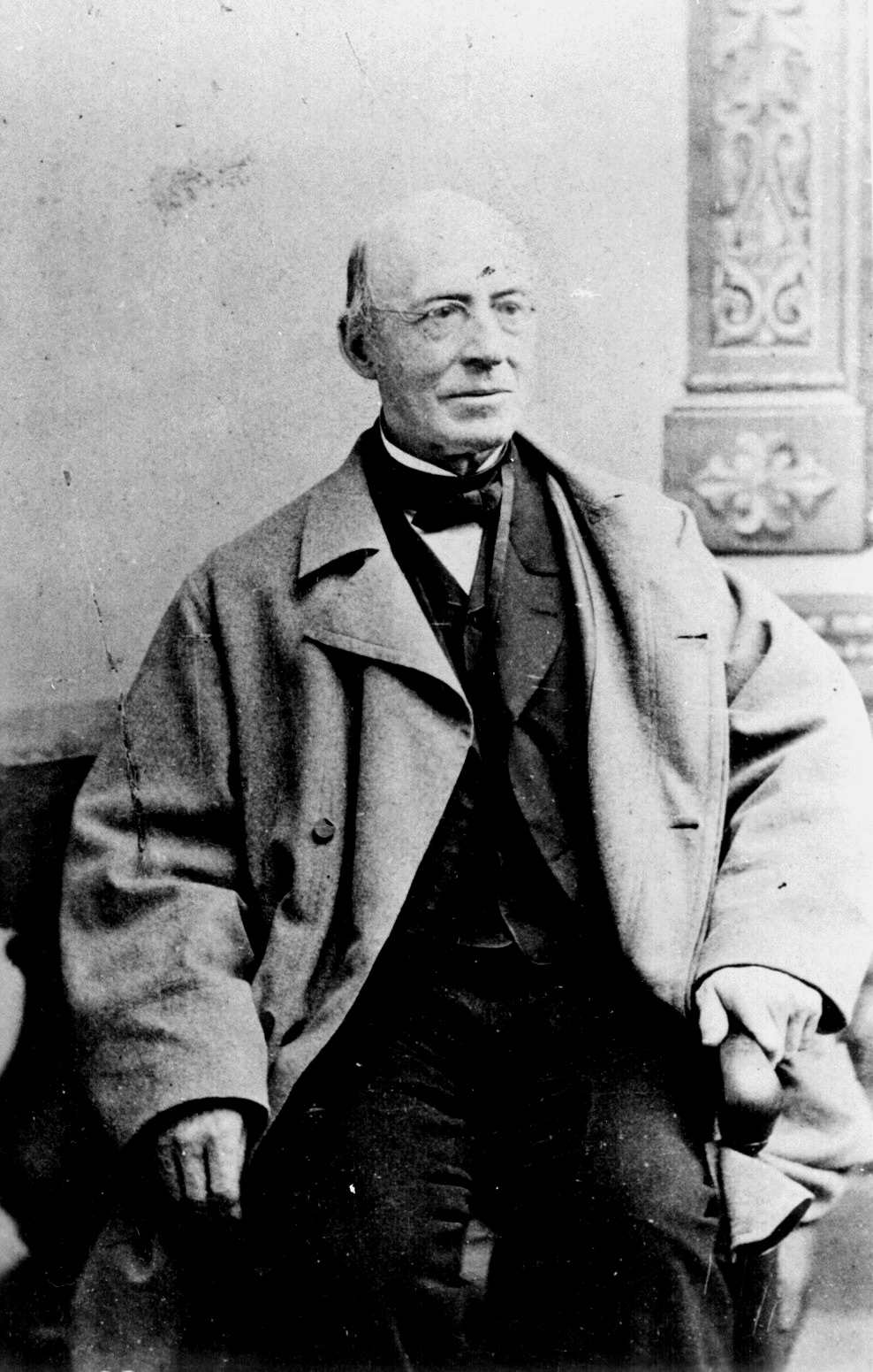
William Lloyd Garrison
In the years leading up to the Civil War, Massachusetts was a center of abolitionist activity within the United States. Two prominent abolitionists from the Commonwealth were William Lloyd Garrison and Wendell Phillips. Garrison founded the New England Anti-Slavery Society in 1832, and helped changed perceptions on slavery. The movement increased antagonistic over the issues of slavery. The antagonism resulted in anti-abolitionist riots in Massachusetts between 1835 and 1837. The works of abolitionists contributed to the eventual actions of the Commonwealth during the Civil War.
Massachusetts was among the first states to respond to President Lincoln's call for troops. Massachusetts was the first state to recruit, train and arm a black regiment with white officers, the 54th Massachusetts Volunteer Infantry.
Prosperity decades: 1900–1929[]
Massachusetts entered the twentieth century with a strong industrial economy. Despite a lack of agricultural progress, the economy prospered between 1900 and 1919. Factories throughout the Commonwealth produced goods varying from paper to metals. Boston, in the year 1900, was still the second most important port within the United States, as well as the most valuable U.S. port in terms of its fish market. By 1908, however, the value of the port dropped considerably due to competition. Population growth within this period, which was aided by immigration from abroad, helped in urbanization and forced a change in the ethnic make-up of the Commonwealth.
The largely industry based economy of Massachusetts began to falter, however, due to the dependence of factory communities upon the production of one or two goods. External low-wage competition, coupled with other factors of the Great Depression in later years, led to the collapse of Massachusetts’s two main industries: shoes and textiles. Between 1921 and 1949 the failure of those industries would reveal itself to be responsible for rampant unemployment and the urban decay of once-prosperous industrial centers.
Depression and war: 1929–1945[]
Even before the Great Depression struck the United States, Massachusetts was experiencing economic problems. The crash of the Commonwealth’s major industries led to declining population in factory towns. The Boston Metropolitan area became one of the slowest growing areas in the United States between 1920 and 1950. Internal migration within the Commonwealth, however, was altered by the Great Depression. In wake of economic woes, people moved to the metropolitan area of Boston looking for jobs, only to find high unemployment and dismal conditions. In the depressed situation that predominated in Boston during this era, racial tension manifested itself in gang warfare at times, notably with clashes between the Irish and Italians.
Massachusetts also endured class conflict during this period. This might be represented by the 1912 general strike of Lawrence. In the course of the disruptive event, almost all of the town’s mills were forced to shut down as a result strife over wages that sustained only poverty. The issues of worker conditions and wages had been subjects of discussion in the Commonwealth before. In example, when the legislature decreed that women and children could work only 50 hours per week, employers cut wages proportionally. Eventually, the demands of the Lawrence strikers were given into, and a pay increase was made.
The net result of the economic and social turmoil in Massachusetts was the beginning of a change in the Commonwealth’s way of functioning. Politics helped to encourage stability among social groups by elevating members of various ranks in society, as well as ethnic groups, to influential posts. The two major industries of Massachusetts, shoes and textiles, had entered of recession of worth that not even World War II could prevent permanently. Thus, the Commonwealth’s economy was ripe for change as the post-war years dawned.
Economic changes: decline of manufacturing 1945–1985[]
World War II precipitated great changes in the economy of Massachusetts, which in turn led to changes in society. The aftermath of WWII created a global economy that was focused upon the interests of the United States, both militarily and in relation to business. The domestic economy in the United States was altered by government procurement policies focused on defense. In the years following WWII, Massachusetts was transformed from a factory system to a largely service and high-tech based economy. During WWII, the U.S. government had built facilities that they leased, and in the post-war years sold, to defense contractors. Such facilities contributed to an economy focused on creating specialized defense goods. That form of economy prospered as a result of the Cold War, the Vietnam War, and the Korean War.
In the ensuing years, government contracts, private investment, and research facilities helped to create a modern industry, which reduced unemployment and increased per capita income. All of these economic changes encouraged suburbanization and the formation of a new generation of well-assimilated and educated middle-class workers. At the same time, suburbanization and urban decay made the differences between various social groups evident, leading to a renewal of racial tension. Boston, a paragon of the problems in Massachusetts cities, experienced numerous challenges that led to racial problems. The problems facing urban centers included; declining population, middle-class flight, departure of industry, high unemployment, rising taxes, low property values, and competition among ethnic groups.
Modern economy and society: 1985–2007[]
Over the past 20-30 years, Massachusetts has cemented its place in the Republic as a center of education (especially higher education) and high-tech industry, including the biotechnology and information technology sectors. With better-than-average schools overall and many elite universities, the area was well placed to take advantage of the technology-based economy of the 1990s.
The Commonwealth had several notable citizens in federal government in the 1980s, including almost presidential hopeful and Senator Ted Kennedy and House Speaker Tip O'Neill. This legislative influence allowed the Commonwealth to receive federal highway funding for the $14.6 Billion Central Artery/Tunnel Project. Known colloquially as the "the Big Dig," it was the biggest federal highway project ever at the time approved. Designed to relieve some of the traffic problems of the poorly planned city, it was approved in 1987. Major construction lasted until 2005, and as of 2007, landscaping is still ongoing. The project has been controversial due to massive budget overruns, repeated construction delays, water leaks in the new tunnels which sprouted in 2004, and a ceiling collapse in 2007 that killed a city resident.
Several Massachusetts Democratic Party politicians have run for the office of President of the United States in this time periods, won the primary elections, and gone on to contest the national elections. These include Michael Dukakis, who was defeated by George H. W. Bush in 1988, as well as John Kerry, who was defeated by George W. Bush in 2004.
In 2002 the Roman Catholic Church sex abuse scandal among local priests became public. The diocese was found to have knowingly moved priests who sexually molested children from parish to parish and to have covered up abuse. The revelations caused the resignation of the archbishop, Cardinal Law, and resulted in a $85 million dollar settlement with the victims. With the large Irish and Italian Catholic populations in Boston, this was a big concern. The diocese, under financial pressure, closed many of its churches. In some churches, parishioners camped out in the churches to protest and block closure.
On November 18, 2003, the Massachusetts Supreme Judicial Court (SJC) deemed that the Commonwealth could not deny marriage rights to same-sex couples under the Constitution of Massachusetts, the oldest written constitution in the world still in force, having entered into effect in 1780. On February 4, 2004, the SJC followed that ruling with a statement saying that allegedly separate but equal civil unions, implemented as of late in Vermont, would not pass constitutional muster and that only full same-sex marriage rights met constitutional guarantees. On May 17, 2004, the ruling took effect and thousands of gay and lesbian couples across the Commonwealth entered into marriage. Opponents of same-sex marriage subsequently pushed for an amendment to the Constitution of Massachusetts that would allow the state to deny marriage rights to same-sex couples. It was necessary for the amendment to be approved by at least 1/4 of the members present in two consecutive legislative sessions of the Massachusetts legislature, as well as receiving majority support in a popular referendum. It passed the first legislative session, but was defeated in the second session, receiving less than 1/4 of the votes of the legislators present. As public opinion polls currently indicate majority support for gay marriage among the people of the Commonwealth, it is likely that the issue is settled in Massachusetts.
Increased white-collar jobs have driven suburban sprawl, but the consequent effects of sprawl have been lessened by regulations on land use and zoning, as well as an emphasis on "smart growth". In recent years, the Commonwealth has lost population as skyrocketing housing costs have driven many away from Massachusetts. The Boston area is the third-most expensive housing market in the country. Over the last several years there has been about a 19,000 person net outflow from the Commonwealth.
In 2006, the Massachusetts legislature enacted the first plan in the United States to provide all Commonwealth citizens with universal health insurance coverage, using a variety of private insurance providers. Insurance coverage for low-income individuals is paid for with tax revenues, and higher income people who don't have health insurance are required to purchase it. (The health insurance market is publicly regulated, so, at least in Massachusetts, no one can be denied coverage because of pre-existing conditions or be forced to pay exorbitant rates.) The implementation of Commonwealth Care, the new universal coverage law, is proceeding, as of 2007.
On October 27, 2004, the Boston Red Sox baseball team won their first World Series in 86 years, after defeating their hated historical rivals, the New York Yankees, in one of the most epic American League Championship Series to have ever been played.
Boundaries[]
The history of the boundaries of Massachusetts is somewhat complex and covers several centuries. Land grants made to various groups of early colonists, mergers and secessions, and settlements of various boundary disputes all had a major influence on the modern definition of the Commonwealth. Disputes arose due to both overlapping grants, inaccurate surveys (creating a difference between where the border "should" be and where markers are placed on the ground). Having loyal settlers actually on the ground also partially determined which portions of their vast claims early groups held on to.
Founding grants[]
In 1607, the Plymouth Company was granted a coastal charter for all coastal territory up to a certain distance from the eastern shoreline of North America, from 38°N to 45°N. The northern boundary was thus slightly farther north than the current Maine-New Brunswick border, and the southern border intentionally overlapped with the Virginia Company of London ("London Company") from the 38th parallel (near the current Maryland-Virginia border) to the 41st (near the current Connecticut-New York border in Long Island Sound). Neither colony was allowed to settle within 100 miles of the other. The Plymouth Company's patent fell into disuse after the failure of the Popham Colony in what is now Maine. In the meantime, the Plymouth Colony had settled outside the territory of the London Company due to navigational difficulties. The Plymouth Company was reorganized as the Plymouth Council for New England, and given a new royal sea-to-sea charter for all North American territory from 40° North (just east between present-day Philadelphia and Trenton, New Jersey) and 48° N (thus including all of modern-day New Brunswick, Nova Scotia, and Prince Edward Island). The Plymouth Colony was granted land patents between 1621 and 1630 from the Council to legitimize its settlement, though it maintained political independence under the Mayflower Compact.
The Plymouth Council for New England made subgrants to various entities before it was surrendered to the crown in 1635 and ceased to operate as a corporate entity.
The Sheffield Patent granted the use of Cape Ann to members of the Plymouth Colony and the Dorchester Company. The fishing colony there failed, but led to the foundation of Salem. The bankrupt Dorchester Company's lands were reissued as part of a larger grant to the Massachusetts Bay Company. Massachusetts Bay obtained in 1628/29 a sea-to-sea patent for all lands and island from three miles north of the Merrimack River (at the current Massachusetts-New Hampshire border), to three miles south of the extents of the Charles River and Massachusetts Bay. The Charles river starts near Boston (in the middle of the territory) but flows in a circuitous path southeast to near present-day Bellingham, which is on the modern Rhode Island border. Land belonging to any other colonies as of November 3, 1629, was excluded from the grant.
The land claims of Massachusetts Bay and Plymouth Colony (later combined) overlapped with several other colonies in the 1600s and 1700s.
The boundary between the Massachusetts Bay Colony and Plymouth Colony was settled in 1639, and today forms most of the border between Norfolk County, Plymouth County, and Bristol County.
In 1622, the Province of Maine obtained a patent for lands north of Massachusetts Bay border near the Merrimack River, up to the Kennebec River. This was soon split at the Piscataqua River, with the southern portion becoming the Province of New Hampshire. In 1664, Maine obtained an enlarged charter containing land out to the St. Croix River, and control of parts Maine changed hands several times, including at times unification with the Province of New York. New Hampshire was joined with Massachusetts Bay from 1641-1679 and 1688-1691.
The 1629 charter of Massachusetts Bay was canceled by a judgment of the high court of chancery of England, June 18, 1684.[3]
The Province of Massachusetts Bay was formed in 1691-92 by the British monarchs William and Mary. It included the Massachusetts Bay Colony, the Plymouth Colony, the Province of Maine (including the eastern territories that had been lost to the Province of New York), and Nova Scotia (which included present-day New Brunswick and Prince Edward Island). Dukes County (Martha's Vineyard and the Elizabeth Islands) and Nantucket were transferred from the Province of New York.
In 1696, Nova Scotia was granted its independence, but the boundary with Maine would be disputed in various ways until the 1840s.
New Hampshire boundary[]
The disputed boundary between Massachusetts Bay Company and the Province of New Hampshire.
The Province of New Hampshire was granted its independence at the foundation of the Province of Massachusetts Bay, but the language defining the southern border with Massachusetts Bay referenced the Merrimack River in an ambiguous way
- all that parte of New England in America lying and extending from the greate River comonly called Monomack als Merrimack on the northpart and from three Miles Northward of the said River to the Atlantick or Western Sea or Ocean on the South part [Pacific Ocean][3]
The resulting was a decades-long disagreement over the northern boundary of Massachusetts. Massachusetts claimed land west of the Merrimack as calculated from the headwaters of the river (in modern-day Franklin), but New Hampshire claimed that its southern boundary was the line of latitude three miles north of the river's mouth. The parties appealed to King George II of England, who ordered the dispute be settled by agreement between the parties. Commissioners from both colonies met at Hampton in 1737 and sent their agreement to the King.
In 1740, the King settled the dispute in a surprising manner, by declaring "that the northern boundary of Massachusetts be a similar curve line pursuing the course of the Merrimack River at three miles distance on the north side thereof, beginning at the Atlantic Ocean and ending at a point due north of a place called Pautucket Falls (now called Lowell), and by a straight line drawn from thence west till it meets his Majesty's other governments." This ruling favored New Hampshire and actually gave it a strip of land 50 miles beyond its claim. Massachusetts declined to do a physical survey, so New Hampshire laid markers on its own.[3]
Rhode Island eastern border[]
Early settlements and boundaries of the Plymouth Colony.
In 1641, the Plymouth Colony (at the time separate from the Massachusetts Bay Colony) purchased from the Indians a large tract of land which today includes the northern half of East Providence (from Watchemoket to Rumford), Rehoboth, Seekonk, and part of Pawtucket. In 1645, John Brown of Plymouth bought a considerably smaller piece of land from the Indians, which today comprises the southern part of East Providence (Riverside), Barrington, and a small part of Swansea. Finally, in 1661, Plymouth completed the "North Purchase", from which Cumberland, Attleboro and North Attleborough were later to be formed. The whole territory, which also included parts of modern Somerset, and Warren, Bristol, and Woonsocket in Rhode Island, was at the time called "Rehoboth". The center of "Old Rehoboth" was within the borders of modern East Providence.
By the 1650s, Massachusetts Bay, the Colony of Rhode Island (not yet unified with Providence) the Connecticut Colony, and two different land companies all claimed what is now Washington County, what was referred to as Narragansett Country. Massachusetts Bay had conquered Block Island in 1636 in retaliation for the murder of a trader, and Massachusetts families settled there in 1661. The Plymouth Colony's land grant specified its western boundary as the Narragansett River;[4] it is unclear whether this referred to the Pawcatuck River (on the current Connecticut-Rhode Island Border) or Narragansett Bay (much farther east, near the modern-day Rhode Island-Massachusetts border).
In 1663, Rhode Island obtained a patent extending its territory in certain places three miles east of Narragansett Bay. In 1664, a royal commission appointed by King Charles II of England denied the claims of Massachusetts and Plymouth to land west of Narragansett Bay, granting jurisdiction to the newly unified Colony of Rhode Island and Providence Plantations (pending resolution of the claims of Connecticut). However, the claims of Plymouth to all lands east of Narragansett Bay were upheld, and so the border was set in practice.[4]
The 1691 charter unified Massachusetts Bay with Plymouth Colony (including Rehoboth) and said that the combined territory would extend as far south as "Our Collonyes of Rhode Island Connecticut and the Marragansett Countrey"[3] (Narragansett Country).
In 1693 the throne of William and Mary issued a patent extending Rhode Island's territory to three miles "east and northeast" of Narragansett Bay, conflicting with the claims of Plymouth Colony.[5] This enlarged the area of conflict between Rhode Island and the Province of Massachusetts.
The issue was not addressed until 1740, when Rhode Island appealed to King George II of England. Royal commissioners from both colonies were appointed in 1741, and decided in favor of Rhode Island. The King affirmed the settlement in 1746 after appeals from both colonies. The royally approved three-mile boundary moved several towns on the eastern shore of Narragansett Bay (east of the mouth of the Blackstone River) from Massachusetts to Rhode Island.
This included what is now Bristol County (the towns of Barrington, Bristol, and Warren), along with Tiverton, Little Compton, and Cumberland (which was carved out of Attleborough). East Freetown, which was left on the Massachusetts side of the border, was officially purchased by Freetown, from Tiverton in 1747.
Commissioners from Rhode Island had the new boundary surveyed in 1746 (without consulting Massachusetts), based on six reference points, from each of which a distance was measured 3 miles inland. Massachusetts accepted this border until 1791, when its own surveyors found that the Rhode Island surveyors had "encroached" on Massachusetts territory by a few hundred feet in certain places. (Rhode Island disagreed.) Of particular concern was the boundary near Fall River, which would later fall in the middle of a thickly settled area of high taxable value.[4]
In 1812, after a court case involving the Massachusetts border, the western half of Old Rehoboth was set off as a separate township called Seekonk, leaving the eastern part as Rehoboth. Old Rehoboth's town center now became the heart of Old Seekonk.
In 1832, Rhode Island filed a case with the United States Supreme Court, but after six years of deliberations, it was dismissed. The court decided it did not have the jurisdiction to rule on the matter.[6]
In 1844 and 1845, commissioners were once again authorized to survey and mark the boundary from Wrentham to the Atlantic Ocean, to address the inaccuracies of the 1746 survey. A report was issued in 1848, but the Massachusetts legislature refused to agree to the proposed solution, after being petitioned by residents of Fall River.[4][7]
Both states filed bills of equity with the Supreme Court in 1852, and after more surveying and negotiation, a decree was issued on December 16, 1861. On March 1, 1862, when the Supreme Court ruling became effective,[3] the western part of Old Seekonk (all of which was on the eastern shore of the Blackstone River) was ceded by Massachusetts and incorporated as East Providence. Part of North Providence was also combined with the former Pawtucket, Massachusetts and a sliver of Seekonk to form the modern Pawtucket. A small amount of land was also added to Westport.[7] The southern boundary of Fall River was moved from Columbia Street to State Street, expanding its territory. The Supreme Court made these adjustments not in conformance with King George's instructions, but to unify the thickly settled areas of Pawtucket and Fall River under the jurisdiction of a single state.[4]
The 1861-2 boundary was slightly redefined in 1897, using stone markers instead of high-water levels. The physical survey was performed in 1898, and ratified by both states.
Rhode Island northern border[]
In 1710-11, commissioners from the Colony of Rhode Island and Providence Plantations and the Province of Massachusetts Bay agreed that the stake planted in 1642 by Nathaniel Woodward and Solomon Saffrey at Burnt Swamp Corner on the plains of Wrentham, said to be at 41°55'N and thought to be three miles south of the southernmost part of the Charles River, would represent the starting point for the border.
The line extending west from the stake was surveyed in 1719, but inaccurately.[3]
In 1748, Rhode Island appointed a commission to survey the line from the stake to the Connecticut border, but Massachusetts failed to send a delegation. The surveyors could not find the 1642 stake, and so marked a line from three miles south, by their reckoning, of "Poppatolish Pond" (presumably Populatic Pond, near Norfolk Airpark in Norfolk). It was discovered that the Woodward and Saffrey stake was considerably farther south than three miles from the Charles River.[3]
Rhode Island claimed that its commissioners had made a mistake in basing the border on the 1642 stake, and in 1832 filed a case with the Supreme Court of the United States. In 1846, the Court ruled in favor of Massachusetts. The same surveyors that marked the eastern boundary the previous year then marked the northern boundary, filing their report in 1848. Rhode Island accepted the markings as the legal boundary on the condition that Massachusetts do the same, but the Commonwealth failed to do so until 1865. But by that time, Rhode Island claimed that the 1861 Supreme Court case had changed matters so much as to render the "line of 1848" unacceptable.
Connecticut border[]
The town of Springfield was settled in 1636 by William Pynchon (as Agawam), covering the modern towns of Westfield, Southwick, West Springfield, Agawam, Chicopee, Wilbraham, Ludlow and Longmeadow in Massachusetts, and Enfield and Somers in Connecticut. It was connected to the Atlantic and major avenues of trade by the Connecticut River, which ran past Hartford and through the territory of the Connecticut Colony. After relations with Connecticut soured in 1637, Pynchon's settlers voted to affiliate with Massachusetts.[8]
In 1641, Connecticut founded a trading post at Woronoke, which was in what was strongly considered to be Massachusetts territory (now Westfield).[9] Massachusetts complained, and Connecticut demanded that Springfield pay taxes to support the upkeep of the fort at the mouth of the river, in the Saybrook Colony. The tax demand was withdrawn after Massachusetts threatened to start charging Connecticut traders for the use of the port of Boston.[8]
To assert its sovereignty on the northern Connecticut River, the Massachusetts Bay Colony sent Nathaniel Woodward and Solomon Saffrey to survey and mark the boundary. They accidentally marked the boundary with Rhode Island significantly farther than the royally decreed three miles south of the southernmost part of the Charles River. Instead of traversing the territory of Massachusetts by land, they sailed around and up the Connecticut River, calculating the same latitude at which they had misplaced the stake on the Rhode Island border. This compounded the error even further, resulting in a four to seven mile discrepancy between where the border should have been and where it was marked, and awarding more territory to Massachusetts Bay than it had been granted by its charter. Though it was suspicious of this survey, Connecticut would not even receive a charter until 1662, and the dispute would lie dormant for several decades.[9]
The towns of Woodstock, Suffield, Enfield, and Somers were incorporated by Massachusetts, and mainly settled by migrants from the Massachusetts Bay and Plymouth Colonies. In 1686, Suffield and Enfield (incorporated in Massachusetts) were in a dispute over town territory with Windsor and Simsbury (incorporated in Connecticut, and which then included Granby). Massachusetts did not agree to a re-survey, so Connecticut hired John Butler and William Whitney to do the job. They found the southernmost part of the Charles River, and then traveled by land westward. Their 1695 report found that the 1642 line had been drawn too far south.
Consternation ensued. Abortive pleas to the King of England were made in 1702. In 1713 a joint commission 1713 awarded control of Springfield-area towns to Massachusetts (without consulting the residents of those towns), compensating Connecticut with an equal amount of land elsewhere. But the inhabitants of the Connecticut River border towns petitioned to be part of Connecticut in 1724, perhaps due to high taxes in Massachusetts or the greater civil liberties granted in the Connecticut charter.[10]
In 1747, Woodstock petitioned the General Assembly of Connecticut to be admitted to the colony, on the grounds that the transfer of lands from Massachusetts in 1713 had not been authorized by the King. Suffield and Enfield soon followed, and the legislature accepted them in May, 1749, and declared the 1713 compromise null and void. Massachusetts continued to assert sovereignty in practice.[10][3]
In 1770, Southwick was granted independence from Westfield. In May, 1774, residents in southern Southwick, also petitioned Connecticut for entry and secession from northern Southwick, on the grounds they were south of the royally approved border of the Massachusetts Bay Colony (three miles south of the Charles River). The part west of Congamond Lake joined Simsbury, and the part east of the lake joined Suffield.[10]
In 1791 and 1793, commissioners were sent from both states to survey the boundary line yet again, but were unable to agree until a compromise was reached in 1803-4. Massachusetts accepted the nullification of the 1713 compromise and the loss of the border towns, but regained the portion of southern Southwick west of the lake. This resulted in the modern boundary with Connecticut, which is a relatively straight east-west line, except for the "Southwick jog", a small, mostly rectangular piece of Massachusetts surrounded by Connecticut on three sides.[10]
New York border[]
Massachusetts claimed all territory to the Pacific Ocean, based on its 1629 charter, but the Province of New York claimed the west bank of the Connecticut River (passing through Springfield) as its eastern boundary, based on 1664 and 1674 grants to the Duke of York.
In 1773, the western boundary of Massachusetts was settled with the New York in its present location, and surveyed in 1787, following the line of magnetic north at the time. The starting point was a 1731 marker at the Connecticut-New York border, 20 miles inland from the Hudson River.[3]
Massachusetts relinquished sovereignty over its western lands (east of the Great Lakes) to New York in the Treaty of Hartford in 1786, but retained the economic right to buy the Boston Ten Townships from Native Americans before any other party. These purchase rights were sold to private individuals in 1788. The Commonwealth also ceded its claim to far western lands (Michigan and all other land to the Pacific Ocean) to Congress in 1785.
In 1853, a small triangle of land in the southwest corner of the Commonwealth, known as Boston Corners, was ceded from Mount Washington to Ancram. The mountainous terrain prevented Massachusetts authorities from enforcing the law there, making the neighborhood a haven for outlaws and prize-fighters. Local residents had petitioned for the transfer to allow New York authorities to clean up the hamlet.
Maine[]
In 1820, Maine was admitted into the Union as an independent state, as part of the Missouri Compromise. (See the History of Maine for information about its boundaries, including disputes with New Hampshire and Canadian provinces.)
See also[]
- Boston Brahmin
- List of Mayflower passengers
- Culture of Colonial Massachusetts
- First Settlers of Danvers, Massachusetts
- List of People from Massachusetts
- First Families of Massachusetts
- Massachusetts
- First Families of Salem, Massachusetts
- Founders and First Settlers of Medway, Massachusetts
- Harvard University
- Politicians from Massachusetts
- Chronological History of Massachusetts
- Deputies and Representatives to the Great and General Court of Massachusetts
- Early Settlers of New England
- Adams Family
- Adams in Massachusetts
- Adams political family
- King Philip's War
- King Philip's War (participants)
- New England American Revolutionary War Families
References[]
Surveys[]
- Brown, Richard D. and Jack Tager. Massachusetts: A Concise History (2002), the most recent scholarly history
- Clark, Will L. ed., Western Massachusetts: A History, 1636–1925 (1926), history of towns and institutions
- Cumbler, John T. Reasonable Use: The People, the Environment, and the State, New England, 1790-1930 (2001), environmental history
- Formisano, Ronald P., and Constance K. Burns, eds. Boston, 1700-1980: The Evolution of Urban Politics (1984)
- Green, James R., William F. Hartford, and Tom Juravich. Commonwealth of Toil: Chapters in the History of Massachusetts Workers and Their Unions (1996)
- Hall, Donald. ed. The Encyclopedia of New England (2005)
- Hart, Albert Bushnell ed.Commonwealth History of Massachusetts, Colony, Province and State 5 Vol. (1927-30), in-depth history; politics and economy
- Langtry, Albert P. ed., Metropolitan Boston: A Modern History 4 vols. (1929).
- Wilkie, Richard W. and Jack Tager. Historical Atlas of Massachusetts (1991)
- Winsor, Justin ed., The Memorial History of Boston, Including Suffolk County, Massachusetts, 1630-1880 4 vols.
- WPA. Massachusetts: A Guide to Its Places and People. (1937), guide to every city and town
Specialized books[]
To 1780[]
- Adams, James Truslow. The Founding of New England (1921)
- Adams, James Truslow. Revolutionary New England, 1691-1776 (1923)
- Adams, James Truslow. New England in the Republic, 1776-1850 (1926)
- Andrews, Charles M. The Fathers of New England: A Chronicle of the Puritan Commonwealths (1919), short survey
- Axtell, James, ed. The American People in Colonial New England (1973), new social history
- Bailyn, Bernard. The Ordeal of Thomas Hutchinson (1975)
- Bailyn, Bernard. The New England Merchants in the Seventeenth Century (1970)
- Bremer, Francis J. John Winthrop: America's Forgotten Founding Father (2003)
- Brown, Robert E. Middle Class Democracy in Massachusetts, 1691-1789 (1955)
- Cronon, William. Changes in the Land: Indians, Colonists and the Ecology of New England (1983), environmental history
- Fischer, David Hackett. Paul Revere's Ride (1994), explains 1775 in depth
- Hart, Albert Bushnell ed.Commonwealth History of Massachusetts, Colony, Province and State Vol. 1 (1927), to 1689
- Hosmer, James Kendall ed. Winthrop's Journal, "History of New England," 1630-1649
- Karlsen, Carol F. The Devil in the Shape of a Woman: Witchcraft in Colonial New England (1998), new social history
- Labaree, Benjamin Woods. Colonial Massachusetts: A History (1979), scholarly overview
- Labaree, Benjamin W. The Boston Tea Party (1964)
- Lockridge, Kenneth A. A New England Town: The First Hundred Years: Dedham, Massachusetts, 1636-1736 (1985), new social history
- Miller, John C. Sam Adams: Pioneer in Propaganda (1936)
- Palfrey, John Gorham. History of New England vol 1 (1858), political narrative.
- Rutman, Darrett B. Winthrop's Boston: Portrait of a Puritan Town, 1630-1649 (1965)
- Taylor, Robert J. Western Massachusetts in the Revolution (1954)
- Vaughan, Alden T. New England Frontier: Puritans and Indians 1620-1675 (1995)
- Warden, G. B. Boston 1689-1776 (1970)
- Weeden, William. Economic and Social History of New England, 1620–1789 (1890)
- Zobel, Hiller B. The Boston Massacre (1978)
1780-1900[]
- Adams, James Truslow. New England in the Republic, 1776-1850 (1926)
- Banner, James. To the Hartford Convention: The Federalists and the Origins of Party Politics in Massachusetts, 1789-1815 (1970)
- Baum, Dale. The Civil War Party System: The Case of Massachusetts, 1848-1876 (1984), new political history
- Blodgett, Geoffrey The Gentle Reformers: Massachusetts Democrats in the Cleveland Era (1966)
- Brooks, Van Wyck. The Flowering of New England, 1815-1865(1936), famous writers
- Clark, Christopher. The Roots of Rural Capitalism: Western Massachusetts, 1780–1860 (1990)
- Deutsch, Sarah. Women and the City: Gender, Space, and Power in Boston, 1870-1940 (2000)
- Dublin, Thomas. Women at Work: The Transformation of Work and Community in Lowell, Massachusetts, 1826-1860 (1993)
- Faler, Paul Gustaf. Mechanics and Manufacturers in the Early Industrial Revolution: Lynn, Massachusetts, 1780-1860 (1981)
- Formisano, Ronald P. The Transformation of Political Culture: Massachusetts Parties, 1790s-1840s (1983), new political history
- Goodman, Paul. The Democratic-Republicans of Massachusetts (1964)
- Green, James R., William F. Hartford, and Tom Juravich. Commonwealth of Toil: Chapters in the History of Massachusetts Workers and Their Unions (1996)
- Gutman, Herbert. The New England Working Class and the New Labor History (1987)
- Handlin, Oscar and Mary Flug Handlin. Commonwealth: A Study of the Role of Government in the American Economy: Massachusetts, 1774-1861 (1947), influential study
- Handlin, Oscar. Boston's Immigrants: A Study in Acculturation (1941), social history to 1865
- Morison, Samuel Eliot. The Maritime History of Massachusetts, 1783-1860 (1921)
- Nelson, William. Americanization of the Common Law: The Impact of Legal Change on Massachusetts Society, 1760–1830 (1994)
- Peters Jr., Ronald M. The Massachusetts Constitution of 1780: A Social Compact (1978)
- Porter, Susan L. Women of the Commonwealth: Work, Family, and Social Change in Nineteenth-Century Massachusetts (1996)
- Prude, Jonathan. The Coming of Industrial Order: A Study of Town and Factory Life In Rural Massachusetts, 1813–1860 (1983)
- Rosenkrantz, Barbara. Public Health and the State: Changing Views in Massachusetts, 1842–1936 (1972),
- Story, Ronald. The Forging of an Aristocracy: Harvard and the Boston Upper Class, 1800-1870 (1980).
- Szatmary, David. Shays' Rebellion: The Making of an Agrarian Insurrection (1980);
- Tager, Jack, and John W. Ifkovic, eds. Massachusetts in the Gilded Age: Selected Essays (1985), essays on ethnic groups
- Wilson, Harold Fisher. The Hill Country of Northern New England: Its Social and Economic History, 1790–1930(1967)
- Trace And Will. "History Of Massachusetts." 2007.
1900-2006[]
- Abrams, Richard M. Conservatism in a Progressive Era: Massachusetts Politics, 1900-1912 (1964)
- Black, John D. The rural economy of New England: a regional study (1950
- Blewett, Mary H. The Last Generation: Work and Life in the Textile Mills of Lowell, Massachusetts, 1910-1960 (1990)
- Brewer, Daniel Chauncey. Conquest of New England by the Immigrant (1926)
- Conforti, Joseph A. Imagining New England: Explorations of Regional Identity from the Pilgrims to the Mid-Twentieth Century (2001)
- Deutsch, Sarah. Women and the City: Gender, Space, and Power in Boston, 1870-1940 (2000)
- Freeland, Richard M. Academia's Golden Age: Universities in Massachusetts, 1945-1970 (1992)
- Green, James R., William F. Hartford, and Tom Juravich. Commonwealth of Toil: Chapters in the History of Massachusetts Workers and Their Unions (1996)
- Gutman, Herbert. The New England Working Class and the New Labor History (1987)
- Huthmacher, J. Joseph. Massachusetts People and Politics, 1919-1933 (1958)
- Kane, Paula M. Separatism and Subculture: Boston Catholicism, 1900-1920 (1994)
- Lazerson, Marvin, Origins of the Urban School: Public Education in Massachusetts, 1870-1915 (1971)
- Litt, Edgar. The Political Cultures of Massachusetts (1965).
- Lockard, Duane. New England State Politics (1959), covers 1945-58
- Peirce, Neal R. The New England States: People, Politics, and Power in the Six New England States (1976), in-depth coverage of the 1958-75 era
- Stack Jr., John F. International Conflict in an American City: Boston's Irish, Italians, and Jews, 1935-1944 (1979).
- Trout, Charles. Boston, The Great Depression and the New Deal (1977)
- White, William Allen. A Puritan in Babylon: The Story of Calvin Coolidge (1938)
- Whitehill, Walter Muir. Boston in the Age of John Fitzgerald Kennedy (1966)
- WPA. Massachusetts: A Guide to Its Places and People. (1937), guide to every city and town
- Zimmerman, Joseph F. The New England Town Meeting: Democracy in Action (1999)
Primary sources[]
- Online sources, via digitalbookindex.com
- Bradford William. History of Plymouth Plantation Edited by Worthington C. Ford. 2 vols. Boston, 1912. online excerpts
- Dwight, Timothy. Travels Through New England and New York (circa 1800) 4 vol. (1969) Online at: vol 1; vol 2; vol 3; vol 4
- 1837 descriptions of Massachusetts cities, towns, mountains, lakes, and rivers, from Hayward's New England Gazetteer.
- McPhetres, S. A. A political manual for the campaign of 1868, for use in the New England states, containing the population and latest election returns of every town (1868)
- Taylor, Robert J. ed. Massachusetts, Colony to Commonwealth: Documents on the Formation of the Constitution, 1775-1780 (1961)
- Wood, William (ed by Alden T. Vaughan). New England's Prospect (1634), the earliest long description of natural history and Indians
Notes[]
- ^ Massachusetts Secretary of the Commonwealth, Citizen Information Service. Available at: http://www.sec.state.ma.us/cis/cismaf/mf1a.htm (Accessed 9 September 2006)
- ^ René Chartrand, French Fortresses in North America 1535–1763: Québec, Montréal, Louisbourg and New Orleans (Fortress 27); Osprey Publishing, March 20 2005. ISBN 9781841767147
- ^ a b c d e f g h i The Boundary of Massachusetts from Boundaries of the United States and the Several States Franklin K VanZandt USGS Bulletin 1212, 1966 "Massachusetts" pages 95-106
- ^ a b c d e History of Fall River, p. 67-71
- ^ http://oceanstater.blogspot.com/2007/02/border-is-where-part-ii.html
- ^ State of Rhode Island v. Commonwealth of Masachusetts, 37 U.S. 657 (1838)[1]
- ^ a b [A Question of Boundaries, Part III http://aviewfrombattleshipcove.blogspot.com/2007/02/question-of-boundaries-part-iii-fall.html] (A View from Battleship Cove blog)
- ^ a b http://www.bio.umass.edu/biology/conn.river/pynchon.html
- ^ a b The Southwick Jog by Reverend Edward R. Dodge
- ^ a b c d Enfield History - Enfield Historical society
| |||||||||||||||||
| |||||||||||
| This page uses content from the English language Wikipedia. The original content was at History of Massachusetts. The list of authors can be seen in the page history. As with this Familypedia wiki, the content of Wikipedia is available under the Creative Commons License. |