| Main | Births etc |
|---|
| Canterbury Sydney, | |||||||||||||
 Canterbury Hotel, Canterbury Road | |||||||||||||
| Population: | 6,159 [1] | ||||||||||||
| Postcode: | 2193 | ||||||||||||
| Location: | 11 km (7 mi) south-west of Sydney CBD | ||||||||||||
| LGA: | City of Canterbury | ||||||||||||
| State District: | Canterbury | ||||||||||||
| Federal Division: | Grayndler, Watson | ||||||||||||
| |||||||||||||
Canterbury is a suburb in south-western Sydney, in the state of New South Wales, Australia. Canterbury is located 11 kilometres south-west of the Sydney central business district in the City of Canterbury.
The City of Canterbury takes its name from the suburb but its administrative centre is located in the adjacent suburb of Campsie, which is also a large commercial centre. Canterbury is surrounded by Ashbury to the north, Campsie to the west, Earlwood to the south, and Hurlstone Park to the east.
13.3 percent of the population of Canterbury is of Chinese ancestry, 10.9 percent is of Lebanese ancestry and 10.8 is of Greek ancestry.[2]
History[]
Indigenous Australians lived in this area for thousands of years. In 1770, the land along the Cooks River was explored by officers from the HMS Bark Endeavour.
In 1793, the area's first land grant was made to the Chaplain of the First Fleet, the Rev. Richard Johnson. He gave the 100 acre (0.4 km²) grant, located one mile (1.6 km) north of the river, the name Canterbury Vale. The grant was passed onto William Cox, who sold the land for 525 pounds to Robert Campbell in May 1803, after going bankrupt. By 1834 the Campbell Estate grew to 1,242 acres (5 km²). In 1865, daughter Sarah Jeffrey subdivided the land into allotments, each containing several acres. The first major industry was established in 1841 with the building of the Australian Sugar Company's sugar mill by the Cooks River to produce molasses and spirits. Other industries and trades such as boiling down works and tanneries later developed along the river. The Methodists built the first church in the suburb, with services beginning in 1841. The railway line was completed in 1895, encouraging suburban development and leading to the area becoming heavily populated. This was too late for the Sugar Mill, which ceased production in September 1854, but was favourable for horse racing, which informally began in 1871.[3]
After much petitioning of the State Government by local residents, the Municipality of Canterbury was proclaimed on 17 March 1879. A Town Hall was opened in 1889, but eventually Campsie became a more important centre and the city administration was moved from Canterbury in 1962.[4]
Trams[]
In 1921, a tram line was extended from Hurlstone Park to Canterbury Station, in 1927, a through service from Canterbury to the city commenced. The Canterbury line commenced at the Canterbury terminus in Broughton Street where a tram turning loop was provided.[5] Trams travelling towards the City or Balmain headed north-east along Canterbury Road. A service that was provided for by the Darling Street Wharf trams branched off from the main line at New Canterbury Road and connected with lines running along Parramatta Road for Balmain. Services heading towards Marrickville, Newtown, Sydenham and Tempe turned right into Marrickville Road.[6]


Trams travelling along Canterbury Road
The line from Dulwich Hill to Canterbury branched off from the Tempe line at Newtown, travelled along Enmore Road, then Victoria Road, before tuning right onto Marrickville Road and all the way through to Canterbury Road to the Canterbury terminus.[6]
Another line also branched off from the route to Dulwich Hill at Addison Road on Enmore Road, then travelled along Addison Road to New Canterbury Road in Petersham. The line then travelled down New Canterbury Road through Dulwich Hill and Hurlstone Park to Canterbury railway station.
A short lived single track line operated from the Canterbury Line at Hurlstone Park along Old Canterbury Road and Prospect Road to Summer Hill railway station. Services operated between Canterbury and Summer Hill from 1915, however low patronage and competition from motor buses saw the line close in 1933. The disused track and overhead remained in place until the 1950s. Buses replaced the trams in 1954. The Canterbury terminus is currently used as a layover area for buses.[7][8]
Demographics[]
According to the 2011 Census of Population, there were 6,59 residents in Canterbury. 45.6% of people were born in Australia. The most common countries of birth were China 7.1%, Greece 4.4%, Vietnam 3.2%, Lebanon 2.8% and Portugal 2.6%. In Canterbury 35.0% of people only spoke English at home. Other languages spoken at home included Greek 10.8%, Arabic 6.3%, Mandarin 5.8%, Cantonese 4.9% and Portuguese 3.9%. The most common responses for religion in Canterbury were Catholic 29.0%, No Religion 16.2%, Eastern Orthodox 14.6%, Buddhism 7.1% and Anglican 5.9%.[1]
Climate[]
| Climate data for Canterbury | |||||||||||||
|---|---|---|---|---|---|---|---|---|---|---|---|---|---|
| Month | Jan | Feb | Mar | Apr | May | Jun | Jul | Aug | Sep | Oct | Nov | Dec | Year |
| Average high °C (°F) | 27.6 (81.7) |
27.3 (81.1) |
25.9 (78.6) |
23.4 (74.1) |
20.5 (68.9) |
18.2 (64.8) |
17.4 (63.3) |
19.0 (66.2) |
22.1 (71.8) |
23.4 (74.1) |
24.3 (75.7) |
26.5 (79.7) |
23.0 (73.4) |
| Average low °C (°F) | 18.2 (64.8) |
18.3 (64.9) |
16.4 (61.5) |
12.7 (54.9) |
9.5 (49.1) |
7.0 (44.6) |
5.7 (42.3) |
6.4 (43.5) |
9.5 (49.1) |
12.1 (53.8) |
14.6 (58.3) |
16.7 (62.1) |
12.3 (54.1) |
| Precipitation mm (inches) | 76.3 (3.004) |
108.1 (4.256) |
57.6 (2.268) |
100.0 (3.937) |
94.3 (3.713) |
85.9 (3.382) |
64.7 (2.547) |
62.8 (2.472) |
45.1 (1.776) |
63.9 (2.516) |
69.8 (2.748) |
59.4 (2.339) |
886.5 (34.902) |
| Source: [9] | |||||||||||||
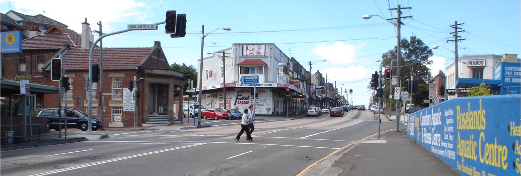
Commercial area[]
Canterbury has a mixture of residential, commercial and industrial developments. Commercial developments are mostly situated on Canterbury Road and surrounding streets. The shopping centre, close to Canterbury railway station, includes an Aldi supermarket and the landmark Hotel Canterbury.
Transport[]

View from the Canterbury Road railway bridge, looking north
Canterbury Road is a major arterial route, 11 kilometres long and the only vehicular crossing of the Cooks River within the suburb. The road connects the inner suburbs of Sydney with Bankstown and suburbs further to the south-west. Secondary routes, King and Holden Streets, connect the suburb to Ashfield in the north.
Canterbury railway station is located on the Bankstown line of the Sydney Trains network. The line, which crosses the Cooks River, was opened in 1895 and electrified in 1926. Two additional tracks were laid for goods traffic through to Port Botany. The station is the terminus for several Sydney bus routes.
Pedestrians and cyclists can cross the Cooks River at one of two dedicated footbridges making the riverside pleasant and accessible for recreational users. The popular Cooks River bicycle track follows the river along its northern bank connecting the suburb with Homebush to the north-west and Botany Bay to the east. The river itself is navigable only during high tide and used occasionally by canoeists. This contrasts with the early history of Canterbury when the river was used to import large quantities of sugarcane.
Parks and gardens[]
Extensive parkland may be found on the banks of the Cooks River. Canterbury Park Racecourse, on the northern bank, features a 1,578-metre track (racecourse) and attracts thousands to its horse racing carnivals.
- Tasker Park is on the southern bank of the Cooks River near the railway bridge. It is named after WS Tasker (alderman 1925-31 and 1937–44). It includes playing fields, a swimming pool and an ice rink. It is connected to the northern bank by a footbridge.


Canterbury Park Racecourse


Industrial area along Cooks River
- Mary MacKillop Reserve is on the southern bank of the Cooks River next to the Canterbury Road Bridge. Originally a rubbish tip, it was built up above flood levels from riverside soils in the 1930s. The reserve was named after Alderman Sydney Hollingsworth Simpson, who helped secure the land, however many residents assumed it was named after Wallis Simpson. A path along the river called "Coronation Row", commemorates the coronation of Queen Elizabeth II and her visit to Sydney in 1953. Simpson Reserve was renamed Mary MacKillop Reserve by Canterbury City Council in 1995.
- Canterbury Park, according to modern boundaries, is part of Ashbury. It is home to Cambell and Blick Ovals.
Schools[]
- Canterbury Boys' High School
- Canterbury Girls High School
- Canterbury Public School[10]
- Canterbury South Public School[11]
Politics[]
Canterbury is part of the East Ward of the City of Canterbury and together with Earlwood, elects three councillors to the city council. The mayor of Canterbury represents the city and not the suburb alone.
For New South Wales state elections, the suburb is in the Electoral District of Canterbury. The district includes surrounding suburbs of Campsie, Earlwood, Hurlstone Park, Croydon Park, western Dulwich Hill, eastern Belfield and northern Turrella.
For federal elections, Canterbury is in the electoral division of Division of Watson . In state and federal elections, Canterbury residents predominantly vote for the Australian Labor Party.
Notable residents[]
- Steve Waugh, cricketer, hails from Canterbury.
- Vali Myers, Artist, born in Canterbury.
- Robbie Farah, Hooker for the Wests Tigers, born in Canterbury.
Gallery[]
")
")
")
")
References[]
- ^ a b Australian Bureau of Statistics (31 October 2012). "Canterbury (State Suburb)". 2011 Census QuickStats. http://www.censusdata.abs.gov.au/census_services/getproduct/census/2011/quickstat/SSC10456?opendocument&navpos=220. Retrieved 29 April 2013.
- ^ http://profile.id.com.au/canterbury/ancestry
- ^ Book of Sydney Suburbs, Frances Pollon (Angus and Robertson) 1990, p.50
- ^ Book of Sydney Suburbs, p.50
- ^ Gregorys, map 33, circa 1945
- ^ a b Gregorys, map 27 and map 28, circa 1945
- ^ http://www.canterbury.nsw.gov.au/www/html/800-heritage-panel-23-earlwood-tram-terminus.asp?intSiteID=1
- ^ http://www.canterbury.nsw.gov.au/www/html/817-heritage-panel-36-wattle-hill-tram-terminus-1913.asp?intSiteID=1
- ^ "BOM - Canterbury". http://www.bom.gov.au/climate/averages/tables/cw_066194.shtml.
- ^ Welcome To Cps!
- ^ Canterbury South Public School - Homepage
External links[]
| ||||||||
| This page uses content from the English language Wikipedia. The original content was at Canterbury, New South Wales. The list of authors can be seen in the page history. As with this Familypedia wiki, the content of Wikipedia is available under the Creative Commons License. |