| Main | Births etc |
|---|
| Mansfield, Ohio | |||
|---|---|---|---|
| — City — | |||
| City of Mansfield | |||
 |
|||
|
|||
| Nickname(s): The Fun Center of Ohio Little Detroit (local nickname) |
|||
| Motto: "The Heart of Ohio" | |||
 |
|||
| Coordinates: Coordinates: | |||
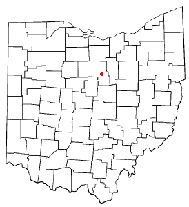
| Country | United States | ||
| State | Ohio | ||
| County | Richland | ||
| Founded | June 11, 1808 | ||
| Incorporated | 1828 (village) | ||
| - | 1857 (city) | ||
| Government | |||
| • Type | Mayor-council | ||
| • Mayor | Timothy Theaker (R) | ||
| Area[1] | |||
| • City | 30.92 sq mi (80.08 km2) | ||
| • Land | 30.87 sq mi (79.95 km2) | ||
| • Water | 0.05 sq mi (0.13 km2) | ||
| Elevation[2] | 1,240 ft (378 m) | ||
| Population (2010)[3] | |||
| • City | 47,821 | ||
| • Estimate (2012[4]) | 47,052 | ||
| • Density | 1,549.1/sq mi (598.1/km2) | ||
| • Urban | 75,250 (US: 372nd) | ||
| • Metro | 124,475 (US: 316th) | ||
| • CSA | 221,398 (US: 130th) | ||
| Time zone | EST (UTC-5) | ||
| • Summer (DST) | EDT (UTC-4) | ||
| ZIP codes | 44900-44999 | ||
| Area code(s) | 419/567 | ||
| FIPS code | 39-47138[5] | ||
| GNIS feature ID | 1056410 | ||
| Website | www.ci.mansfield.oh.us | ||
Mansfield is a city in the U.S. state of Ohio and the county seat of Richland County.[6] Because of its geographic location, the municipality is referred to as being part of the north-east and north-central Ohio regions in the western foothills of the Allegheny Plateau, approximately 63 miles (101 km) northeast of Columbus and 67 miles (108 km) southwest of Cleveland. Mansfield lies midway between Columbus and Cleveland via Interstate 71.
It was founded in 1808 on a fork of the Mohican River in a hilly region surrounded by fertile farmlands, and became a manufacturing center owing to its location with numerous railroad lines. After the decline of heavy manufacturing, the city's industry has since diversified into a service economy, including retailing, education, and healthcare sectors. The 2010 Census showed that the city had a total population of 47,821,[7] making it Ohio's nineteenth largest city.
According to the 2010 Census, the Mansfield, OH Metropolitan Statistical Area (MSA) has a population of 124,475 residents,[8] while the Mansfield-Ashland-Bucyrus, OH Combined Statistical Area (CSA) has 221,398 residents.[9]
Mansfield's official nickname is "The Fun Center of Ohio". It is the largest city in the "Mid-Ohio" region of the state, the north-central region which is generally considered to extend from Marion, Delaware, Knox, Morrow, Crawford, Ashland and Richland counties in the south, to the Firelands area south of Sandusky in the north. Mansfield is also known as the "Carousel Capital of Ohio," "Danger City," and "Racing Capital of Ohio".[10]
History[]
Welcome sign
Mansfield was laid out and founded by James Hedges, Jos. Larwell and Jacob Newman, and was platted in June 1808 as a settlement and was named for Jared Mansfield, the United States, Colonel Surveyor General who directed its planning.[11][12] Originally platted as a square, known today as the public square or Central Park.[11] During that same year of its founding, a log cabin was built by Samuel Martin on lot 97 (where the H.L. Reed building is now), making it the first and only house to be built in Mansfield in 1808.[11] At that time, there were less than a dozen settlers in Richland County while Ohio was still largely wilderness.[11] Two blockhouses were erected on the public square during the War of 1812 for protection against the North American colonies and its Indian allies.[11] Before the war ended, the first courthouse, and jail of Richland County was served in one of two blockhouses that were located on the public square until 1816.[11][13] Mansfield was incorporated in 1828, and in 1857 Mansfield was chartered as a city with a population ascertained to be 5,121.[14] Between 1846 and 1863, the railroads came to the city with the Sandusky, Mansfield and Newark Railroad being the first railroad to reach Mansfield in 1846, the Pittsburgh, Fort Wayne and Chicago Railway in 1849, and the Atlantic and Great Western Railroad in 1863.[15] In 1872 Mansfield became known for the historic Penny Guinness murder, in which an eight-year-old child was killed and left dead in her bed for several days. The case was never solved but remains to be a popular topic of folklore in Mansfield.

View of downtown Mansfield in 1908, looking south on North Main Street from Third Street.
By 1908, the blockhouse became a symbol of Mansfield's heritage during its 100th birthday celebration, and in 1929, the blockhouse was relocated to its present location at South Park.[11][13] In 1913, parts of Mansfield were flooded when the Great Flood of 1913 brought 3 to 8 inches (76 to 200 mm) of rainfall across Ohio between March 23 and March 24.[16][17] The first road across America, the Lincoln Highway came to the city in 1913, smoothing the path for economic growth.[18] In 1924, Oak Hill Cottage, a Gothic Revival brick house, built in 1847 by John Robinson, superintendent of the Sandusky, Mansfield and Newark Railroad was the setting of The Green Bay Tree, Mansfield native Louis Bromfield's first novel.[19]
Like many cities in the Rust Belt, the 1970s and 1980s brought urban blight, a decrease in blue-collar manufacturing jobs, an increase in crime that overwhelmed the city such as drugs and prostitution.[20] In recent years, Mansfield's downtown, which once underscored the community's economic difficulties, has seen innovative revitalization through the establishment of Main Street Mansfield (known today as Downtown Mansfield, Inc.), is a site of new business growth.[20][21] In 1993, Lydia Reid was sworn in as the city's first female mayor and became the longest-serving mayor of Mansfield encompassing three four-year terms.[22] On November 6, 2007, the people of Mansfield elected Donald Culliver as the city's first black mayor and was preceded by Lydia Reid on December 1, 2007.[23]
In December 2009, the city was placed on fiscal watch by the state auditor citing substantial deficit balances in structural operating general funds.[24] On August 19, 2010, Mansfield would become Ohio's largest city to be declared fiscal emergency with a deficit of $3.8 million after city officials failed to pass measures on cost-savings and cut spending, blaming it on the Great Recession.[24][25]
Geography[]
Topography[]


Aerial photo with points of interest
Mansfield is located at (40.754856, −82.522855),[26] directly between Columbus and Cleveland, however, the city lies in the western foothills of the Allegheny Plateau, and its elevation is among the highest of Ohio cities. The highest point in the city 1,493 feet (455 m) above sea level is located at the Woodland Reservoir, an underground water storage (service reservoir) along Woodland Road in southwest Mansfield. The elevation in downtown Mansfield, which is located at Central Park is 1,240 feet (378 m) above sea level,[2] and at Mansfield Lahm Airport, the elevation is 1,293 feet (394 m) above sea level.[27] The highest point in Richland County, second highest point in Ohio (after Campbell Hill) is between 1,510 feet (460 m) and 1,520 feet (463 m) above sea level is located southwest of the city, just off Lexington-Ontario Road at Apple Hill Orchards in Springfield Township.[28]
According to the United States Census Bureau, the city has a total area of 30.92 square miles (80.08 km2), of which, 30.87 square miles (79.95 km2) is land and 0.05 square miles (0.13 km2) is water.[1]
Mansfield is bordered by Madison Township to the east, northwest and southwest, Franklin Township to the north, Weller Township to the northeast, Washington Township to the south, Troy Township to the southwest, Springfield Township and the suburban city of Ontario to the west.
Climate[]
Mansfield has a humid continental climate (Köppen Dfa), typical of the Midwest, with four distinct seasons. Winters are cold and dry but typically bring a mix of rain, sleet, and snow with occasional heavy snowfall and icing. January is the coldest month with an average mean temperature of 25.5 °F (−4 °C),[29] with temperatures dropping to or below 0 °F (−18 °C) 5.3 days per year on average.[29] Snowfall is lighter than in the snowbelt areas to the northeast, but is still somewhat influenced by Lake Erie, located 38 miles (61 km) north of the city. Snowfall averages 48.3 inches (123 cm) per season.[29] The greatest 24-hour snowfall was 23 inches (58 cm) on December 22–23, 2004 when the city was impacted by a major ice storm following the Pre-Christmas 2004 snowstorm, bringing with it a band of freezing rain and sleet led by ice and snow accumulations.[30] Another notable snowstorm to impact the region was the Great Blizzard of 1978. The snowiest month on record was 52.5 inches (133 cm) in February 2010, while winter snowfall amounts have ranged from 91.0 in (231 cm) in 1995–96 to 12.5 in (32 cm) in 1932–33.[31] Springs are short with rapid transition from hard winter to sometimes very warm, and humid conditions. Summers are typically very warm, sometimes hot, and humid with temperatures exceeding 90 °F (32 °C) 6 days per year on average.[29] July is the warmest month with an average mean temperature of 71.5 °F (22 °C).[29] Fall usually is the dryest season with many clear warm days and cool nights. Severe Thunderstorms are not uncommon during the spring, summer, and fall bring with them the threat of large hail, damaging winds and tornadoes. Flooding can also occur from time to time such as the 2007 Midwest flooding that took place in the region on August 20–21, 2007 when Mansfield received 6.24 inches (158 mm) of rain in 24 hours.[32] Monthly precipitation has ranged from 13.23 in (336 mm) in July 1992 to 0.25 in (6.4 mm) in December 1955, while for annual precipitation the historical range is 67.22 in (1,707 mm) in 1990 to 21.81 in (554 mm) in 1963.[31]
The all-time record high temperature in Mansfield of 105 °F (41 °C) was established on July 21, 1934, which occurred during the Dust Bowl drought of the 1930s, and the all-time record low temperature of −22 °F (−30 °C) was set on January 19, 1994 and January 20, 1985.[29] The first and last freezes of the season on average fall on October 17 and April 27, respectively, allowing a growing season of 172 days.[29] The normal annual mean temperature is 49.5 °F (9.7 °C).[29] Normal yearly precipitation based on the 30-year average from 1981–2010 is 44.19 inches (1,122 mm), falling on an average 150 days.[29]
| Climate data for Mansfield, Ohio (Mansfield Lahm Airport), 1981–2010 normals, extremes 1899–present[lower-alpha 1] | |||||||||||||
|---|---|---|---|---|---|---|---|---|---|---|---|---|---|
| Month | Jan | Feb | Mar | Apr | May | Jun | Jul | Aug | Sep | Oct | Nov | Dec | Year |
| Record high °F (°C) | 69 (21) |
71 (22) |
84 (29) |
87 (31) |
95 (35) |
101 (38) |
105 (41) |
103 (39) |
97 (36) |
90 (32) |
78 (26) |
73 (23) |
105 (41) |
| Average high °F (°C) | 32.8 (0.4) |
36.3 (2.4) |
46.2 (7.9) |
59.3 (15.2) |
69.4 (20.8) |
78.1 (25.6) |
81.7 (27.6) |
80.0 (26.7) |
73.3 (22.9) |
61.6 (16.4) |
49.4 (9.7) |
36.5 (2.5) |
58.7 (14.8) |
| Average low °F (°C) | 18.3 (−7.6) |
20.5 (−6.4) |
28.0 (−2.2) |
38.2 (3.4) |
48.1 (8.9) |
57.3 (14.1) |
61.3 (16.3) |
60.0 (15.6) |
52.6 (11.4) |
41.9 (5.5) |
33.1 (0.6) |
22.8 (−5.1) |
40.2 (4.6) |
| Record low °F (°C) | −22 (−30) |
−21 (−29) |
−20 (−29) |
8 (−13) |
20 (−7) |
32 (0) |
40 (4) |
32 (0) |
22 (−6) |
17 (−8) |
−17 (−27) |
−20 (−29) |
−22 (−30) |
| Precipitation inches (mm) | 2.87 (72.9) |
2.39 (60.7) |
3.39 (86.1) |
4.14 (105.2) |
4.54 (115.3) |
4.75 (120.7) |
4.38 (111.3) |
4.37 (111) |
3.32 (84.3) |
2.94 (74.7) |
3.81 (96.8) |
3.29 (83.6) |
44.19 (1,122.4) |
| Snowfall inches (cm) | 13.3 (33.8) |
11.4 (29) |
7.8 (19.8) |
2.6 (6.6) |
trace | 0 (0) |
0 (0) |
0 (0) |
0 (0) |
0.5 (1.3) |
2.2 (5.6) |
10.5 (26.7) |
48.3 (122.7) |
| Avg. precipitation days (≥ 0.01 in) | 14.9 | 12.9 | 13.8 | 14.5 | 13.8 | 11.9 | 10.5 | 10.2 | 9.5 | 10.6 | 12.8 | 14.9 | 150.3 |
| Avg. snowy days (≥ 0.1 in) | 10.8 | 9.0 | 6.1 | 2.1 | 0 | 0 | 0 | 0 | 0 | 0.3 | 2.8 | 8.6 | 39.7 |
| % humidity | 76.1 | 73.5 | 70.7 | 65.2 | 68.0 | 71.3 | 71.4 | 74.8 | 74.8 | 70.2 | 74.8 | 78.0 | 72.4 |
| Source: NOAA (relative humidity 1961–1990)[lower-alpha 2][29][33][34] | |||||||||||||
Demographics[]
| Historical populations | |||
|---|---|---|---|
| Census | Pop. | %± | |
| 1830 | 840 | ||
| 1840 | 1,328 | 58.1% | |
| 1850 | 3,557 | 167.8% | |
| 1860 | 4,581 | 28.8% | |
| 1870 | 8,029 | 75.3% | |
| 1880 | 9,859 | 22.8% | |
| 1890 | 13,473 | 36.7% | |
| 1900 | 17,640 | 30.9% | |
| 1910 | 20,768 | 17.7% | |
| 1920 | 27,824 | 34.0% | |
| 1930 | 33,525 | 20.5% | |
| 1940 | 37,154 | 10.8% | |
| 1950 | 43,564 | 17.3% | |
| 1960 | 47,325 | 8.6% | |
| 1970 | 55,047 | 16.3% | |
| 1980 | 53,927 | −2.0% | |
| 1990 | 50,627 | −6.1% | |
| 2000 | 49,346 | −2.5% | |
| 2010 | 47,821 | −3.1% | |
| Est. 2012 | 47,052 | −4.6% | |
2012 estimate | |||
2010 census[]
As of the census[3] of 2010, there were 47,821 people, 18,696 households, and 10,655 families residing in the city. The population density was 1,549.1 inhabitants per square mile (598.1 /km2). There were 22,022 housing units at an average density of 713.4 per square mile (275.4 /km2). The racial makeup of the city was 73.3% White, 22.1% African American, 0.2% Native American, 0.7% Asian, 0.1% Pacific Islander, 0.5% from other races, and 3.0% from two or more races. Hispanic or Latino of any race were 1.9% of the population.
There were 18,696 households of which 27.5% had children under the age of 18 living with them, 36.0% were married couples living together, 16.6% had a female householder with no husband present, 4.4% had a male householder with no wife present, and 43.0% were non-families. 37.1% of all households were made up of individuals and 14.6% had someone living alone who was 65 years of age or older. The average household size was 2.21 and the average family size was 2.88.
The median age in the city was 38.5 years. 20.2% of residents were under the age of 18; 10.1% were between the ages of 18 and 24; 28% were from 25 to 44; 26% were from 45 to 64; and 15.7% were 65 years of age or older. The gender makeup of the city was 53.0% male and 47.0% female.
2000 census[]
As of the census[5] of 2000, there were 49,346 people, 20,182 households, and 12,028 families residing in the city. The population density was 1,649.8 people per square mile (637.0/km²). There were 22,267 housing units at an average density of 744.6 per square mile (287.4/km²). The racial makeup of the city was 76.77% White, 19.65% African American, 0.28% Native American, 0.63% Asian, 0.04% Pacific Islander, 0.56% from other races, and 2.07% from two or more races. Hispanic or Latino of any race were 1.23% of the population.[35]
There were 20,182 households out of which 27.3% had children under the age of 18 living with them, 40.5% were married couples living together, 15.2% had a female householder with no husband present, and 40.4% were non-families. 34.8% of all households were made up of individuals and 13.8% had someone living alone who was 65 years of age or older. The average household size was 2.28 and the average family size was 2.93.[35]
In the city the population was spread out with 23.9% under the age of 18, 9.3% from 18 to 24, 29.7% from 25 to 44, 21.7% from 45 to 64, and 15.5% who were 65 years of age or older. The median age was 36 years. For every 100 females there were 98.5 males. For every 100 females age 18 and over, there were 96.1 males.[35]
The median income for a household in the city was $30,176, and the median income for a family was $37,541. Males had a median income of $30,861 versus $21,951 for females. The per capita income for the city was $17,726. About 13.2% of families and 16.3% of the population were below the poverty line, including 24.5% of those under age 18 and 9.6% of those age 65 or over.[35]
Languages[]
As of 2000, speakers of English accounted for 95.98% of residents, Spanish by 1.46%, German by 1.11%, and French speakers comprised 0.56% of the population.[36]
Other languages that were spoken throughout the city include Chinese at 0.21%, Italian at 0.17%, Japanese at 0.11%, and Greek at 0.10% of the population.[36] Mansfield also has a small percentage of residents who speak first languages other than English at home (4.02%).[36]
Law and government[]


Mansfield Municipal Building
Mansfield has a mayor-council government. The mayor who is elected every four years, always in November, one year before United States presidential elections and limited to a maximum of three terms. Mayors are traditionally inaugurated on or around the first of December. The current mayor is Timothy Theaker, a Republican, elected in 2011.[37]
Mansfield city council is an eight-member legislative group that serve four-year terms. Six of the members represent specific wards; two are elected city-wide as at-large council members.[38] Democrat Phillip Scott has been Mansfield's council president since November 2007.[39]
While Mansfield and Richland County have historically supported the Republican Party for decades, other parts of Ohio like Cleveland and parts of Northeast Ohio have historically supported the Democratic Party.[40] During the 2008 Presidential election, although Barack Obama carried Ohio, John McCain carried Richland County.[41]
Regional representatives[]
Mansfield is currently represented in the U.S. House of Representatives by Pat Tiberi (R), in the U.S. Senate by Rob Portman (R) and Sherrod Brown (D), in the state senate by Larry Obhof (R), and in the state house by Mark Romanchuk (R).
Crime[]
The City of Mansfield is policed by a Municipal Police Department, the Mansfield Division of Police.[42] According to the FBI statistics released in 2012, Mansfield has a violent crime rate far below the national average, with only one homicide reported in the city that year. Property crime rates were slightly below the national average. 178 violent offenses (1 murder, 27 forcible rapes, 93 robberys and 57 aggravated assaults) were reported in 2012, compared with 3,205 property crimes (1,016 burglarys, 2,104 larceny-thefts, 85 motor vehicle thefts and 51 arsons) that were reported that same year.[43][44] Neighborhoodscout.com reported a crime rate of 69.27 per 100 residents for property crimes, and 2.91 per 1000 for violent crimes (compared to national figures of 32 per 1000 for property crimes and 5 per 1000 for violent crime in 2008).[45]
Economy[]
| Top Employers based in Mansfield, Ohio Source: Richland Community Development Group[46] | |||||
| Rank | Company/Organization | # | |||
| 1 | MedCentral Health System | 2,500 | |||
| 2 | Richland County | 1,474 | |||
| 3 | Newman Technology | 1,100 | |||
| 4 | Jay Industries | 943 | |||
| 5 | Gorman-Rupp Company | 809 | |||
| 6 | CenturyLink | 800 | |||
| 7 | Therm-O-Disc | 721 | |||
| 8 | Mansfield Board of Education | 700 | |||
| 9 | DOFASCO Corp. (Copperweld) | 666 | |||
| 10 | Mansfield Correctional Institution (MANCI) | 621 | |||
| 11 | City of Mansfield | 575 | |||
| 12 | Richland Correctional Institution (RICI) | 443 | |||
| 13 | AK Steel Corp. | 389 | |||
| 14 | School Specialty | 381 | |||
| 15 | Walmart | 314 | |||
| 16 | Kroger | 300 | |||
| 17 | Crane Plumbing | 280 | |||
| 18 | 179th Airlift Wing | 275 | |||
Mansfield's greatest period of industrial development was led by the city's home appliances and stove manufacturing industries, including Westinghouse Electric Corporation and the Tappan Stove Company.[47] By the late 1920s, Westinghouse had become the city's largest employer, specializing in electric lighting, industrial heating and engineering, and home appliances.[48]


AK Steel Mansfield Works production facility
However, like many cities in the rust belt, Mansfield saw a large decline in its manufacturing and retail sectors. Beginning with the steel Recession of the 1970s, the loss of jobs to overseas manufacturing, prolonged labor disputes, and deteriorating factory facilities all contributed to heavy industry leaving the area. Mansfield Tire & Rubber Company, Ohio Brass Company,[49][50] Westinghouse, Tappan and many other manufacturing plants were either bought-out, relocated or closed, leaving only the AK Steel plant in Mansfield as the last remaining heavy industry employers. The AK Steel Mansfield Works production facility, formerly Armco Steel, was the location of a violent 3-year United Steelworkers Union lock-out and strike from 1999 to 2002.[51] On June 1, 2009, General Motors filed for Chapter 11 bankruptcy protection and announced that its Ontario stamping plant (Mansfield-Ontario Metal Center) would close in June 2010.[52]
With the loss of the jobs, locally owned businesses in downtown Mansfield closed, as did much of the retail built in the 1960s along Park Avenue West (formerly known as "The Miracle Mile") and Lexington Avenue. New big-box retail, shopping strips and franchise restaurants have been built in the adjacent suburban city of Ontario, which has replaced Mansfield as the retail hub for Richland County and north-central Ohio.


The Gorman-Rupp Company
The city has sought to diversify its economy to become less dependent on its struggling manufacturing sector. Remaining manufacturers in Mansfield include steel manufacturer AK Steel, Honda supplier Newman Technology Incorporated, generator manufacturer Hyundai Ideal Electric Company,[53] thermostats manufacturer Therm-O-Disc,[54] pumps manufacturer The Gorman-Rupp Company,[55] plumbing manufacturer Crane Plumbing,[56] paper merchant converting center and warehouse Sabin Robbins Converting Company,[57] carousel manufacturer The Carousel Works,[58] business process outsourcing company StarTek,[59] educational products supplier School Specialty Inc. has a distribution center in Mansfield,[60] and Mansfield Engineered Components,[61] a designer and manufacturer of motion control components for the appliance, transportation, medical casegoods and general industrial markets. Mansfield's healthcare industry includes MedCentral Health System, the city's largest employer and the largest in Richland County.[62] The hospital is the city's primary provider of health care and serves as the major regional trauma center for north-central Ohio.[63]
Mansfield is also home of three well-known food companies. Isaly Dairy Company (AKA Isaly's) was a chain of family-owned dairies and restaurants started by William Isaly in the early 1900s until the 1970s, famous for creating the Klondike Bar ice cream treat, popularized by the slogan "What would you do for a Klondike Bar?". Stewart's Restaurants is a chain of root beer stands started by Frank Stewart in 1924, famous for their Stewart's Fountain Classics line of premium beverages now sold worldwide. The Jones Potato Chip Company, started by Frederick W. Jones in 1945 and famous for their Jones Marcelled Potato Chips, is headquartered in Mansfield.[64]
Film industry[]
From the 1950s through the 1970s, Mansfield was the home of the infamous Highway Safety Foundation, the organization that created the controversial driver's education scare films that featured gruesome film photography taken at fatal automobile accidents in the Mansfield area.[65] The films include Signal 30 (1959), Mechanized Death (1961), Wheels of Tragedy (1963), and Highways of Agony (1969). In addition, the Highway Safety Foundation produced other controversial education films including The Child Molester and Camera Surveillance (both 1964).
In 1962, The Highway Safety Foundation loaned camera equipment to the Mansfield Police Department to film the escapades of some of the city's homosexual men, who met for sexual relations in an underground public restroom deep in the bowels of Central Park. An ugly chapter in the city's history, the men filmed were charged under Ohio's sodomy law, and all served a minimum of one year in the state penitentiary. The resulting footage, combined with overdubbed audio commentary by officials of the Mansfield Police Department, was eventually compiled by HSF as the 1964 film Camera Surveillance. Video artist William E. Jones of Massillon, Ohio, obtained copies of the original footage shot by the Mansfield Police Department. Jones transferred the grainy color footage of the original police surveillance films to video and removed the police commentary, presenting it as a silent piece entitled Tearoom (2007). Jones' film was featured in an exhibit at the Whitney Museum of American Art in New York in 2008. Ironically, there exists today an eatery called The Twisted Fig Tea Room on Main St. in Mansfield, located just a few blocks from Central Park.
Mansfield has also been used as a location for several big-budget Hollywood movies; among the most notable of these were The Shawshank Redemption,[66] Air Force One, and Tango & Cash, all of which featured the Ohio State Reformatory as a backdrop in pivotal scenes.
Robert F. Simon (1908–1992), an American character actor who appeared in film and on television from 1950–1985, was born in Mansfield.
Culture[]
Annual events and fairs[]
The Mansfield/Mehock Relays, an annual two-day invitational track and field meet for high school boys and girls, held in April since 1927 (except for Second World War years), began on the initiative of Harry Mehock, track coach at host Mansfield Senior High School.
The Miss Ohio Pageant (Miss America preliminary), hosted by Mansfield since 1975, is staged annually at The Renaissance.[67]
The Richland County Fair is also held in Mansfield, at the Richland County Fairgrounds.[68] The fair is held in the beginning of August. The fair started on October 26, 1849.[69] In 1872 and 1873, Mansfield also hosted the Ohio State Fair.[69] At the fair there are several rides, livestock judging.
Historical structures and museums[]


Oak Hill Cottage, Mansfield, Ohio: Carpenter Gothic trim on a brick house in the manner of A.J. Davis's Rural Residences
Mansfield is home to the old Ohio State Reformatory, constructed between 1886 and 1910 to resemble a German castle. The supervising architect was F. F. Schnitzer, who was responsible for construction and was presented with a silver double inkwell by the governor of the state in a lavish ceremony to thank him for his services. The reformatory is located north of downtown Mansfield on Ohio 545, and has been the location for many major films,[70] including The Shawshank Redemption, Harry and Walter Go to New York, Air Force One and Tango & Cash. Most of the prison yard has now been demolished to make room for expansion of the adjacent Mansfield Correctional Institution and Richland Correctional Institution, but the Reformatory's Gothic-style Administration Building remains standing and due to its prominent use in films, has become a tourist attraction. The building is used during the Halloween season each year as a haunted attraction known as the "Haunted Reformatory." Many people visit Mansfield to take part in the haunted tour, some from as far as Michigan and Indiana.[71][72]


Soldiers & Sailors Memorial Building, founded in 1889 houses the Mansfield Memorial Museum.
Located in the heart of downtown, the Mansfield Memorial Museum, built in 1887, and opened to the public in 1889 as the Soldiers & Sailors Memorial Hall, is a museum of many different exhibits.[73] Oak Hill Cottage, located amongst the ruins of Mansfield's once mighty industrial district, is a Gothic Revival brick house, built in 1847. One of the most perfect Carpenter Gothic houses in the United States, it is operated by the Richland County Historical Society.[19] Located in the Woodland neighborhood, the Mansfield Art Center, opened in 1945, is a visual arts organization.[74] The Living Bible Museum (aka "BibleWalk") opened in 1987, is Ohio's only life-size wax museum.[75] Architect F.B. Hursh designed several large residences and some of the area's churches in the early 20th century.[76] The Bissman Building, built in 1886 is now open for tours from March to November. The location was also featured in Shawshank Redemption as "the brewer hotel" and "The portland daily bugle". More recently used by the Sy Fy channel's "ghost hunters" and recent music videos.
Parks and outdoor attractions[]
Mansfield has 33 parks ranging in size from the 1/2 acre Betzstone Park to the 35-acre (142,000 m2) South Park.[77] There are also several public golf courses in and around the city. These include Coolridge Golf Course, Forest Hills, Oaktree, Twin Lakes and Wooldridge Woods Golf & Swim Club.[78]
Located in downtown Mansfield's Historic Carrousel District is the Richland Carrousel Park, opened in 1991. It is the first hand-carved indoor wooden carousel to be built and operated in the United States since the early 1930s. It was built by Carrousel Works Inc.[79][80] Kingwood Center, a 47-acre (190,000 m2) estate and gardens, is the former home of Ohio Brass industrialist Charles Kelly King. The Mansfield Motorsports Park (formerly Mansfield Motorsports Speedway), a half-mile automobile race track, hosts the NASCAR Craftsman Truck Series once a year and features a regular weekly series of modified and stock car racing. Southwest of Mansfield near Lexington is the Mid-Ohio Sports Car Course, a road course auto racing facility which hosts AMA Motorcycle Racing and Indy Car racing. Malabar Farm State Park, located southeast of the city, is the former home and farm of Mansfield native and Pulitzer Prize-winning author Louis Bromfield. It served as the location of Humphrey Bogart's wedding to Lauren Bacall.[81][82] Snow Trails Ski Resort is Ohio's oldest ski resort, opened in 1961, and highest at 1,475 feet (450 m). With 16 runs, it is one of the few skiing locations in Ohio.[83]
The Richland B & O Bike Trail, opened in 1995 and operated by the Richland County Park District, is a paved 18.3-mile (29.5 km) hiking and bicycle trail laid out on the abandoned Baltimore & Ohio rail branch line from Butler via Bellville and Lexington to North Lake Park in Mansfield.
Performing arts[]
The Renaissance, built in 1927 and opened in 1928 as the Ohio Theatre, is a historic 1,600 seat movie palace theatre located in downtown Mansfield which hosts a range of performances and home to The Mansfield Symphony.[84] The downtown area is the home of the Mansfield Playhouse, Ohio's second oldest, and one of its most successful, community theatres.[85]
Safety Town[]
In 2012 Mansfield celebrated the 75th anniversary of Safety Town, a free program developed in Mansfield for pre-kindergarten children about pedestrian safety. Over the years the program, through the efforts of the National Safety Town Center, has been improved to include all aspects of child safety. Programs operate in over 4000 communities in the US and 38 other countries.
Media[]


The Mansfield News Journal's editorial headquarters in downtown Mansfield.
Mansfield is served in print by the Mansfield News Journal, the city's only daily newspaper.[86] A defunct newspaper is the Mansfield Shield. It ran from 1892 to 1912 as the Mansfield Daily Shield, and from 1912 to 1913 as the Mansfield Shield.[87]
Mansfield is part of the greater Cleveland radio and television media markets. However, due to its proximity to Columbus, it is common for residents to receive stations from that area as well via over-the-air television transmissions. Mansfield's first AM-radio station (1926) was WLGV (later WJW Mansfield). The Mansfield studio and transmitter were on the ninth floor of the Richland Trust Building. (WJW moved to Akron in 1932 and the WJW call letters were later reassigned WJW, now in Cleveland). Among Mansfield's current radio stations are locally owned Mid-State Multimedia properties of WVNO-FM (106.1) and ESPN Radio WRGM (AM 1440 / 97.3FM), also heard in the market WOSV (91.7FM) NPR News and classical music station, WVMC (90.7FM) Mansfield Christian music station, WYHT (105.3FM) pop/rock, WVNO-FM 106.1 adult contemporary, and WMAN (1400 AM) / (98.3 FM), a news/talk radio station.
Mansfield's local television station is WMFD-TV, part of Mid-State Multimedia Group, the first independent digital station in America.[88] Among the station's more popular programs is four hours of NewsWatch HD now in high-definition television at 5,6,10 and 11pm, local high school football and basketball and extensive local programming. WOHZ-CA offers local weather information, local advertising and an audio simulcast of co-owned WVNO-FM 106.1, along with various local sports events, public affairs and educational/informational programs.
Education[]
Mansfield Public Schools enroll 4,591 students in public primary and secondary grades.[89] The district has 9 public schools including one Spanish immersion school, four elementary schools, one intermediate school, one middle school, one high school, and one alternative school. Other than public schools, the city is home to two private Catholic schools, St. Mary's Catholic School and St. Peter's High School along with St. Peter's Junior High and St. Peter's Elementary School and two Christian schools, Mansfield Christian School and Temple Christian School. The Madison Local School District serves eastern parts of Mansfield, neighboring Madison Township, most of Mifflin Township, and parts of Washington Township.[90]
Mansfield is home to three institutions of higher learning. The Ohio State University has a regional campus at Mansfield,[91] North Central State College, a community college that shares the Mansfield Campus with OSU,[92] and Ashland University's Dwight Schar College of Nursing & Health Sciences, a newerly constructed 46,000-square-foot academic and nursing building that opened for classes on August 20, 2012 is a private institution of higher education, located on the University's Balgreen Campus at Trimble Road and Marion Avenue in Mansfield, offering programs of study leading to the baccalaureate degree in nursing.[93]
Libraries[]
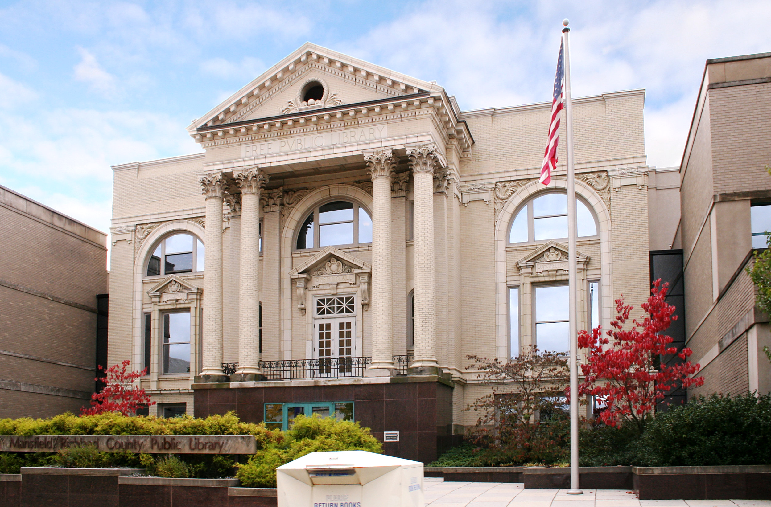
Mansfield/Richland County Public Library, the main branch in downtown Mansfield.
The Mansfield/Richland County Public Library (M/RCPL) has been serving residents of north-central Ohio since 1887.[94] The system has nine branches throughout Richland County including the main library in downtown Mansfield and locations in Bellville, Butler, Crestview, Lexington, Lucas, Madison Township, Ontario, and Plymouth.
Transportation[]
Railroads[]
Three railroads previously served Mansfield, but currently only two, the Norfolk Southern and the Ashland Railway,[95] provide service in the area.
The Sandusky, Mansfield and Newark Railroad opened in 1846 and became part of the Washington-Chicago main line of the Baltimore and Ohio Railroad (B&O) and then later part of a B&O branch line from Newark to Sandusky. In 1849 the Pittsburgh, Fort Wayne and Chicago Railway (later Pennsylvania Railroad mainline) reached Mansfield, and in 1863 the Atlantic and Great Western Railroad (later Erie Railroad mainline) reached Mansfield. After the B&O branch line was abandoned, the 18.3-mile (29.5 km) section from Butler to North Lake Park in Mansfield was opened in 1995 as the recreational Richland B&O Trail.[96] The former B&O track from Mansfield to Willard combined with a piece of the abandoned Erie Railroad east of Mansfield to West Salem to form the L-shaped 56.5-mile (90.9 km) Ashland Railway (1986). A spur of the abandoned Erie Railroad leads west five miles (8 km) to Ontario to serve the General Motors metal stamping plant there.
Highways[]
Mansfield is located on a major east-west highway corridor that was originally known in the early 1900s as "Ohio Market Route 3". This route was chosen in 1913 to become part of the historic Lincoln Highway which was the first road across America, connecting New York City to San Francisco. The arrival of the Lincoln Highway to Mansfield was a major influence on the development of the city. Upon the advent of the federal numbered highway system in 1928, the Lincoln Highway through Mansfield on Park Avenue East and Park Avenue West became U.S. Route 30.
On September 1, 1928, the Lincoln Highway was marked coast-to-coast with approximately 3000 concrete posts set by the Boy Scouts of America. Each post featured a medallion of Abraham Lincoln's profile. One of these concrete markers was erected at curbside in front of Central Methodist Episcopal Church, 378 Park Avenue West. It now stands in downtown's Central Park, on Park Avenue's center divider. The Lincoln Highway Association observed the highway's centennial in June 2013. The celebration's eastern transcontinental tour group visited Mansfield for an overnight stay on June 25 at the Holiday Inn on Park Avenue West, the highway's route through the city.
Mansfield is well connected to the Interstate Highway System. Three highway exits from Interstate 71 connect travelers to Mansfield from Louisville, Kentucky, Cincinnati, Ohio, Columbus, Ohio and points southwest, and from Cleveland, Ohio and points northeast.
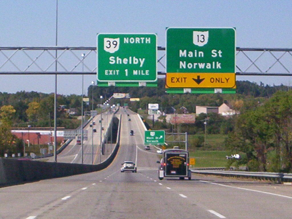

U.S. Route 30 (Martin Luther King Jr. Freeway) westbound approaching the Ohio 13 (Main Street) exit in Mansfield
One limited-access highway serves Mansfield. U.S. Route 30, which carries the Martin Luther King Jr. Freeway along its length through the city has several local highway exits from U.S. Route 30 that connect travelers to Mansfield from Portland, Oregon, Cedar Rapids, Iowa, Fort Wayne, Indiana and points west, and from Atlantic City, New Jersey, Pittsburgh, Pennsylvania, Canton, Ohio and points east.
Two divided highways serve Mansfield. Ohio 309, which connects travelers from the major shopping area of the suburban city of Ontario and points west, and continues east into Mansfield before it merges into U.S. Route 30. Ohio 13 turns into a four-lane divided highway at South Main Street and Chilton Avenue and runs 3.5 miles (5.6 km) to Interstate 71 (full-access interchange) and runs another 3.7 miles (6.0 km) and turns back into a two-lane highway just 2 miles (3.2 km) north of Bellville.
The city has several arterial roads. U.S. Route 42 (Ashland Road and Lexington Avenue), North U.S. Route 42 downtown (South Main Street, East 2nd Street, Hedges Street and Park Avenue East), South U.S. Route 42 downtown (Park Avenue East, Hedges Street, East 1st Street and South Main Street), Ohio 13 (North Main Street and South Main Street), North Ohio 13 downtown (East 2nd Street, South Diamond Street and North Diamond Street), South Ohio 13 downtown (West 5th Street, North Mulberry Street, South Mulberry Street and West 1st Street), Ohio 39 (Springmill Street, North Mulberry Street, West 5th Street, East 5th Street, Park Avenue East and Lucas Road), Ohio 430 (Park Avenue East and Park Avenue West), and Ohio 545 (Wayne Street and Olivesburg Road).[78]
Public transportation[]
The Richland County Transit (RCT) operates local bus service five days a week, except for Saturdays and Sundays. The RCT bus line operates 14 fixed routes within the cities of Mansfield and Ontario along with fixed routes extending into the city of Shelby and Madison Township.[97] Mansfield Checker Cab operates local and regional taxi service 24 hours a day, seven days a week.[98] C & D Taxi also operates local and regional taxi service (Richland and Ashland Counties) seven days a week.
Airports[]


This newly painted 164th Airlift Squadron C-27J Spartan was displayed at Mansfield Lahm Airport in May 2011.
Mansfield Lahm Regional Airport (IATA: MFD, IACO: KMFD, FAA LID: MFD), a city-owned and operated, joint usage facility with global ties, located 3 miles (4.8 km) north of downtown Mansfield.[99] The Mansfield Lahm Air National Guard Base and the 179th Airlift Wing of the Ohio Air National Guard is located at the airport. It uses huge C-130 aircraft, and sponsors an annual air show in July.[100] Area residents take advantage of major airport hubs such as Port Columbus International Airport, Cleveland Hopkins International Airport and Akron-Canton Regional Airport.
Special interest[]
- Johnny Appleseed, American pioneer & conservationist[101]
- The Shawshank Redemption, which was filmed in and around Mansfield
- Elektro, eight robots built by the Westinghouse Corporation in Mansfield.
From the Native American uprising during the war of 1812.
- Copus Massacre and Zimmer Massacre
- The Ohio State Reformatory is also where rapper Lil Wayne shot the video to his song "Go DJ"
- Civil War novel about Richland County soldier in the American Civil War see Hiram's Honor: Reliving Private Terman's Civil War, see http://www.amazon.com/-/e/B001HPJGH0
Sister cities[]
Mansfield has sister city relationships with:[102]
 - Mansfield, England, United Kingdom[103]
- - Tamura, Fukushima, Japan[104]
See also[]
- List of people from Mansfield, Ohio
Notes[]
References[]
- ^ a b "US Gazetteer files 2010". United States Census Bureau. http://www.census.gov/geo/www/gazetteer/files/Gaz_places_national.txt. Retrieved 2013-01-06.
- ^ a b "US Board on Geographic Names". United States Geological Survey. 2007-10-25. http://geonames.usgs.gov. Retrieved 2008-01-31.
- ^ a b "American FactFinder". United States Census Bureau. http://factfinder2.census.gov/faces/nav/jsf/pages/index.xhtml. Retrieved 2013-01-06.
- ^ "Population Estimates". United States Census Bureau. http://www.census.gov/popest/data/cities/totals/2012/SUB-EST2012.html. Retrieved 2013-06-17.
- ^ a b "American FactFinder". United States Census Bureau. http://factfinder.census.gov. Retrieved 2008-01-31.
- ^ "Find a County". National Association of Counties. http://www.naco.org/Counties/Pages/FindACounty.aspx. Retrieved 2011-06-07.
- ^ "American FactFinder - Results". U.S. Census Bureau. http://factfinder2.census.gov/faces/tableservices/jsf/pages/productview.xhtml?pid=DEC_10_DP_DPDP1&prodType=table. Retrieved 2012-01-23.
- ^ Table of United States Metropolitan Statistical Areas
- ^ "U.S. Population - Combined Statistical Area Population". Weblists. http://www.iweblists.com/us/population/CombinedStatisticalAreaPop.html. Retrieved 2012-09-24.
- ^ "In the Heartland: An Ohio Road Trip by RV, Part II by Harry Basch & Shirley Slater". frommers.com. 2002-07-25. http://www.frommers.com/articles/533.html. Retrieved 2006-09-08.
- ^ a b c d e f g "Brief History of Mansfield". The Mansfield Savings Bank. rootsweb. 1923. http://freepages.genealogy.rootsweb.ancestry.com/~censusresearch/MansfieldAlmanac/Beginning.htm. Retrieved 2014-02-24.
- ^ "About". Jared Mansfield (1759-1830). Archived from the original on 2006-09-12. http://web.archive.org/web/20060912054207/http://www.bgsu.edu/departments/math/Ohio-section/bicen/jarad.html. Retrieved 2007-01-18.
- ^ a b "Visitors". Welcome to The City of Mansfield, Ohio. http://www.ci.mansfield.oh.us/index.php/visitors. Retrieved 2011-03-28.
- ^ "History of Richland County by A.J. Baughman". Mansfield News. rootsweb. 21 November 1903. http://www.rootsweb. Retrieved 2014-02-24.
- ^ "Mansfield's Railroads". Mansfield Weekly News. rootsweb. 22 December 1887. http://www.rootsweb.ancestry.com/~ohrichla/Hist-MansfieldRR.htm. Retrieved 2014-02-24.
- ^ "The Storms of March 23-27, 1913". The Great Flood of 1913, 100 Years Later. Silver Jackets. 2013. http://mrcc.isws.illinois.edu/1913Flood/storms_wx/storms.shtml. Retrieved 2014-02-24.
- ^ "Mansfield, Ohio: The Flood of 1913". Prezi. 21 June 2012. http://prezi.com/zhpzcjhcn9uk/mansfield-ohio-the-flood-of-1913/. Retrieved 2014-02-24.
- ^ Weingroff, Richard F. (April 7, 2011). "The Lincoln Highway". Highway History. Federal Highway Administration. http://www.fhwa.dot.gov/infrastructure/lincoln.cfm. Retrieved 2014-02-24.
- ^ a b "History". Oak Hill Cottage. http://oakhillcottage.org/History.htm. Retrieved 2014-03-01.
- ^ a b "Mansfield, Ohio "PR Project-Path to Revitalization" Brownfield Initiative - A National Model" (PDF). financialservices.house.gov. http://financialservices.house.gov/media/pdf/030602lr.pdf. Retrieved 2014-02-25.
- ^ "About us". Downtown Mansfield Inc.. http://downtownmansfield.com/index.php/about-us.html. Retrieved 2014-02-24.
- ^ "Mrs. Lydia J. Reid". zoominfo. http://www.zoominfo.com/p/Lydia-Reid/16950068. Retrieved 2014-03-19.
- ^ "Donald R. Culliver Mayor, City of Mansfield, Ohio" (PDF). City of Mansfield. http://www.ci.mansfield.oh.us/pdf/mayorc.pdf. Retrieved 2014-03-19.
- ^ a b "Fact Finding Report" (PDF). Ohio's State Employment Relations Board. November 18, 2013. http://www.serb.ohio.gov/sections/research/WEB_FACT_FINDING/13-MED-01-0013.pdf. Retrieved 2014-03-01.
- ^ "Mansfield, like Massillon, faces 'fiscal emergency'". IndeOnline.com. 2013-10-19. http://www.indeonline.com/article/20131019/NEWS/310199941. Retrieved 2014-03-01.
- ^ "US Gazetteer files: 2010, 2000, and 1990". United States Census Bureau. 2011-02-12. http://www.census.gov/geo/www/gazetteer/gazette.html. Retrieved 2011-04-23.
- ^ "Mansfield Lahm Regional Airport". AirNav. http://www.airnav.com/airport/KMFD. Retrieved 2013-12-01.
- ^ "Richland County High Point, Ohio". Peakbagger.com. http://www.peakbagger.com/peak.aspx?pid=6526. Retrieved 2013-12-06.
- ^ a b c d e f g h i j "NowData - NOAA Online Weather Data". National Oceanic and Atmospheric Administration. http://www.nws.noaa.gov/climate/xmacis.php?wfo=cle. Retrieved 2012-04-02.
- ^ Stanley A. Changnon and David Changnon. The Pre-Christmas 2004 Snowstorm Disaster in the Ohio Valley. Retrieved on 2011-03-28.
- ^ a b "Top 10 Records for Mansfield, Ohio". National Oceanic and Atmospheric Administration. http://www.erh.noaa.gov/cle/climate/mfd/records/top10mfd.pdf. Retrieved 2014-02-08.
- ^ "Public Information Statement Spotter Reports". National Oceanic and Atmospheric Administration. 2007-08-21. http://www.erh.noaa.gov/cle/txtprod/pns_2007_08_21.txt. Retrieved 2011-04-04.
- ^ "Station Name: OH MANSFIELD LAHM MUNI AP". National Oceanic and Atmospheric Administration. ftp://ftp.ncdc.noaa.gov/pub/data/normals/1981-2010/products/station/USW00014891.normals.txt. Retrieved 2014-05-07.
- ^ "WMO Climate Normals for MANSFIELD WSO AP, OH, OH 1961–1990". National Oceanic and Atmospheric Administration. ftp://ftp.atdd.noaa.gov/pub/GCOS/WMO-Normals/TABLES/REG_IV/US/GROUP2/00334865.TXT. Retrieved 2014-05-07.
- ^ a b c d Mansfield, Ohio Fact Sheet. United States Census Bureau. Retrieved on 2007-01-13.
- ^ a b c "Data Center Results - Mansfield, Ohio". Modern Language Association. http://www.mla.org/map_data_results&state_id=39&place_id=47138&cty_id=. Retrieved 2013-08-27.
- ^ "Mayor Timothy Theaker". http://www.ci.mansfield.oh.us/index.php/component/content/article/413. Retrieved May 2, 2014.
- ^ "City Council". Welcome to The City of Mansfield, Ohio. http://www.ci.mansfield.oh.us/index.php/city-government/city-council. Retrieved 2011-03-28.
- ^ "City Council President - Phillip Scott". Welcome to The City of Mansfield, Ohio. http://www.ci.mansfield.oh.us/index.php/city-council-president. Retrieved 2011-03-28.
- ^ Huskins, David. "Ohio Voter and Election Maps". University of Akron Center for Policy Studies. http://www.3.uakron.edu/src/DataServ/Elections/. Retrieved 2008-03-16.
- ^ Leip, David. 2008 Presidential General Election Results. Atlas of U.S. Presidential Elections. Retrieved on 2008-11-09.
- ^ "Home Page". Mansfield Division of Police. http://mansfieldpolicedepartment.com/. Retrieved 2011-04-03.
- ^ "2012 FBI UCR Data". The FBI Federal Bureau of Investigation. http://www.fbi.gov/about-us/cjis/ucr/crime-in-the-u.s/2012/crime-in-the-u.s.-2012/tables/8tabledatadecpdf/table-8-state-cuts/table_8_offenses_known_to_law_enforcement_by_ohio_by_city_2012.xls. Retrieved 2014-02-10.
- ^ "Mansfield Crime Statistics: 2012". City-Data.com. http://www.city-data.com/crime/crime-Mansfield-Ohio.html. Retrieved 2014-02-10.
- ^ "Mansfield crime rates and statistics". Neighborhood Scout. http://www.neighborhoodscout.com/oh/mansfield/crime/. Retrieved 2011-04-03.
- ^ "Largest Employers". Richland Community Development Group. http://chooserichland.com/index.php/employers/largest-employers. Retrieved 2014-02-10.
- ^ Ohio History Central Online Encyclopedia. "Tappan Stove Company". http://ohiohistorycentral.org/entry.php?rec=2620. Retrieved 2007-02-14.
- ^ Westinghouse. "Timeline of Westinghouse Historical Events". http://www.westinghousenuclear.com/Our_Company/history/Timeline/1900_1939.shtm. Retrieved 2007-02-25.
- ^ "Ohio Brass Co.". AEC Info. http://www.aecinfo.com/1/company/09/17/09/company_1.html. Retrieved 2011-06-27.
- ^ Ohio Brass company
- ^ "COMPANY NEWS; AK STEEL ENDS 3-YEAR LOCKOUT OF WORKERS AT OHIO PLANT". The New York Times. 2002-12-11. http://query.nytimes.com/gst/fullpage.html?res=9D05E0DF153AF932A25751C1A9649C8B63&n=Top%2FRefence%2FTimes+Topics%2FSubjects%2FL%2FLockout. Retrieved 2007-01-16.
- ^ "Two Ohio cities, Parma and Ontario, react to news from General Motors". Cleveland.com. http://www.cleveland.com/business/index.ssf/2009/06/two_ohio_cities_parma_and_onta.html. Retrieved 2009-06-03.
- ^ "About Hyundai Ideal Electric Co.". Hyundai Ideal Electric Company. http://www.hyundaiideal.com/about/index.php. Retrieved 2013-11-30.
- ^ "About Us". Therm-O-Disc. http://www.thermodisc.com/en-US/About/Pages/default.aspx. Retrieved 2013-11-30.
- ^ "Company History". The Gorman-Rupp Company. http://www.gormanrupp.com/history/. Retrieved 2007-08-20.
- ^ "Company Information". Crane Plumbing. http://www.craneplumbing.com/company.aspx. Retrieved 2013-11-30.
- ^ "About Us". Sabin Robbins Converting Company. http://www.sabinrobbins.com/AboutUs.aspx. Retrieved 2014-02-23.
- ^ "History". The Carousel Works. http://www.carouselworks.com/history.htm. Retrieved 2009-06-06.
- ^ "Home page". StarTek. http://www.startek.com/. Retrieved 2014-02-23.
- ^ "About School Specialty". School Specialty. http://www.schoolspecialty.com/about. Retrieved 2014-02-23.
- ^ "About us". Mansfield Engineered Components. http://www.mansfieldec.com/about-us.php. Retrieved 2011-10-14.
- ^ "Leading Employers by all Sectors & Individual Sectors". Welcome to the Richland County Economic Development Corporation. http://www.redec.org/charts/table3.htm. Retrieved 2007-08-18.
- ^ "About MedCentral". MedCentral Health System. http://www.medcentral.org/body.cfm?id=28. Retrieved 2007-08-18.
- ^ "Company History". Jones' Potato Chip Company. http://www.joneschips.com/JonesHistory2.htm. Retrieved 2007-06-18.
- ^ "HSF: A Chronology". The Highway Safety Foundation: A Chronology (who list of scare films that were released). http://www.cinemaweb.com/highwaysafety/pages/about/chronology.html. Retrieved 2007-06-18.
- ^ http://www.imdb.com/title/tt0111161/locations
- ^ "Home page". Miss Ohio Scholarship Program. http://www.missohio.org/. Retrieved 2007-06-22.
- ^ "Home page". Richland County Fair. http://www.richlandcountyfair.com/. Retrieved 2013-11-24.
- ^ a b "About". Richland County Fair. http://www.richlandcountyfair.com/about.html. Retrieved 2013-11-24.
- ^ "Godsmack video "Awake" (RealPlayer) shot in the Reformatory". universalstudios. Archived from the original on 2007-02-21. http://web.archive.org/web/20070221125901/http://www.universalstudios.com/cgi-bin/g2script.cgi?universalrec/godsmack/video/awake.rm. Retrieved 2007-06-15.
- ^ "Brief History of the Building". Ohio State Reformatory. http://www.graveaddiction.com/osr.html. Retrieved 2007-04-29.
- ^ "About". The Ohio State Reformatory. http://www.forgottenoh.com/OSR/osr.html. Retrieved 2007-10-04.
- ^ "About Us". Mansfield Memorial Museum. http://themansfieldmuseum.org/. Retrieved 2008-04-24.
- ^ "About The Mansfield Art Center". Mansfield Art Center. http://www.mansfieldartcenter.org/About.html. Retrieved 2009-03-29.
- ^ "How the Museum Started". BibleWalk. http://www.livingbiblemuseum.org/_pages/history.html. Retrieved 2011-01-08.
- ^ Ohio Architect and Builder, Volume 18 1911
- ^ "Parks and Recreation". Welcome to The City of Mansfield, Ohio. http://www.ci.mansfield.oh.us/index.php/parks-and-recreation. Retrieved 2011-03-28.
- ^ a b "Map of Mansfield, OH". Yahoo Maps. http://maps.yahoo.com/maps_result.php?q1=Mansfield%2C+OH+. Retrieved 2007-10-17.
- ^ "Welcome". Richland Carrousel Park. http://www.richlandcarrousel.com/. Retrieved 2007-04-29.
- ^ "The World's Largest Manufacturer of Wooden Carousels". The Carousel Works. http://www.carouselworks.com/home.htm. Retrieved 2009-05-25.
- ^ "About". Louis Bromfield (1896-1956). http://www.kirjasto.sci.fi/bromfiel.htm. Retrieved 2007-02-12.
- ^ "The Religious Affiliation of Lauren Bacall: great American actress". Adherents.com. 2005-07-30. http://www.adherents.com/people/pb/Lauren_Bacall.html. Retrieved 2007-04-29.
- ^ "Snow Trails homepage". Snow Trails. http://www.snowtrails.com/. Retrieved 2008-05-21.
- ^ "About Us". The Renaissance. http://www.mansfieldtickets.com/content/view/67. Retrieved 2011-03-28.
- ^ "History of the Mansfield Playhouse". Mansfield Playhouse. http://www.mansfieldplayhouse.com/History.aspx. Retrieved 2011-03-28.
- ^ "Mansfield News Journal". Mansfield News Journal. http://www.mansfieldnewsjournal.com/. Retrieved 2008-05-18.
- ^ "Mansfield Daily Shield". Library of Congress. http://chroniclingamerica.loc.gov/lccn/sn88078526/. Retrieved 2013-12-02.
- ^ "WMFD-TV". WMFD.com. http://www.wmfd.com/. Retrieved 2013-11-30.
- ^ greatschools. "Mansfield City School District Profile". http://www.greatschools.org/ohio/mansfield/Mansfield-City/. Retrieved 2013-11-30.
- ^ greatschools. "Madison Local School District Profile". http://www.greatschools.org/ohio/mansfield/Madison-Local/. Retrieved 2013-11-30.
- ^ "About OSU Mansfield". The Ohio State University Mansfield. http://www.mansfield.ohio-state.edu/about-osu-mansfield. Retrieved 2013-11-30.
- ^ "About NC State". North Central State College. http://www.nctc.tec.oh.us/cms/about-nc-state. Retrieved 2013-11-30.
- ^ "Home page". Ashland University - Dwight Schar College of Nursing & Health Sciences. http://www.ashland.edu/conhs/. Retrieved 2013-11-30.
- ^ "Library History & Timeline". Mansfield/Richland County Public Library. http://www.mrcpl.org/about-us/library-history-and-timeline. Retrieved 2011-02-04.
- ^ http://www2.dot.state.oh.us/map1/OhioRailMap/images/Ohio-Rail-Map-07-09-Fr-Lg.jpg
- ^ "Richland B&O Trail". Angelfire. http://www.angelfire.com/oh5/railstotrails/richland_trail.html. Retrieved 2008-05-18.
- ^ "RCT homepage". Richland County Transit. http://www.rcrpc.org/RCT/. Retrieved 2007-06-13.
- ^ "Mansfield Checker Cab homepage". Mansfield Checker Cab. http://www.mansfieldcheckercab.com/. Retrieved 2009-04-16.
- ^ "Airport". Welcome to The City of Mansfield, Ohio. http://www.ci.mansfield.oh.us/index.php/lahm-airport. Retrieved 2011-03-28.
- ^ "179th Airlift Wing". 179th Airlift Wing, Ohio Air National Guard. http://www.179aw.ang.af.mil/. Retrieved 2010-03-29.
- ^ "The Story of Johnny Appleseed". J Appleseed & Co. Archived from the original on 2006-12-31. http://web.archive.org/web/20061231161925/http://www.swedenborg.org/jappleseed/history.html. Retrieved 2007-01-20.
- ^ "Sister Cities of Mansfield, Ohio, USA". PurposeGames. http://www.purposegames.com/game/sister-cities-of-mansfield-ohio-usa-game. Retrieved 2014-03-19.
- ^ "The Sister Cities Association". Sister Cities Association of Mansfield, England. http://www.sistercities.co.uk/. Retrieved 2011-06-24.
- ^ "US-Japan Sister Cities by Prefecture". East - West Center. http://www.asiamattersforamerica.org/japan/data/sister-cities-prefecture. Retrieved 2014-03-19.
External links[]
- Mansfield's official website
- Mansfield/Richland County Convention and Visitors Bureau
- Main Street Mansfield
- Mansfield travel guide from Wikivoyage
- The Great Fire of 1871
- The St. James Hotel fire in 1890
- "American Idle" from The Nation (January 21, 2010)
| ||||||||||||||||||||||||||

| This page uses content from the English language Wikipedia. The original content was at Mansfield, Ohio. The list of authors can be seen in the page history. As with this Familypedia wiki, the content of Wikipedia is available under the Creative Commons License. |