| Main | Births etc |
|---|
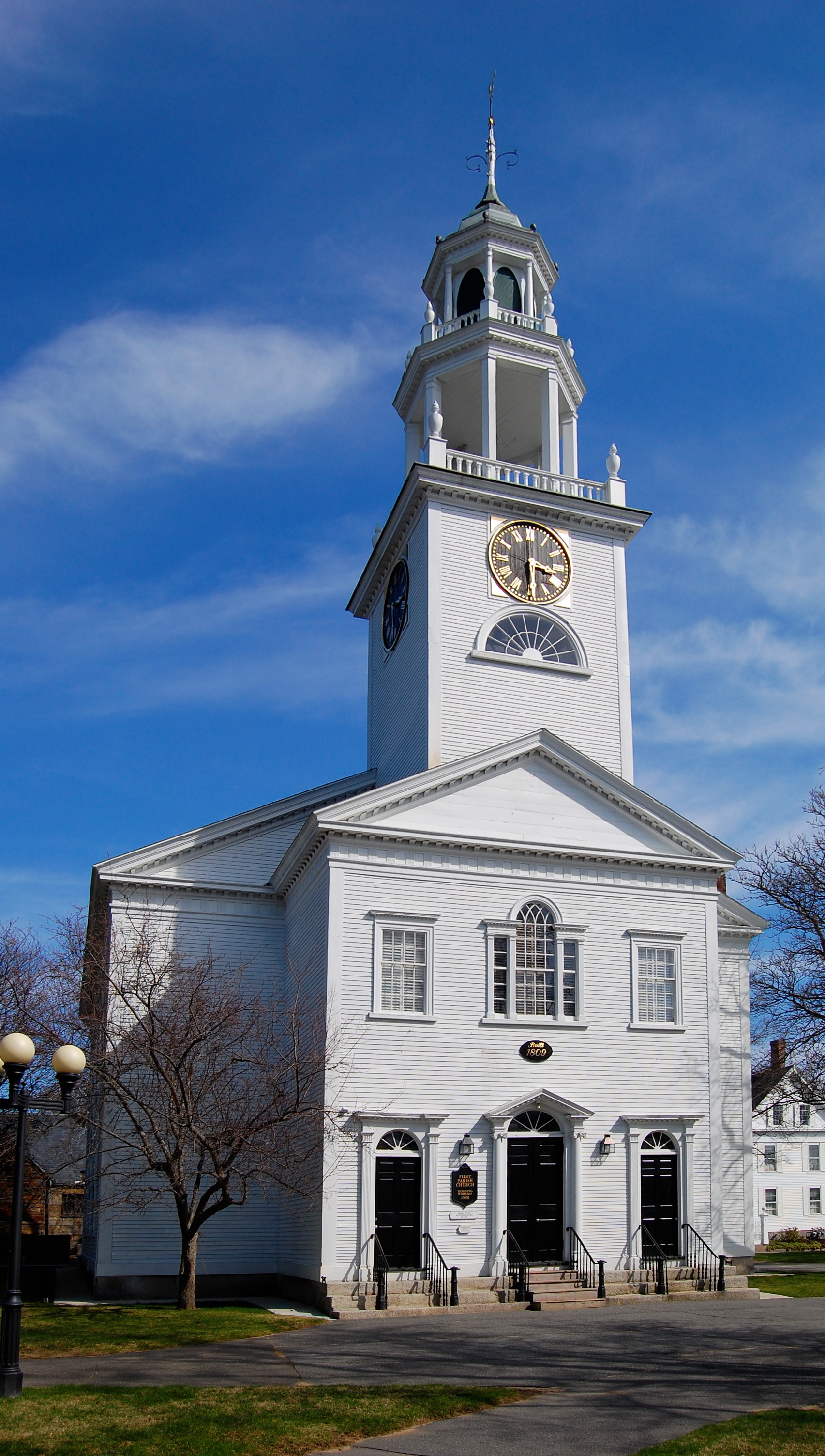
| Manchester-by-the-Sea, Massachusetts | |||
|---|---|---|---|
| — Town — | |||
 |
|||
|
|||
 |
|||
| Coordinates: Coordinates: | |||
| Country | United States | ||
| State | Massachusetts | ||
| County | Essex | ||
| Settled | 1629 | ||
| Incorporated | 1645 | ||
| Government | |||
| • Type | Open town meeting | ||
| Area | |||
| • Total | 18.3 sq mi (47.3 km2) | ||
| • Land | 9.2 sq mi (23.9 km2) | ||
| • Water | 9.0 sq mi (23.4 km2) | ||
| Elevation | 30 ft (9 m) | ||
| Population (2020) | |||
| • Total | 5,395 | ||
| • Density | 300/sq mi (110/km2) | ||
| Time zone | Eastern (UTC-5) | ||
| • Summer (DST) | Eastern (UTC-4) | ||
| ZIP code | 01944 | ||
| Area code(s) | 351 / 978 | ||
| FIPS code | 25-37995 | ||
| GNIS feature ID | 0619451 | ||
| Website | manchester.ma.us | ||
Manchester-by-the-Sea (also known simply as Manchester, its name prior to 1989) is a town on Cape Ann, in Essex County, Massachusetts, United States. The town is known for scenic beaches and vista points. At the 2020 census, the population was 5,395.[1]
History
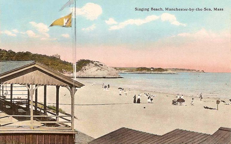

Singing Beach in 1914
Native Americans inhabited what would become northeastern Massachusetts for thousands of years prior to European colonization of the Americas. The area that would become Manchester was inhabited by Agawam people at the time of contact in the early 1600s,[2][3] who were decimated by virgin soil epidemics especially in 1617-1619, after which fewer than 50 indigenous individuals are estimated to have survived within the modern bounds of Manchester.[4]
Manchester was first settled by English colonists in 1629 and was officially incorporated in 1645. It was formed from territory taken from Salem (that portion since given to Beverly) and Gloucester. In 1700, Manchester selectmen paid three grandchildren of Agawam sachem Masconomet three pounds and nineteen shillings for the rights to the land.[2]
The community thrived primarily as a fishing community for more than 200 years. Beginning in 1845, it started to attract summer residents from the Boston area after poet Richard Dana built a house in the town. Over the next fifty years, development of summer houses along the coastline established the community as Boston society's community of choice for summer residency. The trend continued with designs of houses by architects, such as "Sunny Waters", designed by John Hubbard Sturgis for his older brother, Russell, in 1862.
The best known of these "summer cottages" was Kragsyde, built on Smith's Point in 1883. Commissioned by George Nixon Black, the Peabody and Stearns-designed residence has been hailed as the zenith of the Shingle style substyle of the Queen Anne style of architecture. It was demolished in 1929.
Name
To prevent confusion with the nearby and much larger city of Manchester, New Hampshire, the name of the town was officially changed in 1989 following a close town meeting vote that year, where it passed by just two votes.[5] This was ratified by an act of the state legislature passed on September 25, 1989.[6] "Manchester by the Sea" was a familiar alternative town name since it was first used in 1877 by Boston publisher James T. Fields while attending an annual summer picnic of the "Manchester Elder Brethren" that still takes place today.[7]
The name change was driven by Edward Corley, a longtime resident of Manchester.[8] All town documents, and the town seal, now use the name "Manchester-by-the-Sea". As a result of some minor resident activism, so do the majority of public and private lists of Massachusetts cities and towns, including that of the state government.
Geography
According to the United States Census Bureau, the town has a total area of 47.3 square kilometres (18.3 sq mi), of which 23.9 square kilometres (9.2 sq mi) is land and 23.4 square kilometres (9.0 sq mi), or 49.47%, is water. The town lies along the North Shore of Massachusetts Bay, which in turn leads to the Atlantic Ocean. There are seven beaches lining the coast, and several small islands dot the coast, the largest being Kettle Island and House Island.
Several small coves edge the coast, the largest being Manchester Harbor, which is fed by Sawmill Brook and other small bodies of water. There are several protected areas within town, including Cedar Swamp Conservation Area, Cheever Commons Conservation Area, Coolidge Reservation, Dexter Pond, Owl's Nest Nature Preservation Land, Powder House Hill Reservation, and Wyman Hill Conservation Area.
Manchester-by-the-Sea is bordered by Beverly and Wenham to the west, Hamilton to the northwest, Essex to the north, and Gloucester to the east. The town is located 9 miles (14 km) northeast of Salem and 24 miles (39 km) northeast of Boston.
Transportation
Manchester-by-the-Sea lies along Massachusetts Route 128, the inner of two beltways around Greater Boston. Route 128 has two exits within town as it passes from Beverly to Gloucester, with a small portion crossing through the corner of Essex. Route 127 also passes from west to east through town, traveling through the center of town. There is no bus service directly into town, with service passing east via the Cape Ann Transportation Authority in Gloucester, and an MBTA bus route providing service to Beverly.
The town is served by a stop along the Newburyport/Rockport Line of the MBTA Commuter Rail, providing service from Rockport along the North Shore to Boston's North Station. The nearest airport is the Beverly Municipal Airport, with the nearest national and international service at Boston's Logan International Airport.
Demographics
| Historical population | ||
|---|---|---|
| Year | Pop. | ±% |
| 1850 | 1,638 | — |
| 1860 | 1,698 | +3.7% |
| 1870 | 1,665 | −1.9% |
| 1880 | 1,640 | −1.5% |
| 1890 | 1,789 | +9.1% |
| 1900 | 2,522 | +41.0% |
| 1910 | 2,673 | +6.0% |
| 1920 | 2,466 | −7.7% |
| 1930 | 2,636 | +6.9% |
| 1940 | 2,472 | −6.2% |
| 1950 | 2,868 | +16.0% |
| 1960 | 3,932 | +37.1% |
| 1970 | 5,151 | +31.0% |
| 1980 | 5,424 | +5.3% |
| 1990 | 5,286 | −2.5% |
| 2000 | 5,228 | −1.1% |
| 2010 | 5,136 | −1.8% |
| 2020 | 5,395 | +5.0% |
As of the census of 2010,[19] there were 5,136 people, 2,147 households, and 1,444 families residing in the town. The population density was 562.7 people per square mile (217.3/km2). The racial makeup of the town was 97.6% (5,012) White, 0.1% (5) African American, 0.2% (10) Native American, 0.9% (46) Asian, 0.1% from other races, and 1.1% from two or more races. Hispanic or Latino of any race were 1.5% (77) of the population. The median income for a household in the town was $95,243, and the median income for a family was $109,760. About 4.5% of families and 5.1% of the population were below the poverty line, including 3.9% of those under age 18 and 3.7% of those age 65 or over.[19]
Newspaper
The local newspaper, The Manchester Cricket, has published weekly since 1888.[20] The newspaper has been owned by just three families since it began. Within the Cricket, there is a special section dedicated to the neighboring town, Essex. This section is called The Essex Echo. The town is also served by a regional newspaper, the Gloucester Daily Times.
Controversies
The Manchester By The Sea Police Department have been subject to controversy including sexual harassment by sworn officers including allegations "that officials had permitted a sexually hostile environment, and that Christopher Locke, an officer in the police department, made a secret recording of [a young woman], violating the state’s wiretap law."[21]
Points of interest
Singing Beach
One mile from the town center is Singing Beach, so named because the sand comprising the beach squeaks when walked upon. The sand is an iridescent color when the sun sets.[22] This beach is quite popular during summer months in particular, because it is easily accessible from Boston by a half-mile walk from the MBTA train station. Also located on this historic beach is the famous tourist attraction "Eaglehead", a rock composite that is the focal point of rock climbing and other recreation activities.
Other points of interest
- Agassiz Rock
- Masconomo Park
- Coolidge Reservation
- Crow Island
- Kragsyde
- Smith's Point
- Manchester Historical Museum (Trask House)
- Tucks Point
- Cathedral Pines[23]
")
")
")
Film and television references
The town provided the backdrop for these films:
- Tell Me That You Love Me, Junie Moon (1970)
- Mermaids (1990)
- The Good Son (1993)
- The Love Letter (1999)
- State and Main (2000)
- What's the Worst That Could Happen? (2001; standing in for Marblehead, Massachusetts)
- The Proposal (2009; standing in for Sitka, Alaska)
- Edge of Darkness (2010)
- Joy (2015)
- Manchester by the Sea (2016)
- Daddy's Home 2 (2017)
It was also featured in a season of the TV series This Old House, and was featured in a "Main Streets and Back Roads" episode of Chronicle, a newsmagazine program in New England.
Notable people
- Junius Brutus Booth, Jr., brother of John Wilkes Booth, Abraham Lincoln's assassin. Died September 17, 1883. Buried in Manchester.
- Nat Faxon, comedian and Oscar winner for adapted screenplay for The Descendants at the 84th Academy Awards
- Josh Gates, host of Destination Truth—former resident
- Rufus Gifford, United States ambassador to the Kingdom of Denmark from 2013-2017
- Elizabeth Porter Gould, poet and author
- Sprague Grayden, actress
- Henry Northey Hooper, manufacturer and Boston politician
- William Northey Hooper, a founder of the sugar industry in Hawaii
- Joe Lloyd, professional golfer
- James McMillan, Michigan senator instrumental in the design of the Washington Mall, died (1902) at his summer home in Manchester
- Susan Minot, author
- Ray Ozzie, software entrepreneur
- George Putnam III, trustee of Putnam Investments
- Gardner Read, composer
- David I. Robinson, politician
- Jay Severin, radio talk show host
- Josiah Spaulding, businessman, attorney, and politician; chairman of the Massachusetts Republican Party from 1965-1970
References
- ^ "Census - Geography Profile: Manchester-by-the-Sea town, Essex County, Massachusetts". United States Census Bureau. https://data.census.gov/cedsci/profile?g=0600000US2500937995.
- ^ a b Perley, Sidney (1912). The Indian land titles of Essex County, Massachusetts. The Library of Congress. Salem, Mass. : Essex Book and Print Club. http://archive.org/details/indianlandtitles00perl.
- ^ Smith, John (1837). A description of New England; or, The observations, and discoveries of Captain Iohn Smith (admirall of that country) in the north of America, in the year of our Lord 1614; with the successe of sixe ships, that went the next yeare 1615; and the accidents befell him among the French men of warre: with the proofe of the present benefit this countrey affoords; whither this present yeare, 1616, eight voluntary ships are gone to make further tryall.. Washington: P. Force. https://catalog.hathitrust.org/Record/100693021.
- ^ Massachusetts Historical Commission. "MHC Reconnaissance Survey Town Report: Manchester-By-The-Sea". https://www.sec.state.ma.us/mhc/mhcpdf/townreports/Essex/man.pdf.
- ^ "http://manchestercricket.advantage-preservation.com". http://manchestercricket.advantage-preservation.com/.
- ^ Manchester-by-the-Sea official website; accessed August 10, 2015.
- ^ "N.H. city hopes to make big splash with whitewater park, new name". 2021-04-28. http://realestate.boston.com/new-developments/2021/04/28/nh-city-whitewater-park-renamed-downtown/.
- ^ "Edward F. Corley, 68, Leader in Manchester-by-the-Sea". The Boston Globe, January 13, 1991. Archived by HighBeam Research. Retrieved February 28, 2017.
- ^ "TOTAL POPULATION (P1), 2010 Census Summary File 1". American FactFinder, All County Subdivisions within Massachusetts. United States Census Bureau. 2010. http://factfinder2.census.gov/faces/tableservices/jsf/pages/productview.xhtml?src=bkmk.
- ^ "Massachusetts by Place and County Subdivision - GCT-T1. Population Estimates". United States Census Bureau. http://factfinder.census.gov/servlet/GCTTable?_bm=y&-geo_id=04000US25&-_box_head_nbr=GCT-T1&-ds_name=PEP_2009_EST&-_lang=en&-format=ST-9&-_sse=on. Retrieved July 12, 2011.
- ^ "1990 Census of Population, General Population Characteristics: Massachusetts". US Census Bureau. December 1990. Table 76: General Characteristics of Persons, Households, and Families: 1990. 1990 CP-1-23. http://www.census.gov/prod/cen1990/cp1/cp-1-23.pdf. Retrieved July 12, 2011.
- ^ "1980 Census of the Population, Number of Inhabitants: Massachusetts". US Census Bureau. December 1981. Table 4. Populations of County Subdivisions: 1960 to 1980. PC80-1-A23. http://www2.census.gov/prod2/decennial/documents/1980a_maABC-01.pdf. Retrieved July 12, 2011.
- ^ "1950 Census of Population". Bureau of the Census. 1952. Section 6, Pages 21-10 and 21-11, Massachusetts Table 6. Population of Counties by Minor Civil Divisions: 1930 to 1950. http://www2.census.gov/prod2/decennial/documents/23761117v1ch06.pdf. Retrieved July 12, 2011.
- ^ "1920 Census of Population". Bureau of the Census. Number of Inhabitants, by Counties and Minor Civil Divisions. Pages 21-5 through 21-7. Massachusetts Table 2. Population of Counties by Minor Civil Divisions: 1920, 1910, and 1920. http://www2.census.gov/prod2/decennial/documents/41084506no553ch2.pdf. Retrieved July 12, 2011.
- ^ "1890 Census of the Population". Department of the Interior, Census Office. Pages 179 through 182. Massachusetts Table 5. Population of States and Territories by Minor Civil Divisions: 1880 and 1890. http://www2.census.gov/prod2/decennial/documents/41084506no553ch2.pdf. Retrieved July 12, 2011.
- ^ "1870 Census of the Population". Department of the Interior, Census Office. 1872. Pages 217 through 220. Table IX. Population of Minor Civil Divisions, &c. Massachusetts. http://www2.census.gov/prod2/decennial/documents/1870e-05.pdf. Retrieved July 12, 2011.
- ^ "1860 Census". Department of the Interior, Census Office. 1864. Pages 220 through 226. State of Massachusetts Table No. 3. Populations of Cities, Towns, &c.. http://www2.census.gov/prod2/decennial/documents/1860a-08.pdf. Retrieved July 12, 2011.
- ^ "1850 Census". Department of the Interior, Census Office. 1854. Pages 338 through 393. Populations of Cities, Towns, &c.. http://www2.census.gov/prod2/decennial/documents/1850c-11.pdf. Retrieved July 12, 2011.
- ^ a b "U.S. Census website". United States Census Bureau. https://www.census.gov.
- ^ Cricket, The. "thecricket.com | A Local Tradition Since 1888" (in en). https://www.thecricket.com/.
- ^ "Town admits liability for officer's harassment". https://www.salemnews.com/news/local_news/town-admits-liability-for-officers-harassment/article_d2f2dc41-6fb7-5967-9119-5a3b103b268c.html.
- ^ "Singing Beach". http://www.manchester.ma.us/Facilities/Facility/Details/Singing-Beach-11.
- ^ "Kiosk Completed at Wilderness Conservation Area Gateway". http://www.mect.org/kiosk-completed-at-wilderness-conservation-area-gateway/.
External links
| Wikisource has the text of a 1911 Encyclopædia Britannica article about Manchester-by-the-Sea, Massachusetts. |
| ||||||||||||||||

| This page uses content from the English language Wikipedia. The original content was at Manchester-by-the-Sea, Massachusetts . The list of authors can be seen in the page history. As with this Familypedia wiki, the content of Wikipedia is available under the Creative Commons License. |