| Main | Births etc |
|---|
| City of Salisbury | |
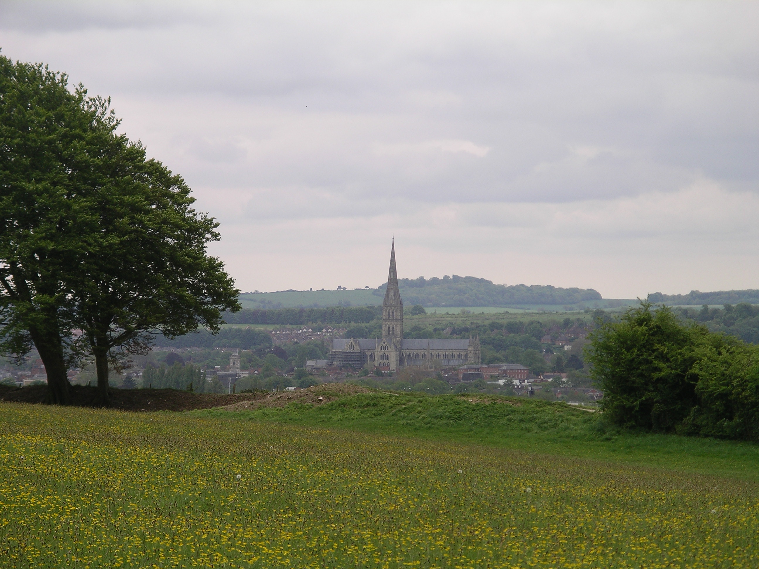
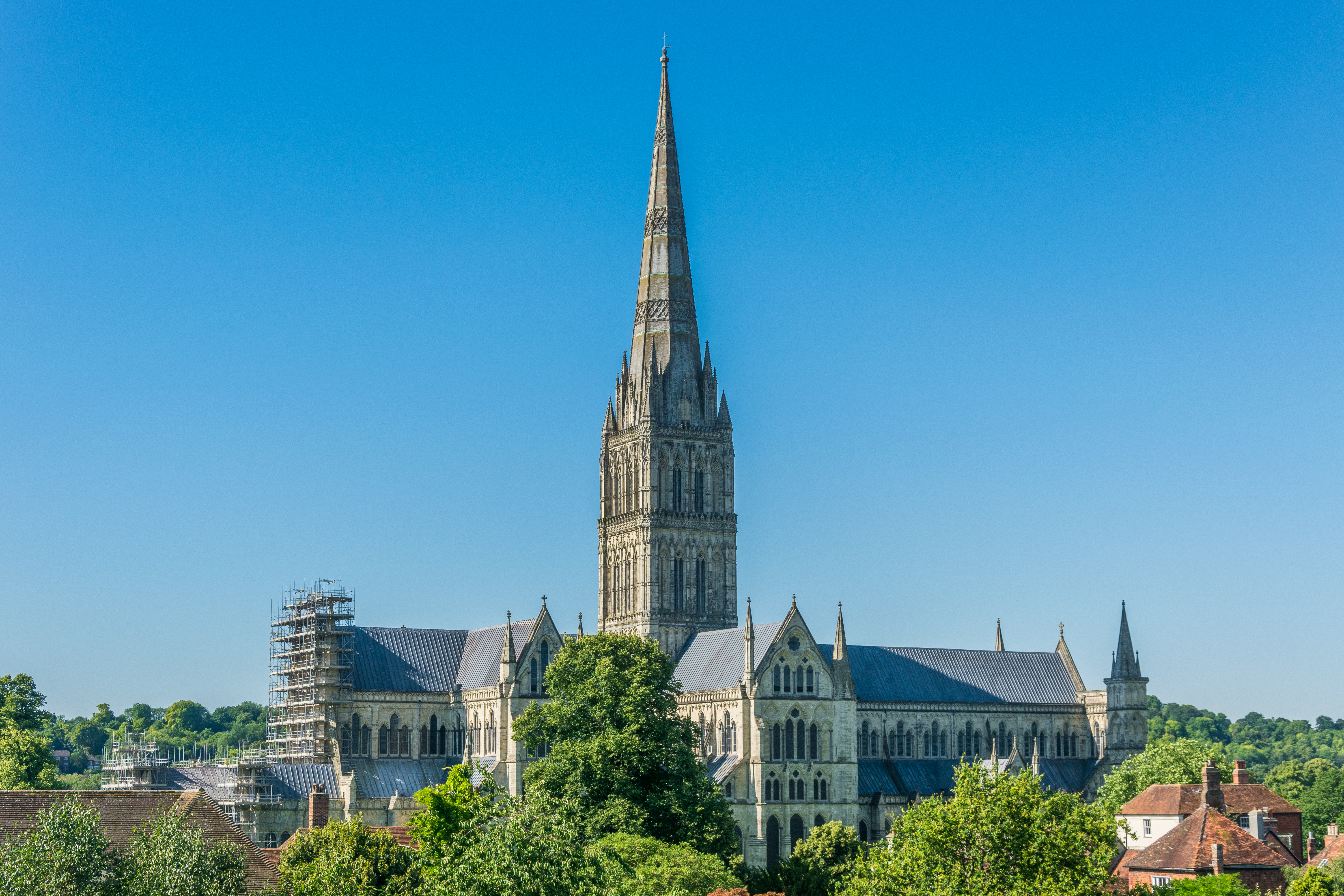 Salisbury Cathedral from the Old George Mall in July 2016 |
|
City of Salisbury | |
| Population | 40,302 (2011 Census)[1] |
|---|---|
| OS grid reference | |
| - London | 85 miles (137 km) |
| Parish | Salisbury |
| Unitary authority | Wiltshire |
| Ceremonial county | Wiltshire |
| Region | South West |
| Country | England |
| Sovereign state | United Kingdom |
| Post town | SALISBURY |
| Postcode district | SP1, SP2 |
| Dialling code | 01722 |
| Police | Wiltshire |
| Fire | Wiltshire |
| Ambulance | Great Western |
| EU Parliament | South West England |
| UK Parliament | Salisbury |
| List of places: UK • England • Wiltshire | |
Salisbury (various pronunciations,[3] but locally /ˈsɔːzbri/, SAWZ-bree) is a cathedral city in Wiltshire, England, and the only city within the county. It is the third-largest settlement in the county, after Swindon and Chippenham, with a population of 40,302, unusually declining from 45,000 at the 2006 census.[4]
The city is located in the southeast of Wiltshire, near the edge of Salisbury Plain. Its cathedral was formerly located to the north at Old Sarum; following its relocation, a settlement grew up around it, drawing residents from Old Sarum and Wilton. The new town received its city charter in 1227 under the name New Sarum, which continued to be its official name until 2009, when the Salisbury City Council was established. It sits at the confluence of five rivers: the Nadder, Ebble, Wylye, and Bourne are tributary to the Hampshire Avon, which flows to the south coast and into the sea at Christchurch in Dorset. Salisbury railway station serves the city and is a regional interchange, at the crossing point between the West of England Main Line and the Wessex Main Line.
Stonehenge, a UNESCO World Heritage Site, is about 8 miles (13 km) northwest of Salisbury and greatly aids the local economy. The city itself, Old Sarum, the present cathedral and the ruins of the former one also attract visitors.
Name[]
The name Salisbury, which is first recorded around the year 900 as Searobyrig, is a partial translation of the original Celtic name Sorviodunum, with *dūnon, meaning "stronghold" (in reference to the fort that stood at Old Sarum), replaced by its Old English equivalent byrig.[note 1] The first part of the name is of obscure origin. The form "Sarum" is a Latinization of Sar, a medieval abbreviation for "Sarisberie."[5]
Salisbury appeared in the Welsh Chronicle of the Britons as Caer-Caradog, Caer-Gradawc, and Caer-Wallawg.[6][7][8] Cair-Caratauc, one of the 28 British cities listed in the History of the Britons, has also been indentified with Salisbury.[9][10]
History[]

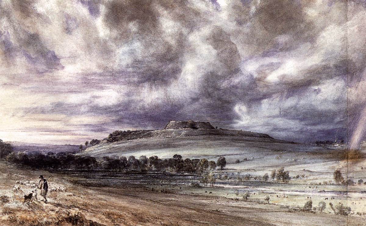
The ruined hillfort at Old Sarum in an 1834 watercolor by John Constable

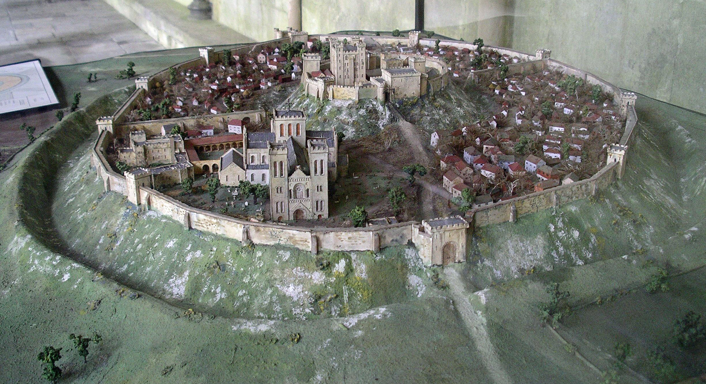
A reconstruction of Old Sarum in the 12th century
Old Sarum[]
The hilltop at Old Sarum lies near the Neolithic sites of Stonehenge and Avebury and shows some signs of early settlement.[11] It commanded a salient between the River Bourne and the Hampshire Avon near a crossroads of several early trade routes.[12] During the Iron Age, a hillfort (oppidum) was constructed around it sometime between 600 and 300 bc.[12] The Romans may have occupied the site or left it in the hands of an allied tribe. Amid the Saxon invasions, Old Sarum fell to King Cynric of Wessex in 552.[13] Preferring settlements in bottomland like nearby Wilton, the Saxons largely ignored Old Sarum until the Viking invasions led King Alfred to restore its fortifications.[12] Along with Wilton, however, it was abandoned by its residents to be sacked and burned by the Dano-Norwegian king Sweyn Forkbeard in 1003.[14] It subsequently became the site of Wilton's mint.[12] Following the Norman invasion, a motte-and-bailey castle was constructed by 1070.[12] The castle was held directly by the Norman kings; its castellan was generally also the sheriff of Wiltshire.
In 1075, the Council of London established Herman as the first bishop of Salisbury,[15] uniting his former sees of Sherborne and Ramsbury into a single diocese which covered the counties of Dorset, Wiltshire, and Berkshire. (He had earlier planned to move his seat to Malmesbury but was blocked by its monks and Earl Godwin.[16]) Hermann and his successor Saint Osmund began the construction of the first Salisbury cathedral but neither lived to see its completion in 1092.[15] Osmund was a cousin of William the Conqueror[17] and Lord Chancellor of England; he was responsible for the codification of the Sarum Rite,[18] the compilation of the Domesday Book (which was probably presented to William at Old Sarum[12]), and—after centuries of advocacy from Salisbury's bishops—was finally canonized by Pope Callixtus III in 1457.[19] The cathedral was consecrated on 5 April 1092 but suffered extensive damage in a storm, traditionally said to have occurred only five days later.[20][21] Bishop Roger was a close ally of Henry I who served as his viceroy during the king's absence to Normandy[22] and directed the royal administration and exchequer along with his extended family.[23] He refurbished and expanded Old Sarum's cathedral in the 1110s and began work on a royal palace during the 1130s, prior to his arrest by Henry's successor Stephen.[22] After this arrest, the castle at Old Sarum was allowed to fall into disrepair, but the sheriff and castellan continued to administer the area under the king's authority.[24]

Salisbury Cathedral as seen from the motte at Old Sarum
New Sarum[]
Bishop Hubert Walter was instrumental in the negotiations with Saladin during the Third Crusade, but he spent little time in his diocese prior to his elevation to archbishop of Canterbury.[25] The brothers Herbert and Richard Poore succeeded him and began planning the relocation of the cathedral into the valley almost immediately. Their plans were approved by King Richard I but repeatedly delayed: Herbert was first forced into exile in Normandy in the 1190s by the hostility of his archbishop Walter and then again to Scotland in the 1210s owing to royal hostility following the papal interdiction against King John. The secular authorities were particularly incensed, according to tradition, owing to some of the clerics debauching the castellan's female relations.[24] In the end, the clerics were refused permission to reënter the city walls following their rogations and processions.[26] This caused Peter of Blois to describe the church as "a captive within the walls of the citadel like the ark of God in the profane house of Baal". He advocated
“Let us descend into the plain! There are rich fields and fertile valleys abounding in the fruits of the earth and watered by the living stream. There is a seat for the Virgin Patroness of our church to which the world cannot produce a parallel.”[27]
His successor and brother Richard Poore who finally removed the cathedral to a new town on his estate at Veretes Sarisberias ("Old Salisburies") in 1220. The site was at "Myrifield" ("Merryfield"),[28] a meadow near the confluence of the River Nadder and the Hampshire Avon. It was first known as "New Sarum"[27] or New Saresbyri.[26] The town was laid out on a grid.

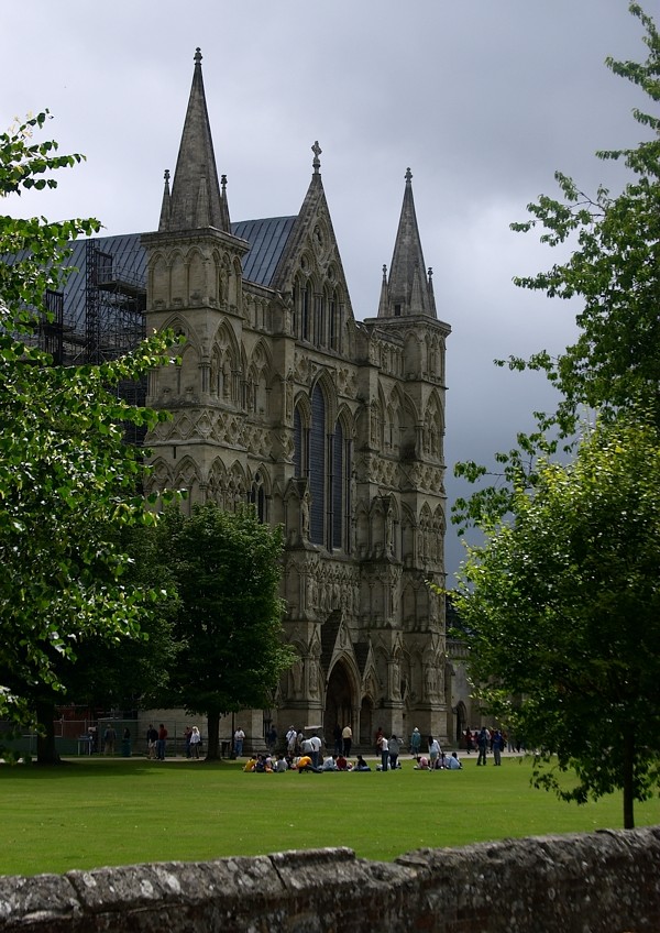
The Great West Front of Salisbury Cathedral.
Work on the new cathedral building—the present Salisbury Cathedral—began in 1221. The site was supposedly established by shooting an arrow from Old Sarum, although this is certainly a legend: the distance is over 3 km (1.9 mi). (The legend is sometimes emended to claim that the arrow struck a white deer, which continued to run and died on the spot where the cathedral now rests.) The structure was built upon wooden faggots on a gravel bed with unusually shallow foundations of 18 inches (46 cm) and the main body was completed in only 38 years. (The Template:Convert/LoffAonDorSon tall spire, the tallest in the UK, was built later.) With royal approval, many of the stones for the new cathedral were taken from the old one; others came from Chilmark. They were probably transported by ox-cart owing to the obstruction to boats on the River Nadder caused by its many weirs and watermills. The cathedral is considered a masterpiece of Early English architecture. The spire's large clock was installed in 1386, the oldest surviving mechanical clock in the world. The Cathedral also contains the best-preserved of the four surviving copies of the Magna Carta.
New Sarum was made a city by a charter from King Henry III in 1227[29] and, by the 14th century, was the largest settlement in Wiltshire. The city wall surrounds the Close and was built in the 14th century, again with stones removed from the former cathedral at Old Sarum. The wall now has five gates: the High Street Gate, St Ann's Gate, the Queen's Gate, and St Nicholas's Gate were the original ones while a fifth was constructed in the 19th century to allow access to Bishop Wordsworth's School in the Cathedral Close. During his time in the city, the composer Handel stayed in a room above St Ann's gate. The original site of the city at Old Sarum, meanwhile, fell into disuse. It continued as a rotten borough: at the time of its abolishment during the reforms of 1832, its MP represented three households.
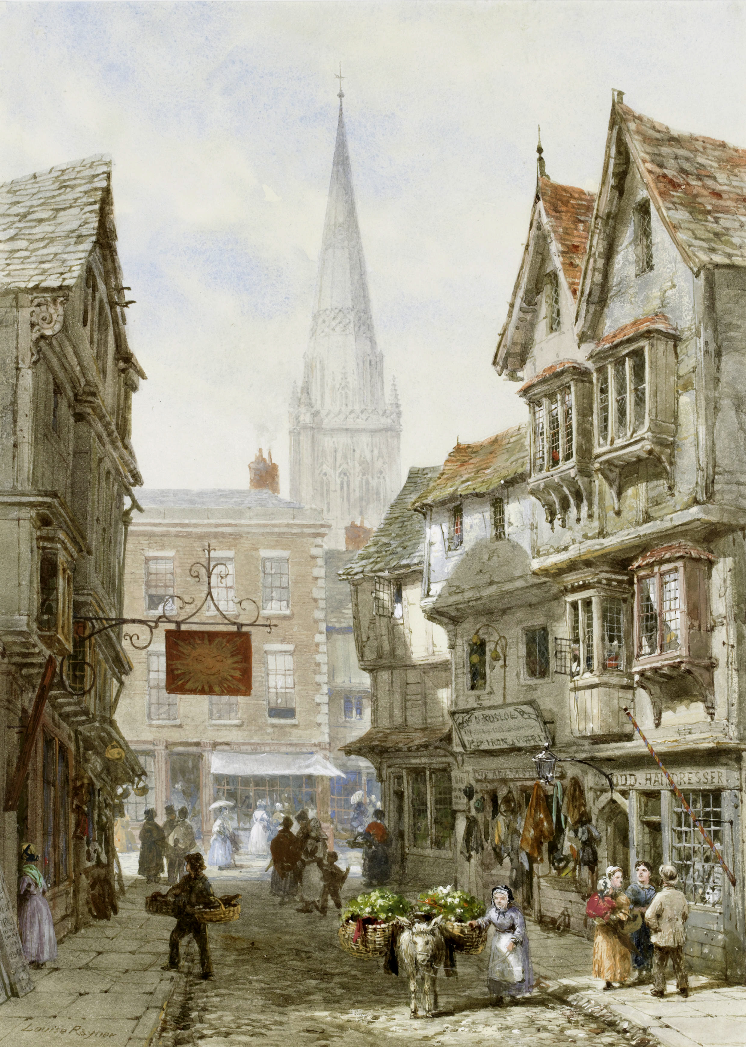

A picture of Minster Street, c. 1870
In May 1289, there was uncertainty about the future of Margaret, Maid of Norway, and her father sent ambassadors to Edward I. Edward met Robert the Bruce and others at Salisbury in October 1289, which resulted in the Treaty of Salisbury, under which Margaret would be sent to Scotland before 1 November 1290 and any agreement on her future marriage would be delayed until she was in Scotland.[30]
In 1450, a number of riots broke out in Salisbury at roughly the same time Jack Cade led a famous rebellion through London. The riots occurred for related reasons, although the declining fortunes of Salisbury's cloth trade may have also been influential. The violence peaked with the murder of the bishop William Ayscough, who been involved with the government. In 1483, a large-scale rebellion against Richard III broke out, led by his own 'kingmaker', Henry Stafford, 2nd Duke of Buckingham. After the revolt collapsed, Buckingham was executed at Salisbury, near the Bull's Head Inn. In 1664, an act for making the River Avon navigable from Christchurch to the city of New Sarum was passed[31] and the work completed, only for the project to be ruined shortly thereafter by a major flood.[32] Soon after, during the Great Plague of London, Charles II held court in Salisbury's cathedral close.
Salisbury was the site chosen to assemble James II's forces to resist the Glorious Revolution. He arrived to lead his approximately 19 000 men on 19 November 1688. His troops were not keen to fight Mary or her husband William, and the loyalty of many of James's commanders was in doubt. The first blood was shed at Wincanton, in Somerset. In Salisbury, James heard that some of his officers had deserted, such as Edward Hyde, and he broke out in a nosebleed which he took as an omen that he should retreat. His commander in chief, the Earl of Feversham, advised retreat on 23 November, and the next day John Churchill deserted to William. On 26 November, James's own daughter, Princess Anne, did the same, and James returned to London the same day, never again to be at the head of a serious military force in England.[33]
At the time of the 1948 Summer Olympics, held in London, a relay of runners carried the Olympic Flame from Wembley Stadium, where the Games were based, to the sailing centre at Torbay via Slough, Basingstoke, Salisbury, and Exeter.
Salisbury[]
The 1972 Local Government Act eliminated the administration of the City of New Sarum under its former charters, but its successor—Wiltshire County's Salisbury District—continued to be accorded its former city status. The name was finally formally emended from "New Sarum" to "Salisbury" during the 2009 changes occasioned by the 1992 Local Government Act, which established the Salisbury City Council.
Governance[]
Salisbury now falls under two authorities created in 2009, Salisbury City Council and Wiltshire Council. It was once at the heart of the now defunct Salisbury District, which oversaw most of south Wiltshire as well as the city. When Wiltshire's local government was reorganised under a unitary authority in April 2009, Salisbury City Council was formed, although with fewer responsibilities than the former district council. There are 8 electoral wards in Salisbury. The city has one Member of Parliament for the Salisbury constituency, currently John Glen (Conservative) who was first elected in the 2010 election.
Geography[]


Queen Elizabeth Gardens showing part of the River Avon diverted through the gardens.
Salisbury is located in a valley. The geology of the area, like much of South Wiltshire and Hampshire, is largely chalk. The rivers which flow through the city have been redirected, and along with landscaping, have been used to feed into public gardens. They are popular in the summer, particularly the Queen Elizabeth Gardens, as the water there is shallow and slow-flowing enough to enter safely. Close to Queen Elizabeth Gardens are water-meadows, where the water is controlled by weirs. Because of the low-lying land, the rivers are prone to flooding particularly during the winter months. The Town Path, a walkway that links Harnham with the rest of the city, is at times impassable.
A cause of concern to the people of Salisbury is the lack of adequate roads. Although there is no motorway to link the ports of Southampton and Bristol, traffic passes around the city's ring-road via the A36 to Bath.

|
Warminster 30 km | Stonehenge18 km Amesbury 15 km |
Andover 25 km Basingstoke 45 km |
|
| Wilton 5 km | Winchester 30 km | |||
 Salisbury | ||||
| Shaftesbury 25 km | Ringwood 20 km Bournemouth 35 km |
Romsey 25 km Southampton 30 km |
There are civil airfields at Old Sarum (where the experimental aircraft the Edgley Optica was developed and tested) and at Thruxton near Andover.
Climate[]
Salisbury experiences an oceanic climate (Köppen climate classification Cfb) similar to almost all of the United Kingdom. The nearest Met Office weather station to Salisbury is Boscombe Down, about 6 miles to the north of the city centre. In terms of the local climate, Salisbury is amongst the sunniest of Inland areas in the UK, averaging over 1650 hours of sunshine in a typical year. Temperature extremes since 1960 have ranged from −12.4 °C (10 °F) in January 1963[34] to 34.5 °C (94.1 °F) during July 2006.[35] The lowest temperature to be recorded in recent years was −10.1 °C (14 °F) during December 2010.[36]
| Climate data for Boscombe Down 126asl, 1971–2000, Extremes 1960– | |||||||||||||
|---|---|---|---|---|---|---|---|---|---|---|---|---|---|
| Month | Jan | Feb | Mar | Apr | May | Jun | Jul | Aug | Sep | Oct | Nov | Dec | Year |
| Record high °C (°F) | 13.6 (56.5) |
15.7 (60.3) |
21.3 (70.3) |
25.9 (78.6) |
27.5 (81.5) |
33.7 (92.7) |
34.5 (94.1) |
34.2 (93.6) |
27.8 (82.0) |
26.2 (79.2) |
17.6 (63.7) |
14.3 (57.7) |
34.5 (94.1) |
| Average high °C (°F) | 6.9 (44.4) |
7.3 (45.1) |
9.8 (49.6) |
12.4 (54.3) |
16.1 (61.0) |
18.9 (66.0) |
21.7 (71.1) |
21.4 (70.5) |
18.2 (64.8) |
14.1 (57.4) |
10.0 (50.0) |
7.8 (46.0) |
13.8 (56.8) |
| Average low °C (°F) | 1.1 (34.0) |
1.0 (33.8) |
2.8 (37.0) |
3.8 (38.8) |
6.8 (44.2) |
9.5 (49.1) |
11.8 (53.2) |
11.7 (53.1) |
9.6 (49.3) |
6.9 (44.4) |
3.6 (38.5) |
2.2 (36.0) |
5.7 (42.3) |
| Record low °C (°F) | −12.4 (9.7) |
−9.6 (14.7) |
−9.6 (14.7) |
−4.7 (23.5) |
−2.4 (27.7) |
−0.1 (31.8) |
4.4 (39.9) |
3.6 (38.5) |
−0.1 (31.8) |
−3.4 (25.9) |
−6.4 (20.5) |
−11.3 (11.7) |
−12.4 (9.7) |
| Precipitation mm (inches) | 76.4 (3.008) |
52.9 (2.083) |
59.0 (2.323) |
48.2 (1.898) |
52.1 (2.051) |
55.1 (2.169) |
40.5 (1.594) |
57.1 (2.248) |
64.5 (2.539) |
70.9 (2.791) |
73.2 (2.882) |
85.9 (3.382) |
735.6 (28.961) |
| Mean monthly sunshine hours | 58.0 | 75.4 | 115.3 | 169.2 | 206.8 | 207.3 | 223.5 | 208.3 | 151.2 | 113.8 | 78.3 | 53.9 | 1,661.0 |
| Source #1: MetOffice[37] | |||||||||||||
| Source #2: Royal Dutch Meteorological Institute/KNMI[38] | |||||||||||||
Demography[]
The civil parish of Salisbury – which excludes some of the city's suburbs such as Laverstock, Ford, Britford, Harnham and Odstock – had a population of 40,302 at the 2011 census.[1]
The urban zone, which contains the wards immediately surrounding the city, had a population of 62,216 at the 2011 Census.[39] The wards included in this figure are Laverstock, Britford, Downton, Alderbury, Odstock and the neighbouring town of Wilton, among others, however does not include the towns of Amesbury or Romsey as these support their own local populations and are further afield.
At the 2011 census the population of the civil parish was 95.73% white (91.00% White British), 2.48% Asian (0.74% Indian, 0.41% Bangladeshi, 0.40% Chinese), 0.45% black and 1.15% mixed race.[40]
86.43% of the civil parish's population were born in England, 3.94% were born elsewhere in the UK and 4.94% were born elsewhere in the EU (including the Republic of Ireland), while 4.70% of the population were born outside the EU.[41]
62.49% of the civil parish's population declared their religion as Christianity, while 27.09% stated "no religion" and 8.02% declined to state their religion.[42] 0.79% of the population declared their religion as Islam, 0.41% as Buddhism, 0.40% as Hinduism and 0.80% as some other religion.[42]
95.89% of the civil parish's population considered their "main language" to be English, while 1.12% considered it to be Polish, 0.28% considered it to be Bengali and 0.24% considered it to be Tagalog.[43] 99.43% of the population claimed to be able to speak English well or very well.[44]
In 2001, 22.33% of Salisbury's population were aged between 30–44, 42.76% were over 45, and only 13.3% were between 18–29.[45]
Economy[]
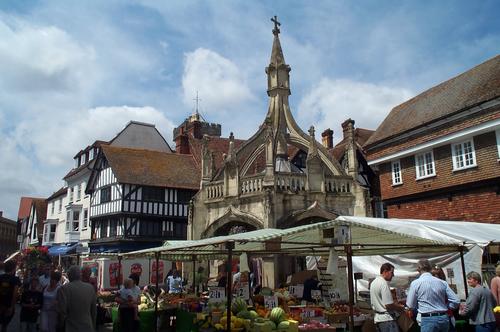

The 15th-century Poultry Cross originally marked the section of the market trading in poultry.
Salisbury holds a Charter[46] market on Tuesdays and Saturdays and has held markets regularly since 1227. In the 15th century the Market Place had four crosses. The Poultry Cross whose name describes its market. The cheese and milk cross indicated that market which was in the triangle between the HSBC bank and the Salisbury Library. There was a third cross near the site of the present war memorial and this marked a woollen and yarn market. A fourth cross called Barnwell or Barnards Cross was situated around the Culver Street, Barnard Street area, this marked a cattle and livestock market.[47] Today only the Poultry Cross remains, to which flying buttresses were added in 1852.
In 1226, King Henry III granted the Bishop of Salisbury a charter to hold a fair lasting 8 days from the Feast of the Assumption of Mary (15 August).[48] Over the centuries the dates for the fair have moved around, but in its modern guise, a funfair is now held in the Market Place for three days from the third Monday in October. However, there is still an ancient law stating that the fair can be held in the Cathedral Close.
From 1833 to its demolition in the mid-1980s, the Salisbury Gas Light & Coke Company, who ran the city's gasworks, were one of the major employers in the area. The company was formed in 1832 with a share capital of £8,000, and its first chairman was The 3rd Earl of Radnor. The company was incorporated by a private Act of Parliament in 1864, and the Gas Orders Confirmation Act 1882 empowered the company to raise capital of up to £40,000. At its peak, the gasworks were producing not only coal gas but also coke which was sold off as the by-product of gas-making. Ammonical liquor which came out as another by-product in the making of gas, was mixed with sulphuric acid, dried and ground to make a powder which was sold as an agricultural fertiliser. The clinker from the retort house was sold to a firm in London to be used as purifier beds in the construction of sewage works.[49]
Shopping centres include The Old George Mall, The Maltings, Winchester Street and the Crosskeys precinct. Major employers include Salisbury District Hospital. Closure of the Friends Life office, the second largest employer, was announced in 2015.[50]
Culture[]


Salisbury High Street
Salisbury was an important centre for music in the 18th century. The grammarian James Harris, a friend of Handel, directed concerts at the Assembly Rooms for almost 50 years up to his death in 1780, with many of the most famous musicians and singers of the day performing there.[51]
Salisbury holds an annual St George's Day pageant, the origins of which are claimed to go back to the 13th century.
Salisbury has a strong artistic community, with galleries situated in the city centre, including one in the public library. In the 18th century, John Constable made a number of celebrated landscape paintings featuring the cathedral's spire and the surrounding countryside. Salisbury's annual International Arts Festival, started in 1973, and held in late May to early June, provides a programme of theatre, live music, dance, public sculpture, street performance and art exhibitions. Salisbury also houses a producing theatre – Salisbury Playhouse – which produces between eight and ten plays a year, as well as welcoming touring productions.
Salisbury Museum[]


Salisbury Museum, housed in the King's House
The Salisbury Museum is housed in The King's House, a Grade I listed building whose history dates back to the 13th century, opposite the west front of the cathedral.
The permanent Stonehenge exhibition gallery has interactive displays about Stonehenge and the archaeology of south Wiltshire, and its collections include the skeleton of the Amesbury Archer, which is on display.
The Pitt Rivers display holds a collection from General Augustus Pitt Rivers.
The costume gallery showcases costume and textiles from the area with costumes for children to try on while imagining themselves as characters from Salisbury's past.
Twinning, Brother, Sister Cities[]
Salisbury has been twinned with Saintes, France, since 1990;[52] and with Xanten, Germany, since 2005.[52] Salisbury is also a sister city of Salisbury, North Carolina and Salisbury, Maryland, both of which are in the United States.[52]
Education[]
There are numerous schools in and around Salisbury. The city has the only grammar schools in Wiltshire: South Wilts Grammar School for Girls and Bishop Wordsworth's School, which is for boys and is located in the Cathedral Close. Also in the Close is Salisbury Cathedral School. Other schools in or near the city include the Chafyn Grove School, Leehurst Swan School, the Godolphin senior and prep school, St Edmund's Girls' School, Sarum Academy, St Joseph's Catholic School and South Wiltshire UTC.
Sixth form education is offered by Salisbury Sixth Form College, while the Salisbury campus of Wiltshire College offers a range of further education courses, as well as some higher education courses in association with Bournemouth University. Sarum College is a Christian theological college located within the Cathedral close in Salisbury.
Transport[]
Road[]
The main transport links for the city are the roads. Salisbury lies on the intersection of the A30, the A36 and the A338 and is at the end of the A343, A345, A354 and A360. Car parks around the periphery of the city are linked to the city centre by a park and ride scheme (see details in the bus section below).
Bus[]
There are bus links to Southampton, Bournemouth and Andover working seven days a week with limited services on Sundays. Wilts & Dorset are the main local bus company, part of the Go-Ahead group. Stagecoach in Hampshire runs the number 87 to Andover every two hours from Salisbury and also every other journey on route 8 to Andover via Amesbury and Tidworth along with Wilts & Dorset. Bodman's also runs the number 24 bus between Salisbury and Warminster,[53] which replaced the X4/X5 service which used to run between Salisbury and Bath.
Salisbury also has a Park and Ride bus scheme with five sites around the city. These park and ride sites attempt to relieve pressure on the city centre but run at an annual loss of £1 million.[54] The Park and Ride sites, which are funded by Wiltshire Council and cost £2.50 for parking and bus transport for an individual or £3.50 for up to six passengers, are:[55] 501 Beehive – |A345 Castle Road to the north, 502 Wilton – A36 Wilton Road to the west, 503 Britford – A338 Downton Road to the south, 504 London Road – A30 London Road to the northeast, 505 Petersfinger – A36 Southampton Road, to the southeast.[54]
Railways[]
Salisbury railway station is the crossing point of the West of England Main Line, from London Waterloo to Exeter St Davids, and the Wessex Main Line from Bristol to Southampton. The station is operated by South West Trains. First Great Western hourly trains call from Cardiff Central, Bristol Temple Meads, Bath Spa to Southampton Central and Portsmouth Harbour.


Salisbury Racecourse with the cathedral in the distance.
Sport and leisure[]
The city has a football team, Salisbury F.C., who play in the Wessex Football League. Their games are at The Raymond McEnhill Stadium on the northern edge of the city. Also in the city are other non-league clubs, Bemerton Heath Harlequins F.C. and Laverstock & Ford F.C., the latter playing at The Dell.
Salisbury Rugby Club, which is based at Castle Road, has produced several England Internationals in recent years and continues to nurture future talent through a buoyant Mini and Youth section. It is seen as one of the prime rugby nurturing centres nationwide, regularly providing County Championship winning sides, County Players at all ages, and academy players for the professional game. Their junior section has also won National tournaments on a regular basis playing finals at Twickenham.[56]
South Wilts Cricket Club, which is based at Wilton Road play in the Southern Premier Cricket League. The club has won the Southern Premier Cricket League five times in the past 25 years. They produce many juniors which represent both Hampshire and Wiltshire at county level and the junior teams have continuous success in regional and national competitions.
Winterbourne Cricket Club is based in Winterbourne Gunner; and Farley Cricket Club is based at Coronation Field, Farley.[57] [58] [59] Salisbury Hockey Club is also based at the Salisbury and South Wilts Sports Club.[60]
The Five Rivers Leisure Centre and Swimming Pool is located just outside the ring road and was opened in 2002. Salisbury Racecourse is a flat racing course to the south-west of the city. Five Rivers Indoor Bowls Club and Salisbury Snooker Club share a building on Tollgate Road (behind the College). The snooker club also has sections for pool and darts. The Bishop's Walk on the edge of the city provides a popular viewing point.
The Old Sarum Airfield, North of Salisbury city centre, is home to a variety of aviation based businesses including traditional flying schools and the APT Charitable Trust.
The local theatre is the Salisbury Playhouse. The City Hall is an entertainment venue and hosts comedy, musical performances (including those by the resident Musical Theatre Salisbury) as well as seminars and conventions. Salisbury Arts Centre[61] has exhibitions and workshops.
Salisbury is well-supplied with pubs. 'The Haunch of Venison', overlooking the Poultry Cross, still operates from a 14th-century building. One of its attractions is a cast of a mummified hand, supposedly severed during a game of cards. The hand vanished in 2004 as a publicity stunt for the pub but later reappeared and can still be seen there.[62] The Rai d’Or has original deeds dating from 1292. It was the home of Agnes Bottenham who used the profits of the tavern to found Trinity Hospital next door around 1380.
Some buildings in Salisbury are reputed to be haunted. Ghost tours are popular with locals and visitors. One such building is the local Odeon cinema located in the Hall of John Halle – the oldest building in the UK to contain a cinema. The Debenhams department store is said to be haunted by Henry Stafford, 2nd Duke of Buckingham – the store is on the site where he was beheaded in 1483.
Media[]
Salisbury is served by two local radio stations. Spire FM is the Independent Local Radio station, and BBC Wiltshire is the BBC Local Radio public service station for the whole county. Regional television services are provided by BBC South and ITV Meridian.
The Salisbury Journal is the local paid-for weekly newspaper which is available in shops every Thursday, with some home deliveries coming on Wednesday night. The local free weekly newspaper from the same publisher is the Avon Advertiser, which is delivered to houses in Salisbury and the surrounding area.
A local television channel called That's Salisbury was launched on 7 May 2015 and broadcasts from studios at Scots Lane.
In fiction[]
- Salisbury is the origin of "Melchester" in Thomas Hardy's novels, such as Jude the Obscure (1895).
- A lively account of the Salisbury markets, as they were in 1842, is contained in Chapter 5 of "Martin Chuzzlewit" by Charles Dickens.
- The fictitious Kingsbridge Cathedral in TV miniseries, The Pillars of the Earth (2010) based on a historical novel by the same name by Ken Follett is modelled on the cathedrals of Wells and Salisbury. The final aerial shot of the series is of Salisbury Cathedral.[63][64]
- The novel Sarum by Edward Rutherfurd describes the history of Salisbury.
- The novel The Spire by William Golding tells the story of the building of the spire of an unnamed cathedral similar to Salisbury Cathedral.
- The Starbridge series (six novels) of Susan Howatch is laid in a cathedral city similar to Salisbury during the 1930s and 1960s. It tracks various strands of religious thought and action in the Church of England.
- The detective Lord Peter Wimsey visits Salisbury in Whose Body? by Dorothy L. Sayers, the first novel in which he appears.
See also[]
- Salisbury Cathedral
- Salisbury steak, which is not named for the city but after an American physician
References[]
- ^ The normal word for "fort" was burh. Byrig could be either the dative or the plural form of this, thus meaning "to the fort" or "forts".
- ^ a b "Key Figures for 2011 Census". Office for National Statistics. http://www.neighbourhood.statistics.gov.uk/dissemination/LeadKeyFigures.do?a=7&b=11128149&c=salisbury&d=16&e=62&g=6476082&i=1001x1003x1032x1004&m=0&r=1&s=1428743528969&enc=1&nsjs=true&nsck=false&nssvg=false&nswid=1019. Retrieved 11 April 2015.
- ^ "Salisbury". Collins Dictionary. n.d.. http://www.collinsdictionary.com/dictionary/english/salisbury. Retrieved 23 September 2014.
- ^ Including /ˈsɔːlzbri/, SAWLZ-bree, /ˈsɔːlzbərɪ/ SAWLZ-berry,[2] and /ˈsɒlzbri/ SOLZ-bree.
- ^ "Salisbury Census 2011 Selected Statistics Profile" (PDF). Wiltshire Census 2011 results. intelligencenetwork.org.uk. http://www.intelligencenetwork.org.uk/EasysiteWeb/getresource.axd?AssetID=55535&type=full&servicetype=Attachment.
- ^ Mills, David. A Dictionary of British Place-Names. Oxford University Press, 2003.
- ^ Roberts (1811), p. 135.
- ^ Welsh Prose 1300–1425. "Oxford Jesus College MS. 111 (The Red Book of Hergest) – page 147r: Trioedd Ynys Prydain, Cas Bethau, Enwau ac Anrhyfeddodau Ynys Prydain", col. 600. University of Cardiff (Cardiff), 2014. Template:Owl-icon
- ^ Roberts, Peter. The Chronicle of the Kings of Britain; Translated from the Welsh Copy Attributed to Tysilio; Collated with Several Other Copies, and Illustrated with Copious Notes; to Which Are Added, Original Dissertations, pp. 150–151. E. Williams (London), 1811.
- ^ Nennius (attrib.). Theodor Mommsen (ed.). Historia Brittonum, VI. Composed after ad 830. (Latin) Hosted at Latin Wikisource.
- ^ Newman, John Henry & al. Lives of the English Saints: St. German, Bishop of Auxerre, Ch. X: "Britain in 429, A. D.", p. 92. James Toovey (London), 1844.
- ^ English Heritage. Old Sarum, p. 22. (London), 2003.
- ^ a b c d e f "Salisbury: Thumbnail History". Wiltshire Council. https://history.wiltshire.gov.uk/community/getcom.php?id=193. Retrieved 14 October 2016.
- ^ Leeds, E.T. "The Growth of Wessex" in Oxoniensia, Vol. LIX, pp. 55–56. Oxford Architectural and Historical Society, 1954. Accessed 6 October 2011.
- ^ Hunt, William. "Sweyn (d. 1014)" in the Dictionary of National Biography, Vol. LV. Smith, Elder, & Co. (London), 1898. Hosted at Wikisource. Accessed 3 January 2014.
- ^ a b British History Online. Fasti Ecclesiae Anglicanae 1066–1300, Vol. IV, "Salisbury: Bishops". Institute of Historical Research (London), 1991.
- ^ Dolan, John Gilbert. "Malmesbury" in the Catholic Encyclopedia, Vol. IX. Encyclopedia Press (New York), 1913.
- ^ Sarum Charters, 373.
- ^ Bergh, Frederick T. "Sarum Rite" in the Catholic Encyclopedia, Vol. XIII. Robert Appleton Co. (New York), 1912. Hosted at New Advent. Accessed 28 December 2014.
- ^ Swanson, R.N. Religion and Devotion in Europe, c. 1215–c. 1515, pp. 148 & 315. Cambridge University Press (Cambridge), 1995. ISBN 0-521-37950-4.
- ^ The Ecclesiologist, p. 60.
- ^ "Old Sarum" at Sacred Destinations. Accessed 10 September 2010.
- ^ a b "Roger" in the Encyclopædia Britannica, 11th ed, Vol. XXIII. Encyclopædia Britannica Co. (New York), 1911. Hosted at Wikisource.
- ^ Davis, R.H.C. King Stephen, p. 31. Longman (London), 1977. ISBN 0-582-48727-7.
- ^ a b Storer, James. History and Antiquities of the Cathedral Churches of Great Britain, Vol. IV, p. 73. Rivingtons (London), 1819.
- ^ Frost, Christian. Time, Space, and Order: The Making of Medieval Salisbury, p. 34. Peter Lang (Bern), 2009.
- ^ a b John Leland, quoted in Ledwich (1777), pp. 253 ff.
- ^ a b George Walter Prothero, The Quarterly Review, Volume 103, p. 115 online at books.google.com
- ^ Ledwich, Edward. Antiquitates Sariſburienſes: The History and Antiquities of Old and New Sarum Collected from Original Records and Early Writers, Rev. Ed., "Appendix of Original Records, with Observations", p. 260. E. Easton (Salisbury), 1777.
- ^ Easton, James. A Chronology of Remarkable Events Relative to the City of New Sarum, with the Year, and the Name of the Mayor in whose Time they occurred: Chiefly collected from the authentic Sources of the City Records, and Manuscripts of Citizens, From a.d. 1227 to 1823, a Period of 596 Years, Including the Prices of Wheat and Barley from an Early Æra: To which are added, Their annual Average Prices for 28 Years, Being from 1796 to 1823, 5th ed., p. 1. J. Easton (Salisbury), 1824.
- ^ Oram. Canmore Kings, p. 109.
- ^ 17 Charles II. Cap. 12. 2 March 1664.
- ^ Priestley, Joseph. Historical Account of the Navigable Rivers, Canals, and Railways, of Great Britain, as a Reference to Nichols, Priestley & Walker's New Map of Inland Navigation, Derived from Original and Parliamentary Documents in the Possession of Joseph Priestley, Esq., p. 37. Longman, Rees, Orme, Brown, & Green (London), 1831. Hosted at Wikisource.
- ^ Childs, J. The Army, James II, and the Glorious Revolution. (Manchester), 1980.
- ^ "1963 Temperature". KNMI. http://eca.knmi.nl/utils/monitordetail.php?seasonid=7&year=1963&indexid=TNn&stationid=2127.
- ^ "2006 temperature". UKMO. http://www.metoffice.gov.uk/climate/uk/interesting/july2006/.
- ^ "2010 temperature". Tutiempo. http://www.tutiempo.net/en/Climate/Boscombe_Down/12-2010/37460.htm.
- ^ "Boscombe Down 1971–2000". UKMO. http://www.metoffice.gov.uk/climate/uk/averages/19712000/sites/boscombe_down.html. Retrieved 9 November 2011.
- ^ "Boscombe Down extreme values". KNMI. http://eca.knmi.nl/utils/mapserver/anomaly.php?indexcat=**&indexid=TNn&year=1963&seasonid=7&create_image=true&minx=-1111428.5714287&miny=-4687142.8571429&maxx=621904.76190476&maxy=-3387142.8571428&MapSize=560%2C420&imagewidth=560&imageheight=420&mainmap.x=314&mainmap.y=362&CMD=QUERY_POINT&CMD=QUERY_POINT#bottom. Retrieved 9 November 2011.
- ^ Compiled Neighbourhood Statistics
- ^ Neighbourhood Statistics. "British government census statistics for race and ethnicity". Neighbourhood.statistics.gov.uk. http://www.neighbourhood.statistics.gov.uk/dissemination/LeadTableView.do?a=7&b=11128149&c=Salisbury&d=16&e=61&g=6476082&i=1001x1003x1032x1004&o=362&m=0&r=1&s=1399017573656&enc=1&dsFamilyId=2575. Retrieved 2 May 2014.
- ^ Neighbourhood Statistics. "British government census statistics for country of birth". Neighbourhood.statistics.gov.uk. http://www.neighbourhood.statistics.gov.uk/dissemination/LeadTableView.do?a=7&b=11128149&c=Salisbury&d=16&e=61&g=6476082&i=1001x1003x1032x1004&o=362&m=0&r=1&s=1399017573641&enc=1&dsFamilyId=2525. Retrieved 2 May 2014.
- ^ a b Neighbourhood Statistics. "British government census statistics for religion". Neighbourhood.statistics.gov.uk. http://www.neighbourhood.statistics.gov.uk/dissemination/LeadTableView.do?a=7&b=11128149&c=Salisbury&d=16&e=61&g=6476082&i=1001x1003x1032x1004&o=362&m=0&r=1&s=1399017573656&enc=1&dsFamilyId=2579. Retrieved 2 May 2014.
- ^ Neighbourhood Statistics. "British government census statistics for main language". Neighbourhood.statistics.gov.uk. http://www.neighbourhood.statistics.gov.uk/dissemination/LeadTableView.do?a=7&b=11128149&c=Salisbury&d=16&e=61&g=6476082&i=1001x1003x1032x1004&o=362&m=0&r=1&s=1399017573656&enc=1&dsFamilyId=2528. Retrieved 2 May 2014.
- ^ Neighbourhood Statistics. "British government census statistics for proficiency in English". Neighbourhood.statistics.gov.uk. http://www.neighbourhood.statistics.gov.uk/dissemination/LeadTableView.do?a=7&b=11128149&c=Salisbury&d=16&e=61&g=6476082&i=1001x1003x1032x1004&o=362&m=0&r=1&s=1399017573656&enc=1&dsFamilyId=2500. Retrieved 2 May 2014.
- ^ Neighbourhood Statistics. "British government census statistics for age". Neighbourhood.statistics.gov.uk. http://www.neighbourhood.statistics.gov.uk/dissemination/LeadTableView.do?a=7&b=277143&c=Salisbury&d=13&e=15&g=498191&i=1001x1003x1004&o=1&m=0&r=1&s=1336139701751. Retrieved 17 July 2010.
- ^ http://www.salisburycitycouncil.gov.uk/c/charter-market
- ^ "Wiltshire Community History". Wiltshire Council.
- ^ "Wiltshire". Gazetteer OF MARKETS AND FAIRS IN ENGLAND AND WALES TO 1516. Centre for Metropolitan History. http://www.history.ac.uk/cmh/gaz/wilts.html. Retrieved 12 April 2010.
- ^ Watts, John (1991)Salisbury Gasworks: The Salisbury Gas Light & Coke Company Salisbury: South Wiltshire Industrial Archaeology Society ISBN 0-906195-12-8
- ^ Cork, Tristan (15 June 2015). "450 jobs to go in Salisbury as Aviva shuts Friends Life offices". http://www.westerndailypress.co.uk/450-jobs-Salisbury-Aviva-shuts-Friends-Life/story-26700087-detail/story.html. Retrieved 13 July 2015.
- ^ Music and Theatre in Handel's World: The Family Papers of James Harris 1732–1780, by Donald Burrows and Rosemary Dunhill, Oxford University Press, USA (29 March 2002)
- ^ a b c "Twinning and Sister Cities". Salisbury City Council. http://www.salisburycitycouncil.gov.uk/index.php?option=com_content&view=article&id=300:twinning-and-sister-cities&catid=38:responsibilities&Itemid=258. Retrieved 16 February 2013.
- ^ "www.wiltshiretimes.co.uk". www.wiltshiretimes.co.uk. http://www.wiltshiretimes.co.uk/news/2243373.no_24_bus_changes_hands/. Retrieved 17 July 2010.
- ^ a b Riddle, Annie (25 February 2010). "Park and ride losing £1million". Salisbury Journal. http://www.salisburyjournal.co.uk/news/5024727.Park_and_ride_losing___1million/. Retrieved 12 April 2010.
- ^ "Park and ride". Wiltshire Council. http://www.wiltshire.gov.uk/parkingtransportandstreets/publictransport/parkandride.htm?from=sdc. Retrieved 12 April 2010.
- ^ "Salisbury Rugby R.F.C.". http://www.salisburyrfc.org//. Retrieved 17 March 2013.
- ^ "South Wilts Club". http://www.southwiltscc.com/joomla/. Retrieved 17 March 2013.
- ^ "Winterbourne Cricket Club". http://www.pitchero.com/clubs/winterbournecc/. Retrieved 17 March 2013.
- ^ "Farley Cricket Club". http://www.farleycricketclub.co.uk/. Retrieved 17 March 2013.
- ^ "Salisbury Hockey Club". http://www.salisburyhc.co.uk/. Retrieved 17 March 2013.
- ^ "Home – Salisbury Art Centre". Salisburyartscentre.co.uk. http://www.salisburyartscentre.co.uk/home.aspx. Retrieved 17 July 2010.
- ^ "BBC Wiltshire". BBC News. 16 March 2004. http://news.bbc.co.uk/1/hi/england/wiltshire/3515304.stm. Retrieved 17 July 2010.
- ^ "Ken Follett on the Cathedrals in The Pillars of the Earth". Oprah.com. 3 May 2010. http://www.oprah.com/oprahsbookclub/Ken-Follett-on-the-Cathedrals-in-The-Pillars-of-the-Earth.
- ^ Hale, Mike (22 July 2010). "Pillars of the Earth". New York Times. http://www.nytimes.com/2010/07/23/arts/television/23pillars.html.
External links[]
| Wikisource has the text of The New Student's Reference Work article Salisbury. |
 Salisbury (England) travel guide from Wikivoyage
- Salisbury at the Open Directory Project
- Official tourism website
- Let Me Tell You: Salisbury- a BBC film about life in the city in 1967 at BBC Wiltshire
- Historic Salisbury photos at BBC Wiltshire
| ||||||||||||||
| ||||||||||||||
|
| This page uses content from the English language Wikipedia. The original content was at Salisbury. The list of authors can be seen in the page history. As with this Familypedia wiki, the content of Wikipedia is available under the Creative Commons License. |