| Main | Births etc |
|---|
| Greenwich Sydney, | |||||||||||||
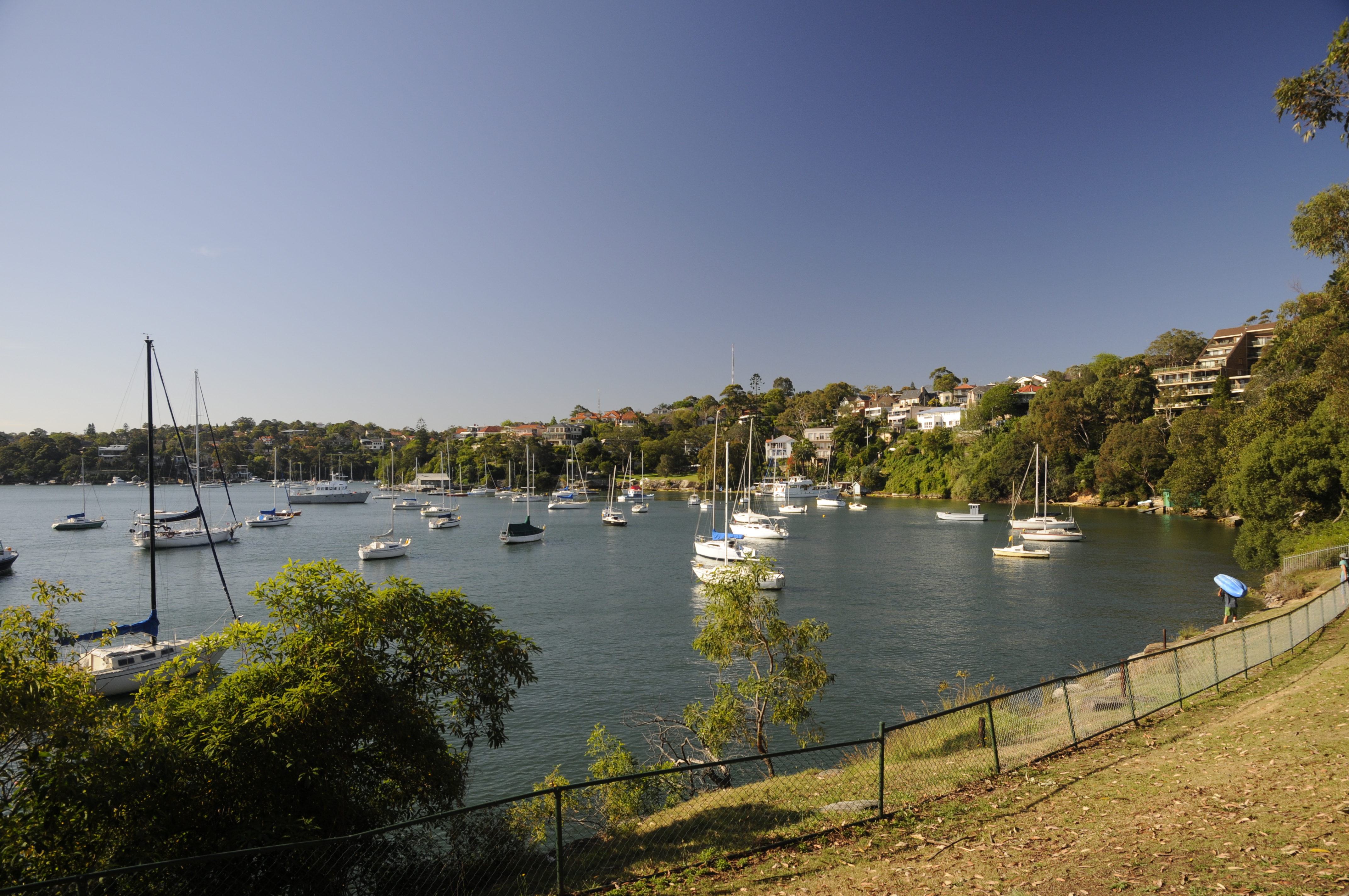 View from Shell Park | |||||||||||||
| Population: | 5,178 (2011)[1] | ||||||||||||
| Postcode: | 2065 | ||||||||||||
| Area: | 1.7 km² (0.7 sq mi) | ||||||||||||
| Location: | 7 km (4 mi) north west of Sydney CBD | ||||||||||||
| LGA: | Municipality of Lane Cove | ||||||||||||
| State District: | Lane Cove | ||||||||||||
| Federal Division: | North Sydney | ||||||||||||
| |||||||||||||
Greenwich (local pronunciation GREN-itch) is a suburb on the lower North Shore of Sydney, in the state of New South Wales, Australia. Greenwich is located 7 kilometres (4.3 mi) north-west of the Sydney central business district, in the local government area of the Municipality of Lane Cove.
The suburb occupies a peninsula on the northern side of Sydney Harbour, at the opening of the Lane Cove River. The suburb features harbour views, a few pockets of bushland, shops, restaurants and cafes, a harbour swimming pool with shark net.
History[]
The suburb's name is derived from its namesake Greenwich, by the banks of the Thames in London. Parramatta River had been known as the 'Thames of the Antipodes' and other nearby suburbs were also named after Thames localities of Putney, Woolwich and Henley.


Greenwich_House.jpg)
Greenwich House, George Street
The Cammeraygal clan of the Guringai people were the first inhabitants of the Greenwich area, and lived along the foreshores of the harbour, hunting in the hinterland and trading with other clans.
The first known occasion when a European went to the area was in 1788, when Lieutenant Henry Ball passed through the area while returning from a trip to the Middle Harbour area. Land grants began in 1794 and industries developed in the area during the 1830s.[2]
Aboriginal people were still present in the 1820s, but disease and displacement had driven them out by the 1860s.
Early land grants were made to Samuel Lightfoot, a convict, in 1794, and William Gore, public servant, in 1813. Gore built a road from his farm at Artarmon to Gore Cove, which was the beginning of Greenwich Road.[3]
In the 1830s George Green and his father Amaziah bought land in Greenwich, with access to the harbour, and along with others began a shipbuilding industry on the foreshore. When Green subdivided his land in 1840, the name 'Greenwich' was mentioned for the first time.


Plaque in honour of Captain Gother Kerr Mann
Greenwich House—a two-storey Georgian home made from sandstone blocks—was built on the 20-acre (8.1 ha) estate of George Green in 1836 and still stands on the corner of George and St Lawrence Streets.[4] The house was eventually sold, by the mortgage holders, to Gother Kerr Mann in the early 1850s, and remained in that family until 1949.
The eastern tip of Greenwich is called Manns Point, after Gother Kerr Mann (1809-1899). Mann was the first Chief Commissioner for Railways, the Superintendent of convicts at Cockatoo Island and the builder of Fitzroy Dock.
By the early 1880s Greenwich Point already had a post office, general store, and school, with around 16 houses. Upper Greenwich took longer to develop, with most of the area still virgin bush. But with the improvement in north shore roads, and increasing subdivision in upper Greenwich, some grander houses were built near River Road, and new estates were subdivided as Greenwich became a commuter suburb.[3]
Between the 1880s and the 1940s a number of successful dairies operated in Greenwich, run by the Anderson, Hogan, Mather and Clarke families. The milk from Anderson's was delivered by boat along the Lane Cove River and to the residents of Cockatoo Island. Hogan's dairy at Chisholm Street had 300 cows by the time it closed in 1928. Clarke's dairy was on the site of the current golf course.
Light industry was set up along the foreshores of Greenwich, including Shipbuilding, brickmaking, quarrying, and the Patent Asphaltum Company which refined bitumen and manufactured building materials. The Shell Transport and Trading Company opened a terminal at Gore Bay in 1901, importing and distributing petroleum products. It grew over time to include the sites of the Patent Asphaltum works, and several wharves, as well as the shale oil refining works of John Fell & Co. By the late 1930s, over 500 workers were employed at the Shell site.[3]
Education[]
Greenwich Public School is a local primary school with two separate campuses located 1.5 kilometres apart. It was opened in 1876 as a provisional school, after repeated petitions from residents, and became a public school in 1880, with a new building and site in Mitchell Street in 1881. In 1909 the school moved to the site of the current infants school in Greenwich Road, and the primary school moved to Kingslangley Road in 1950.[3] The children of John Howard, the 25th Prime Minister of Australia, attended the school.[5]
Transport[]
Greenwich ferry wharf provides access to the Inner Harbour ferry services, with ferry services to Circular Quay. A bus service from Greenwich Point runs to McMahons Point, Lane Cove and St Leonards (Route 265). The closest train stations are at Wollstonecraft and St Leonards.
Sport and recreation[]
The Greenwich Village Games are held every four years and feature numerous sports and competitions held mainly at Bob Campbell Oval (Gore Creek Oval) and Lane Cove Aquatic Centre. Greenwich Sports Club, which was founded in 1936, organises football (soccer) for men, women and children and netball for girls.
Population[]
Demographics[]
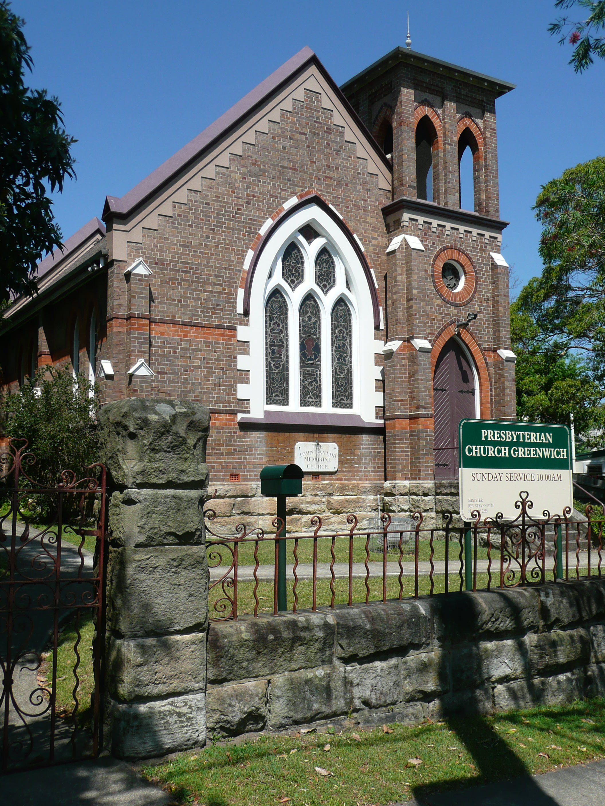

John Taylor Memorial Church (Presbyterian Church),
In the 2006 Australian Bureau of Statistics Census of Population and Housing, the population of Greenwich stood at 5,054 people, 50.7% females and 49.3% males, with a Median age of 39 years. 28.4% of the population was born overseas with England (5.3%), New Zealand (2.9%) and China (1.9%) the most common. The five strongest religious affiliations in the area were in descending order: Catholic (23.5%), no religion (22.5%), Anglican (22.2%), Uniting Church (3.7%) and Presbyterian and Reformed (3%).[6] The Catholic Church maintains Mary Help of Christians Chapel and the adjacent Clancy Terrace retirement village, and there are Anglican, Presbyterian and LDS Churches.[7]
Greenwich's population has a median weekly household income of $1,951, compared with $1,027 in Australia. The most common types of occupation for employed persons were Professionals (42.6%), Managers (18.1%), and Clerical and Administrative Workers (14.8%). 64% of the suburbs occupied private dwellings were family households, 22.5% were lone person households and 5.5% were group households.[6]
Notable residents[]
- Antonia Kidman - Journalist and sister of actress Nicole Kidman
Politics[]
Greenwich falls within the Federal Parliament electoral division of North Sydney, currently represented by Joe Hockey, a member of the Liberal Party. Hockey has held the seat since the 1996 federal election and is currently the Shadow Treasurer.[8]
For NSW state elections, Greenwich is in the electorate of Lane Cove, presently held by Anthony Roberts, a member of the Liberal Party, who has held the seat since the 2003 state election.[9]
Gallery[]
")
")
")
")
Federation_Bungalow_in_Greenwich.jpg "(1)Federation Bungalow in Greenwich.jpg (896 KB)")
References[]
- ^ Australian Bureau of Statistics (31 October 2012). "Greenwich (State Suburb)". 2011 Census QuickStats. http://www.censusdata.abs.gov.au/census_services/getproduct/census/2011/quickstat/SSC11027?opendocument&navpos=220. Retrieved 5 November 2012.
- ^ Lane Cove Council Website:retrieved 21 October 2009
- ^ a b c d Macleod, Prudence (2012). "Greenwich". Dictionary of Sydney. Dictionary of Sydney Trust. http://www.dictionaryofsydney.org/entry/greenwich. Retrieved 10 July 2012.
- ^ The Book of Sydney Suburbs, Compiled by Frances Pollon, Angus & Robertson Publishers, 1990, Published in Australia ISBN 0-207-14495-8, page 116
- ^ Sydney Morning Herald, 2004
- ^ a b Australian Bureau of Statistics (25 October 2007). "Greenwich (State Suburb)". 2006 Census QuickStats. http://www.censusdata.abs.gov.au/ABSNavigation/prenav/LocationSearch?collection=Census&period=2006&areacode=SSC11431&producttype=QuickStats&breadcrumb=PL&action=401. Retrieved 2008-02-28.
- ^ http://www.greenwich.org.au/Churches.htm
- ^ "Curriculum Vitae". Meet Joe. The Hon. Joe Hockey. 2007. http://www.joehockey.com/meetjoe/default.aspx. Retrieved 19 December 2007.
- ^ "Mr Anthony John ROBERTS, MP". Legislative Assembly. Parliament of New South Wales. 2007. Archived from the original on 2007-09-29. http://web.archive.org/web/20070929141356/http://www.parliament.nsw.gov.au/Prod/Parlment/Members.nsf/d890a06557517cedca256e700008765e/7e28286e85f7f13dca256cfa00127f1c!OpenDocument. Retrieved 19 December 20079.
External links[]
- Lane Cove at the Open Directory Project
- Greenwich Community Association
- The Lawyers Team of the Greenwich Village Games
- Greenwich Sports Club
| |||||||||||
| |||||||||||||||||||||||||||||
| This page uses content from the English language Wikipedia. The original content was at Greenwich, New South Wales. The list of authors can be seen in the page history. As with this Familypedia wiki, the content of Wikipedia is available under the Creative Commons License. |