| Main | Births etc |
|---|
| Burwood Sydney, | |||||||||||||
 Burwood Road, Burwood | |||||||||||||
| Population: | 11,130 | ||||||||||||
| Established: | 1814 | ||||||||||||
| Postcode: | 2134 | ||||||||||||
| Location: | 11 km (7 mi) west of Sydney CBD | ||||||||||||
| LGA: | Burwood Council | ||||||||||||
| State District: | Strathfield | ||||||||||||
| Federal Division: | Reid, Watson | ||||||||||||
| |||||||||||||
Burwood is a suburb in the inner-west of Sydney, in the state of New South Wales, Australia 12 kilometres west of the Sydney central business district and is the administrative centre for the local government area of Burwood Council.
Burwood Heights is a separate suburb to the south. The Appian Way is a street in Burwood, known for its architecturally designed Federation-style homes.
History[]
Archaeological evidence indicates people were living in the Sydney area for at least 11,000 years. This long association had led to a harmonious relationship between the indigenous inhabitants and their environment, which was interrupted by the arrival of the British in 1788. The European desire to cultivate the land aided and abetted by a smallpox epidemic that forced the local people, the Wangal clan, away from their source of food and their spiritual connection with the land.[1]

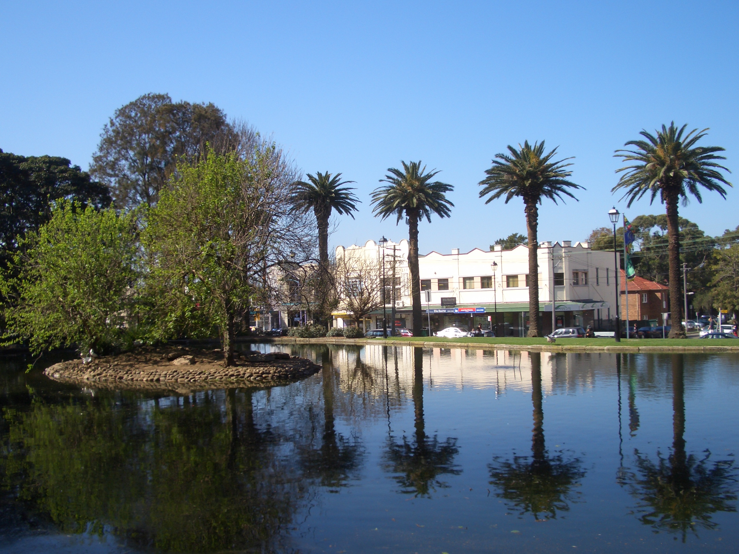
Lake in Burwood Park
Captain Thomas Rowley (1748–1806) received a grant of 260 acres (1.05 km2) in 1799, and called his property Burwood Farm after Burwood Park, England. Following more land grants, his estate increased to 750 acres (3.04 km2) stretching from Parramatta Road to Nicholson Street and The Boulevarde to Croydon railway station, whereat he ran merino sheep on the property.


War Memorial in Burwood Park
The first house, Burwood Villa was built in the area in 1814, the same year that a stagecoach began running between Sydney and Parramatta. Burwood became a staging post along the road and the beginnings of a settlement started to develop. One of its most prominent early residents was Dr. John Dulhunty, a former naval surgeon who was appointed the Superintendent of Police for the Colony of New South Wales after his arrival in Sydney from England in 1826. Dr. Dulhunty became famous in the colony for fighting a gang of bushrangers that attacked his residence, Burwood House. He died suddenly in the house in 1828 but his son, Robert Dulhunty, went on to become the founder of the New South Wales regional city of Dubbo.
Subdivisions in the Burwood area in the 1830s propelled the growth of a village and by 1855, when the railway line came through, Burwood was one of the first six stops on the Sydney-to-Parramatta route. This led to a huge growth in population. In 1874, the area became a municipality.[2]
Commercial area[]
Burwood has a mixture of residential, commercial, and light industrial developments. The main shopping strip runs along Burwood Road, beside Burwood railway station. Westfield Burwood is a large regional shopping centre, north of the railway line, on Burwood Road opposite Burwood Park. Burwood Plaza is a smaller shopping centre on Railway Parade, south of the railway line.
High rise residential and commercial buildings are also found in surrounding streets and along the railway line. Commercial and light industrial developments are located along Parramatta Road.
Transport[]
Burwood railway station is on the Inner West Line, South Line, Northern Line and Western Line of the CityRail network.
Trams to Mortlake and Cabarita once travelled down Burwood Road; trams ceased in August 1948.
Sydney Buses provide many bus services to Burwood, from Hurstville, Rockdale, Bondi Junction, Strathfield, Homebush, Campsie, Ryde as well as many other locations across Sydney. Sydney Buses has two terminuses, Burwood station and Westfield Burwood. Sydney Buses Burwood Bus Depot is located on the corner of Shaftesbury and Parramatta Roads.
Landmarks[]


St Nectarios Greek Orthodox Church, Railway Parade
Burwood features many fine examples of architecture from the Victorian and Federation styles. St Paul's Anglican Church on Burwood Road was designed by colonial architect Edmund Blacket and built in 1871. Nearby Woodstock in Church St was built in the early 1870s by tobacco manufacturer Edwin Penfold. In the 1940s, it was taken over by the army, later becoming a migrant hostel, before being bought by the council in 1974 for use as a community centre. Radio station, 2RDJ-FM, has been broadcasting from Woodstock since November 1983. Further south on Burwood Road is The Priory, built in 1877 by local councillor Mowbray Forrest, and Gayton, built in 1888 by NSW parliamentarian Richard Jones. The heritage listed St Nectarios Greek Orthodox Church in Railway Parade was formerly a Methodist church.
Running between Burwood Road and Liverpool Road is The Appian Way, a model housing estate conceived by George Hoskins at the turn of the century. The street has been described as one of the finest streets of Federation houses in Australia and it is state heritage listed. In the centre of the Appian Way is a communal reserve which was converted into a lawn tennis club.[3]
National Estate[]
The following buildings are on the Register of the National Estate:[4]
- Congregational Church, Burwood Road
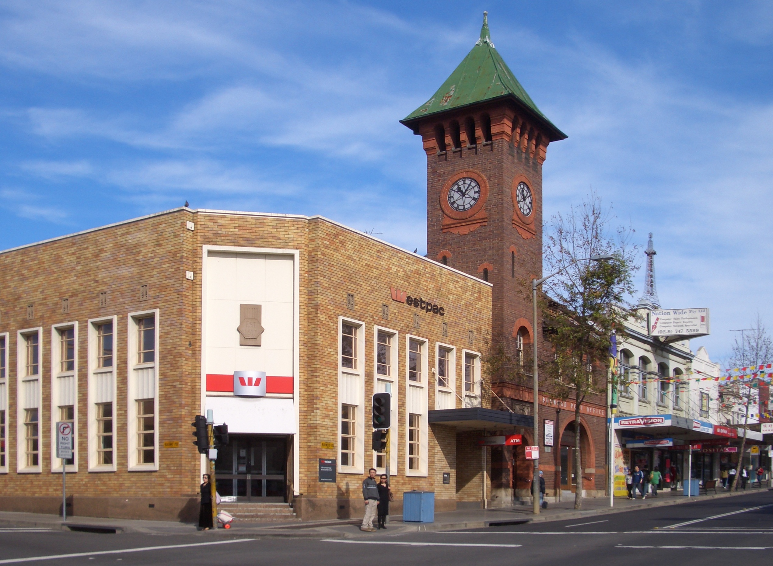
- Post Office, Burwood Road
- St Paul's Anglican Church, 205 Burwood Road
- St Cloud, 223 Burwood Road[5]
Burwood Park[]


Burwood Park pathway
Burwood Park was established by the local council in 1882 on land formerly known as Edrop's Paddock. The original design of the park was based on the Union Jack flag although it was later modified to allow a cricket oval to be established at the western edge of the park. Other features of Burwood Park include memorials to soldiers who died in World War I and Sandakan, a rotunda, a playground, a lake and an obelisk commemorating the site of Burwood Villa, the area's first house. Burwood Park is located on Burwood Road opposite Westfield Burwood
Woodstock[]
Edwin Thomas Penfold, who made his fortune working on the goldfields and by establishing a successful tobacco business in Sydney, was living at Randwick at a cottage called Sandgate in 128 Belmore Road when he decided to purchase 6 acres of land at Church Street in Burwood suburb in the inner-west of Sydney, in the state of New South Wales, Australia in 1871. He ordered the construction of Woodstock, a magnificent late Victorian Italianate villa, where he moved in with his wife Susannah Clarke. His son was born there. The main characteristics of the style are:
- classical mouldings around windows, doors and brackets under eaves
- often a square tower to one side
- often multi-storied
- ornamental chimneys
- elaborate four panel doors
- mosaic tile or marble porch and hall floors
- coloured and etched glass windows
- plastered walls.
It is believed the name Woodstock relates to a novel written by Sir Walter Scott published in April 28, 1826 named Woodstock or The Cavalier. The place remained with the Penfold family until 1895. One of his descendents would buy William Moffitt's printing and stationery firm and renamed it W. C. Penfold & Co. One of the largest stationaries company today in Australia.
Until 1907, it was owned by Edward Scholes, a prominent local identity of the Strathfield and Burwood areas. He was a barrister in law and later a Judge of the District Court of New South Wales. Scholes had a long involvement in local government, serving as an Alderman on Burwood Council for twelve years and Mayor in 1891. Edward married Gertrude Annie Keep in 1886, daughter of John Keep ('Keep McPherson' Hardware Merchants and a prominent local family).
In 1907, Woodstock was acquired by Sir Arthur Renwick, a physician, philanthropist and politician. Though he died the next year leaving the estate to his family.
In 1912, the property at 22 Church Street was purchased by the Keep sisters, Miss Amy Isabel and Miss Edith Ellen, who renamed it Broughton after their earlier home "Broughton Hall" at Leichhardt.
The Keep sisters maintained a beautiful garden at Broughton and history believe they were responsible for many of internal alterations which are see today such as the current entrance, the staircase and hall, the leadlight skylaight, the pressed metal ceilings and the Art Noveau stained glass window. This two storey mansion is not heavily decorated, has a new tiled roof and part of the verandah is enclosed. The original wooden staircase is in good condition. The entry is marked by remnant planting of ficus sp. to the end of Duff Street. Ficus are an excellent tree for beginners, as most species are fast growers, tolerant of most any soil and light conditions.
Woodstock is an example of gentlemen’s residences in Burwood and the changing use of 19th century mansions.
In 1942, the building was commandeered by the Commonwealth government to be used as one of the 28 army base for the Australian Women's Army Service (AWAS) Barracks which comprised both LTD and a General Details Depot until 1946. After that, the Reverence W. Deane, Principal, had a brief period of occupation of the place with his Methodist Ladies College Burwood (MLCB), currently it is known as MLC.
Two years later, between 1948 and 1974, the place operated as a the Broughton Migrant Hostel welcoming many families from Europe and Great Britain.
Burwood Council started leasing the property from 1976 until 1982 when it was purchased from the Commonwealth government. Burwood Council gave it back its original name and many community functions are now undertaken in this site.
Nowadays is undergoing upgrades to the original building so far include better disabled entry and ramps, and improvements to the Park’s footpaths. New play equipment and soft-surfaces worth $34,800 have also been installed.
Population[]
Demographics[]
In 2006, there were over 11,000 people in Burwood on census night and the vast majority were born overseas. Only 31.9% were born in Australia with the other major countries of birth being mainland China (21.5%), South Korea (4.8%), India (3.8%), Hong Kong (3.0%) and Italy (3.0%). The area had a high number of apartments (51.3%) and a high number of people renting (42.6%). The area had a higher unemployment rate (8.5%) than the national average at the time (5.2%) with the most common industries of employment being Cafes, Restaurants and Takeaway Food Services (5.8%), Legal and Accounting Services (4.1%) and Hospitals (3.4%).[6]
Notable residents[]
Three former Australian prime ministers have lived in Burwood:
- George Reid
- Earle Page
- William McMahon
Other notable residents include:
- Angus and Malcolm Young from AC/DC grew up in Burwood.
- Novelist Eleanor Dark was born in Burwood but moved away at a young age.
- Clare Dennis, gold medallist in the 200m breaststroke at the 1932 Summer Olympics was born in the suburb.
- Sir Norman McAlister Gregg, an ophthalmologist who discovered the link between rubella and birth defects was born in Burwood.
- Doug Sutherland, former lord mayor of Sydney
- Charles Smith Wilkinson Spent his last days in Burwood [7]
- Serial killer William MacDonald once owned and lived in a store in Burwood, where he murdered and castrated one of his victims.
- Cartoonist and creator of Mr. Squiggle, Norman Hetherington, grew up at 35 Meryla Street, Burwood.
- Robert Kaleski, writer, environmentalist, and breeder influential in the development of the Australian Cattle Dog, was born in Burwood.
Gallery[]
")
")
")
References[]
- ^ "Local History". Burwood Council. http://www.burwood.nsw.gov.au/default.asp?iNavCatId=3&iSubCatId=12. Retrieved 18 April 2009.
- ^ Pollon, F. (1990.) The Book of Sydney Suburbs, Angus & Robertson Publishers, Sydney, p.41
- ^ "Burwood Heritage Trail". Burwood Council. http://www.burwood.nsw.gov.au/default.asp?iNavCatId=3&iSubCatId=14. Retrieved 18 April 2009.
- ^ The Heritage of Australia, Macmillan Company, 1981, pp. 2 – 14
- ^ http://www.heritage.nsw.gov.au/07_subnav_04_2.cfm?itemid=5045017
- ^ Australian Bureau of Statistics (25 October 2007). "Burwood (State Suburb)". 2006 Census QuickStats. http://www.censusdata.abs.gov.au/ABSNavigation/prenav/LocationSearch?collection=Census&period=2006&areacode=SSC11149&producttype=QuickStats&breadcrumb=PL&action=401. Retrieved 18 April 2009.
- ^ http://www.asap.unimelb.edu.au/bsparcs/biogs/P000186b.htm
 Media related to Category:Burwood, New South Wales at Wikimedia Commons
| ||||||||
| This page uses content from the English language Wikipedia. The original content was at Burwood, New South Wales. The list of authors can be seen in the page history. As with this Familypedia wiki, the content of Wikipedia is available under the Creative Commons License. |