| Main | Births etc |
|---|
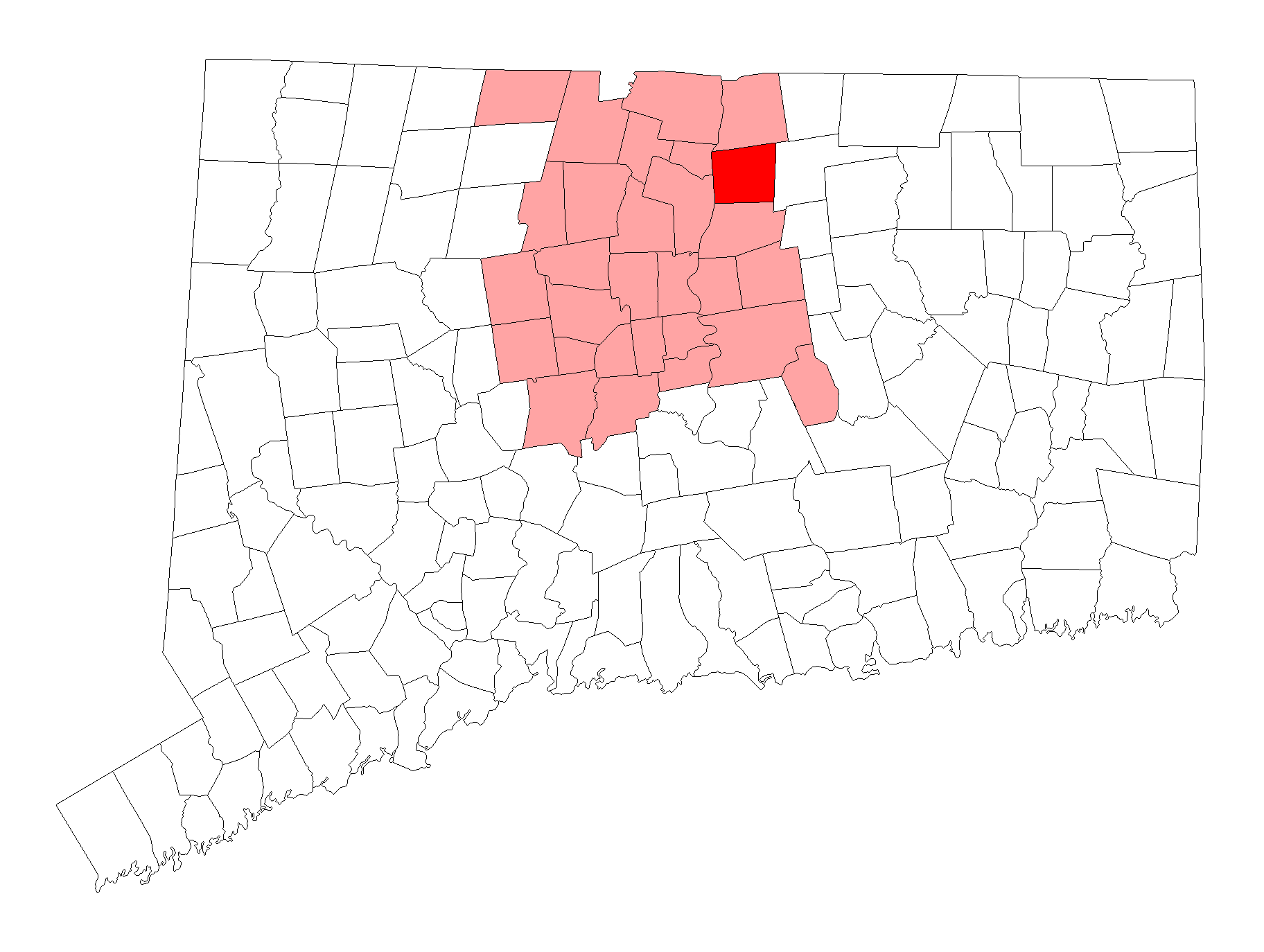
| East Windsor, Connecticut | |||
|---|---|---|---|
| — Town — | |||
 |
|||
|
|||
| Nickname(s): East Side | |||
| Motto: Unity, Strength | |||
 |
|||
| Country | United States | ||
| State | Connecticut | ||
| NECTA | Springfield | ||
| Region | Capitol Region | ||
| Settled | 1680 | ||
| Incorporated | 1768 | ||
| Government | |||
| • Type | Selectman-town meeting | ||
| • First Selectman | Robert Maynard (R) | ||
| • Selectmen | Jason E. Bowsza (D) Dale A. Nelson (D) Steve Dearborn (R) Richard P. Pippin, Jr. (R) |
||
| Area | |||
| • Total | 26.8 sq mi (69.5 km2) | ||
| • Land | 26.3 sq mi (68.0 km2) | ||
| • Water | 0.6 sq mi (1.5 km2) | ||
| Elevation | 72 ft (22 m) | ||
| Population (2010)[1] | |||
| • Total | 11,162 | ||
| • Density | 420/sq mi (160/km2) | ||
| Time zone | Eastern (UTC-5) | ||
| • Summer (DST) | Eastern (UTC-4) | ||
| ZIP code | 06016, 06088 | ||
| Area code(s) | 860 | ||
| FIPS code | 09-24800 | ||
| GNIS feature ID | 0212329 | ||
| Website | eastwindsor-ct.gov | ||
East Windsor is a town in Hartford County, Connecticut, United States. The population was 11,162 at the 2010 census. The town has five villages: Broad Brook, Melrose, Scantic, Warehouse Point and Windsorville.
History[]
In 1633, Settlers laid claim to the area now known as Windsor which included East Windsor. No English settlers lived on the east side of the river. The first English settler in what is today known as East Windsor, was William Pynchon, the founder of Springfield, Massachusetts. In 1636, he erected a warehouse for his settlement's transshipment of goods at what is now known as "Warehouse Point". Warehouse Point served as the southern border of Springfield, Massachusetts, for 132 years — until 1768 — when Warehouse Point, Connecticut, was annexed by the Connecticut Colony. Pynchon selected the site of Warehouse Point because of its location near the Enfield Falls — the first major falls in the Connecticut River, where all seagoing vessels were forced to terminate their voyages, and then transship to smaller shallops. By constructing a warehouse at Warehouse Point, Pynchon essentially forced all northern Connecticut River business to run through him and his settlement at Springfield.
Meanwhile, most of today's East Windsor was part of the prominent Windsor settlement on the east side of the river. Settlers avoided the East Side of the river doe to the Podunk tribe who inhabited the area, particularly following King Philip's War in 1675. It is unknown who was the first settler in today's East Windsor. East Windsor also included today's Ellington and South Windsor. Eventually in 1768, The East Windsor parish was partitioned from Windsor. The center of town became what is now East Windsor Hill in today's South Windsor. The North Part of town center was Scantic.
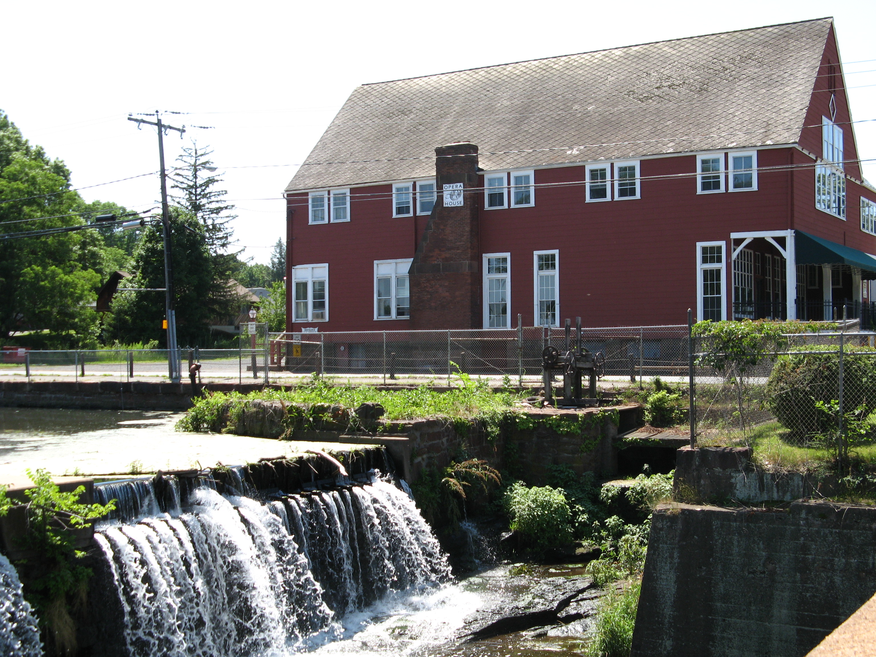
In 1832, the Broad Brook Mill was created at the waterfall of the Mill Pond.
The town has five sections of town, Warehouse Point, Broad Brook, Scantic, Melrose, and Windsorville. The oldest section of town is Warehouse Point, which, as mentioned, was first used by William Pynchon in the 1630s, and later settled as part of Springfield in the 1680s. The Scantic section of town was the center of town until the mills were built. The Windsorville section of town was once its own community, featuring a church, post office, mini-mart, and a park. Mulnite Farms is a tobacco farm on Graham Road, established in 1905. In 1897, the town's voluntary fire department was created in the mill. The Broad Brook Elementary school was established in 1951. In 1961 the town hall burned down. The new town hall is on Rye Street across from the elementary school. The new voluntary fire department building and senior center was built on the same site of the old town hall. On Memorial Day Weekend in 1986 the Broad Brook Mill caught on fire during renovations and the mill and the tire shop (on the site of the mill) burned down and the smoke could be seen as far as Bradley International Airport and Hartford. A new mini strip mall was built on the site of the mill. In recent years, the town's location — equidistant to the two major cities of Springfield and Hartford — has led to exponential population growth, and has caused it to become the fastest growing town in Connecticut.
Geography[]
According to the United States Census Bureau, the town has a total area of 69.5 square kilometres (26.8 sq mi), of which 68.0 square kilometres (26.3 sq mi) is land and 1.5 square kilometres (0.58 sq mi), or 2.11%, is water.[2]

Tobacco field in the Windsorville section of town
East Windsor is bordered by the town of Enfield to the north, South Windsor to the south, Ellington to the east, and Windsor Locks and Windsor to the west, across the Connecticut River.
By virtue of its location on the Connecticut River, Windsor functioned as a vital port. Merchants on both sides of the river shipped timber products, brick, livestock, wheat, tobacco and other produce to supply plantations in the West Indies, importing sugar, molasses, salt, and British manufactured textiles, ceramics, hardware and glass on return trips. Windsor’s Hooker and Chaffee mercantile firm maintained a store and packing houses right off Windsor’s Palisado Green. Small scale shipbuilding took place at the mouth of the Scantic River in what is now South Windsor, Warehouse Point in what is now East Windsor, and along the Farmington from as far upriver as today’s village of Poquonock (Stiles p. 428-9).
Demographics[]
| Historical populations | |||
|---|---|---|---|
| Census | Pop. | %± | |
| 1820 | 3,400 | ||
| 1840 | 3,600 | ||
| 1850 | 2,633 | −26.9% | |
| 1860 | 2,580 | −2.0% | |
| 1870 | 2,882 | 11.7% | |
| 1880 | 3,019 | 4.8% | |
| 1890 | 2,890 | −4.3% | |
| 1900 | 3,158 | 9.3% | |
| 1910 | 3,362 | 6.5% | |
| 1920 | 3,741 | 11.3% | |
| 1930 | 3,815 | 2.0% | |
| 1940 | 3,967 | 4.0% | |
| 1950 | 4,859 | 22.5% | |
| 1960 | 7,500 | 54.4% | |
| 1970 | 8,513 | 13.5% | |
| 1980 | 8,925 | 4.8% | |
| 1990 | 10,081 | 13.0% | |
| 2000 | 9,818 | −2.6% | |
| 2010 | 11,162 | 13.7% | |
| Est. 2014 | 11,423 | [3] | 16.3% |
| U.S. Decennial Census[4] | |||
As of the census[5] of 2000, there were 9,818 people, 4,078 households, and 2,556 families residing in the town. The population density was 373.5 people per square mile (144.2/km²). There were 4,356 housing units at an average density of 165.7 per square mile (64.0/km²). The racial makeup of the town was 91.47% White, 4.09% African American, 0.16% Native American, 2.00% Asian, 0.04% Pacific Islander, 0.83% from other races, and 1.41% from two or more races. Hispanic or Latino of any race were 2.11% of the population.
There were 4,078 households out of which 27.5% had children under the age of 18 living with them, 48.7% were married couples living together, 10.1% had a female householder with no husband present, and 37.3% were non-families. 30.0% of all households were made up of individuals and 9.5% had someone living alone who was 65 years of age or older. The average household size was 2.34 and the average family size was 2.94.
In the town, the population was spread out with 22.2% under the age of 18, 6.2% from 18 to 24, 33.1% from 25 to 44, 23.8% from 45 to 64, and 14.7% who were 65 years of age or older. The median age was 39 years. For every 100 females there were 96.4 males. For every 100 females age 18 and over, there were 92.6 males.
The median income for a household in the town was $51,092, and the median income for a family was $60,694. Males had a median income of $39,785 versus $33,446 for females. The per capita income for the town was $24,899. About 3.5% of families and 4.1% of the population were below the poverty line, including 2.9% of those under age 18 and 4.6% of those age 65 or over.
Government and politics[]
| Voter Registration and Party Enrollment as of October 30, 2012[6] | |||||
|---|---|---|---|---|---|
| Party | Active Voters | Inactive Voters | Total Voters | Percentage | |
| Democratic | 2,369 | 106 | 2,475 | 31.94% | |
| Republican | 1,460 | 48 | 1,508 | 19.46% | |
| Unaffiliated | 3,499 | 218 | 3,717 | 47.96% | |
| Minor Parties | 49 | 1 | 50 | 0.65% | |
| Total | 7,377 | 373 | 7,750 | 100% | |
Elections[]
| Election results from statewide races | ||
|---|---|---|
| Year | Office | Results |
| 2012 | President | Obama 56.8 – 42.0% |
| Senator | Murphy 52.3 – 45.4% | |
| Congress | Larson 65.1 – 32.7% | |
| 2010 | Governor | Foley 56.0 – 42.0% |
| Senator | Blumenthal 50.7 – 47.4% | |
| Congress | Larson 53.1 – 45.3% | |
| 2008 | President | Obama 48.8 – 38.8% |
| Congress | Larson 69.6 – 27.1% | |
| 2006 | Governor | Rell 63.8 – 34.7% |
| Senator | Lieberman 46.8 – 39.8 – 12.5% | |
| Congress | Larson 71.7 – 28.3% | |
| 2004 | President | Kerry 54.3 – 43.8% |
| Senator | Dodd 66.8 – 31.1% | |
| Congress | Larson 56.8 – 43.2% | |
Education[]
Elementary[]
East Windsor Elementary School System serves students in pre-kindergarten through grade 4. The Connecticut Children's Place runs from Grade 4 through Grade 12. Its principal is Joyce Welch. Homebound schooling runs from Pre-K through 12. The Broad Brook Elementary School principal is Laura Fox.
Middle school[]
East Windsor Middle School serves students in grades 5 through 8. Its principal is Kimberly Hellerich.
High school[]
East Windsor High School serves students in grades 9 through 12. Its principal is Ted Keleher.
Transportation[]
U.S. Route 5 runs though the town from the border with South Windsor to Enfield.
East Windsor is halfway between Hartford and Springfield, each 12 miles (19 km) away. Interstate 91 serves East Windsor with exits 44 and 45.
Bradley International Airport is 5 miles (8 km) away. Skylark Airport is a small airstrip to help young aviators learn how to fly.
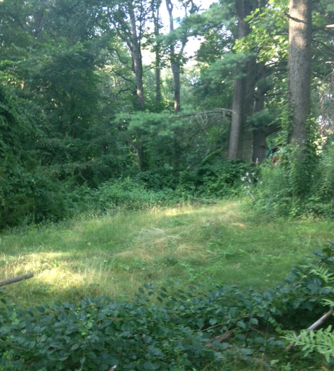

The Woods near the Scantic River
Crime[]
Graph of East Windsor Crime Statistics
East Windsor crime, according to city-data.com is relatively low against U.S. averages. Between 1999 and 2004, not including 2003, there was one murder, 26 rapes, 43 robberies, 41 assaults, 254 burglaries, 1248 thefts, and 177 car thefts.
Points of interest[]
- The Connecticut Trolley Museum and the Connecticut Fire Museum are located in the Warehouse Point section of town.
- The East Windsor Academy Museum operated by the historical society is located in the Scantic neighborhood.
- The East Windsor Hill section of the nearby town of South Windsor was the boyhood home of the theologian Jonathan Edwards.
- The Melrose School, now called the Melrose Library, is a one-room schoolhouse that was active until the early 20th century. It is located in the Melrose section of town and is now used for local functions.
- St. John's Episcopal Church (Warehouse Point, Connecticut) is on the National Register of Historic Places.
Notable people[]
- Lorrin Andrews – Congregational Church clergyman missionary to Hawaii, judge, and first Associate Justice of Hawaii State Supreme Court[7]
- John Warner Barber – An engraver whose books of state, national, and local history featured his vivid engravings.
- Israel Bissell – A post-rider who alerted the colonists of the British attack on April 19, 1775.
- Daniel Bissell – Soldier and spy for the Continental Army during the American Revolutionary War.
- Samuel Robbins Brown – Missionary to China and Japan with the Dutch Reformed Church
- Eliphalet Chapin – Cabinetmaker and furniture maker
- Jonathan Edwards – Theologian
- Frederick Holbrook – Governor of Vermont,
- Jerry Marquis – Former NASCAR driver
- Oliver Newberry – Veteran of the Black Hawk War
- Walter Loomis Newberry – Businessman and philanthropist
- Kevin Olson – Actor
- Eli Terry – The first inventor to receive a United States patent for a clock mechanism
- Zarley Zalapski – Former NHL player. Lived here during his tenure with the Hartford Whalers.
References[]
- ^ http://2010.census.gov/2010census/popmap/ipmtext.php?fl=09
- ^ "Geographic Identifiers: 2010 Demographic Profile Data (G001): East Windsor town, Hartford County, Connecticut". U.S. Census Bureau, American Factfinder. http://factfinder2.census.gov/bkmk/table/1.0/en/DEC/10_DP/G001/0600000US0900324800. Retrieved November 26, 2012.
- ^ "Annual Estimates of the Resident Population for Incorporated Places: April 1, 2010 to July 1, 2014". https://www.census.gov/popest/data/cities/totals/2014/SUB-EST2014.html. Retrieved June 4, 2015.
- ^ "Census of Population and Housing". Census.gov. Archived from the original on May 12, 2015. https://www.webcitation.org/6YSasqtfX?url=http://www.census.gov/prod/www/decennial.html. Retrieved June 4, 2015.
- ^ "American FactFinder". United States Census Bureau. Archived from the original on 2013-09-11. https://web.archive.org/web/20130911234518/http://factfinder2.census.gov/. Retrieved 2008-01-31.
- ^ "Registration and Party Enrollment Statistics as of October 30, 2012" (PDF). Connecticut Secretary of State. Archived from the original on 2012-10-30. http://www.sots.ct.gov/sots/lib/sots/electionservices/registration_and_enrollment_stats/nov12re.pdf. Retrieved 2006-10-02.
- ^ Who Was Who in America, Historical Volume, 1607-1896. Chicago: Marquis Who's Who. 1963.
External links[]
 Media related to East Windsor, Connecticut at Wikimedia Commons
- Town of East Windsor official website
- East Windsor Schools
- East Windsor Ambulance Association
- Connecticut Trolley Museum
- East Windsor Chamber of Commerce
| ||||||||||||||||||||
| |||||||||||||

Template:Connecticut River
| This page uses content from the English language Wikipedia. The original content was at East Windsor, Connecticut. The list of authors can be seen in the page history. As with this Familypedia wiki, the content of Wikipedia is available under the Creative Commons License. |