| Main | Births etc |
|---|
| Dennington | |
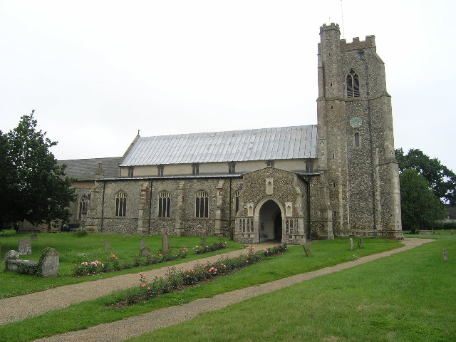 Church of St Mary, Dennington |
|

Dennington | |
| Population | 578 (2011)[1] |
|---|---|
| OS grid reference | |
| District | Suffolk Coastal |
| Shire county | Suffolk |
| Region | East |
| Country | England |
| Sovereign state | United Kingdom |
| Post town | WOODBRIDGE |
| Postcode district | IP13 |
| Dialling code | 01728 |
| Police | Suffolk |
| Fire | Suffolk |
| Ambulance | East of England |
| EU Parliament | East of England |
| UK Parliament | Central Suffolk and North Ipswich |
| List of places: UK • England • Suffolk | |
Dennington is a small village in Suffolk, England, just north of Framlingham along the A1120 Bypass. It has a CEVCP school, Church, Village Hall and Pub.[2][3][4]
Transport[]
Dennington is served by the route 482 which operates 3 return journeys Monday to Friday to Framlingham or Diss[5] and a peak hour only route 118 Monday to Friday service to Ipswich also via Framlingham.[6] A public school bus (route 551) operates to Thomas Mills High School, Framlingham.[7] The nearest railway station is Darsham with an hourly service to either Ipswich or Lowestoft.[8]
History[]
The village did have a police office which closed in the early 1900. It is still visible today.[9]
The village dates back to medieval times.
References[]
- ^ "Parish population 2011". http://www.neighbourhood.statistics.gov.uk/dissemination/LeadKeyFigures.do?a=7&b=11122671&c=IP13+7NB&d=16&e=62&g=6467030&i=1001x1003x1032x1004&o=362&m=0&r=0&s=1442239643375&enc=1. Retrieved 14 September 2015.
- ^ "Dennington Church". http://www.suffolkchurches.co.uk/Dennington.htm. Retrieved January 31, 2013.
- ^ "Dennington School". http://www.dennington.suffolk.dbprimary.com/suffolk/primary/dennington. Retrieved January 31, 2013.
- ^ "Village Website". http://dennington.onesuffolk.net/. Retrieved January 31, 2013.
- ^ "482 Timetable". http://www.suffolkonboard.com/content/download/21188/315417/482.pdf. Retrieved January 31, 2013.
- ^ "118 Timetable". http://www.suffolkonboard.com/content/download/21179/315380/118%2C%20119.pdf. Retrieved January 31, 2013.
- ^ "Framlingham Area Bus Timetable". http://www.suffolkonboard.com/timetables_leaflets/timetables_by_area/framlingham_stradbroke_surrounding_area. Retrieved January 31, 2013.
- ^ "Darsham Train Timetable". http://www.greateranglia.co.uk/timetables/download/771. Retrieved January 31, 2013.
- ^ "nearthecoast.com". http://www.nearthecoast.com/dennington/index.htm. Retrieved January 31, 2013.
External links[]
Wikimedia Commons has media related to:
- Diss Express - village's local newspaper website
- Dennington at nearthecoast.com
| ||||||||||||||
| This page uses content from the English language Wikipedia. The original content was at Dennington. The list of authors can be seen in the page history. As with this Familypedia wiki, the content of Wikipedia is available under the Creative Commons License. |