| ||||||||||||||
| Dauphin County, Pennsylvania | ||
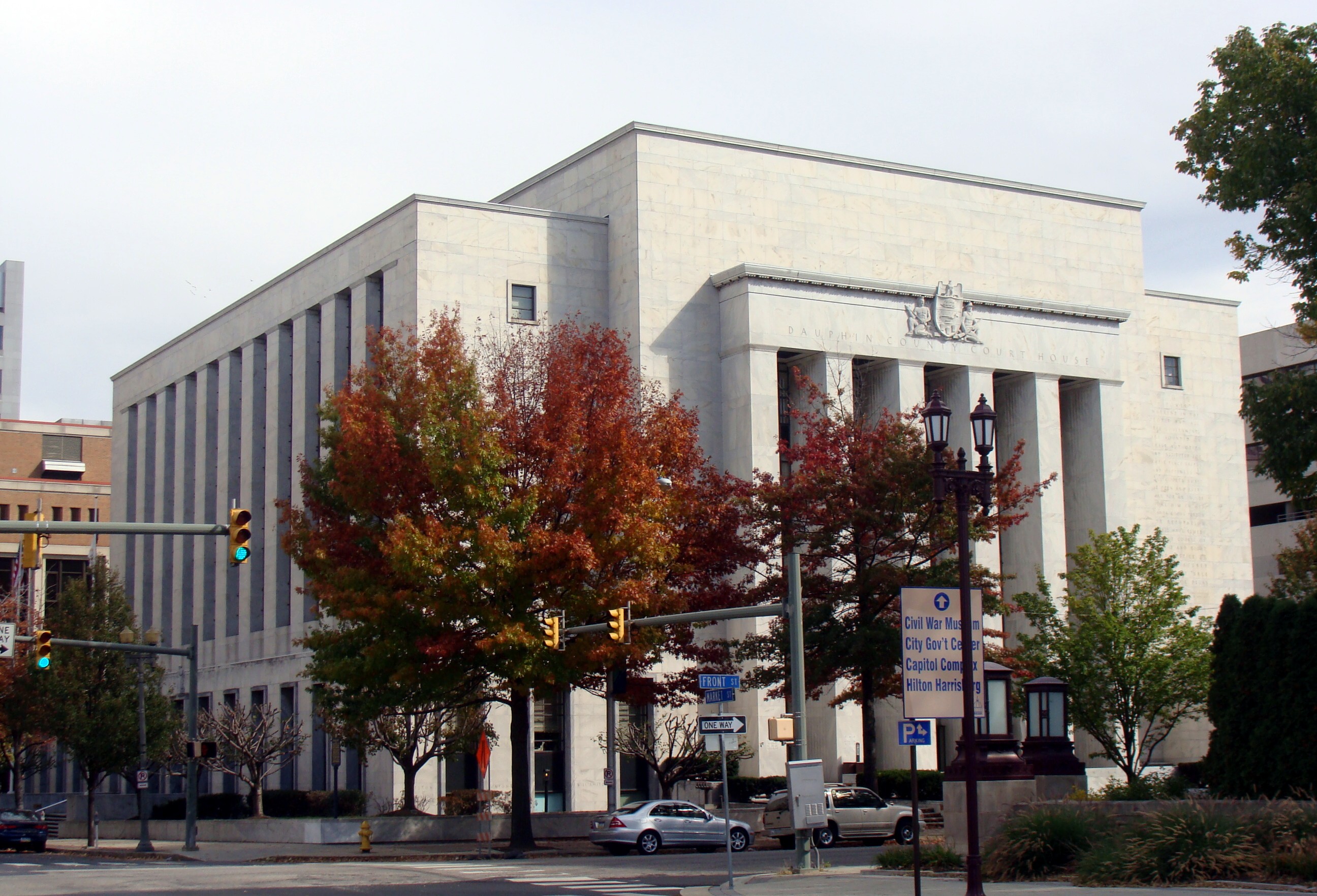 Dauphin County Courthouse
| ||
| ||
 Location in the state of Pennsylvania | ||
 Pennsylvania's location in the U.S. | ||
| Founded | March 4, 1785 | |
|---|---|---|
| Seat | Harrisburg | |
| Largest city | Harrisburg | |
| Area - Total - Land - Water |
558 sq mi (1,445 km²) 525 sq mi (1,360 km²) 32 sq mi (83 km²), | |
| Population - (2020) - Density |
286,401 510/sq mi (197.1/km²) | |
| Website | www.dauphincounty.org | |

Dauphin County (![]() /ˈdɔːfɪn/) is a county in the U.S. state of Pennsylvania and is one of the three counties comprising the Harrisburg–Carlisle Metropolitan Statistical Area. As of 2020 census, the population was 286,401. The county includes the city of Harrisburg, which has served as the state capital since 1812. Also located within the county is Three Mile Island Nuclear Generating Station, site of the 1979 nuclear core meltdown.
/ˈdɔːfɪn/) is a county in the U.S. state of Pennsylvania and is one of the three counties comprising the Harrisburg–Carlisle Metropolitan Statistical Area. As of 2020 census, the population was 286,401. The county includes the city of Harrisburg, which has served as the state capital since 1812. Also located within the county is Three Mile Island Nuclear Generating Station, site of the 1979 nuclear core meltdown.
Dauphin County was created on March 4, 1785, from part of Lancaster County and was named after Louis-Joseph, Dauphin of France the first son of Louis XVI. Louis-Joseph's title of Dauphin signified that he was the heir apparent to the throne of France. The county seat is Harrisburg, Pennsylvania's capital and tenth largest city.[1]
Geography[]
According to the U.S. Census Bureau, the county has a total area of 558 square miles (1,450 km2), of which 525 square miles (1,360 km2) is land and 32 square miles (83 km2) (5.78%) is water. The county is bound to its western border by the Susquehanna River.
Adjacent counties[]
- Northumberland County (north)
- Schuylkill County (northeast)
- Lebanon County (east)
- Lancaster County (south)
- York County (southwest)
- Cumberland County (west)
- Perry County (west)
Major Highways[]
|
|
Demographics[]
| Historical populations | |||
|---|---|---|---|
| Census | Pop. | %± | |
| 1790 | 18,155 | ||
| 1800 | 22,270 | 22.7% | |
| 1810 | 31,883 | 43.2% | |
| 1820 | 21,653 | −32.1% | |
| 1830 | 25,243 | 16.6% | |
| 1840 | 30,118 | 19.3% | |
| 1850 | 35,754 | 18.7% | |
| 1860 | 46,756 | 30.8% | |
| 1870 | 60,740 | 29.9% | |
| 1880 | 76,148 | 25.4% | |
| 1890 | 96,977 | 27.4% | |
| 1900 | 114,443 | 18.0% | |
| 1910 | 136,152 | 19.0% | |
| 1920 | 153,116 | 12.5% | |
| 1930 | 165,231 | 7.9% | |
| 1940 | 177,410 | 7.4% | |
| 1950 | 197,784 | 11.5% | |
| 1960 | 220,255 | 11.4% | |
| 1970 | 223,834 | 1.6% | |
| 1980 | 232,317 | 3.8% | |
| 1990 | 237,813 | 2.4% | |
| 2000 | 251,805 | 5.9% | |
| 2010 | 268,100 | 6.5% | |
| [2][3] | |||
As of the 2010 census, the county was 72.7% White, 18.0% Black or African American, 0.2% Native American, 3.2% Asian, and 3.1% were two or more races. 7.0% of the population were of Hispanic or Latino ancestry[1].
As of the census[4] of 2000, there were 251,798 people, 102,670 households, and 66,119 families residing in the county. The population density was 479 people per square mile (185/km²). There were 111,133 housing units at an average density of 212 per square mile (82/km²). The racial makeup of the county was 77.11% White, 16.91% Black or African American, 0.16% Native American, 1.96% Asian, 0.03% Pacific Islander, 1.97% from other races, and 1.85% from two or more races. 4.13% of the population were Hispanic or Latino of any race. 29.2% were of German, 7.5% Irish, 7.3% American and 7.2% Italian ancestry according to Census 2000. 91.8% spoke English and 3.9% Spanish as their first language.
According to 2005 estimates, 73.9% of the county's population was non-Hispanic whites. 17.8% of the population was African-Americans. 2.5% were Asians. Latinos now were 5.0% of the population.[5]
In 2000 there were 102,670 households out of which 29.70% had children under the age of 18 living with them, 47.60% were married couples living together, 12.90% had a female householder with no husband present, and 35.60% were non-families. 30.00% of all households were made up of individuals and 10.30% had someone living alone who was 65 years of age or older. The average household size was 2.39 and the average family size was 2.98.
In the county, the population was spread out with 24.30% under the age of 18, 7.60% from 18 to 24, 30.10% from 25 to 44, 23.80% from 45 to 64, and 14.20% who were 65 years of age or older. The median age was 38 years. For every 100 females there were 92.30 males. For every 100 females age 18 and over, there were 88.80 males.
Politics and government[]
| Year | Republican | Democratic | Third party | |||
|---|---|---|---|---|---|---|
| No. | % | No. | % | No. | % | |
| 2020 | 66,408 | 44.90% | 78,983 | 53.40% | 2,510 | 1.70% |
| 2016 | 60,863 | 46.18% | 64,706 | 49.10% | 6,214 | 4.72% |
| 2012 | 57,450 | 46.22% | 64,965 | 52.26% | 1,886 | 1.52% |
| 2008 | 58,238 | 44.85% | 69,975 | 53.89% | 1,632 | 1.26% |
| 2004 | 65,296 | 53.87% | 55,299 | 45.62% | 613 | 0.51% |
| 2000 | 53,631 | 53.28% | 44,390 | 44.10% | 2,637 | 2.62% |
| 1996 | 44,417 | 47.78% | 40,936 | 44.03% | 7,618 | 8.19% |
| 1992 | 45,479 | 45.98% | 36,990 | 37.40% | 16,441 | 16.62% |
| 1988 | 48,917 | 57.77% | 35,079 | 41.43% | 681 | 0.80% |
| 1984 | 54,330 | 61.28% | 33,576 | 37.87% | 752 | 0.85% |
| 1980 | 44,039 | 56.18% | 27,252 | 34.77% | 7,096 | 9.05% |
| 1976 | 46,819 | 56.33% | 34,342 | 41.32% | 1,961 | 2.36% |
| 1972 | 54,307 | 69.38% | 22,587 | 28.86% | 1,376 | 1.76% |
| 1968 | 48,394 | 59.17% | 25,480 | 31.15% | 7,914 | 9.68% |
| 1964 | 42,718 | 47.77% | 46,119 | 51.57% | 594 | 0.66% |
| 1960 | 61,726 | 64.22% | 33,962 | 35.33% | 427 | 0.44% |
| 1956 | 61,342 | 67.45% | 29,226 | 32.14% | 375 | 0.41% |
| 1952 | 58,385 | 65.12% | 30,985 | 34.56% | 286 | 0.32% |
| 1948 | 46,861 | 62.16% | 27,729 | 36.78% | 796 | 1.06% |
| 1944 | 44,725 | 59.05% | 30,684 | 40.51% | 333 | 0.44% |
| 1940 | 42,394 | 52.35% | 38,305 | 47.30% | 282 | 0.35% |
| 1936 | 39,598 | 47.42% | 43,256 | 51.80% | 644 | 0.77% |
| 1932 | 36,278 | 60.31% | 22,412 | 37.26% | 1,462 | 2.43% |
| 1928 | 49,108 | 83.78% | 9,115 | 15.55% | 394 | 0.67% |
| 1924 | 27,838 | 68.04% | 9,004 | 22.01% | 4,074 | 9.96% |
| 1920 | 26,094 | 65.36% | 11,990 | 30.03% | 1,839 | 4.61% |
| 1916 | 13,954 | 52.16% | 11,483 | 42.92% | 1,315 | 4.92% |
| 1912 | 6,012 | 23.29% | 7,470 | 28.93% | 12,337 | 47.78% |
| 1908 | 15,637 | 63.38% | 7,546 | 30.59% | 1,488 | 6.03% |
| 1904 | 16,508 | 72.61% | 5,040 | 22.17% | 1,186 | 5.22% |
| 1900 | 14,673 | 64.23% | 7,390 | 32.35% | 783 | 3.43% |
| 1896 | 14,752 | 66.84% | 6,584 | 29.83% | 733 | 3.32% |
| 1892 | 11,010 | 57.47% | 7,520 | 39.25% | 627 | 3.27% |
| 1888 | 10,852 | 57.66% | 7,684 | 40.82% | 286 | 1.52% |
| 1884 | 9,394 | 58.46% | 6,378 | 39.69% | 298 | 1.85% |
| 1880 | 8,573 | 55.21% | 6,619 | 42.62% | 337 | 2.17% |
Dauphin County was historically a Republican stronghold, like most of south-central Pennsylvania. It was long one of the more conservative urban counties in the nation, having only supported a Democrat for president twice from 1880 to 2004. However, there has been a decided shift toward the Democrats in national and statewide elections in recent years. This culminated when the Democrats overtook the Republicans in countywide registration during the summer of 2008. As of November 1, 2021, 45.5% of registered voters in the county were Democrats, 38.9% Republicans, and 15.5% other party/non-affiliated.[7] Bob Casey Jr. carried the county in the 2006 Senate election when he unseated Rick Santorum. According to the Dauphin County Board of Elections, in 2008 Barack Obama became the first Democratic presidential candidate to carry Dauphin County since 1964, receiving 9.0% more of the vote than John McCain.[8] It was also only the third time Dauphin County had supported a Democrat for president since 1936. Obama won Dauphin with a slightly reduced majority in 2012, while Hillary Clinton won it with a narrow plurality in 2016. It is now the only blue county in the traditionally powerfully Republican Susquehanna Valley.
Nonetheless, the GOP still holds all of the county row offices, as well as a majority on the county commission. All but one state house seat is in Republican hands, as well as both of the state senate seats and the congressional seat. Most local elected officials are also Republican, by a margin of 3 to 1. This is because most of the Democratic gains have been in already heavily Democratic Harrisburg, which has had a Democratic mayor since 1982 and has been represented in the state house by a Democrat since 1975. In contrast, the suburbs and rural areas remain some of the most Republican areas in Pennsylvania.
County commissioners[]
- Michael Pries, Chairman, Republican
- Chad Saylor, Vice Chairman, Republican
- George P. Hartwick III, Secretary, Democrat
In December 2015, the Commissioners adopted a new $5 per year car registration fee. The funds to be used for development programs. The County receives substantial dollars from the taxes on Gaming ($6.4 million in 2015).[9] The commissioners disperse these funds for community projects and development on an annual basis. The county also levies an annual property tax. Real estate tax levy is 6.876 millage.
- Budget
- $243 million (2016)
- $187 million (2014)[10]
- $193 million (2013)[11]
- $119,417,496 (2010–11)[12]
- $119,923,654 (2009–10)
Other county offices[]
- Clerk of Courts, Dale Klein, Republican
- Controller, Jim Markel (acting), Republican
- Coroner, Graham Hetrick, Republican
- District Attorney, Fran Chardo, Republican
- Prothonotary, Matt Krupp, Republican
- Recorder of Deeds, Jim Zugay, Republican
- Register of Wills and Clerk of the Orphans' Court, Jean Marfizo King, Republican
- Sheriff, Nick Chimienti, Republican
- Treasurer, Janis Creason, Republican
- Solicitor, Joseph A. Curcillo III, Esquire
State Representatives[13][]
- David Hickernell, Republican, 98th district
- Patty Kim, Democrat, 103rd district
- Sue Helm, Republican, 104th district
- Andrew Lewis, Republican, 105th district
- Tom Mehaffie, Republican, 106th district
- Joseph Kerwin, Republican, 125th district
State Senate[13][]
- John DiSanto, Republican, 15th district
- Chris Gebhard, Republican, 48th district
United States House of Representatives[14][]
- Scott Perry, Republican, 10th district
United States Senate[14][]
| Senator | Party |
|---|---|
| Pat Toomey | Republican |
| Bob Casey | Democrat |
Municipalities in Dauphin County[]


Map of Dauphin County, Pennsylvania with Municipal Labels showing Cities and Boroughs (red), Townships (white), and Census-designated places (blue).
Under Pennsylvania law, there are four types of incorporated municipalities: cities, boroughs, townships, and, in at most two cases, towns. The following cities, boroughs and townships are located in Dauphin County:
Cities[]
See also: List of Harrisburg neighborhoods
|
Boroughs[]
|
|
|
|
Townships[]
|
|
|
|
Unincorporated and Census-designated places[]
Census-designated places are geographical areas designated by the U.S. Census Bureau for the purposes of compiling demographic data. They are not actual jurisdictions under Pennsylvania law. Other unincorporated communities, such as villages, may be listed here as well.
Census-designated places[]
|
|
Unincorporated villages[]
|
|
|
Education[]


Map of Dauphin County, Pennsylvania School Districts
Colleges and universities[]
- Dixon University Center
- Harrisburg Area Community College
- Harrisburg University of Science and Technology
- Penn State Harrisburg
- Penn State Hershey Medical Center
- Temple University Harrisburg Campus
- Widener University School of Law
Public School Districts[]
- Central Dauphin School District
- Derry Township School District
- Halifax Area School District
- Harrisburg School District (Pennsylvania)
- Lower Dauphin School District
- Middletown Area School District
- Millersburg School District
- Steelton-Highspire School District
- Susquehanna Township School District
- Susquenita School District (also in Perry County)
- Upper Dauphin School District
- Williams Valley School District (also in Schuylkill County)
Public Charter Schools[]
Several public charter schools are established in Dauphin County [15]
- Infinity Charter School
- Pennsylvania Distance and Electronic Learning Charter School
- Sylvan Heights Science Charter School
- Capital Area School for the Arts
Intermediate Unit[]
The Capital Area Intermediate Unit 15 is a state approved education agency that offers: school districts, charter schools, private schools, and home school students, a variety of services including: a completely developed K-12 curriculum that is mapped and aligned with the Pennsylvania Academic Standards (available online), shared services, a group purchasing program and a wide variety of special education and special needs services.
Library system[]
The Dauphin County Library System provides library service to the residents of the county through a main library in Harrisburg, Pennsylvania and seven branch libraries. DCLS is a private, non-profit corporation. It is governed by a 17-member Board of Trustees, five appointed annually by the Dauphin County Commissioners, and twelve elected for three-year terms. The library is a member of the Pennsylvania library system.
Private Schools[]
As reported by the National Center for Educational Statistics[16]
- Armstrong Valley Christian School - Halifax
- Berrysburg Christian Academy - Elizabethvile
- Bishop McDevitt High School - Harrisburg
- Cathedral Consolidated School - Harrisburg
- Covenant Christian Academy - Harrisburg
- East Shore Montessori School - Harrisburg
- Emmanuel Wesleyan Academy - Gratz
- Garden Spot Amish School - Millersburg
- Garden Spot School - Millersburg
- Goddard School - Harrisburg
- Hansel and Gretel Early Learning Centers - Harrisburg
- Harrisburg Adventist School - Harrisburg
- Harrisburg Christian School - Harrisburg
- Hershey Christian School - Hershey
- Hillside Amish School - Harrisville
- Hillside Seventh Day Adventist School - Harrisburg
- Keystone Math and Science Academy - Harrisburg
- Kinder-Care Learning Center - Harrisburg
- KinderCare Learning Center - Hershey
- Londonderry School - Harrisburg
- Mahantango School - Lykens
- Matterstown School - Millersburg
- Middletown Christian School - Middletown
- Milton Hershey School - Hershey
- North Mountain View Amish - Millersburg
- Northern Dauphin Christian School - Millersburg
- Pride of the Neighborhood Academies - Harrisburg
- Prince of Peace School - Steelton
- Rakers Mill School - Elizabethville
- Rolling Acres School - Lykens
- Seven Sorrows of BMV School - Middletown
- Sonshine Learning Station - Middletown
- South Mountain View School - Spring Glen
- Specktown School - Lykens
- St. Catherine Laboure School - Harrisburg
- St Joan of Arc Elementary School - Hershey
- St. Margaret Mary School - Harrisburg
- St. Stephen's Episcopal School - Harrisburg
- Tender Years Inc. - Hershey
- The Nativity School of Harrisburg - Harrisburg
- Windy Knoll School - Spring Glen
- Wordsworth Academy - Harrisbrug
- Yeshiva Academy - Harrisburg
Recreation[]
There are two Pennsylvania state parks in Dauphin County.
- Boyd Big Tree Preserve Conservation Area
- Joseph E. Ibberson Conservation Area
See also[]
- Harrisburg Regional Chamber
- Hummelstown brownstone
- List of municipal authorities in Dauphin County, Pennsylvania
- National Register of Historic Places listings in Dauphin County, Pennsylvania
References[]
- ^ "Find a County". National Association of Counties. http://www.naco.org/Counties/Pages/FindACounty.aspx. Retrieved 2011-06-07.
- ^ http://factfinder2.census.gov
- ^ http://mapserver.lib.virginia.edu/
- ^ "American FactFinder". United States Census Bureau. http://factfinder.census.gov. Retrieved 2008-01-31.
- ^ Dauphin County QuickFacts from the US Census Bureau
- ^ Leip, David. "Dave Leip's Atlas of U.S. Presidential Elections". http://uselectionatlas.org/RESULTS.
- ^ Pennsylvania Department of States, Voter registration statistics by county, accessed November 2, 2021
- ^ "Pennsylvania Election Returns". http://www.electionreturns.state.pa.us/ElectionsInformation.aspx?ElectionID=28.
- ^ Barbara Miller (February 11, 2015). "Here's how Dauphin County commissioners are giving out $6.4 million in gaming grants". Pennlive.com. http://www.pennlive.com/midstate/index.ssf/2015/02/dauphin_county_commissioners_a_27.html.
- ^ Jeff Frantz (December 18, 2013). "Dauphin County approves $187 million 2014 budget". Pennlive.com. http://www.pennlive.com/midstate/index.ssf/2013/12/dauphin_county_commissioners_m_61.html.
- ^ Matt Miller (December 19, 2012). "Dauphin County commissioners approve budget without tax increase for 2013". Pennlive.com. http://www.pennlive.com/midstate/index.ssf/2012/12/dauphin_county_commissioners_a_17.html.
- ^ "Dauphin County Budget Summary 2010-11". 2010. http://www.dauphincounty.org/government/About-the-County/Budget%20Info/10-11-Dauphin-County-Fiscal-Year-Budget.pdf.
- ^ a b Center, Legislativate Data Processing. "Find Your Legislator" (in en). http://www.legis.state.pa.us/cfdocs/legis/home/findyourlegislator/county_list.cfm?CNTYLIST=Dauphin.
- ^ a b "Pennsylvania Senators, Representatives, and Congressional District Maps - GovTrack.us". https://www.govtrack.us/congress/members/PA.
- ^ Pennsylvania Department of Education Approved Public Charter Schools, January 2010
- ^ ies, National Center for Education Statistics, US Department of Education, Institute of Education Sciences, Private School Universe Survey 2008
External links[]
- County of Dauphin (official website)
- The Historical Society of Dauphin County
- Dauphin County Library System
Template:Harrisburg, Pennsylvania
| |||||||||||||||||||||||

| This page uses content from the English language Wikipedia. The original content was at Dauphin County, Pennsylvania. The list of authors can be seen in the page history. As with this Familypedia wiki, the content of Wikipedia is available under the Creative Commons License. |