(Copy from Wikipedia) |
No edit summary |
||
| (3 intermediate revisions by 2 users not shown) | |||
| Line 1: | Line 1: | ||
| + | {{bdm}} |
||
| − | {{Infobox Australian |
+ | {{Infobox Australian place | type=town |
|name = Crookwell |
|name = Crookwell |
||
|state = nsw |
|state = nsw |
||
|image = Crookwell 1.jpg |
|image = Crookwell 1.jpg |
||
| − | |caption = |
+ | |caption = Crookwell |
|postcode = 2583 |
|postcode = 2583 |
||
| − | |pop = |
+ | |pop = 1,993 |
| + | | pop_footnotes=<ref name=Census2006Y>{{Census 2006 AUS|id=UCL123600|name=Crookwell (Urban Centre/Locality)|accessdate=14 July 2009|quick=on}}</ref> |
||
| − | |state = nsw |
||
| ⚫ | |||
| + | | latd =34 |latm =27 |lats =0 |
||
| + | | longd =149 |longm =28 |longs =0 |
||
|fedgov = [[Division of Hume|Hume]] |
|fedgov = [[Division of Hume|Hume]] |
||
|stategov = [[Electoral district of Burrinjuck|Burrinjuck]] |
|stategov = [[Electoral district of Burrinjuck|Burrinjuck]] |
||
| − | |lga = [[ |
+ | |lga = [[Upper Lachlan Shire]] |
| − | |dist1 = |
+ | |dist1 = |
| − | |dist2 = |
+ | |dist2 = |
}} |
}} |
||
| − | '''Crookwell''' is a small town |
+ | '''Crookwell''' is a small town located in the [[Southern Tablelands]] of [[New South Wales]], [[Australia]], in the [[Upper Lachlan Shire]]. At the 2006 [[census in Australia|census]], Crookwell had a population of 1,993 people.<ref name=Census2006Y /> The town is at a relatively high altitude in Australian terms (980 metres), and there are occasional snowfalls during the winter months. The nearest major centre is the city of [[Goulburn, New South Wales|Goulburn]] which is about a half hour drive to the south of the town. Crookwell is easily accessible to the state capital of [[Sydney]] and also the [[Government of Australia|Federal]] capital of [[Canberra]]. |
| − | Most |
+ | Most employment is based on rural industries, and the district is renowned for potato farming. Crookwell is also home to what was [[New South Wales|NSW]]'s first [[wind farm]], which consists of 8 turbines, and is located a few kilometres out of town on the road towards Goulburn. |
| + | A [[Crookwell railway line, New South Wales|railway]] once connected Goulburn and Crookwell, which opened in 1902, but passenger services to [[Crookwell railway station, New South Wales|Crookwell station]] ceased in 1974,<ref>Scrymgeour, R. ''A History of the Goulburn- Crookwell Line''. [[Australian Railway History|Australian Railway Historical Society Bulletin]]. Vol 48, no 721. November 1997.</ref><ref>[http://www.nswrail.net/locations/show.php?name=NSW:Crookwell&line=NSW:crookwell:0 Crookwell station]. NSWrail.net, accessed 21 August 2009.</ref> and the last goods train ran in 1985. The line is technically not closed, but has been listed as out of use, although in some locations is now impassable. |
||
| − | Crookwell is also home to NSW's first [[wind farm]]. The wind farm consisting of 8 poles is located 8 minutes out of Crookwell on the Goulburn road. The "windmill" operates automatically when there is 15km/h wind and shuts off when wind speed reaches 72km/h. There is controversy about its aesthetic appeal amongst Crookwell and surrounding residents, and forms a curious tourist attraction amidst the general decline of sheep farming and the continued drought in the area. |
||
| − | == |
+ | ==History== |
| ⚫ | |||
| + | The area around Crookwell was first settled in the 1820s, and had received its current name by the 1860s. After this, [[selection (Australian history)|selection]] of blocks occurred; and the population of was over 100 by midway through that decade. The first allotments were sold at the end of the decade. By the mid 1870s the population had already reached 1000 people.<ref>[http://upperlachlan.local-e.nsw.gov.au/about/1273/1274.html A Snapshot of Crookwell's History]. Upper Lachlan Shire Council, accessed 20 September 2011.</ref> |
||
| + | ==Governance== |
||
| − | == External Links: == |
||
| + | Crookwell is the seat of the [[Upper Lachlan Shire|Upper Lachlan Shire Council]] [[Local Government Areas in Australia|Local Government Area]] (LGA) of [[New South Wales]], [[Australia]], formed in 2004. |
||
| + | ==Transport== |
||
| − | [http://www.nswrail.net/locations/show.php?name=NSW:Crookwell&line=NSW:crookwell:0 Crookwell Railway Station] |
||
| + | Crookwell is approximately 2.5 hours drive from [[Sydney]] via the [[Goulburn]]. Or a 1.5 hours drive from [[Canberra]]. Other than the main road to Goulburn, minor roads link Crookwell with [[Bathurst]], [[Boorowa]], [[Grabben Gullen]], [[Laggan, New South Wales|Laggan]], and [[Taralga]]. |
||
| + | [[Crookwell railway station]] is the terminus of the now disused [[Crookwell railway line]]. |
||
| + | Crookwell has a small unpaved airstrip. |
||
| ⚫ | |||
| + | |||
| ⚫ | |||
| + | ==Media== |
||
| + | ===Radio stations=== |
||
| + | Radio stations with transmitters located in Crookwell include- |
||
| + | *[[Triple J]] 91.7 FM (2JJJ) |
||
| + | *[[2GN]] 106.1 FM ''(commercial)'' |
||
| + | *[[ABC Local Radio]] 106.9 FM (2ABCRR) |
||
| + | *[[Radio National|ABC Radio National]] 107.7 FM (2ABCRN) |
||
| + | |||
| + | Depending on location some Goulburn, Illawarra, and/or Canberra based radio stations can also heard. |
||
| + | |||
| + | ===Television=== |
||
| + | Crookwell has a low powered transmitter broadcasting [[ABC Television]] in analog only, located on Wades Hill. This is expected to be upgraded to digital before the analog turn-off at the end of 2013. |
||
| + | |||
| + | Residents wishing to receive a wider range of channels and in digital can attempt to receive signals from either [[Canberra]] ([[Black Mountain (Australian Capital Territory)|Black Mountain]]), or [[Orange, New South Wales|Orange]] ([[Mount Canobolas]]), although Crookwell is located in the fringe area of both transmitters. |
||
| + | |||
| + | Another option is to use the [[Viewer Access Satellite Television|VAST]] free-to-air satellite service, which offers a similar range of channels. |
||
| + | |||
| + | ==See also== |
||
| ⚫ | |||
| + | |||
| + | ==References== |
||
| + | {{reflist}} |
||
| + | |||
| + | ==Photo gallery== |
||
| + | <gallery caption="Crookwell Images" widths="100px" heights="100px" perrow="4"> |
||
| + | File:Crookwell Town Entry West.jpg|<center>Town entry sign</center> |
||
| + | File:Crookwell Scout Hall.jpg|<center>Scout Hall</center> |
||
| + | File:Crookwell Bluestone.jpg|<center>Bluestone building</center> |
||
| + | File:Crookwell Railway Station.jpg|<center>Disused railway station</center> |
||
| + | File:Crookwell Sunburst.jpg|<center>Sunburst façade</center> |
||
| + | File:Crookwell Trompe l'oeil.jpg|<center>Trompe l'oeil on shop wall</center> |
||
| + | </gallery> |
||
| + | |||
| ⚫ | |||
| + | |||
| + | {{LGAs Southern Tablelands}} |
||
| − | {{usedwp}} |
||
| − | [[Category:Crookwell, New South Wales| ]] |
||
[[Category:Towns in New South Wales]] |
[[Category:Towns in New South Wales]] |
||
| + | |||
| − | [[Category:Settlements in South East, New South Wales]] |
||
| + | {{usedwps}} |
||
| − | [[Category:Settlements in King County, New South Wales]] |
||
Latest revision as of 21:57, 19 July 2012
| Main | Births etc |
|---|
| Crookwell | |
 Crookwell | |

Crookwell | |
| Population: | 1,993 [1] |
| Postcode: | 2583 |
| Coordinates: | Coordinates: |
| LGA: | Upper Lachlan Shire |
| State District: | Burrinjuck |
| Federal Division: | Hume |
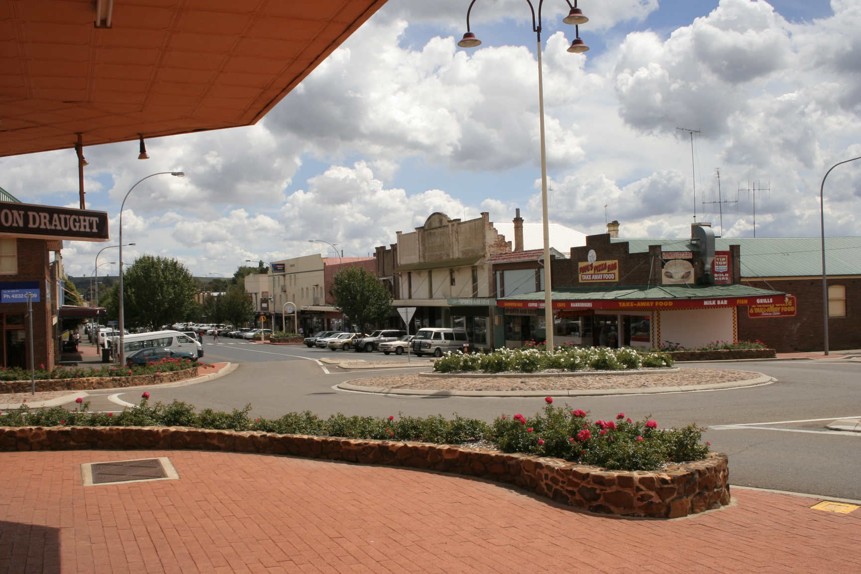
Crookwell is a small town located in the Southern Tablelands of New South Wales, Australia, in the Upper Lachlan Shire. At the 2006 census, Crookwell had a population of 1,993 people.[1] The town is at a relatively high altitude in Australian terms (980 metres), and there are occasional snowfalls during the winter months. The nearest major centre is the city of Goulburn which is about a half hour drive to the south of the town. Crookwell is easily accessible to the state capital of Sydney and also the Federal capital of Canberra.
Most employment is based on rural industries, and the district is renowned for potato farming. Crookwell is also home to what was NSW's first wind farm, which consists of 8 turbines, and is located a few kilometres out of town on the road towards Goulburn.
A railway once connected Goulburn and Crookwell, which opened in 1902, but passenger services to Crookwell station ceased in 1974,[2][3] and the last goods train ran in 1985. The line is technically not closed, but has been listed as out of use, although in some locations is now impassable.
History[]
The area around Crookwell was first settled in the 1820s, and had received its current name by the 1860s. After this, selection of blocks occurred; and the population of was over 100 by midway through that decade. The first allotments were sold at the end of the decade. By the mid 1870s the population had already reached 1000 people.[4]
Governance[]
Crookwell is the seat of the Upper Lachlan Shire Council Local Government Area (LGA) of New South Wales, Australia, formed in 2004.
Transport[]
Crookwell is approximately 2.5 hours drive from Sydney via the Goulburn. Or a 1.5 hours drive from Canberra. Other than the main road to Goulburn, minor roads link Crookwell with Bathurst, Boorowa, Grabben Gullen, Laggan, and Taralga.
Crookwell railway station is the terminus of the now disused Crookwell railway line.
Crookwell has a small unpaved airstrip.
Media[]
Radio stations[]
Radio stations with transmitters located in Crookwell include-
- Triple J 91.7 FM (2JJJ)
- 2GN 106.1 FM (commercial)
- ABC Local Radio 106.9 FM (2ABCRR)
- ABC Radio National 107.7 FM (2ABCRN)
Depending on location some Goulburn, Illawarra, and/or Canberra based radio stations can also heard.
Television[]
Crookwell has a low powered transmitter broadcasting ABC Television in analog only, located on Wades Hill. This is expected to be upgraded to digital before the analog turn-off at the end of 2013.
Residents wishing to receive a wider range of channels and in digital can attempt to receive signals from either Canberra (Black Mountain), or Orange (Mount Canobolas), although Crookwell is located in the fringe area of both transmitters.
Another option is to use the VAST free-to-air satellite service, which offers a similar range of channels.
See also[]
- Crookwell railway line
References[]
- ^ a b Australian Bureau of Statistics (25 October 2007). "Crookwell (Urban Centre/Locality)". 2006 Census QuickStats. http://www.censusdata.abs.gov.au/ABSNavigation/prenav/LocationSearch?collection=Census&period=2006&areacode=UCL123600&producttype=QuickStats&breadcrumb=PL&action=401. Retrieved 14 July 2009.
- ^ Scrymgeour, R. A History of the Goulburn- Crookwell Line. Australian Railway Historical Society Bulletin. Vol 48, no 721. November 1997.
- ^ Crookwell station. NSWrail.net, accessed 21 August 2009.
- ^ A Snapshot of Crookwell's History. Upper Lachlan Shire Council, accessed 20 September 2011.
Photo gallery[]
")
")
")
")
")
")
| |||||||||||
| This page uses content from the English language Wikipedia. The original content was at Crookwell, New South Wales. The list of authors can be seen in the page history. As with this Familypedia wiki, the content of Wikipedia is available under the Creative Commons License. |