| Cowley New South Wales | |||||||||||||
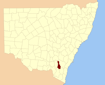 Location in New South Wales | |||||||||||||
| |||||||||||||

Looking south near the Tharwa Bridge; the Murrumbidgee River formed the boundary between Murray, on the left and Cowley on the right. This land is now part of the Australian Capital Territory and not in any county.
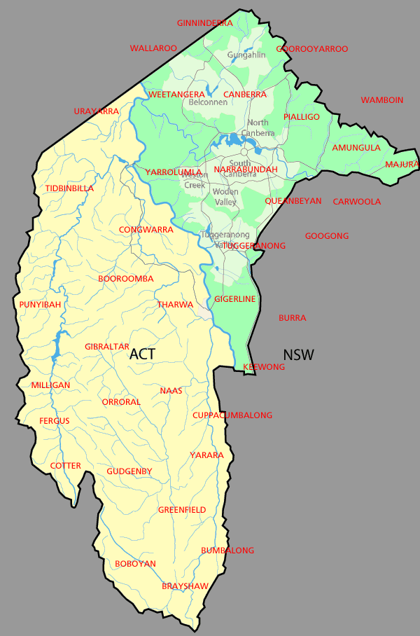
Map showing parishes in the ACT area. Cowley County shown in yellow.


The Goodradigbee River in the Brindabella Ranges; the river was the western boundary between Cowley (left) and Buccleuch (right)
Cowley County is one of the 141 Cadastral divisions of New South Wales. It contains the locality of Cavan. It was originally bordered on the north, east and part of the south by the Murrumbidgee River, and on the west by the Goodradigbee River. A large part of the county was transferred to the Commonwealth to make the Australian Capital Territory in 1909, with the remaining part the area to the north-west of the ACT as far north as the Burrinjuck Dam, and thin strips of land along the western, southern and south-eastern borders of the ACT.
Cowley County is named in honour of Henry Richard Charles Wellesley, First Earl Cowley (1804-1884).[1]
Parishes within this county[]
A full list of parishes found within this county including the 15 former parishes which are now part of the ACT; their current LGA and mapping coordinates to the approximate centre of each location is as follows:
| Parish | LGA | Coordinates |
|---|---|---|
| Bimberi | Tumut Shire Council | |
| Boboyan (former) | Australian Capital Territory | |
| Booroomba (former) | Australian Capital Territory | |
| Brayshaw (former) | Australian Capital Territory | |
| Brindibella | Tumut Shire Council | |
| Bumbalong | Cooma-Monaro Shire | |
| Cavan | Yass Valley Council | |
| Cochran | Cooma-Monaro Shire | |
| Congwarra (former) | Australian Capital Territory | |
| Cooleman | Tumut Shire Council | |
| Coree | Yass Valley Council | |
| Cotter (former) | Australian Capital Territory | |
| Cuppacumbalong | Cooma-Monaro Shire | |
| East Goodradigbee | Yass Valley Council | |
| Fergus (former) | Australian Capital Territory | |
| Gibraltar (former) | Australian Capital Territory | |
| Greenfield (former) | Australian Capital Territory | |
| Gudgenby (former) | Australian Capital Territory | |
| Gurrangora | Cooma-Monaro Shire | |
| Long Plain | Cooma-Monaro Shire | |
| Micalong | Yass Valley Council | |
| Milligan (former) | Australian Capital Territory | |
| Mullion | Yass Valley Council | |
| Murray | Tumut Shire Council | |
| Naas (former) | Australian Capital Territory | |
| Narrangullen | Yass Valley Council | |
| Nattung | Cooma-Monaro Shire | |
| Orroral (former) | Australian Capital Territory | |
| Pabral | Yass Valley Council | |
| Punyibah (former) | Australian Capital Territory | |
| Taemas | Yass Valley Council | |
| Tharwa (former) | Australian Capital Territory | |
| Tidbinbilla (former) | Australian Capital Territory | |
| Umburra | Yass Valley Council | |
| Urayarra | Yass Valley Council | |
| Venterman | Tumut Shire Council | |
| Yaouk | Cooma-Monaro Shire | |
| Yarara | Cooma-Monaro Shire |
References[]
- County of Cowley and Co. Buccleuch New South Wales, 1871 map, National Library of Australia
- Districts Act 1966
| This page uses content from the English language Wikipedia. The original content was at Cowley County, New South Wales. The list of authors can be seen in the page history. As with this Familypedia wiki, the content of Wikipedia is available under the Creative Commons License. |