| State of Connecticut | |||||
| |||||
| Nickname(s): The Constitution State, The Nutmeg State[1] | |||||
| Motto(s): Qui transtulit sustinet Latin meaning "He who is transplanted still sustains" | |||||
 | |||||
| Official language(s) | English | ||||
| Capital | Hartford | ||||
| Largest city | Bridgeport | ||||
| Largest metro area | Hartford Metro Area | ||||
| Area | Ranked 48th in the U.S. | ||||
| - Total | 5,543[4] sq mi (14,356 km2) | ||||
| - Width | 70 miles (113 km) | ||||
| - Length | 110 miles (177 km) | ||||
| - % water | 12.6 | ||||
| - Latitude | 40°58′ N to 42°03′ N | ||||
| - Longitude | 71°47′ W to 73°44′ W | ||||
| Population | Ranked 29th in the U.S. | ||||
| - Total | {{{2000Pop}}} | ||||
| - Density | 702.9/sq mi (271.40/km2) Ranked 4th in the U.S. | ||||
| - Median household income | $55,970 (4th) | ||||
| Elevation | |||||
| - Highest point | South slope of Mount Frissel Note: The peak of Mount Frissel is in Massachusetts 2,380 ft ({{{HighestElev}}} m) | ||||
| - Mean | 500 ft (152 m) | ||||
| - Lowest point | Long Island Sound sea level | ||||
| Admission to Union | January 9 | ||||
| Governor | M. Jodi Rell | ||||
| Lieutenant Governor | {{{Lieutenant Governor}}} | ||||
| Legislature | {{{Legislature}}} | ||||
| - Upper house | {{{Upperhouse}}} | ||||
| - Lower house | {{{Lowerhouse}}} | ||||
| U.S. Senators | Christopher Dodd Joe Lieberman | ||||
| U.S. House delegation | List | ||||
| Time zone | Eastern | ||||
| Abbreviations | CT. Conn. US-CT | ||||
| Website | ct.gov | ||||

Connecticut (English pronunciation: /kəˈnɛtɪkət/)[6] is a state![]() located in the New England
located in the New England![]() region of the northeastern
region of the northeastern![]() United States of America
United States of America![]() . Southwestern Connecticut is also considered part of the New York metropolitan area
. Southwestern Connecticut is also considered part of the New York metropolitan area![]() . Connecticut is the 29th
. Connecticut is the 29th![]() most populous state with 3.4 million residents and ranked 48th
most populous state with 3.4 million residents and ranked 48th![]() in size by area, making it the 4th
in size by area, making it the 4th![]() most densely populated state.[4]. Called the "Constitution State," Connecticut has a long history dating from the early colonial times, and was influential in the development of early American government.
most densely populated state.[4]. Called the "Constitution State," Connecticut has a long history dating from the early colonial times, and was influential in the development of early American government.
While Connecticut's first European settlers were Dutch![]() , the first major settlements were established in the 1630s by the English. Thomas Hooker
, the first major settlements were established in the 1630s by the English. Thomas Hooker![]() led a band of followers overland from the Massachusetts Bay colony
led a band of followers overland from the Massachusetts Bay colony![]() and founded what would become the Connecticut Colony
and founded what would become the Connecticut Colony![]() ; other settlers from Massachusetts founded the Saybrook Colony
; other settlers from Massachusetts founded the Saybrook Colony![]() and the New Haven Colony
and the New Haven Colony![]() . Both the Connecticut and New Haven Colonies established documents of Fundamental Orders
. Both the Connecticut and New Haven Colonies established documents of Fundamental Orders![]() , considered the first constitution
, considered the first constitution![]() s in North America. In 1662, the disparate colonies merged under a royal charter, making Connecticut a crown colony
s in North America. In 1662, the disparate colonies merged under a royal charter, making Connecticut a crown colony![]() . This colony was one of the Thirteen Colonies
. This colony was one of the Thirteen Colonies![]() that revolted against British
that revolted against British![]() rule in the American Revolution
rule in the American Revolution![]() .
.
Connecticut enjoys a temperate![]() climate thanks to its long coastline on the Long Island Sound
climate thanks to its long coastline on the Long Island Sound![]() . This has given the state a strong maritime
. This has given the state a strong maritime![]() tradition. Modern Connecticut is also known for its wealth. In the 18th and 19th centuries, Connecticut had ready access to raw materials which helped to develop a strong manufacturing industry
tradition. Modern Connecticut is also known for its wealth. In the 18th and 19th centuries, Connecticut had ready access to raw materials which helped to develop a strong manufacturing industry![]() . In the 19th and 20th centuries, financial organizations flourished: first insurance
. In the 19th and 20th centuries, financial organizations flourished: first insurance![]() companies in Hartford, then hedge funds
companies in Hartford, then hedge funds![]() along the Gold Coast
along the Gold Coast![]() . This prosperity has helped give Connecticut the highest per capita
. This prosperity has helped give Connecticut the highest per capita![]() income and median household income
income and median household income![]() in the country.[7][8]
in the country.[7][8]
Geography
Connecticut is bordered on the south by Long Island Sound![]() , on the west by New York State
, on the west by New York State![]() , on the north by Massachusetts
, on the north by Massachusetts![]() , and on the east by Rhode Island
, and on the east by Rhode Island![]() . The state capital is Hartford
. The state capital is Hartford![]() , and the other major cities include New Haven
, and the other major cities include New Haven![]() , New London
, New London![]() , New Britain
, New Britain![]() , Norwich
, Norwich![]() , Milford
, Milford![]() , Norwalk
, Norwalk![]() , Stamford
, Stamford![]() , Waterbury
, Waterbury![]() , Danbury
, Danbury![]() and Bridgeport
and Bridgeport![]() . There are 169 incorporated town
. There are 169 incorporated town![]() s in Connecticut. There is an ongoing civic pride and economic competition between Hartford and New Haven, which stems back to the days when the two cities shared the state's capital, and even back to the rivalry between New Haven Colony
s in Connecticut. There is an ongoing civic pride and economic competition between Hartford and New Haven, which stems back to the days when the two cities shared the state's capital, and even back to the rivalry between New Haven Colony![]() and Connecticut Colony
and Connecticut Colony![]() .
.


Bear Mountain, highest peak in Connecticut
The highest peak in Connecticut is Bear Mountain![]() in Salisbury
in Salisbury![]() in the northwest corner of the state. The highest point is just east of where Connecticut, Massachusetts
in the northwest corner of the state. The highest point is just east of where Connecticut, Massachusetts![]() , and New York
, and New York![]() meet (42° 3' N; 73° 29' W), on the southern slope of Mount Frissell
meet (42° 3' N; 73° 29' W), on the southern slope of Mount Frissell![]() , whose peak lies nearby in Massachusetts.[9]
, whose peak lies nearby in Massachusetts.[9]
The Connecticut River cuts through the center of the state, flowing into Long Island Sound, Connecticut's outlet to the Atlantic Ocean![]() .
.
Despite its size, the state has regional variations in its landscape and culture from the wealthy estates of Fairfield County's "Gold Coast![]() " to the rolling mountains and horse-farms of the Litchfield Hills
" to the rolling mountains and horse-farms of the Litchfield Hills![]() of northwestern Connecticut. Connecticut's rural areas and
of northwestern Connecticut. Connecticut's rural areas and

Highest point in Connecticut on slope of Mount Frissell, as seen from Bear Mountain
small towns in the northeast and northwest corners of the state contrast sharply with its industrial cities, located along the coastal highways from the New York border to New Haven, then northwards to Hartford, as well as further up the coast near New London. Many towns center around a small park, known as a "green," (such as the New Haven Green![]() ), Litchfield Green, Simsbury Green, and New Milford Green(the largest in the state). Near the green may stand a small white church, a town meeting hall, a tavern and several colonial houses. Forests, rivers, lakes, waterfalls and a sandy shore add to the state's beauty.
), Litchfield Green, Simsbury Green, and New Milford Green(the largest in the state). Near the green may stand a small white church, a town meeting hall, a tavern and several colonial houses. Forests, rivers, lakes, waterfalls and a sandy shore add to the state's beauty.
The northern boundary of the state with Massachusetts is marked by the distinctive Southwick Jog![]() /Granby Notch
/Granby Notch![]() , an approximately 2.5 mile (4.0 km) square detour into Connecticut slightly west of the center of the border. Somewhat surprisingly, the actual origin of this anomaly is not absolutely certain, with stories ranging from surveyors who were drunk, attempting to avoid hostile Native Americans, or taking a shortcut up the Connecticut River; Massachusetts residents attempting to avoid Massachusetts' high taxes for the low taxes of Connecticut; Massachusetts' interest in the resources represented by the Congamond Lakes
, an approximately 2.5 mile (4.0 km) square detour into Connecticut slightly west of the center of the border. Somewhat surprisingly, the actual origin of this anomaly is not absolutely certain, with stories ranging from surveyors who were drunk, attempting to avoid hostile Native Americans, or taking a shortcut up the Connecticut River; Massachusetts residents attempting to avoid Massachusetts' high taxes for the low taxes of Connecticut; Massachusetts' interest in the resources represented by the Congamond Lakes![]() which lie on the border of the jog; and the need to compensate Massachusetts for an amount of land given to Connecticut due to inaccurate survey work.[10][11] The dispute over the border slowed development in the region, since neither state would invest in public services for the area until the dispute had been settled.
which lie on the border of the jog; and the need to compensate Massachusetts for an amount of land given to Connecticut due to inaccurate survey work.[10][11] The dispute over the border slowed development in the region, since neither state would invest in public services for the area until the dispute had been settled.
The southwestern border of Connecticut, where it abuts New York State, is marked by a panhandle![]() in Fairfield County
in Fairfield County![]() , containing the towns of Greenwich
, containing the towns of Greenwich![]() , Stamford
, Stamford![]() , New Canaan
, New Canaan![]() and Darien
and Darien![]() . This irregularity in the boundary is the result of territorial disputes
. This irregularity in the boundary is the result of territorial disputes![]() in the late 1600s, culminating with New York giving up its claim to this area, whose residents considered themselves part of Connecticut, in exchange for an equivalent area extending northwards from Ridgefield, Connecticut
in the late 1600s, culminating with New York giving up its claim to this area, whose residents considered themselves part of Connecticut, in exchange for an equivalent area extending northwards from Ridgefield, Connecticut![]() to the Massachusetts border as well as undisputed claim to Rye, New York
to the Massachusetts border as well as undisputed claim to Rye, New York![]() .[12]
.[12]
Areas maintained by the National Park Service![]() include: Appalachian National Scenic Trail
include: Appalachian National Scenic Trail![]() ; Quinebaug & Shetucket Rivers Valley National Heritage Corridor
; Quinebaug & Shetucket Rivers Valley National Heritage Corridor![]() ; and Weir Farm National Historic Site
; and Weir Farm National Historic Site![]() .
.
Climate
Connecticut has a Humid Continental Climate, with seasonal extremes tempered by its proximity to the Atlantic Ocean![]() . Winters are cold, with average temperatures ranging from 31 °F (-1 °C) in the southeast to 23 °F (-5 °C) in the northwest in January. The average yearly snowfall is about 25–100" (64–254 cm) across the state, with higher totals in the northwest. Spring has variable temperatures with frequent rainfall. Summer is hot and humid throughout the state, with average highs in New London of 81 °F (27 °C) and 87 °F (31 °C) in Windsor Locks. Fall months are mild, and bring foliage across the state in October and November. During hurricane season, tropical cyclones occasionally affect the region. Thunderstorms are most frequent during the summer, occurring on average 30 times annually. These storms can be severe, though tornadoes are rare.[13]
. Winters are cold, with average temperatures ranging from 31 °F (-1 °C) in the southeast to 23 °F (-5 °C) in the northwest in January. The average yearly snowfall is about 25–100" (64–254 cm) across the state, with higher totals in the northwest. Spring has variable temperatures with frequent rainfall. Summer is hot and humid throughout the state, with average highs in New London of 81 °F (27 °C) and 87 °F (31 °C) in Windsor Locks. Fall months are mild, and bring foliage across the state in October and November. During hurricane season, tropical cyclones occasionally affect the region. Thunderstorms are most frequent during the summer, occurring on average 30 times annually. These storms can be severe, though tornadoes are rare.[13]
| Monthly Normal High and Low Temperatures For Various Connecticut Cities | ||||||||||||
| City | Jan | Feb | Mar | Apr | May | Jun | Jul | Aug | Sep | Oct | Nov | Dec |
|---|---|---|---|---|---|---|---|---|---|---|---|---|
| Bridgeport | 37/23 | 39/25 | 47/32 | 57/41 | 67/51 | 76/60 | 82/66 | 81/65 | 74/58 | 63/46 | 53/38 | 42/28 |
| Hartford | 34/17 | 38/20 | 48/28 | 60/38 | 72/48 | 80/57 | 85/62 | 82/61 | 74/52 | 63/41 | 51/33 | 39/23 |
| [1] | ||||||||||||
History


A map of the Connecticut, New Haven, and Saybrook colonies.
The name "Connecticut" originates from the Mohegan![]() word quinnitukqut, meaning "place of long tidal river."[14] The first European explorer in Connecticut was the Dutch explorer Adriaen Block
word quinnitukqut, meaning "place of long tidal river."[14] The first European explorer in Connecticut was the Dutch explorer Adriaen Block![]() . After he explored this region in 1614, Dutch fur traders sailed up the Connecticut River (Named Versche Rivier by the Dutch) and built a fort at Dutch Point near present-day Hartford, which they called "House of Hope" (Dutch
. After he explored this region in 1614, Dutch fur traders sailed up the Connecticut River (Named Versche Rivier by the Dutch) and built a fort at Dutch Point near present-day Hartford, which they called "House of Hope" (Dutch![]() : Huis van Hoop).
: Huis van Hoop).
John Winthrop![]() , then of Massachusetts, got permission to create a new colony at Old Saybrook
, then of Massachusetts, got permission to create a new colony at Old Saybrook![]() at the mouth of the Connecticut River in 1635. This was the first of three distinct colonies that later would be combined to make up Connecticut. Saybrook Colony was a direct challenge to Dutch claims. The colony was not more than a small outpost and never matured. In 1644, the Saybrook Colony merged itself into the Connecticut Colony.
at the mouth of the Connecticut River in 1635. This was the first of three distinct colonies that later would be combined to make up Connecticut. Saybrook Colony was a direct challenge to Dutch claims. The colony was not more than a small outpost and never matured. In 1644, the Saybrook Colony merged itself into the Connecticut Colony.
The first English settlers came in 1633 and settled Windsor and Wethersfield. However the main body of settlers came in one large group in 1636. The settlers were Puritan![]() s from Massachusetts, led by Thomas Hooker
s from Massachusetts, led by Thomas Hooker![]() . Hooker had been prominent in England, and was a professor of Theology at Cambridge. He was also an important political writer, and made a significant contribution to Constitutional theory. He broke with the political leadership in Massachusetts, and, just as Roger Williams
. Hooker had been prominent in England, and was a professor of Theology at Cambridge. He was also an important political writer, and made a significant contribution to Constitutional theory. He broke with the political leadership in Massachusetts, and, just as Roger Williams![]() created a new polity in Rhode Island
created a new polity in Rhode Island![]() , Hooker and his cohort did the same and established the Connecticut Colony
, Hooker and his cohort did the same and established the Connecticut Colony![]() at Hartford in 1636. This was the second of the three colonies.
at Hartford in 1636. This was the second of the three colonies.
Because the Dutch were outnumbered by the flood of English settlers from Massachusetts, they left their fort in 1654.
The third colony was founded in March of 1638. New Haven Colony![]() , (originally known as the Quinnipiack Colony), was established by John Davenport
, (originally known as the Quinnipiack Colony), was established by John Davenport![]() , Theophilus Eaton
, Theophilus Eaton![]() and others at New Haven. The New Haven Colony had its own Constitution, 'The Fundamental Agreement of the New Haven Colony' which was signed on June 4, 1639.
and others at New Haven. The New Haven Colony had its own Constitution, 'The Fundamental Agreement of the New Haven Colony' which was signed on June 4, 1639.
Neither the establishment of the Connecticut Colony or the Quinnipiack Colony were done with the sanction of British imperial authorities, and were independent political entities. They naturally were presumptively English, but in a legal sense, they were only secessionist outposts of Massachusetts Bay. In 1662, Winthrop took advantage of this void in political affairs, and obtained in England the charter by which the colonies of Connecticut and Quinnipiack were united. Although Winthrop's charter favored the Connecticut colony, New Haven remained a seat of government with Hartford, until after the American Revolution.
Winthrop was very politically astute, and secured the charter from the newly restored Charles II![]() ; who granted the most liberal political terms.
; who granted the most liberal political terms.
Historically important colonial settlements included:
- Windsor
 (1633),
 - Wethersfield (1634),
- Saybrook (1635),
- Hartford (1636),
- New Haven (1638),
- Fairfield (1639),
- Stratford (1639),
- New London (1646),
- Middletown (1647)
Its first constitution, the "Fundamental Orders![]() ," was adopted on January 14
," was adopted on January 14![]() , 1639
, 1639![]() , while its current constitution
, while its current constitution![]() , the third for Connecticut, was adopted in 1965. Connecticut is the fifth of the original thirteen states. The original constitutions influenced the US Constitution as one of the leading authors was Roger Sherman
, the third for Connecticut, was adopted in 1965. Connecticut is the fifth of the original thirteen states. The original constitutions influenced the US Constitution as one of the leading authors was Roger Sherman![]() of New Haven.
of New Haven.
The western boundaries of Connecticut have been subject to change over time. According to a 1650 agreement with the Dutch![]() , the western boundary of Connecticut ran north from the west side of Greenwich Bay
, the western boundary of Connecticut ran north from the west side of Greenwich Bay![]() "provided the said line come not within 10 miles [16 km] of Hudson River." On the other hand, Connecticut's original Charter in 1662 granted it all the land to the "South Sea," i.e. the Pacific Ocean. Most colonial royal grants were for long east-west strips. Connecticut took its grant seriously, and established a ninth county between the Susquehanna and Delaware Rivers, named Westmoreland County
"provided the said line come not within 10 miles [16 km] of Hudson River." On the other hand, Connecticut's original Charter in 1662 granted it all the land to the "South Sea," i.e. the Pacific Ocean. Most colonial royal grants were for long east-west strips. Connecticut took its grant seriously, and established a ninth county between the Susquehanna and Delaware Rivers, named Westmoreland County![]() . This resulted in the brief Pennamite Wars
. This resulted in the brief Pennamite Wars![]() with Pennsylvania
with Pennsylvania![]() .
Connecticut's lands also extended across northern Ohio, called the Western Reserve
.
Connecticut's lands also extended across northern Ohio, called the Western Reserve![]() lands. The Western Reserve section was settled largely by people from Connecticut, and they brought Connecticut place names to Ohio. Agreements with Pennsylvania and New York extinguished the land claims by Connecticut within its neighbors, and the Western Reserve lands were relinquished to the federal government, which brought the state to its present boundaries.
lands. The Western Reserve section was settled largely by people from Connecticut, and they brought Connecticut place names to Ohio. Agreements with Pennsylvania and New York extinguished the land claims by Connecticut within its neighbors, and the Western Reserve lands were relinquished to the federal government, which brought the state to its present boundaries.
Names and symbols
Connecticut's official nickname, adopted in 1959, is "The Constitution State," based on its colonial constitution of 1638–39.[1] Unofficially (but popularly) Connecticut is also known as "The Nutmeg![]() State".[1] The nutmeg connection to Connecticut may come from its sailors returning from voyages with nutmeg (which in the 18th and 19th centuries was a very valuable spice in New England). It is also said to come from Yankee
State".[1] The nutmeg connection to Connecticut may come from its sailors returning from voyages with nutmeg (which in the 18th and 19th centuries was a very valuable spice in New England). It is also said to come from Yankee![]() peddlers from Connecticut who would sell small carved nobs of wood shaped to look like nutmeg to unsuspecting customers.[15] George Washington
peddlers from Connecticut who would sell small carved nobs of wood shaped to look like nutmeg to unsuspecting customers.[15] George Washington![]() gave Connecticut the title of "The Provisions State"[1] because of the material aid the state rendered to the Revolutionary War
gave Connecticut the title of "The Provisions State"[1] because of the material aid the state rendered to the Revolutionary War![]() effort. Connecticut is also known as "The Land of Steady Habits".[1]
effort. Connecticut is also known as "The Land of Steady Habits".[1]
According to Webster's New International Dictionary, 1993, a person who is a native or resident of Connecticut is a "Connecticuter". There are numerous other terms coined in print, but not in use, such as: "Connecticotian" - Cotton Mather![]() in 1702. "Connecticutensian" - Samuel Peters
in 1702. "Connecticutensian" - Samuel Peters![]() in 1781. "Nutmegger" is sometimes used,[16] as is "Yankee" (the official State Song is "Yankee Doodle
in 1781. "Nutmegger" is sometimes used,[16] as is "Yankee" (the official State Song is "Yankee Doodle![]() "), though this usually refers someone from the wider New England
"), though this usually refers someone from the wider New England![]() region.[17] Linguist Allen Walker Read reports a more playful term, 'connecticutie.' The traditional abbreviation of the state's name is "Conn."; the official postal abbreviation
region.[17] Linguist Allen Walker Read reports a more playful term, 'connecticutie.' The traditional abbreviation of the state's name is "Conn."; the official postal abbreviation![]() is CT.
is CT.
Commemorative stamp![]() s issued by the United States Postal Service
s issued by the United States Postal Service![]() with Connecticut themes include Nathan Hale
with Connecticut themes include Nathan Hale![]() , Eugene O'Neill
, Eugene O'Neill![]() , Josiah Willard Gibbs
, Josiah Willard Gibbs![]() , Noah Webster
, Noah Webster![]() , Eli Whitney
, Eli Whitney![]() , the whaling
, the whaling![]() ship
ship![]() the Charles W. Morgan
the Charles W. Morgan![]() which is docked in Mystic Seaport
which is docked in Mystic Seaport![]() , and a decoy
, and a decoy![]() of a broadbill duck
of a broadbill duck![]() .
.

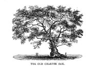
The Charter Oak

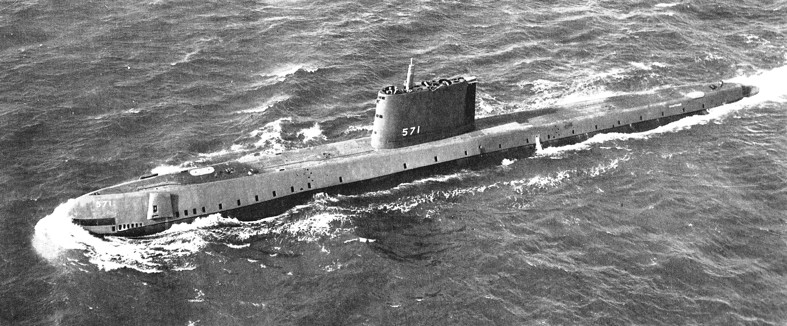
The USS Nautilus
| State tree |
White Oak |
| State bird |
American Robin |
| State flower |
Mountain Laurel |
| State insect |
European Mantis |
| State animal |
Sperm Whale |
| State mineral |
Garnet |
| State shellfish |
Eastern Oyster |
| State fish |
American Shad |
| State fossil |
Eubrontes giganteus |
| State ship |
USS Nautilus (SSN-571) |
| State flagship |
Freedom Schooner Amistad |
| State aircraft |
F4U Corsair |
| State tartan |
visible here |
| State song |
Yankee Doodle |
| State folk dance |
Square dance |
| State cantata |
The Nutmeg |
| State hero |
Nathan Hale |
| State heroine |
Prudence Crandall |
| State composer |
Charles Edward Ives |
| State statues in Statuary Hall |
Roger Sherman |
| State poet laureate |
John Hollander |
| Connecticut State Troubadour |
Pierce Campbell |
| State composer laureate |
Jacob Druckman |
Demographics
| Historical populations | |||
|---|---|---|---|
| Census | Pop. | %± | |
| 1790 | 237,946 | ||
| 1800 | 251,002 | 5.5% | |
| 1810 | 261,942 | 4.4% | |
| 1820 | 275,248 | 5.1% | |
| 1830 | 297,675 | 8.1% | |
| 1840 | 309,978 | 4.1% | |
| 1850 | 370,792 | 19.6% | |
| 1860 | 460,147 | 24.1% | |
| 1870 | 537,454 | 16.8% | |
| 1880 | 622,700 | 15.9% | |
| 1890 | 746,258 | 19.8% | |
| 1900 | 908,420 | 21.7% | |
| 1910 | 1,114,756 | 22.7% | |
| 1920 | 1,380,631 | 23.9% | |
| 1930 | 1,606,903 | 16.4% | |
| 1940 | 1,709,242 | 6.4% | |
| 1950 | 2,007,280 | 17.4% | |
| 1960 | 2,535,234 | 26.3% | |
| 1970 | 3,031,709 | 19.6% | |
| 1980 | 3,107,576 | 2.5% | |
| 1990 | 3,287,116 | 5.8% | |
| 2000 | 3,405,565 | 3.6% | |
| Sources:[20][21] | |||

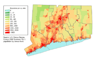
Connecticut Population Density Map
As of 2005, Connecticut has an estimated population of 3,510,297,[22] which is an increase of 11,331, or 0.3%, from the prior year and an increase of 104,695, or 3.1%, since the year 2000. This includes a natural increase since the last census of 67,427 people (that is 222,222 births minus 154,795 deaths) and an increase due to net migration of 41,718 people into the state. Immigration![]() from outside the United States resulted in a net increase of 75,991 people, and migration
from outside the United States resulted in a net increase of 75,991 people, and migration![]() within the country produced a net loss of 34,273 people. Based on the 2005 estimates, Connecticut moves from the 29th most populous state to 30th.[22]
within the country produced a net loss of 34,273 people. Based on the 2005 estimates, Connecticut moves from the 29th most populous state to 30th.[22]
6.6% of its population was reported as being under 5 years old, 24.7% under 18 years old, and 13.8% were 65 years of age or older. Females made up approximately 51.6% of the population, with 48.4% male.
In 1790, 97% of the population in Connecticut were classified as "rural". The first census in which less than half the population was classified as rural was 1890. In the 2000 census, it was only 12.3%. The southwestern coast is all urban and is most widely known from New York City. The eastern half of the state though mostly is associated with Boston because of proximity. This split has caused a lack of more than a few professional sport teams. ie: NHL hockey since the mid 1990s, NFL football, MLS soccer and men's basketball.
The center of population![]() of Connecticut is located in the town of Cheshire
of Connecticut is located in the town of Cheshire![]() .[23]
.[23]
Race, ancestry, and language
| Demographics of Connecticut (csv) | |||||
|---|---|---|---|---|---|
| By race | White | Black | AIAN | Asian | NHPI |
| AIAN is American Indian or Alaskan Native - NHPI is Native Hawaiian or Pacific Islander | |||||
| 2000 (total population) | 87.09% | 10.46% | 0.73% | 2.83% | 0.13% |
| 2000 (Hispanic only) | 8.31% | 1.04% | 0.14% | 0.07% | 0.04% |
| 2005 (total population) | 86.09% | 10.88% | 0.76% | 3.56% | 0.15% |
| 2005 (Hispanic only) | 9.74% | 1.09% | 0.16% | 0.07% | 0.05% |
| Growth 2000-2005 (total population) | 1.89% | 7.19% | 6.59% | 29.77% | 15.41% |
| Growth 2000-2005 (non-Hispanic only) | -0.11% | 7.16% | 3.74% | 30.12% | 16.21% |
| Growth 2000-2005 (Hispanic only) | 20.87% | 7.40% | 18.36% | 14.98% | 13.68% |
As of 2004, 11.4% of the population (400,000) was foreign-born, and 10% of the foreign-born in the state were illegal aliens (about 1.1% of the population). In 1870, native-born Americans had accounted for 75% of the state's population, but that had dropped to 35% by 1918.
As of 2000, 81.69% of Connecticut residents age 5 and older spoke English![]() at home and 8.42% spoke Spanish
at home and 8.42% spoke Spanish![]() , followed by Italian
, followed by Italian![]() at 1.59%, French
at 1.59%, French![]() at 1.31% and Polish
at 1.31% and Polish![]() at 1.20%.[24]
at 1.20%.[24]
The five largest reported ancestries in the state are: Italian![]() (18.6%), Irish
(18.6%), Irish![]() (16.6%), English
(16.6%), English![]() (10.3%), German
(10.3%), German![]() (9.9%), and French/French Canadian
(9.9%), and French/French Canadian![]() (9.9%).
(9.9%).
Connecticut has large Italian-American![]() and Irish-American
and Irish-American![]() populations , as well as German and Portuguese-American
populations , as well as German and Portuguese-American![]() , second highest percentage of any state behind Rhode Island. Italian
, second highest percentage of any state behind Rhode Island. Italian![]() is the largest ancestry group in five of the state's counties, while the Irish
is the largest ancestry group in five of the state's counties, while the Irish![]() are the largest group in Tolland county, French-Canadians
are the largest group in Tolland county, French-Canadians![]() the largest group in Windham county, and old stock New England Yankees
the largest group in Windham county, and old stock New England Yankees![]() are present throughout. Connecticut is the most Italian-American state percentage-wise, just above Rhode Island. Blacks
are present throughout. Connecticut is the most Italian-American state percentage-wise, just above Rhode Island. Blacks![]() and Hispanics
and Hispanics![]() (mostly Puerto Ricans
(mostly Puerto Ricans![]() ) are numerous in the urban areas of the state. Connecticut also has a sizable Polish American
) are numerous in the urban areas of the state. Connecticut also has a sizable Polish American![]() population, with New Britain
population, with New Britain![]() containing the largest Polish-American population in the state.
containing the largest Polish-American population in the state.
More recent immigrant populations include those from Laos![]() , Vietnam
, Vietnam![]() , Thailand
, Thailand![]() , Indonesia
, Indonesia![]() , Mexico
, Mexico![]() , Brazil
, Brazil![]() , Guatemala
, Guatemala![]() , Panama
, Panama![]() , and former Soviet
, and former Soviet![]() countries.
countries.
Religion
A 2001 survey of Connecticut residents' religious self-identification showed the following distribution of affiliations:[25]
- Roman Catholic – 32%
- Baptist – 10%
- Episcopal – 6%
- Methodist – 4%
- Lutheran – 4%
- Congregational/United Church of Christ – 2%
- Presbyterian – 1%
- Pentecostal – 1%
- Other Protestant or general Protestant – 4%
- Latter-Day Saint – 2%
- Church of Christ – 2%
- Assembly of God – 1%
- Non-denominational – 1%
- Other Christian – 7%
- Jewish – 1%
- Muslim – 1%
- Other Religions – 4%
- Non-Religious – 12%
- No answer – 6%
There is a significant Jewish![]() population in the state, concentrated in the towns near Long Island Sound between Greenwich
population in the state, concentrated in the towns near Long Island Sound between Greenwich![]() and New Haven
and New Haven![]() , in Greater New Haven
, in Greater New Haven![]() and in Greater Hartford
and in Greater Hartford![]() , especially the suburb of West Hartford
, especially the suburb of West Hartford![]() .
.
Recent immigration![]() has brought other non-Christian religions to the state, but the numbers of adherents of other religions are still low.
has brought other non-Christian religions to the state, but the numbers of adherents of other religions are still low.
Economy

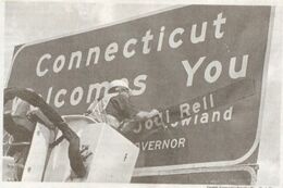
Connecticut welcome sign being updated as Rell takes office on July 1, 2004.

The total gross state product![]() for 2004 was $187 billion. The per capita income
for 2004 was $187 billion. The per capita income![]() for 2005 was $47,819, ranking first among the states.[26] There is, however, a great disparity in incomes through the state; although New Canaan has one of the highest per capita incomes in America, Hartford is one of the ten cities with the lowest per capita incomes
for 2005 was $47,819, ranking first among the states.[26] There is, however, a great disparity in incomes through the state; although New Canaan has one of the highest per capita incomes in America, Hartford is one of the ten cities with the lowest per capita incomes![]() in America (The low number may partially be due to the fact that the city, like other cities in the area, has a small footprint relative to a typical American city (only about 18 square miles) and therefore does not have more middle-income areas included in its total to "balance out", statistically, inner areas with older housing stock and a poorer population). Should Hartford (or similar cities New Haven and Bridgeport) be combined with its immediate suburbs, it would rank as one of the richest cities in the country. Fairfield County has become a bedroom community
in America (The low number may partially be due to the fact that the city, like other cities in the area, has a small footprint relative to a typical American city (only about 18 square miles) and therefore does not have more middle-income areas included in its total to "balance out", statistically, inner areas with older housing stock and a poorer population). Should Hartford (or similar cities New Haven and Bridgeport) be combined with its immediate suburbs, it would rank as one of the richest cities in the country. Fairfield County has become a bedroom community![]() for higher-paid New York City
for higher-paid New York City![]() workers seeking a less urban lifestyle. This in turn has attracted businesses wishing to remain near New York City to southwestern Connecticut, most notably to Stamford
workers seeking a less urban lifestyle. This in turn has attracted businesses wishing to remain near New York City to southwestern Connecticut, most notably to Stamford![]() .
.
New Canaan![]() is the wealthiest town in Connecticut
is the wealthiest town in Connecticut![]() , with a per capita income of $85,459. Darien
, with a per capita income of $85,459. Darien![]() , Greenwich
, Greenwich![]() , Stamford
, Stamford![]() , Weston
, Weston![]() , Woodbridge
, Woodbridge![]() , Westport
, Westport![]() and Wilton
and Wilton![]() also have per capita incomes over $65,000. Hartford
also have per capita incomes over $65,000. Hartford![]() is the poorest city in Connecticut, with a per capita income of $13,428 (although see above). There are other lower-income and blue-collar towns, mostly parts of towns, in the eastern part of the State. Poor and medium wealth households are particularly affected by a very high cost of living, due to a combination of expensive real estate, expensive heating for the winters, and other factors.
is the poorest city in Connecticut, with a per capita income of $13,428 (although see above). There are other lower-income and blue-collar towns, mostly parts of towns, in the eastern part of the State. Poor and medium wealth households are particularly affected by a very high cost of living, due to a combination of expensive real estate, expensive heating for the winters, and other factors.
Taxation
Prior to 1991, Connecticut had a highly populist income tax![]() system. Income from employment was untaxed, but income from investments was taxed at the highest rate in the United States: 13%. And this burden was further increased by the method of calculation: no deductions were allowed for the cost (for example, interest on borrowing) of producing the investment income. Under Governor Lowell P. Weicker, Jr.
system. Income from employment was untaxed, but income from investments was taxed at the highest rate in the United States: 13%. And this burden was further increased by the method of calculation: no deductions were allowed for the cost (for example, interest on borrowing) of producing the investment income. Under Governor Lowell P. Weicker, Jr.![]() , an Independent, this was reformed to the present system.
, an Independent, this was reformed to the present system.
This system prior to 1991 made it an attractive haven for high-salaried earners fleeing the heavy taxes of New York State![]() , but highly unattractive for members of Wall Street partnerships. It put an enormous burden on Connecticut property tax
, but highly unattractive for members of Wall Street partnerships. It put an enormous burden on Connecticut property tax![]() payers, particularly in the cities with their more extensive municipal services
payers, particularly in the cities with their more extensive municipal services![]() . As a result, the middle class
. As a result, the middle class![]() largely fled the urban areas for the suburb
largely fled the urban areas for the suburb![]() s, taking stores and other tax-paying businesses with them, leaving mostly the urban poor in the older, central areas of Connecticut cities.
s, taking stores and other tax-paying businesses with them, leaving mostly the urban poor in the older, central areas of Connecticut cities.
With Weicker's 1991 tax reform, the tax on employment and investment income was equalized at a then-maximum of 4%. Since then, Greenwich, Connecticut, has become the headquarters of choice for a large number of America's largest hedge fund![]() s, and Connecticut income from that industry has soared. Today the income tax rate on Connecticut individuals is divided into two tax brackets of 3% and 5%.[27] All wage
s, and Connecticut income from that industry has soared. Today the income tax rate on Connecticut individuals is divided into two tax brackets of 3% and 5%.[27] All wage![]() s of a Connecticut resident are subject to the state's income tax, even when the resident works outside of the state. However, in those cases, Connecticut income tax must be withheld only to the extent the Connecticut tax exceeds the amount withheld by the other jurisdiction. Since New York state has higher tax rates than Connecticut, this effectively means that Connecticut residents that work in New York state pay no income tax to Connecticut.
s of a Connecticut resident are subject to the state's income tax, even when the resident works outside of the state. However, in those cases, Connecticut income tax must be withheld only to the extent the Connecticut tax exceeds the amount withheld by the other jurisdiction. Since New York state has higher tax rates than Connecticut, this effectively means that Connecticut residents that work in New York state pay no income tax to Connecticut.
Connecticut levies a 6% state sales tax![]() on the retail sale, lease, or rental of most goods. Some items and services in general are not subject to sales and use taxes unless specifically enumerated as taxable by statute
on the retail sale, lease, or rental of most goods. Some items and services in general are not subject to sales and use taxes unless specifically enumerated as taxable by statute![]() . There are no additional sales taxes imposed by local jurisdictions. During the summer there is one week of duty free buying to spur retail sales.
. There are no additional sales taxes imposed by local jurisdictions. During the summer there is one week of duty free buying to spur retail sales.
All real and personal property located within the state of Connecticut is taxable unless specifically exempted by statute. All assessments are at 70% of fair market value![]() . Another 20% of the value may be taxed by the local government though. The maximum property tax credit is $500 per return and any excess may not be refunded or carried forward.[27] Connecticut does not levy an intangible personal property tax
. Another 20% of the value may be taxed by the local government though. The maximum property tax credit is $500 per return and any excess may not be refunded or carried forward.[27] Connecticut does not levy an intangible personal property tax![]() .
.
Real estate
Homes in southwestern Connecticut on the fringes of the New York City![]() metropolitan area are quite expensive. Many towns have median home prices over $500,000, with some more desirable homes exceeding $1 million. Greenwich has the most expensive real estate market, with most houses selling at over $1 million and most condos selling at over $600,000. Connecticut has the most million-dollar homes in the northeast, and the second most in the nation after California, with 3.3% of homes in Connecticut priced over one million dollars in 2003.[28] In 2007, the median price for a house in Connecticut passed $300,000 for the first time, even though most of the country was mired in a real estate slump.[29]
metropolitan area are quite expensive. Many towns have median home prices over $500,000, with some more desirable homes exceeding $1 million. Greenwich has the most expensive real estate market, with most houses selling at over $1 million and most condos selling at over $600,000. Connecticut has the most million-dollar homes in the northeast, and the second most in the nation after California, with 3.3% of homes in Connecticut priced over one million dollars in 2003.[28] In 2007, the median price for a house in Connecticut passed $300,000 for the first time, even though most of the country was mired in a real estate slump.[29]
Industries
The agricultural output for the state is nursery stock![]() , eggs
, eggs![]() , dairy product
, dairy product![]() s, cattle
s, cattle![]() , and tobacco
, and tobacco![]() . Its industrial outputs are transport
. Its industrial outputs are transport![]() ation equipment (especially helicopter
ation equipment (especially helicopter![]() s, aircraft
s, aircraft![]() parts, and nuclear submarine
parts, and nuclear submarine![]() s), heavy industrial machinery and electrical equipment, military weaponry and fabricated metal products, chemical
s), heavy industrial machinery and electrical equipment, military weaponry and fabricated metal products, chemical![]() and pharmaceutical
and pharmaceutical![]() products, and scientific instrument
products, and scientific instrument![]() s.
s.

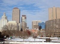
_....jpg)
Downtown Hartford's Central Business District .
.
Due to the prominence of the aircraft industry in the state, Connecticut has an official state aircraft, the F4U Corsair![]() , and an official Connecticut Aviation Pioneer, Igor Sikorsky
, and an official Connecticut Aviation Pioneer, Igor Sikorsky![]() . The state officially recognizes aircraft designer Gustav Whitehead
. The state officially recognizes aircraft designer Gustav Whitehead![]() as "Father of Connecticut Aviation" for his research into powered flight in Bridgeport, Connecticut
as "Father of Connecticut Aviation" for his research into powered flight in Bridgeport, Connecticut![]() in 1901, two years before the Wright brothers
in 1901, two years before the Wright brothers![]() at Kitty Hawk, North Carolina
at Kitty Hawk, North Carolina![]() .[30] Governor John Dempsey also declared August 15 to be "Gustave Whitehead Day."[31]
.[30] Governor John Dempsey also declared August 15 to be "Gustave Whitehead Day."[31]
A report issued by the Connecticut Commission on Culture & Tourism on December 7![]() , 2006 demonstrated that the economic impact of the arts, film, history and tourism generated more than $14 billion in economic activity and 170,000 jobs annually. This provides $9 billion in personal income for Connecticut residents and $1.7 billion in state and local revenue.[32]
, 2006 demonstrated that the economic impact of the arts, film, history and tourism generated more than $14 billion in economic activity and 170,000 jobs annually. This provides $9 billion in personal income for Connecticut residents and $1.7 billion in state and local revenue.[32]
Transportation
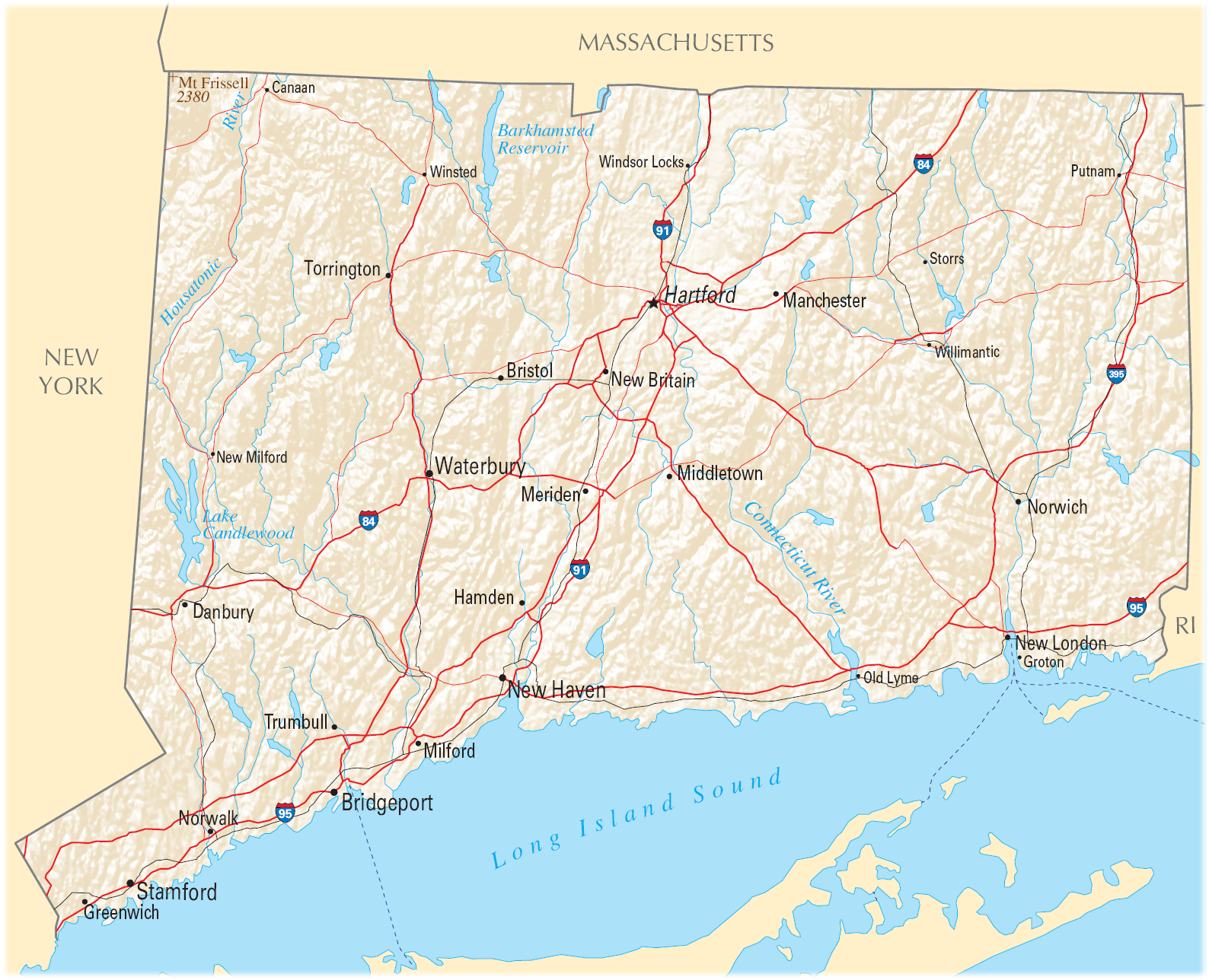
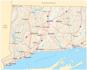
Map of Connecticut showing major highways
Roads
Glacier![]() s carved valleys in Connecticut running north to south; as a result, many more roadways in the state run north to south than do east to west, mimicking the previous use of the many north-south rivers as transportation. The Interstate highway
s carved valleys in Connecticut running north to south; as a result, many more roadways in the state run north to south than do east to west, mimicking the previous use of the many north-south rivers as transportation. The Interstate highway![]() s in the state are I-95
s in the state are I-95![]() (the Connecticut Turnpike
(the Connecticut Turnpike![]() ) running southwest to northeast along the coast, I-84
) running southwest to northeast along the coast, I-84![]() running southwest to northeast in the center of the state, I-91
running southwest to northeast in the center of the state, I-91![]() running north to south in the center of the state, and I-395
running north to south in the center of the state, and I-395![]() running north to south near the eastern border of the state. The other major highways in Connecticut are the Merritt Parkway
running north to south near the eastern border of the state. The other major highways in Connecticut are the Merritt Parkway![]() and Wilbur Cross Parkway
and Wilbur Cross Parkway![]() , which together form State Route 15
, which together form State Route 15![]() , running from the Hutchinson River Parkway
, running from the Hutchinson River Parkway![]() in New York State
in New York State![]() parallel to I-95 before turning north of New Haven
parallel to I-95 before turning north of New Haven![]() and running parallel to I-91, finally becoming a surface road in Berlin, Connecticut
and running parallel to I-91, finally becoming a surface road in Berlin, Connecticut![]() . Route 15 and I-95 were originally toll road
. Route 15 and I-95 were originally toll road![]() s; they relied on a system of toll plaza
s; they relied on a system of toll plaza![]() s at which all traffic stopped and paid fixed tolls. A series of terrible crashes at these plazas eventually contributed to the decision to remove the tolls in 1988.[33] Other major arteries in the state include U.S. Route 7
s at which all traffic stopped and paid fixed tolls. A series of terrible crashes at these plazas eventually contributed to the decision to remove the tolls in 1988.[33] Other major arteries in the state include U.S. Route 7![]() in the west running parallel to the NY border, State Route 8
in the west running parallel to the NY border, State Route 8![]() farther west near the industrial city of Waterbury and running north-south along the Naugatuck River Valley nearly parallel with U.S. 7, and State Route 9
farther west near the industrial city of Waterbury and running north-south along the Naugatuck River Valley nearly parallel with U.S. 7, and State Route 9![]() in the east. See List of State Routes in Connecticut
in the east. See List of State Routes in Connecticut![]() for an overview of the state's highway system.
for an overview of the state's highway system.
Between New Haven and the New York City, I-95 is one of the most congested highways in the United States. Many people now drive longer distances to work in the New York City area. This strains the three lanes of traffic capacity, resulting in lengthy rush hour![]() delays. Frequently, the congestion spills over to clog the parallel Merritt Parkway. The state has encouraged traffic reduction schemes, including rail use and ride-sharing
delays. Frequently, the congestion spills over to clog the parallel Merritt Parkway. The state has encouraged traffic reduction schemes, including rail use and ride-sharing![]() .[34]
.[34]
Public transportation
Rail
Since many Connecticut residents commute to New York City![]() , there is an extensive commuter rail
, there is an extensive commuter rail![]() way network connecting New York City to New Haven
way network connecting New York City to New Haven![]() on Metro North Railroad
on Metro North Railroad![]() (a commuter railroad based in New York and operated by the Metropolitan Transit Authority) with spurs servicing Waterbury, Danbury, and New Canaan. Rail service does not end with New Haven, however. Connecticut is in the heart of Amtrak's Northeast Corridor
(a commuter railroad based in New York and operated by the Metropolitan Transit Authority) with spurs servicing Waterbury, Danbury, and New Canaan. Rail service does not end with New Haven, however. Connecticut is in the heart of Amtrak's Northeast Corridor![]() and the Amtrak Regional line makes stops in New Haven-State Street, Old Saybrook, New London, and Mystic. Smaller town stops between New Haven and New London are served by Shore Line East
and the Amtrak Regional line makes stops in New Haven-State Street, Old Saybrook, New London, and Mystic. Smaller town stops between New Haven and New London are served by Shore Line East![]() , which takes commuters to those stations to catch a main train. These commuter services are heavily utilized during weekday rush hours. Regional rail service is provided by Amtrak
, which takes commuters to those stations to catch a main train. These commuter services are heavily utilized during weekday rush hours. Regional rail service is provided by Amtrak![]() , which makes regular stops in Stamford, Bridgeport, New Haven, and Hartford, as well as in Wallingford, Meriden, Berlin, Windsor, and Windsor Locks. There are plans to operate commuter trains from New Haven to Springfield on Amtrak's New Haven-Springfield Line
, which makes regular stops in Stamford, Bridgeport, New Haven, and Hartford, as well as in Wallingford, Meriden, Berlin, Windsor, and Windsor Locks. There are plans to operate commuter trains from New Haven to Springfield on Amtrak's New Haven-Springfield Line![]() .[35]
.[35]
Bus
Statewide bus![]() service is supplied by Connecticut Transit
service is supplied by Connecticut Transit![]() , owned by the Connecticut Department of Transportation
, owned by the Connecticut Department of Transportation![]() , with smaller municipal authorities providing local service. Bus networks are an important part of the transportation system in Connecticut, especially in urban areas like Hartford, Stamford, Norwalk, Bridgeport and New Haven. A three-year construction project to build a busway from New Britain to Hartford will begin in August 2009.[36][37]
, with smaller municipal authorities providing local service. Bus networks are an important part of the transportation system in Connecticut, especially in urban areas like Hartford, Stamford, Norwalk, Bridgeport and New Haven. A three-year construction project to build a busway from New Britain to Hartford will begin in August 2009.[36][37]
Air
Bradley International Airport![]() , which became truly 'International' in the summer of 2007 beginning service to Europe, is located in Windsor Locks
, which became truly 'International' in the summer of 2007 beginning service to Europe, is located in Windsor Locks![]() , 15 miles (24 km) north of Hartford
, 15 miles (24 km) north of Hartford![]() . Regional air service is provided at Tweed-New Haven Airport
. Regional air service is provided at Tweed-New Haven Airport![]() . Larger civil airports include Danbury Municipal Airport
. Larger civil airports include Danbury Municipal Airport![]() and Waterbury-Oxford Airport
and Waterbury-Oxford Airport![]() in western Connecticut. The Westchester County Airport
in western Connecticut. The Westchester County Airport![]() in Harrison, New York
in Harrison, New York![]() serves part of southwestern Connecticut.
serves part of southwestern Connecticut.
Law and government

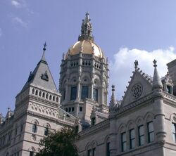
The Connecticut State Capitol in downtown Hartford
Hartford![]() has been the sole capital of Connecticut since 1875. Before then, New Haven
has been the sole capital of Connecticut since 1875. Before then, New Haven![]() and Hartford alternated as capitals.[14]
and Hartford alternated as capitals.[14]
Constitutional History
Connecticut is known as the “Constitution State.” While the origin on this title is uncertain, the nickname is assumed to reference the Fundamental Orders![]() of 1638-39. These Fundamental Orders represent the framework for the first formal government
of 1638-39. These Fundamental Orders represent the framework for the first formal government![]() written by a representative body in Connecticut. The government has operated under the direction of four separate documents in the course of Connecticut Constitutional History
written by a representative body in Connecticut. The government has operated under the direction of four separate documents in the course of Connecticut Constitutional History![]() . After the Fundamental Orders, Connecticut was granted governmental authority by King Charles II of England
. After the Fundamental Orders, Connecticut was granted governmental authority by King Charles II of England![]() through the Connecticut Charter of 1662. While these two documents acted to lay the ground work for the state’s government, both lacked essential characteristics of a constitution
through the Connecticut Charter of 1662. While these two documents acted to lay the ground work for the state’s government, both lacked essential characteristics of a constitution![]() . The Fundamental Orders and the Connecticut Charter could both be altered simply by a majority vote of the General Assembly
. The Fundamental Orders and the Connecticut Charter could both be altered simply by a majority vote of the General Assembly![]() . Separate branches of government did not exist during this period, and the General Assembly acted as the supreme authority. A true constitution was not adopted in Connecticut until 1818. Finally, the current state constitution was implemented in 1965. The 1965 constitution absorbed a majority of its 1818 predecessor, but incorporated a handful of important modifications.
Another possible source of the nickname "constitution state" comes from Connecticut's pivotal role in the federal constitutional convention of 1787, during which Roger Sherman and Oliver Ellsworth
. Separate branches of government did not exist during this period, and the General Assembly acted as the supreme authority. A true constitution was not adopted in Connecticut until 1818. Finally, the current state constitution was implemented in 1965. The 1965 constitution absorbed a majority of its 1818 predecessor, but incorporated a handful of important modifications.
Another possible source of the nickname "constitution state" comes from Connecticut's pivotal role in the federal constitutional convention of 1787, during which Roger Sherman and Oliver Ellsworth![]() helped to orchestrate what became known as the Connecticut Compromise
helped to orchestrate what became known as the Connecticut Compromise![]() , or the Great Compromise. This plan combined the Virginia Plan
, or the Great Compromise. This plan combined the Virginia Plan![]() and the New Jersey Plan
and the New Jersey Plan![]() to form a bicameral legislature, a form copied by almost every state constitution since the adoption of the federal constitution.
to form a bicameral legislature, a form copied by almost every state constitution since the adoption of the federal constitution.
Executive
The governor heads the executive branch. The current Governor of Connecticut![]() is M. Jodi Rell
is M. Jodi Rell![]() (Republican). The current Lieutenant Governor
(Republican). The current Lieutenant Governor![]() is Michael Fedele
is Michael Fedele![]() . From 1639 until the adoption of the 1818 constitution, the governor presided over the General Assembly. Connecticut was the first state in the United States to elect a woman as governor without electing her husband first, Ella Grasso
. From 1639 until the adoption of the 1818 constitution, the governor presided over the General Assembly. Connecticut was the first state in the United States to elect a woman as governor without electing her husband first, Ella Grasso![]() in 1974.
in 1974.
There are several executive departments: Administrative Services, Agriculture, Banking, Children and Families, Consumer Protection, Correction, Economic and Community Development, Developmental Services, Education, Environmental Protection, Higher Education, Information Technology, Insurance, Labor, Mental Health and Addiction Services, Military, Motor Vehicles, Public Health, Public Safety, Public Utility Control, Public Works, Revenue Services, Social Services, Transportation, Veterans Affairs. In addition to these departments, there are other independent bureaus, offices and commissions.[38]
In addition to the Governor and Lieutenant Governor, there are four other executive officers named in the state constitution that are elected directly by voters: Secretary of State, Treasurer, Comptroller and Attorney General. All executive officers are elected to four year terms.[14]
Legislative
The legislature![]() is the General Assembly
is the General Assembly![]() . The General Assembly is a bicameral
. The General Assembly is a bicameral![]() body consisting of an upper body, the State Senate
body consisting of an upper body, the State Senate![]() (36 senators); and a lower body, the House of Representatives
(36 senators); and a lower body, the House of Representatives![]() (151 representatives).[14] Bills must pass each house in order to become law. The governor can veto the bill, but this veto can be overridden by a two-thirds majority in each house. Senators and representatives, all of whom must be at least eighteen years of age, are elected to two-year terms in November on even-numbered years. The Lieutenant Governor presides over the senate, except when absent from the chamber, when the President Pro Tempore
(151 representatives).[14] Bills must pass each house in order to become law. The governor can veto the bill, but this veto can be overridden by a two-thirds majority in each house. Senators and representatives, all of whom must be at least eighteen years of age, are elected to two-year terms in November on even-numbered years. The Lieutenant Governor presides over the senate, except when absent from the chamber, when the President Pro Tempore![]() presides. The Speaker of the House
presides. The Speaker of the House![]() presides over the House; James A. Amann
presides over the House; James A. Amann![]() is the current Speaker of the House of Connecticut. The Democrats
is the current Speaker of the House of Connecticut. The Democrats![]() currently hold the majority in both houses of the General Assembly.
currently hold the majority in both houses of the General Assembly.
Connecticut's U.S. senators are Christopher J. Dodd![]() (Democrat) and Joseph I. Lieberman
(Democrat) and Joseph I. Lieberman![]() (Democrat) who is part of the Democratic Caucus. Connecticut currently has five representatives in the U.S. House
(Democrat) who is part of the Democratic Caucus. Connecticut currently has five representatives in the U.S. House![]() , four of whom are Democrats.
, four of whom are Democrats.
Judicial
The highest court![]() of Connecticut's judicial branch is the Supreme Court, headed by the Chief Justice of Connecticut. The Supreme Court is responsible for deciding on the constitutionality of the law or cases as they relate to the law. Its proceedings are similar to those of the United States Supreme Court, with no testimony given by witnesses, and the lawyers of the two sides each present oral arguments no longer than thirty minutes. Following a court proceeding, the court may take several months to arrive at a judgment. The current Chief Justice
of Connecticut's judicial branch is the Supreme Court, headed by the Chief Justice of Connecticut. The Supreme Court is responsible for deciding on the constitutionality of the law or cases as they relate to the law. Its proceedings are similar to those of the United States Supreme Court, with no testimony given by witnesses, and the lawyers of the two sides each present oral arguments no longer than thirty minutes. Following a court proceeding, the court may take several months to arrive at a judgment. The current Chief Justice![]() is Chase T. Rogers
is Chase T. Rogers![]() .
.
Before 1818 the highest court in Connecticut was the General Assembly, and later, the Upper House, with the Governor having the title "Chief Judge". In 1818, the court became a separate entity, independent of the legislative and executive branches.[39] The Appellate Court is a lesser state-wide court and the Superior Courts are lower courts that resemble county courts of other states.
Local government
and several lists: List of municipalities of Connecticut by population![]() , List of towns in Connecticut
, List of towns in Connecticut![]() , List of cities in Connecticut
, List of cities in Connecticut![]() , Borough (Connecticut)
, Borough (Connecticut)![]() , List of counties in Connecticut
, List of counties in Connecticut![]()
Connecticut has 169 towns![]() , which serve as the fundamental local political subdivision of the state; the entire state is divided into towns.[14] Connecticut shares a local form of government with the rest of New England
, which serve as the fundamental local political subdivision of the state; the entire state is divided into towns.[14] Connecticut shares a local form of government with the rest of New England![]() called the New England town
called the New England town![]() . There are also 21 cities,[14] most of which are coterminous with their namesake towns and have a merged city-town government. There are two exceptions: City of Groton
. There are also 21 cities,[14] most of which are coterminous with their namesake towns and have a merged city-town government. There are two exceptions: City of Groton![]() , which is a subsection of the Town of Groton
, which is a subsection of the Town of Groton![]() and the City of Winsted
and the City of Winsted![]() in the Town of Winchester
in the Town of Winchester![]() . There are also nine incorporated borough
. There are also nine incorporated borough![]() s which may provide additional services to a section of town.[14][40] One, Naugatuck
s which may provide additional services to a section of town.[14][40] One, Naugatuck![]() , is a consolidated town and borough.
, is a consolidated town and borough.
Unlike most other states, Connecticut does not have county![]() government. Connecticut county governments were mostly eliminated in 1960, with the exception of the sheriff
government. Connecticut county governments were mostly eliminated in 1960, with the exception of the sheriff![]() system.[41] In 2000, the county sheriff was abolished and replaced with the state marshal
system.[41] In 2000, the county sheriff was abolished and replaced with the state marshal![]() system, which has districts that follow the old county territories. The judicial system is divided, at the trial court level, into judicial districts.[42] The eight counties
system, which has districts that follow the old county territories. The judicial system is divided, at the trial court level, into judicial districts.[42] The eight counties![]() are still widely used for purely geographical and statistical purposes, such as weather report
are still widely used for purely geographical and statistical purposes, such as weather report![]() s, and census reporting.
s, and census reporting.
The state is divided into 15 planning regions![]() defined by the state Office of Planning and Management.[43] The Intragovernmental Policy Division of this Office coordinates regional planning with the administrative bodies of these regions. Each region has an administrative body known as either a regional council of governments, a regional council of elected officials, or a regional planning agency. The regions are established for the purpose of planning "coordination of regional and state planning activities; designation or redesignation of logical planning regions and promotion of the continuation of regional planning organizations within the state; and provision for technical aid and the administration of financial assistance to regional planning organizations."[43]
defined by the state Office of Planning and Management.[43] The Intragovernmental Policy Division of this Office coordinates regional planning with the administrative bodies of these regions. Each region has an administrative body known as either a regional council of governments, a regional council of elected officials, or a regional planning agency. The regions are established for the purpose of planning "coordination of regional and state planning activities; designation or redesignation of logical planning regions and promotion of the continuation of regional planning organizations within the state; and provision for technical aid and the administration of financial assistance to regional planning organizations."[43]
Politics
| Year | Republican |
Democratic |
|---|---|---|
| 2004 |
43.95% 693,826 | 54.31% 857,488 |
| 2000 |
38.44% 561,094 | 55.91% 816,015 |
| 1996 |
34.69% 483,109 | 52.83% 735,740 |
| 1992 |
35.78% 578,313 | 42.21% 682,318 |
| 1988 |
51.98% 750,241 | 46.87% 676,584 |
| 1984 |
60.73% 890,877 | 38.83% 569,597 |
| 1980 |
48.16% 677,210 | 38.52% 541,732 |
| 1976 |
52.06% 719,261 | 46.90% 647,895 |
| 1972 |
58.57% 810,763 | 40.13% 555,498 |
| 1968 |
44.32% 556,721 | 49.48% 621,561 |
| 1964 |
32.09% 390,996 | 67.81% 826,269 |
| 1960 |
46.27% 565,813 | 53.73% 657,055 |
Connecticut is a generally left-leaning state, allotting its electoral votes to Democratic candidates in the past four presidential elections but to Republican presidential candidates five times in the 1970s and 1980s. Connecticut has a high number of voters who are not registered with a major party. As of 2004, 33.7% of registered voters were registered Democratic, 22.0% were registered Republican, and 44.0% were unaffiliated with any party, with 0.2% registered with a minor party.[45] Voters in the state are more supportive of fiscal conservatives![]() and may be considered to be generally socially liberal
and may be considered to be generally socially liberal![]() .
.
Many Connecticut towns show a marked preference for moderate candidates of either party. Democrats hold a registration edge especially in the cities of Hartford![]() ; New Haven
; New Haven![]() ; and Bridgeport
; and Bridgeport![]() , where Democratic machines have held power since the great immigration waves of the 1800s. The state's Republican-leaning areas are the rural Litchfield County
, where Democratic machines have held power since the great immigration waves of the 1800s. The state's Republican-leaning areas are the rural Litchfield County![]() and adjoining towns in the west of Hartford County
and adjoining towns in the west of Hartford County![]() , the industrial towns of the Naugatuck River Valley
, the industrial towns of the Naugatuck River Valley![]() , and some of the affluent Fairfield County
, and some of the affluent Fairfield County![]() towns near the New York
towns near the New York![]() border. The suburban towns of New Canaan
border. The suburban towns of New Canaan![]() and Darien
and Darien![]() in Fairfield County are considered the most Republican areas in the state, the former being the hometown of conservative activist Ann Coulter
in Fairfield County are considered the most Republican areas in the state, the former being the hometown of conservative activist Ann Coulter![]() . Westport
. Westport![]() , a wealthy town a few miles to the east, is often considered one of the most loyally-Democratic, liberal towns in Fairfield County. Norwalk
, a wealthy town a few miles to the east, is often considered one of the most loyally-Democratic, liberal towns in Fairfield County. Norwalk![]() and Stamford
and Stamford![]() , two larger, affluent communities in Fairfield County, have in many elections favored moderate Republicans including former Governor John G. Rowland
, two larger, affluent communities in Fairfield County, have in many elections favored moderate Republicans including former Governor John G. Rowland![]() and Congressman Chris Shays
and Congressman Chris Shays![]() , however they have favored Democrats in recent US presidential candidates. Waterbury
, however they have favored Democrats in recent US presidential candidates. Waterbury![]() has a Democratic registration edge, but usually favors conservative candidates in both parties. In Danbury
has a Democratic registration edge, but usually favors conservative candidates in both parties. In Danbury![]() unaffiliated voters outnumber voters registered with either major party. Other smaller cities including Meriden
unaffiliated voters outnumber voters registered with either major party. Other smaller cities including Meriden![]() , New Britain
, New Britain![]() , and Middletown
, and Middletown![]() favor Democratic candidates.
favor Democratic candidates.
Democrats hold veto-proof majorities in both houses of the state legislature. In 2006, Republicans were reduced from three out of five to one out of five congressional seats. The remaining Republican, Chris Shays![]() , is the only Republican from New England in the House of Representatives in the current Congress
, is the only Republican from New England in the House of Representatives in the current Congress![]() and is also one of the most liberal Republicans in the House. Christopher Dodd
and is also one of the most liberal Republicans in the House. Christopher Dodd![]() and Joseph Lieberman
and Joseph Lieberman![]() are Connecticut's U.S. senators. The senior Dodd is a Democrat while the junior Lieberman serves as an Independent Democrat
are Connecticut's U.S. senators. The senior Dodd is a Democrat while the junior Lieberman serves as an Independent Democrat![]() caucusing with Senate Democrats after his victory on the Connecticut for Lieberman
caucusing with Senate Democrats after his victory on the Connecticut for Lieberman![]() ballot line in the 2006 general election. Lieberman's predecessor, Lowell P. Weicker, Jr.
ballot line in the 2006 general election. Lieberman's predecessor, Lowell P. Weicker, Jr.![]() , was the last Connecticut Republican to serve as Senator. Weicker was known as a liberal Republican. He broke with President Richard Nixon
, was the last Connecticut Republican to serve as Senator. Weicker was known as a liberal Republican. He broke with President Richard Nixon![]() during Watergate
during Watergate![]() and successfully ran for governor in 1990 as an independent, creating A Connecticut Party
and successfully ran for governor in 1990 as an independent, creating A Connecticut Party![]() as his election vehicle. Before Weicker, the last Republican
as his election vehicle. Before Weicker, the last Republican![]() to represent Connecticut in the Senate was Prescott Bush
to represent Connecticut in the Senate was Prescott Bush![]() , the father of former President George H.W. Bush
, the father of former President George H.W. Bush![]() and the grandfather of President George W. Bush
and the grandfather of President George W. Bush![]() . He served from 1953–1963.
. He served from 1953–1963.
Political corruption
Several mayors, state legislators, and government employees have been convicted and imprisoned for crimes ranging from bribery to racketeering. In 2004, Governor John G. Rowland![]() , a Republican, was forced to resign when it was discovered he helped steer state contracts to firms that offered him gifts and free vacations.[46] Following his resignation, he pled guilty to corruption charges and served ten months in federal prison. Former Waterbury
, a Republican, was forced to resign when it was discovered he helped steer state contracts to firms that offered him gifts and free vacations.[46] Following his resignation, he pled guilty to corruption charges and served ten months in federal prison. Former Waterbury![]() Mayor and 2000 GOP Senate candidate Philip Giordano
Mayor and 2000 GOP Senate candidate Philip Giordano![]() was stripped of power in 2001 after a corruption investigation had to be cut short when phone taps unexpectedly revealed alleged sexual acts with 8- and 10-year-old minor girls and other possible acts of pedophilia
was stripped of power in 2001 after a corruption investigation had to be cut short when phone taps unexpectedly revealed alleged sexual acts with 8- and 10-year-old minor girls and other possible acts of pedophilia![]() .[47] In 2003, he was convicted and sentenced to 37 years in federal prison.[48] Democrats have been convicted of corruption as well, most notably former Bridgeport Mayor Joe Ganim
.[47] In 2003, he was convicted and sentenced to 37 years in federal prison.[48] Democrats have been convicted of corruption as well, most notably former Bridgeport Mayor Joe Ganim![]() . The current Mayor of Bridgeport, John Fabrizi
. The current Mayor of Bridgeport, John Fabrizi![]() admitted to using cocaine while in office, but has stayed on while not running for re-election.[49][50] In August 2007 Hartford Mayor Eddie Perez
admitted to using cocaine while in office, but has stayed on while not running for re-election.[49][50] In August 2007 Hartford Mayor Eddie Perez![]() announced he had been investigated for ties to a city contractor. [2]
announced he had been investigated for ties to a city contractor. [2]
Several state agencies, including the Department of Transportation (DOT)![]() , Department of Motor Vehicles (DMV)
, Department of Motor Vehicles (DMV)![]() , and Department of Children and Families (DCF)
, and Department of Children and Families (DCF)![]() have been rocked by scandals over the past decade.
have been rocked by scandals over the past decade.
A more recent scandal involved a botched construction project on Interstate 84![]() near Waterbury. An independent audit of the project in late 2006 revealed that over 300 storm drains installed by the now-defunct L.G. DeFelice Construction Company, were either filled with sand, were improperly installed, or were connected with pipes that led to nowhere. In addition to the faulty storm drains, officials discovered light fixtures with defective mounting brackets when one of the fixtures fell off of its support pole and onto the highway. Inspectors also discovered the structural steel for an overpass was not properly installed, raising serious questions about the bridge's structural integrity. Following the uncovering of this scandal, Attorney-General Richard Blumenthal
near Waterbury. An independent audit of the project in late 2006 revealed that over 300 storm drains installed by the now-defunct L.G. DeFelice Construction Company, were either filled with sand, were improperly installed, or were connected with pipes that led to nowhere. In addition to the faulty storm drains, officials discovered light fixtures with defective mounting brackets when one of the fixtures fell off of its support pole and onto the highway. Inspectors also discovered the structural steel for an overpass was not properly installed, raising serious questions about the bridge's structural integrity. Following the uncovering of this scandal, Attorney-General Richard Blumenthal![]() filed suit against L.G. DeFelice, its bonding company USF&G
filed suit against L.G. DeFelice, its bonding company USF&G![]() , and the consultants (the Maguire Group) hired by CONNDOT to oversee the project, resulting in a $17.5 million settlement to fix the problems. A federal grand jury
, and the consultants (the Maguire Group) hired by CONNDOT to oversee the project, resulting in a $17.5 million settlement to fix the problems. A federal grand jury![]() and FBI investigation were also launched into the operations of L.G. DeFelice before the company ceased operations in 2004. Several CONNDOT employees were fired after being implicated in the scandal, and are also subjects of state and federal investigations for allegedly taking bribes
and FBI investigation were also launched into the operations of L.G. DeFelice before the company ceased operations in 2004. Several CONNDOT employees were fired after being implicated in the scandal, and are also subjects of state and federal investigations for allegedly taking bribes![]() in exchange for covering up substandard work on the I-84 project. Finally, the scandal prompted the Connecticut General Assembly
in exchange for covering up substandard work on the I-84 project. Finally, the scandal prompted the Connecticut General Assembly![]() to consider contract reform legislation and Governor M. Jodi Rell
to consider contract reform legislation and Governor M. Jodi Rell![]() to order a complete reorganization of CONNDOT.
to order a complete reorganization of CONNDOT.
On June 1, 2007, Senate Minority Leader Louis DeLuca![]() (R-Woodbury) was arrested on conspiracy charges after it was discovered he was dealing with a local Mafia boss who is currently facing federal charges stemming from his trash-hauling operations, [51] and allegations that he tried to use these same ties to intimidate the husband of his grandaughter, whom he claimed was abusing her.
(R-Woodbury) was arrested on conspiracy charges after it was discovered he was dealing with a local Mafia boss who is currently facing federal charges stemming from his trash-hauling operations, [51] and allegations that he tried to use these same ties to intimidate the husband of his grandaughter, whom he claimed was abusing her.
Following Rowland's resignation, the state legislature passed a campaign finance reform bill that bans contributions from lobbyists and state contractors in future campaigns.[52]
Education
Connecticut is well-known as the home of Yale University![]() , which maintains a consistent ranking as one of the world's most renowned universities, and has the most selective undergraduate program of any university in the United States (an 8.6% acceptance rate in 2006).[53][54] Yale is one of the largest employers in the state, and its research activity has recently spun off dozens of growing biotechnology companies.
, which maintains a consistent ranking as one of the world's most renowned universities, and has the most selective undergraduate program of any university in the United States (an 8.6% acceptance rate in 2006).[53][54] Yale is one of the largest employers in the state, and its research activity has recently spun off dozens of growing biotechnology companies.
Connecticut is also the host of many other academic institutions, including Trinity College![]() , (1825), and Wesleyan University
, (1825), and Wesleyan University![]() , (1832). The University of Connecticut
, (1832). The University of Connecticut![]() has been the highest ranked public university in New England for eight years running, according to U.S. News and World Report
has been the highest ranked public university in New England for eight years running, according to U.S. News and World Report![]() . The State's capital university,University of Hartford
. The State's capital university,University of Hartford![]() , (1877), is a private, independent, and nonsectarian coeducational university located in West Hartford, Connecticut. It was chartered through the joining of the Hartford Art School, Hillyer College, and The Hartt School of Music in 1957.
, (1877), is a private, independent, and nonsectarian coeducational university located in West Hartford, Connecticut. It was chartered through the joining of the Hartford Art School, Hillyer College, and The Hartt School of Music in 1957.
Additionally, the State has many noted boarding school![]() s, such as Miss Porter's School
s, such as Miss Porter's School![]() , Choate Rosemary Hall
, Choate Rosemary Hall![]() , Hotchkiss
, Hotchkiss![]() , Pomfret School
, Pomfret School![]() , Avon Old Farms
, Avon Old Farms![]() , Loomis Chaffee
, Loomis Chaffee![]() , Salisbury School
, Salisbury School![]() and The Taft School
and The Taft School![]() which draw students from all over the world. Also Connecticut has many noted private day schools such as Kingswood-Oxford School
which draw students from all over the world. Also Connecticut has many noted private day schools such as Kingswood-Oxford School![]() located in West Hartford
located in West Hartford![]() and the Hopkins School
and the Hopkins School![]() based in New Haven
based in New Haven![]() .
.
for a comprehensive listing.
Sports
| Club | Sport | League |
|---|---|---|
| Bridgeport Sound Tigers |
Ice hockey |
American Hockey League |
| Danbury Trashers |
Ice hockey | United Hockey League |
| Hartford Wolf Pack |
Ice hockey | American Hockey League |
| New England Stars |
Ice hockey | North Eastern Hockey League |
| Connecticut Defenders |
Baseball |
Minor League Baseball |
| New Britain Rock Cats |
Baseball | Minor League Baseball (AA) |
| Bridgeport Bluefish |
Baseball | Atlantic League |
| Manchester Silkworms |
Baseball | New England Collegiate Baseball League |
| New Haven County Cutters |
Baseball | Canadian-American League |
| Stamford Robins |
Baseball | Atlantic Collegiate Baseball League |
| Torrington Twisters |
Baseball | New England Collegiate Baseball League |
| Connecticut Sun |
Basketball |
Women's National Basketball Association |
| Connecticut Roller Girls | Flat Track Roller Derby |
Women's Flat Track Roller Derby Association |
- From 1979 to 1997, the National Hockey League had a franchise in Hartford, the Hartford Whalers. Their departure to Raleigh, North Carolina, caused great controversy and resentment. The former Whalers are now known as the Carolina Hurricanes.
- Connecticut is a battleground between fans of the New York Yankees, Boston Red Sox, and New York Mets[3]
- In 1876, Hartford had a franchise in baseball's National League known as the Hartford Dark Blues.
- In 1926, Hartford had a franchise in the National Football League known as the Hartford Blues.
- From 1975 to 1995, the Boston Celtics of the National Basketball Association played a number of home games at the Hartford Civic Center.
- Since 1952, a PGA Tour golf tournament has been played in the Hartford area. Originally called the "Insurance City Open" and later the "Greater Hartford Open," the event is now know as the Travelers Championship.
The Pilot Pen Tennis Tournament is held annually at the Connecticut Tennis Center at Yale University. It is one of the few dual-sex tournaments in professional tennis and is the warm-up tournament to the US Open, played the following week in Queens, New York. The court speed and weather conditions are identical to those at the US Open.
The Connecticut Interscholastic Athletic Conference (CIAC)![]() is the state's sanctioning body for high school sports. Xavier High School (Middletown, CT)
is the state's sanctioning body for high school sports. Xavier High School (Middletown, CT)![]() claimed the 2005 Class LL football championship. Other state champions in football include Staples (in Westport), Greenwich High School (Greenwich, CT) 2006 state LL champions, Branford, Daniel Hand (in Madison), Woodland Regional (in Beacon Falls), East Lyme High School (in East Lyme), Hyde Leadership (in Hamden), Southington High School (in Southington).
claimed the 2005 Class LL football championship. Other state champions in football include Staples (in Westport), Greenwich High School (Greenwich, CT) 2006 state LL champions, Branford, Daniel Hand (in Madison), Woodland Regional (in Beacon Falls), East Lyme High School (in East Lyme), Hyde Leadership (in Hamden), Southington High School (in Southington).
Famous residents
George Walker Bush![]() , the current President of the United States, was born in Connecticut. He is a member of the Bush political family
, the current President of the United States, was born in Connecticut. He is a member of the Bush political family![]() , with roots in the state extending three generations. Other notable figures from the state span American political and cultural history, including Ralph Nader
, with roots in the state extending three generations. Other notable figures from the state span American political and cultural history, including Ralph Nader![]() , Eli Whitney
, Eli Whitney![]() , Benedict Arnold
, Benedict Arnold![]() , Nathan Hale
, Nathan Hale![]() , Harriet Beecher Stowe
, Harriet Beecher Stowe![]() , Mark Twain
, Mark Twain![]() , John Brown
, John Brown![]() , Eugene O'Neill
, Eugene O'Neill![]() , Charles Ives
, Charles Ives![]() and Katharine Hepburn
and Katharine Hepburn![]() , and Roger Sherman
, and Roger Sherman![]() . The state is home to many actors, entertainers and businesspeople.
. The state is home to many actors, entertainers and businesspeople.
See also
- Connecticut census statistical areas
- Connecticut State Police
- Connecticut State Troubadour
- List of television shows set in Connecticut
- Scouting in Connecticut
References
- ^ a b c d e f g Cite error: Invalid
<ref>tag; no text was provided for refs namedSOTS - ^ Population Estimates for All Places: 2000 to 2006: Connecticut SUB-EST2006-04-09.xls. United States Census Bureau. Last accessed 2007-10-16.
- ^ State Data from the State and Metropolitan Area Data Book: 2006. United States Census Bureau. Last accessed 2007-10-16.
- ^ a b Cite error: Invalid
<ref>tag; no text was provided for refs namedpop - ^ a b
"Elevations and Distances in the United States". U.S Geological Survey. 29 April 2005. http://erg.usgs.gov/isb/pubs/booklets/elvadist/elvadist.html#Highest. Retrieved 2006-11-03.
- ^ "Connecticut - Definitions from Dictionary.com". http://dictionary.reference.com/browse/connecticut. Retrieved 2007-09-17.
- ^ "Highest wages in East, lowest in South". USA Today. 29 November 2005. http://www.usatoday.com/money/economy/2005-11-29-wage_x.htm.
- ^ "Census 2000". United States Census Bureau. 18 March2000. http://factfinder.census.gov/servlet/GCTTable?_bm=y&-geo_id=01000US&-_box_head_nbr=GCT-P14&-ds_name=DEC_2000_SF3_U&-format=US-9.
- ^ "Mount Frissell-South Slope". peakbagger.com. http://peakbagger.com/peak.aspx?pid=7083.
- ^ "The Southwick Jog". http://www.southwickma.org/Public_Documents/F000102F9/S00476B50-00476B5B.0/The%20Southwick%20Jog.pdf.
- ^ "Connecticut's Southwick Jog". Connecticut State Library. http://www.cslib.org/jog.htm.
- ^ "Connecticut's "Panhandle"". Connecticut State Library. http://www.cslib.org/panhandle.htm.
- ^ "Annual average number of tornadoes". NOAA National Climatic Data Center. http://www.ncdc.noaa.gov/img/climate/research/tornado/small/avgt5304.gif. Retrieved 2006-10-24.
- ^ a b c d e f g "CT.gov: About Connecticut". http://www.ct.gov/ctportal/cwp/view.asp?a=843&q=246434. Retrieved 2005-12-18.
- ^ "roadscape.com/nutmeg.html". http://www.roadescape.com/nutmeg.html.
- ^ "Connecticut's Nicknames". Connecticut State Library. http://www.cslib.org/nicknamesCT.htm.
- ^ See Yankee main article.
- ^ See National Statuary Hall Collection
- ^ Connecticut State Troubadour; CT Commission on Culture & Tourism Arts Division website; retrieved January 4, 2007
- ^ Population: 1790 to 1990 census.gov
- ^ Resident Population of the 50 States, the District of Columbia, and Puerto Rico: Census 2000 census.gov
- ^ a b "Annual Estimates of the Population for the United States and States, and for Puerto Rico: April 1, 2000 to July 1, 2005" (CSV). 2005 Population Estimates. U.S. Census Bureau, Population Division. June 21 2006. http://www.census.gov/popest/states/tables/NST-EST2005-01.csv. Retrieved 2006-11-17.
- ^ "Population and Population Centers by State: 2000". US Census Bureau. http://www.census.gov/geo/www/cenpop/statecenters.txt.
- ^ "Most spoken languages in Connecticut". MLA Language Map. The Modern Language Association. http://www.mla.org/map_data_results&state_id=9&mode=state_tops&order=r. Retrieved 2007-01-16.
- ^ Mayer, Egon; Kosmin, Barry A., Keysar, Ariela (2001). "American Religious Identification Survey, Key Findings, Exhibit 15". City University of New York. http://www.gc.cuny.edu/faculty/research_briefs/aris/key_findings.htm. Retrieved 2007-01-04.
- ^ "Per Capita Income Growth in 2005" (PDF). Bureau of Economic Analysis, US Dept. of Commerce. 2006-09-26. http://www.bea.gov/bea/newsrel/spi_highlights.pdf.
- ^ a b Connecticut income tax instructions
- ^ Christie, Les (23 February 2006). "Million Dollar Homes". CNN.com. http://money.cnn.com/2006/02/22/real_estate/february_million_dollar_homes/index.htm?section=money_topstories. Retrieved 2007-01-23.
- ^ UConn in the News: August 2007
- ^ O'Dwyer, Maj. William J. (October 1998). "The "Who Flew First" Debate". Flight Journal. Retrieved on 2007-01-23.
- ^ Delear, Frank (March 1996). "Gustave Whitehead and the First-Flight Controversy". Aviation History. Retrieved on 2007-01-23.
- ^ The Economic Impact of the Arts, Film, History, and Tourism Industries in Connecticut (Highlights) Connecticut Commission on Culture and Tourism
- ^ Connecticut Turnpike (I-95) nycroads.com
- ^ ctrides.com
- ^ Reitz, Stephanie (2006-07-30). "Conn. looks into building rail line from Springfield to New Haven". The Boston Globe (The New York Times Company). http://www.boston.com/news/local/massachusetts/articles/2006/07/30/conn_looks_into_building_rail_line_from_springfield_to_new_haven/. Retrieved 2007-01-29.
- ^ "New Britain-to-Hartford ‘Busway’ Receives Final Federal Design Approval" (Press release). State of Connecticut. 2006-10-31. http://www.ct.gov/governorrell/cwp/view.asp?Q=326626&A=2425. Retrieved 2007-01-29.
- ^ New Britain-Hartford Rapid Transit Project Schedule
- ^ "Connecticut's Executive Branch of Government". ct.gov. http://www.ct.gov/ctportal/cwp/view.asp?a=843&q=246450.
- ^ History of the Connecticut Courts. Last retrieved 2007-02-20.
- ^ Connecticut's Boroughs and Cities. Connecticut State Library. Accessed 20 January 2007.
- ^ "Connecticut State Register and Manual: Counties". http://www.sots.ct.gov/RegisterManual/SectionVI/SecVICounty.htm. Retrieved 2006-11-07.
- ^ State of Connecticut Judicial Branch
- ^ a b Regional Planning Coordination at the CT Office of Planning and Management
- ^ "Presidential General Election Results Comparison - Connecticut". Dave Leip's Atlas of United States Presidential Elections. 2005. http://www.uselectionatlas.org/RESULTS/compare.php?year=2004&fips=9&f=0&off=0&elect=0&type=state. Retrieved 2007-01-20.
- ^ Party Enrollment in Connecticut. Connecticut Office of the Secretary of State. Last retrieved 2007-02-22.
- ^ "Connecticut governor announces resignation". CNN.com. 1 July 2004. http://www.cnn.com/2004/ALLPOLITICS/06/21/connecticut.governor/index.html. Retrieved 2007-01-20.
- ^ "Federal Child Sex Charges Against Republican Mayor Giordano". New York Daily News. 23 November 2001. http://liberty.hypermart.net/voices/2002/Giordano.htm. Retrieved 2007-01-20.
- ^ "Ex-Republican Mayor in Connecticut Is Sentenced to 37 Years for Sex Abuse". New York Times (AP). 14 June 2003. http://liberty.hypermart.net/voices/2002/Giordano.htm. Retrieved 2007-01-20.
- ^ "Politics top state stories of 2006". The Stamford Times (AP). http://nwkpublish.bits.baseview.com/stamford_templates/stamford_story/319603830946543.php. Retrieved 2007-01-20.
- ^ Cummings, Bill (21 June 2006). "Fabrizi: I used coke". Connecticut Post. http://www.connpost.com/news/ci_3958182. Retrieved 2007-01-20.
- ^ State Sen. DeLuca arrested. WTNH Channel 8 New Haven, June 1, 2007
- ^ "Connecticut Legislature Passes Sweeping Campaign Finance Reform Bill" (Press release). Brennan Center for Justice. 1 December 2005. http://www.brennancenter.org/press_detail.asp?key=100&subkey=10529&init_key=84. Retrieved 2007-01-20.
- ^ "College acceptance rates: How many get in?". USA Today. 8 November 2006. http://www.usatoday.com/news/education/2006-11-02-collegerates_x.htm. Retrieved 2007-01-20.
- ^ Lutts, Chloe (4 April 2006). "Class of 2010 acceptance rate lowest in University history". The Brown Daily Herald. http://media.www.browndailyherald.com/media/storage/paper472/news/2006/04/04/CampusNews/Class.Of.2010.Acceptance.Rate.Lowest.In.University.History-1779032.shtml?sourcedomain=www.browndailyherald.com&MIIHost=media.collegepublisher.com. Retrieved 2007-01-20.
External links
| Find more about Connecticut on Wikipedia's sister projects: |
| Definitions from Wiktionary | |
| Textbooks from Wikibooks | |
| Quotations from Wikiquote | |
| Source texts from Wikisource | |
| Images and media from Commons | |
| News stories from Wikinews | |
| Learning resources from Wikiversity |
Government
- State of Connecticut - Official state website
- Connecticut State Register & Manual - updated annually
- Directory of Web sites of Connecticut towns and cities
Tourism
- CTVisit.com - Official state tourism website
- Template:Wikitravel
History
- www.ctgenealogy.com Connecticut Society of Genealogists (Est. 1968)
- Connecticut Historical Society
- USGS real-time, geographic, and other scientific resources of Connecticut
- U.S. Census Bureau
- Connecticut State Facts
Civic and business organizations
- Connecticut Junior Chamber (Jaycees)
- Connecticut Newspapers
- Connecticut Business & Industry Association
- The Connecticut Business Hall Of Fame
| ||||||||||||||||||||
| ||||||||||||||
| Preceded by Georgia |
List of U.S. states by date of statehood Ratified Constitution |
Succeeded by Massachusetts |
| This page uses content from the English language Wikipedia. The original content was at Connecticut. The list of authors can be seen in the page history. As with this Familypedia wiki, the content of Wikipedia is available under the Creative Commons License. |