| ||||||||||||||
| Chittoor district చిత్తూరు |
|
|---|---|
| — district — | |
 |
|

Chittoor district |
|
| Coordinates: Coordinates: | |
| District | Chittoor |
| State | Andhra Pradesh |
| Region | Rayalaseema |
| Headquarters | Chittoor |
| Area | |
| • Total | 15,359 km2 (5,930 sq mi) |
| Population (2011) | |
| • Total | 4,170,468 |
| • Density | 275/km2 (710/sq mi) |
| Languages | |
| • Official | Telugu |
| Time zone | IST (UTC+5:30) |
| ISO 3166 code | IN-AP-PR |
| Website | chittoor.nic.in |


Archaean rocks formations of Tirumala Hills make a look alike shape of Garuda
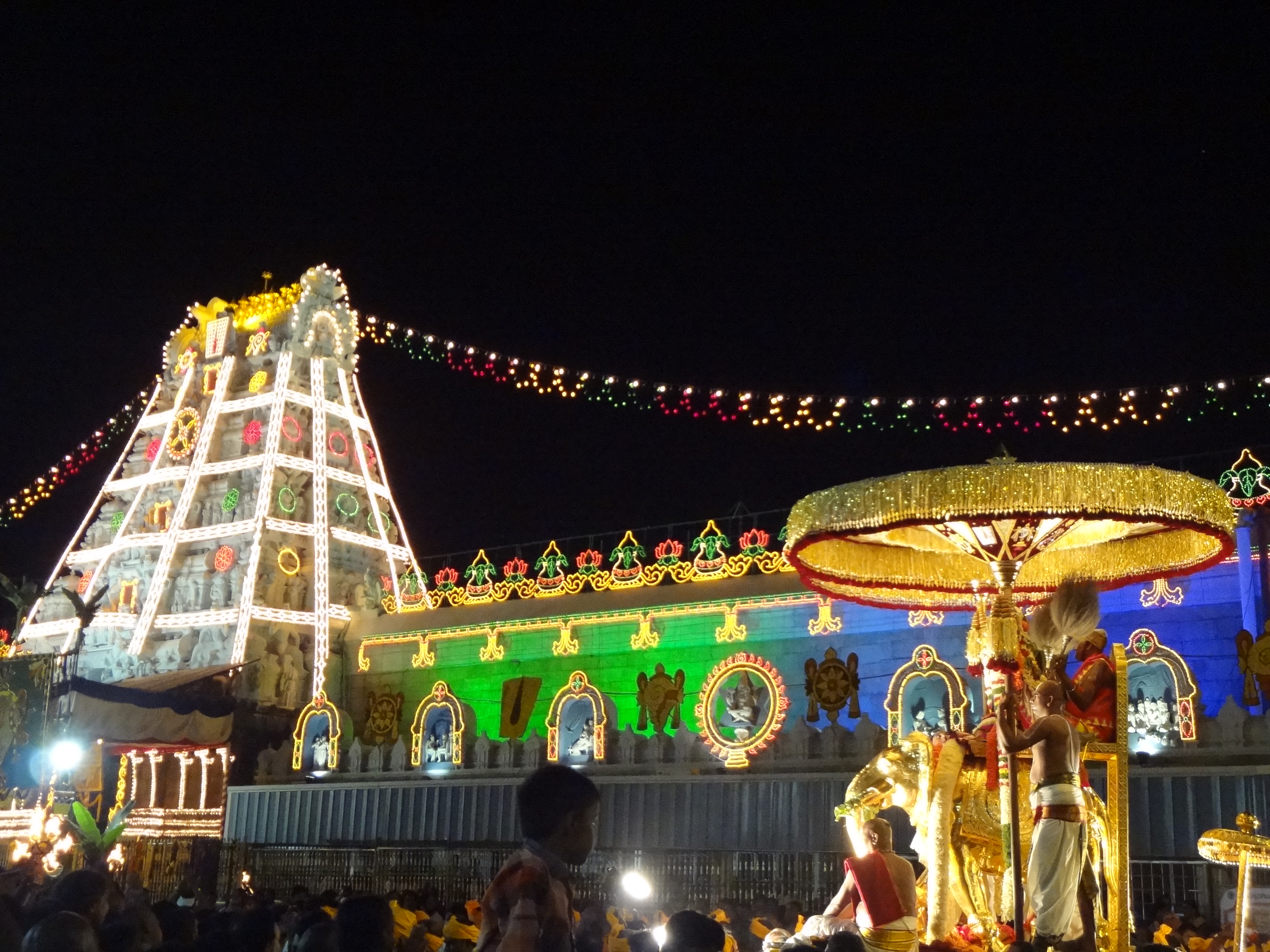
Chittoor District ![]() pronunciation (help·info) (Telugu: చిత్తూరు జిల్లా, Tamil:சித்தூர், Urdu: چتور ضلع), also known as Chittur, is a district of India's Andhra Pradesh state in the Rayalaseema region. The district headquarters is Chittoor City. The district has a population of 4,170,468 according to 2011 census of India,[1] nearly equal to the population of Liberia. Chittoor district is famous for the Tirupati, Kanipakam and Sri Kalahasti temples. It lies in the Poini river valley of southernmost Andhra Pradesh, on the NH4 Bangalore–Chennai highway. It is a major market center for mangoes, grains, sugarcane, and peanuts. Major industries around the city are Amaron Batteries, nations leading automobile batteries, and Nutrine Confectionaries, a major chocolate/candies producer and this city is one of the major Granite, mango pulp producing centers of India.
pronunciation (help·info) (Telugu: చిత్తూరు జిల్లా, Tamil:சித்தூர், Urdu: چتور ضلع), also known as Chittur, is a district of India's Andhra Pradesh state in the Rayalaseema region. The district headquarters is Chittoor City. The district has a population of 4,170,468 according to 2011 census of India,[1] nearly equal to the population of Liberia. Chittoor district is famous for the Tirupati, Kanipakam and Sri Kalahasti temples. It lies in the Poini river valley of southernmost Andhra Pradesh, on the NH4 Bangalore–Chennai highway. It is a major market center for mangoes, grains, sugarcane, and peanuts. Major industries around the city are Amaron Batteries, nations leading automobile batteries, and Nutrine Confectionaries, a major chocolate/candies producer and this city is one of the major Granite, mango pulp producing centers of India.
Etymology[]
The word Chittoor is combination of two Tamil words Chit+oor(சிறிய+ஊர்=சிற்றூர்=சித்தூர்) which means Small Town in Tamil language. In ancient days, Chittoor was part of Tamil country of Thondai Nadu. Also said that the word Chittoor comes from Chittadavula Ooru (Dense Forest - in Telugu).
History[]
Chittoor District was formed on 1 April 1911, taking Chittoor, Palamaneru, Chandragiri from the then North Arcot District of Tamil Nadu and Madanapalli, Vayalpadu from Cuddapah and Punganur, Sri Kalahasti, Karvetinagar from Zamindari provinces to form united Chittoor district. Later in the late 1960s about 280 villages of chittoor district were added into the then Kanchipuram district and Thiruvallur districts of Tamil Nadu through the demands of Ma. Po. Si. and other leaders.
Geography[]
Chittoor is a part of Rayalaseema.[2] The district occupies an area of 15,359 square kilometres (5,930 sq mi),[3] comparatively equivalent to Svalbard's Nordaustlandet.[4] The district is bounded by Anantapur District to the northwest, Cuddapah District to the north, Nellore District to the northeast, Krishnagiri District, Vellore District and Tiruvallur District of Tamil Nadu state to the south, and Kolar District of Karnataka state to the west. Chittoor district lies extreme south of the Andhra Pradesh state approximately between 12°37' - 14°8' north latitudes and 78°3' - 79°55' east longitudes.30% of the total land area is covered by forests in the district.[5] Mango and tamarind groves surround the city of Chittoor, and cattle are raised in the district. The soils in the district constitute redloamy 57%, red sandy 34% and the remaining 9% is covered by black clay black loamy, black sandy and red clay[5]
Chittoor is around 180KM from Bangalore, around 160KM from Chennai, and around 590KM from Hyderabad, state capital and around 1800KM from National capital Delhi.
Hydrology[]
The important rivers in the district are Ponnai and Swarnamukhi rivers which originate in eastern ghats. Other rivers include Kusasthali, Beema, Bahuda, Pincha, Kalyani, Araniyar and Pedderu. None of the rivers are perennial. Rivers include:
- Swarnamukhi
- Kalangi
- Papaghni
- Koundinya
- Paleru
- Arani
- Pinchcha
- Cheyyeru
- Neeva
- Kusasthali
Climate[]
The temperature in the western parts of the district like Madanapalle, Horsley Hills, Chembakur are relatively lower than the eastern parts of the Chittoor District. This is because of the higher altitude of the western parts compared to the eastern parts. The summer temperatures touches 46°C in the eastern parts whereas in the western parts it ranges around 36º to 38°C. Similarly the winter temperatures of the western parts are relatively low ranging around 12°C to 14°C and in eastern parts it is 16°C to 18°C.[6]
Chittoor District receives an annual rainfall of 918.1 mm. The South West Monsoon and North East Monsoon are the major sources of rainfall for the district. On average the district receives 438.0 mm of rainfall through the South West Monsoon (From June to September) and 396.0 mm from North East Monsoon (From October to December). The rainfall received by the district in the years 2002 and 2003 are 984.2 mm and 934 mm respectively.[7]
Image Gallery[]
")
")
")
")
")
.jpg "Sri Kalyana Venkateswa Swami Temple, Tumalagunta, Tirupati (YS).jpg (882 KB)")
")
")
")
")
")
")
")
")
Economy[]
In 2006 the Indian government named Chittoor one of the country's 250 most backward districts (out of a total of 640).[8] It is one of the thirteen districts in Andhra Pradesh currently receiving funds from the Backward Regions Grant Fund Programme (BRGF).[8]
Household indicators[]
In 2007–2008 the International Institute for Population Sciences interviewed 1010 households in 38 villages across the district.[9] They found that 92.7% had access to electricity, 99.6% had drinking water, 33.3% toilet facilities, and 53.8% lived in a pucca (permanent) home.[9] 29.3% of girls wed before the legal age of 18[10] and 88.2% of interviewees carried a BPL card.[9]
Divisions[]
Assembly Constituencies[]
There are 14 Andhra Pradesh Legislative Assembly MLA constituencies in Chittoor district.[11] They are
- Chandragiri MLA NAME - Srimathi Galla Aruna Kumari (Indian National Congress)
- Chittoor MLA NAME - C K Babu (Indian National Congress)
- G.D.Nellore (Gangadhara Nellore) MLA NAME - Dr.Kuthuhallama (Indian National Congress)
- Kuppam MLA NAME - Sri Nara Chandra Babu Naidu(Ex Chief Minister Of Andhra Pradesh) (Telugu Desam Party)
- Madanapalle MLA NAME - Sri Mohammed Shahjahan Basha(Jaha) (Indian National Congress)
- Nagari MLA NAME - Sri Gali Muddu Krishnama Naidu (Telugu Desam Party)
- Palamaner MLA NAME - Sri Amarnath Reddy (Telugu Desam Party)
- PileruMLA NAME- Sri N.Kiran Kumar Reddy (Chief Minister of Andhra pradesh) (Indian National Congress)
- Punganur MLA NAME- SRI PEDDI REDDY RAMACHANDRA REDDY (Indian National Congress)
- PuthalapattuMLA NAME - Sri Ravi (Indian National Congress)
- Satyavedu MLA NAME - Smt Hemalatha(Telugu Desam Party)
- Srikalahasti MLA NAME - Sri Bojjala Gopala krishna Reddy (Telugu Desam Party)
- Thamballapalle and MLA Sri Praveen Kumar Reddy (Telugu Desam Party)
- Tirupati MLA NAME - Karunakara Reddy (YSR Party)
Political divisions[]
There are 66 Mandals in Chittoor district.[12]
- Peddamandyam
- Thamballapalle
- Mulakalacheruvu
- Peddathippasamudram
- B.Kothakota
- Kurabalakota
- Gurramkonda
- Kalakada
- Kambhamvaripalle
- Yerravaripalem
- Tirupati Urban
- Renigunta
- Yerpedu
- Srikalahasti
- Thottambedu
- Buchinaidu khandriga
- Varadaiahpalem
- Satyavedu
- Nagalapuram
- Pitchatur
- Vijayapuram
- Nindra
- K V B Puram
- Narayanavanam
- Vadamalapeta
- Tirupati Rural
- Ramachandrapuram
- Chandragiri
- Chinnagottigallu
- Rompicherla
- Pileru
- Kalikiri
- Vayalpadu
- Nimmanapalle
- Madanapalle
- Ramasamudram
- Punganur
- Chowdepalle
- Somala
- Sodam
- Pulicherla
- Pakala
- Vedurukuppam
- Puttur
- Nagari
- Karvetinagar
- Srirangarajapuram
- Palasamudram
- Gangadhara nellore
- Penumuru
- Puthalapattu
- Irala
- Thavanampalle
- Chittoor
- Gudipala
- Yadamari
- Bangarupalem
- Palamaner
- Gangavaram
- Peddapanjani
- Baireddipalle
- Venkatagirikota
- Ramakuppam
- Santhipuram
- Gudupalle
- Kuppam
Demographics[]
According to the 2011 census Chittoor district has a population of 4,170,468,[13] roughly equal to the nation of Lebanon[14] or the US state of Kentucky.[15] This gives it a ranking of 47th in India (out of a total of 640) and 6th in its state.[13] The district has a population density of 275 inhabitants per square kilometre (710 /sq mi) .[13] Its population growth rate over the decade 2001–2011 was 11.33%.[13] Chittoor has a sex ratio of 1002 females for every 1000 males,[13] and a literacy rate of 72.36%.[13]
The population of Chittoor District according to 1991 census was 32.5 lakhs with density of 214/km².
Telugu is the native language in the district. Urdu is second official language in the district[16] while Tamil and Kannada is spoken by a significant amount of people in the eastern mandals of the district.
Culture[]
Notable people[]
- Raj Reddy, a Computer Scientist and winner of Turing Award
- Madabhushi Ananthasayanam Ayyangar, first Deputy Speaker and second Speaker of Lok Sabha
- Chittor V. Nagaiah, Renowned Film actor, Director.
- Pratap C Reddy, Appolo Hospitals Founder.
- Sir C.R. Reddy, Educationalist, Founder & Vice-chancellor of Andhra University
- Jiddu Krishnamurti, Philosopher.
- P. Chinnamma Reddy, was a prominent politician, known for building P.C.R. Junior College and Krishnavani Junior College and for establishing the Chittoor cooperative sugar factory
- Nara Chandrababu Naidu, Ex-Chief Minister of A.P.
- Mohan Babu alias Bhaktavatsalam Naidu, Film actor
- N.Kiran Kumar Reddy, Chief Minister of A.P.
- D.Adikesavulu naidu, former MP, philanthropist
- Dr. Ramachandra Naidu Galla, Ex-NRI, Noted Industrialist, Founder of Amara Raja group of companies
- Paturi Raja Gopala Naidu, Former MP, Freedom fighter, Kisan Leader, Political Guru of Sri N. Chandrababu Naidu
- Madhurantakam Rajaram, Writer, sahitya academy award winner
Education[]
Municipal Corporation of Tirupati in Chittoor District is renowned for education, and stands first in the entire Rayalaseema region. Tirupati is home to multiple institutions of higher learning. Sri Venkateswara University, AP's first women's university Sri Padmavathi Mahila Viswavidyalayamu, Rashtriya Sanskrit Vidyapeetha are located in Tirupathi. Additionally Tirupati urban area is home to several colleges and educational institutions. Apart from Tirupati, Chittoor District has numerous colleges imparting professional courses. Kuppam in Chittoor District has the 'Dravidian University', a one of its kind university.
Chittoor district is also home to the prestigious National Atmospheric Research Laboratory (NARL) of the Department of Space. The lab is involved in carrying out fundamental and applied research in Atmospheric and Space Sciences.
References[]
- ^ "Census of India 2011". http://censusindia.gov.in. http://censusindia.gov.in/2011-prov-results/data_files/andhra_pradesh/DCOAP-PAPER-1-BROCHURE.pdf.
- ^ "The District Of Seven Hills - Tirumala". http://chittoor.ap.nic.in/history.htm.
- ^ Srivastava, Dayawanti et al. (ed.) (2010). "States and Union Territories: Andhra Pradesh: Government". India 2010: A Reference Annual (54th ed.). New Delhi, India: Additional Director General, Publications Division, Ministry of Information and Broadcasting (India), Government of India. pp. 1111–1112. ISBN 978-81-230-1617-7.
- ^ "Island Directory Tables: Islands by Land Area". United Nations Environment Program. 1998-02-18. http://islands.unep.ch/Tiarea.htm. Retrieved 2011-10-11. "Nordaustlandet 14,467"
- ^ a b "National Informatics Center, Chittoor". Chittoor.nic.in. 2005-06-28. http://chittoor.nic.in/history.htm. Retrieved 2012-11-04.
- ^ "Chittoor district". Atmachittoor.com. http://www.atmachittoor.com/About%20Chittoor%20Dist..htm. Retrieved 2012-11-04.
- ^ "Irrigation". Irrigation.cgg.gov.in. http://irrigation.cgg.gov.in/dp/ChittoorDistrictProfile.jsp. Retrieved 2012-11-04.
- ^ a b Ministry of Panchayati Raj (September 8, 2009). "A Note on the Backward Regions Grant Fund Programme". National Institute of Rural Development. http://www.nird.org.in/brgf/doc/brgf_BackgroundNote.pdf. Retrieved September 27, 2011.
- ^ a b c "District Level Household and Facility Survey (DLHS-3), 2007-08: India. Andhra Prades" (PDF). International Institute for Population Sciences and Ministry of Health and Family Welfare. 2010. http://www.rchiips.org/pdf/rch3/report/AP.pdf. Retrieved 2011-10-03.
- ^ "How Do I? : Obtain Marriage Certificate". National Portal Content Management Team, National Informatics Centre. 2005. http://india.gov.in/howdo/howdoi.php?service=3. Retrieved 2011-10-03. "To be eligible for marriage, the minimum age limit is 21 for males and 18 for females."
- ^ "District-wise Assembly-Constituencies in Andhra Pradesh". Ceoandhra.nic.in. http://ceoandhra.nic.in/Right%20to%20Infn.Act/annex1.htm. Retrieved 2012-11-04.
- ^ "APOnline.Chittoor factfile". Aponline.gov.in. http://www.aponline.gov.in/Quick%20links/apfactfile/info%20on%20districts/chittoor.html. Retrieved 2012-11-04.
- ^ a b c d e f "District Census 2011". Census2011.co.in. 2011. http://www.census2011.co.in/district.php. Retrieved 2011-09-30.
- ^ US Directorate of Intelligence. "Country Comparison:Population". https://www.cia.gov/library/publications/the-world-factbook/rankorder/2119rank.html. Retrieved 2011-10-01. "Lebanon 4,143,101 July 2011 est."
- ^ "2010 Resident Population Data". U. S. Census Bureau. http://2010.census.gov/2010census/data/apportionment-pop-text.php. Retrieved 2011-09-30. "Kentucky 4,339,367"
- ^ "Language in India". Language in India. http://www.languageinindia.com/april2003/urduinap.html. Retrieved 2012-08-08.
External links[]
- Official site
- list of Villages in Chittoor
 Chittoor district travel guide from Wikivoyage

|
Anantapur district | Cuddapah district | Nellore district |
|
| Chikkaballapura district, Karnataka Kolar district, Karnataka |
||||
 Chittoor district | ||||
| Krishnagiri district, Tamil Nadu | Vellore district, Tamil Nadu | Thiruvallur district, Tamil Nadu |
| |||||||||||||||||
Template:Cities and towns in Chittoor district
| This page uses content from the English language Wikipedia. The original content was at Chittoor district. The list of authors can be seen in the page history. As with this Familypedia wiki, the content of Wikipedia is available under the Creative Commons License. |