| ||||||||||||||
| Cass County, Missouri | |
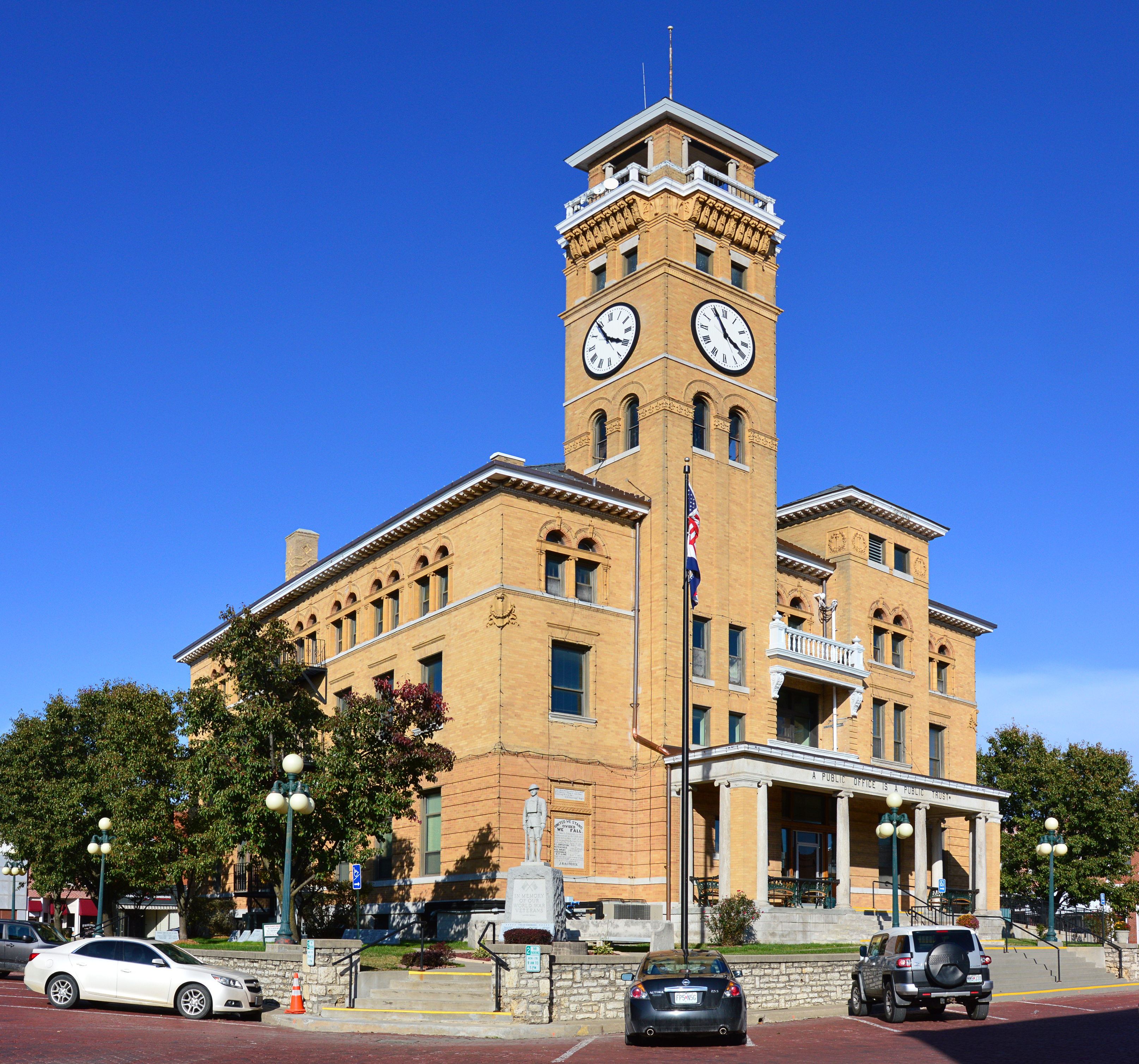 County courthouse in Harrisonville
| |
 Location in the state of Missouri | |
 Missouri's location in the U.S. | |
| Founded | March 3, 1835 |
|---|---|
| Named for | Lewis Cass |
| Seat | Harrisonville |
| Area - Total - Land - Water |
702 sq mi (1,818 km²) 697 sq mi (1,805 km²) 5.7 sq mi (15 km²), 0.8 |
| Population - (2020) - Density |
107,824 |
| Congressional district | 4th |
| Time zone | Central: UTC-6/-5 |
| Website | http://www.casscounty.com/ |
Cass County is a county located in the western part of the U.S. state of Missouri and is part of the Kansas City metropolitan area. As of the 2020 census, the population was 107,824.[1] Its county seat is Harrisonville, however the county contains a portion of Kansas City, Missouri.[2] The county was organized in 1835 as Van Buren County, but was renamed in 1849 after U.S. Senator Lewis Cass of Michigan, who later became a presidential candidate.[3][4]
History[]
The Harrisonville area was long inhabited by speakers of the Dhegihan Siouan-language family: The Osage, Quapaw, Omaha, Ponca and Kansa tribes make up this sub-group. The Kansa tribal range extended southward from the Kansas-Missouri River junction as far as the northern edge of present-day Bates County, Missouri, taking in the sites of modern Pleasant Hill, Garden City, Archie and Drexel. On their southeastern border they were neighbors of the Osage. There is no evidence that either of these tribes ever had a truly permanent settlement in the territory of Cass County.
Other historical tribes in the area were reportedly Shawnee and Lenape (aka Delaware), whose tribes spoke related Algonquian languages. The Lenape had been pushed to the Midwest from their territory along the mid-Atlantic coast by continuous white encroachment.[5]
In 1818 the United States had granted land to the Lenape in southern Missouri Territory, but they were forced to cede it back in 1825, after Missouri became a state. At that time, they were removed to a reservation in Kansas. Other Lenape had previously migrated south to Texas, seeking refuge in what was still Mexican territory after it gained independence from Spain. Those who remained in the Harrisonville area were close relatives of the Sauk, Fox and Kickapoo tribes.
The early camp meetings held by European-American settlers southwest of Harrisonville often attracted as many as 500 Indians, in addition to Europeans. They seemed the enthusiastic religious services, accompanied by hymn singing and socializing, as much as the white settlers did.[5]
The first European-American settler on the site of modern Harrisonville was James Lackey in 1830. Other early settlers were Humphrey Hunt, John Blythe, and Dr. Joseph Hudspeth. Lackey was considered a "squatter," as he built a cabin and enclosed a small field on the tract of public land taken to establish the county seat.
The site of the town was fixed under an act of the Missouri General Assembly in 1835, by David Waldo of Lafayette County and Samuel Hink and William Brown, both of Jackson County. In the same year, the first court met for the county, known as Van Buren County. Justices James McClellan and William Savage met in McClellan's residence about three miles (5 km) southeast of Peculiar on September 14, 1835. William Lyon was appointed clerk of the court and county government was organized, including the establishment of Grand River Township.
In the spring of 1837 the town of Harrisonville was platted by Enoch Rice, Francis Prine and Welcome Scott, who had been appointed commissioners by the state legislature in the winter of 1836. These commissioners, in company with Martin Rice, the county surveyor, met at the home of John Cook on April 3, 1837, to resolve Lackey's preemption claim. In May they laid off the town in lots 3, 4, 5 and 6 of the northeast and northwest quarters of Section 4, Township 44N., Range 31W. Within these 160 acres (0.65 km2) there were to be four streets: Wall and Pearl running east to west, and Lexington and Independence going north and south, each less than 40 feet wide. Fleming Harris was appointed town commissioner on April 8, 1837. The first town lots were sold on June 12 of that year; those facing the public square sold at $20 each, the others at $10.
"Democrat" was strongly urged as a name for the new town but was finally rejected. The town was named after U.S. Representative Albert G. Harrison from Missouri. The first house within the town was erected by Jason L. Dickey in 1836. The first jail in Harrisonville and second for Cass County was established in 1838. Its site was 312 S. Independence. One of its successors is recognized among the state's historic sites.
On October 8, 1835, the first church in Harrisonville was organized. Its site was two miles southwest of town and it was known as Hopewell or New Hope Baptist.
Harrisonville eventually was served by railroad lines known as the Missouri Pacific and the Frisco. After a scandal in funding railroad construction by the issuance of bonds, three men involved in the swindle were shot and killed by a mob on April 24, 1872, when their train was stopped on a Katy railroad spur. This became known as the "Gunn City Massacre" because it took place near that city.
In 1857 Cass County had approved a large stock subscription for the Pacific Railroad Company, to support its construction in the area. This corporation later surrendered the bonds to the new Saint Louis and Santa Fe Railroad, from whence they were later assigned to the Land Grant Railroad & Construction Company of New York City. Residents of Cass County gained a court injunction in an effort to prevent the funding of these bonds, but by legal maneuvering and collusion, the company gained a new set of bonds, issued secretly.
The populace was outraged, believing this maneuver was intended to benefit the holders of the now worthless bonds, by re-obligating the county to pay those same bonds. The county attorney, a judge of the county court, and a third man involved in the scandal were shot and killed while on a train stopped between Bryson, Missouri and Paola, Kansas. (It was in or near what is now known as Gunn City). Afterward some 41 men were arrested as suspects and prosecuted for these killings, but none was convicted. At the time of the shootings, a related mob burned a Republican newspaper owned by Porter J. Coston, in Harrisonville, Missouri.[6][7]
By 1860, the year before the Civil War, 12 cities in Missouri had populations of approximately 2,500 or more. Harrisonville ranked 37th, with a population of 675. In 1863 the town was depopulated, as the United States forces pushed the people out in an effort to reduce any local support for insurgent guerrilla activity in the area. Most of the buildings were burned, the jail among them. Fort Harrisonville was a Union stronghold for a brief period in 1863 and provided protection for loyal Union families.
Some of the county's local history is presented at the Pleasant Hill Historical Society Museum, in Pleasant Hill on the northern edge of the county.
Geography[]
According to the U.S. Census Bureau, the county has a total area of 702 square miles (1,820 km2), of which 697 square miles (1,810 km2) is land and 5.7 square miles (15 km2) (0.8%) is water.[8]
Adjacent counties[]
- Jackson County (north)
- Johnson County (east)
- Henry County (southeast)
- Bates County (south)
- Miami County, Kansas (west)
- Johnson County, Kansas (northwest)
Major highways[]
 Interstate 49
- U.S. Route 71
- Route 2
- Route 7
- Route 58
- Route 291
Demographics[]
| Historical populations | |||
|---|---|---|---|
| Census | Pop. | %± | |
| 1840 | 4,693 | ||
| 1850 | 6,090 | 29.8% | |
| 1860 | 9,794 | 60.8% | |
| 1870 | 19,296 | 97.0% | |
| 1880 | 22,431 | 16.2% | |
| 1890 | 23,301 | 3.9% | |
| 1900 | 23,636 | 1.4% | |
| 1910 | 22,973 | −2.8% | |
| 1920 | 21,536 | −6.3% | |
| 1930 | 20,962 | −2.7% | |
| 1940 | 19,534 | −6.8% | |
| 1950 | 19,325 | −1.1% | |
| 1960 | 29,702 | 53.7% | |
| 1970 | 39,748 | 33.8% | |
| 1980 | 51,029 | 28.4% | |
| 1990 | 63,808 | 25.0% | |
| 2000 | 82,092 | 28.7% | |
| 2010 | 99,478 | 21.2% | |
| U.S. Decennial Census[9] 1790-1960[10] 1900-1990[11] 1990-2000[12] 2010-2020[1] | |||
As of the census[13] of 2000, there were 82,092 people, 30,168 households, and 22,988 families residing in the county. The population density was 117 people per square mile (45/km2). There were 31,677 housing units at an average density of 45 per square mile (18/km2). The racial makeup of the county was 95.62% White, 1.42% Black or African American, 0.58% Native American, 0.48% Asian, 0.04% Pacific Islander, 0.50% from other races, and 1.35% from two or more races. Approximately 2.21% of the population were Hispanic or Latino of any race.
There were 30,168 households, out of which 38.10% had children under the age of 18 living with them, 63.60% were married couples living together, 9.10% had a female householder with no husband present, and 23.80% were non-families. 20.00% of all households were made up of individuals, and 8.50% had someone living alone who was 65 years of age or older. The average household size was 2.69 and the average family size was 3.09.
In the county, the population was spread out, with 28.40% under the age of 18, 7.30% from 18 to 24, 30.20% from 25 to 44, 22.30% from 45 to 64, and 11.70% who were 65 years of age or older. The median age was 36 years. For every 100 females there were 95.90 males. For every 100 females age 18 and over, there were 92.90 males.
The median income for a household in the county was $49,562, and the median income for a family was $55,258. Males had a median income of $39,001 versus $26,174 for females. The per capita income for the county was $21,073. About 4.20% of families and 5.80% of the population were below the poverty line, including 7.00% of those under age 18 and 5.20% of those age 65 or over.
Religion[]
According to the Association of Religion Data Archives County Membership Report (2010), Cass County is sometimes regarded as being on the northern edge of the Bible Belt, with evangelical Protestantism being the most predominant religion. The most predominant denominations among residents in Cass County who adhere to a religion are Southern Baptists (43.71%), Roman Catholics (17.42%), and United Methodists (11.07%).
Education[]
Public schools[]
- Archie R-V School District – Archie
- Cass County Elementary School (PK-06)
- Archie High School (07-12)
- Belton School District No. 124 – Belton
- Grace Early Childhood Education Center (PK)
- Cambridge Elementary School (K-04)
- Scott Elementary School (K-04)
- Hillcrest Elementary School (K-04)
- Gladden Elementary School (K-04)
- Kentucky Trail Elementary School (K-04)
- Mill Creek Upper Elementary School (05-06)
- Belton Middle School/Freshman Center (07-09)
- Belton High School (10-12)
- Drexel R-IV School District – Drexel
- Drexel Elementary School (K-06)
- Drexel High School (07-12)
- East Lynne School District No. 40 – East Lynne
- East Lynne Elementary School (PK-08)
- Harrisonville R-IX School District – Harrisonville
- Early Childhood Center (PK-K)
- Harrisonville Elementary School (01-05)
- McEowen Elementary School (04-05)
- Harrisonville Middle School (06-08)
- Harrisonville High School (09-12)
- Midway R-I School District – Cleveland
- Midway Elementary School (K-06)
- Midway High School (07-12)
- Pleasant Hill R-III School District – Pleasant Hill
- Pleasant Hill Primary School (PK-02)
- Pleasant Hill Elementary School (03-04)
- Pleasant Hill Intermediate School (05-06)
- Pleasant Hill Middle School (07-08)
- Pleasant Hill High School (09-12)
- Raymore-Peculiar R-II School District – Peculiar
- Raymore Elementary School (K-05)
- Creekmoor Elementary School (K-05)
- Stonegate Elementary School (K-05)
- Timber Creek Elementary School (K-05)
- Peculiar Elementary School (K-05)
- Shull Early Learning Center
- Bridle Ridge Elementary School (K-05)
- Eagle Glen Elementary School (K-05)
- Raymore-Peculiar East Middle School (06-08)
- Raymore-Peculiar South Middle School (06-08)
- Raymore-Peculiar High School (09-12)
- Sherwood Cass R-VIII School District – Creighton
- Sherwood Elementary School (K-05)
- Sherwood Middle School (06-08)
- Sherwood High School (09-12)
- Strasburg C-3 School District – Strasburg
- Strasburg Elementary School (K-08)
Private schools[]
- Hope Baptist Christian School – Pleasant Hill (01-12) – Baptist
- Harrisonville Christian School – Harrisonville (PK-08) – Nondenominational Christian
- Training Center Christian School – Garden City (PK-12) – Pentecostal
- Heartland High School & Academy – Belton (PK-12) – Baptist
- Blue Ridge Christian School South – Belton (PK-06) – Nondenominational Christian
Public libraries[]
- Cass County Public Library[14]
Politics[]
Local[]
Local politics are controlled by the Republican Party in Cass County.
| Cass County, Missouri | ||||
|---|---|---|---|---|
| Elected countywide officials | ||||
| Assessor | Roger Raffety | Republican | ||
| Circuit Clerk | Kim York | Republican | ||
| County Clerk | Jeff Fletcher | Republican | ||
| Collector | Chris Molendorp | Republican | ||
| Commissioner (Presiding) |
Bob Huston | Republican | ||
| Commissioner (District 1) |
Monty Kisner | Republican | ||
| Commissioner (District 2) |
Ryan Johnson | Republican | ||
| Prosecuting Attorney | Ben Butler | Republican | ||
| Public Administrator | Randy Jones | Republican | ||
| Recorder | Mike Medsker | Republican | ||
| Sheriff | Jeff Weber | Republican | ||
| Treasurer | Steve Cheslik | Republican | ||
State[]
| Year | Republican | Democratic | Third Parties |
|---|---|---|---|
| 2020 | 64.80% 37,025 | 32.85% 18,770 | 2.36% 1,347 |
| 2016 | 56.05% 28,571 | 40.64% 20,713 | 3.31% 1,688 |
| 2012 | 49.19% 23,837 | 47.81% 23,168 | 3.00% 1,454 |
| 2008 | 45.77% 22,592 | 52.18% 25,754 | 2.05% 1,010 |
| 2004 | 53.53% 23,538 | 44.97% 19,772 | 1.49% 659 |
| 2000 | 52.74% 18,777 | 45.18% 16,084 | 2.08% 742 |
| 1996 | 38.32% 11,038 | 59.21% 17,055 | 2.47% 710 |
Political culture[]
| Year | Republican | Democratic | Third party | |||
|---|---|---|---|---|---|---|
| No. | % | No. | % | No. | % | |
| 2020 | 37,197 | 64.61% | 19,052 | 33.09% | 1,319 | 2.29% |
| 2016 | 33,098 | 64.38% | 14,846 | 28.88% | 3,466 | 6.74% |
| 2012 | 30,912 | 62.95% | 17,044 | 34.71% | 1,148 | 2.34% |
| 2008 | 29,695 | 58.99% | 19,844 | 39.42% | 802 | 1.59% |
| 2004 | 27,253 | 61.63% | 16,681 | 37.73% | 283 | 0.64% |
| 2000 | 20,113 | 56.07% | 14,921 | 41.60% | 835 | 2.33% |
| 1996 | 13,495 | 46.52% | 11,743 | 40.48% | 3,772 | 13.00% |
| 1992 | 10,349 | 34.61% | 10,246 | 34.26% | 9,310 | 31.13% |
| 1988 | 12,799 | 55.75% | 10,092 | 43.96% | 67 | 0.29% |
| 1984 | 14,456 | 65.79% | 7,517 | 34.21% | 0 | 0.00% |
| 1980 | 10,105 | 52.81% | 8,198 | 42.85% | 831 | 4.34% |
| 1976 | 7,182 | 43.98% | 9,008 | 55.16% | 140 | 0.86% |
| 1972 | 9,242 | 71.24% | 3,731 | 28.76% | 0 | 0.00% |
| 1968 | 5,271 | 45.14% | 4,468 | 38.26% | 1,938 | 16.60% |
| 1964 | 3,665 | 35.50% | 6,658 | 64.50% | 0 | 0.00% |
| 1960 | 6,523 | 53.29% | 5,718 | 46.71% | 0 | 0.00% |
| 1956 | 5,589 | 50.06% | 5,575 | 49.94% | 0 | 0.00% |
| 1952 | 6,000 | 54.04% | 5,089 | 45.84% | 13 | 0.12% |
| 1948 | 3,614 | 39.96% | 5,415 | 59.87% | 16 | 0.18% |
| 1944 | 4,687 | 51.84% | 4,347 | 48.08% | 7 | 0.08% |
| 1940 | 4,983 | 47.55% | 5,479 | 52.29% | 17 | 0.16% |
| 1936 | 4,070 | 41.31% | 5,731 | 58.17% | 52 | 0.53% |
| 1932 | 3,009 | 34.01% | 5,772 | 65.24% | 66 | 0.75% |
| 1928 | 5,299 | 59.11% | 3,647 | 40.68% | 18 | 0.20% |
| 1924 | 3,610 | 42.17% | 4,709 | 55.01% | 242 | 2.83% |
| 1920 | 4,055 | 44.15% | 5,030 | 54.76% | 100 | 1.09% |
| 1916 | 2,104 | 37.95% | 3,337 | 60.19% | 103 | 1.86% |
| 1912 | 1,034 | 18.38% | 3,247 | 57.70% | 1,346 | 23.92% |
| 1908 | 2,193 | 39.84% | 3,143 | 57.10% | 168 | 3.05% |
| 1904 | 2,375 | 44.36% | 2,750 | 51.36% | 229 | 4.28% |
| 1900 | 2,162 | 37.85% | 3,350 | 58.65% | 200 | 3.50% |
| 1896 | 2,229 | 35.50% | 3,975 | 63.31% | 75 | 1.19% |
| 1892 | 1,908 | 35.23% | 3,027 | 55.89% | 481 | 8.88% |
| 1888 | 2,095 | 40.03% | 3,015 | 57.60% | 124 | 2.37% |
Cass County was, up to World War II, solidly Democratic rooted in its strong secessionist sympathies during the Civil War. However, since 1952 it has become a strongly Republican county in presidential elections. Cass County strongly favored Donald Trump in both 2016 and 2020. The last Democratic candidate to carry the county was Jimmy Carter in 1976.
Voters in Cass County generally adhere to socially and culturally conservative principles which tend to influence their Republican leanings. Despite Cass County's longstanding tradition of supporting socially conservative platforms, voters in the county have a penchant for advancing populist causes. In 2018, Missourians voted on a proposition (Proposition A) concerning right to work, the outcome of which ultimately reversed the right to work legislation passed in the state the previous year. 66.33% of Cass County voters cast their ballots to overturn the law.
Communities[]
Cities[]
- Archie
- Belton
- Cleveland
- Creighton
- Drexel
- East Lynne
- Freeman
- Garden City
- Harrisonville (county seat)
- Kansas City (mostly in Jackson, Platte and Clay Counties)
- Lake Annette
- Lake Winnebago
- Lee's Summit (mostly in Jackson County)
- Peculiar
- Pleasant Hill
- Raymore
- Strasburg
Villages[]
- Baldwin Park
- Gunn City
- Riverview Estates
- West Line
Census-designated places[]
- Loch Lloyd
- Martin City
Unincorporated Communities[]
- Austin
- Coleman
- Daugherty
- Dayton
- Everett
- Jaudon
- Lisle
- Lone Tree
- Main City
- Wingate
Notable people[]
- Robert C. Bell, federal judge
- Angelica Bridges, actress, model, and singer
- Delmer Brown, Japanologist* Emmett Dalton, of the bank-robbing Dalton Gang
- Carson Coffman, AFL player
- Chase Coffman, NFL tight end
- Paul Coffman, NFL player* Tyler Farr, Country music singer-songwriter
- Brutus Hamilton, decathlete and track and field coach
- Ben Hardaway, storyboard artist, animator, voice actor, gagman, writer, and director during the Golden Age of American animation
- Vicky Hartzler, U.S. Representative from Missouri (2011-present)
- Kevin Hern, U.S. Representative from Oklahoma (2018-present)
- Ewing Kauffman, businessman who founded Marion Laboratories and was the first owner of the Kansas City Royals
- Chris Koster, 41st Attorney General of Missouri (2009-2017)
- Tammy Faye Messner, televangelist
- Carrie Nation, leader of temperance movement
- Edward Capehart O'Kelley, man who killed Robert Ford, who killed Jesse James* Tate Stevens, 2012 winner of The X Factor
- Oad Swigart, professional baseball player
- Glenn Wright, professional baseball player
See also[]
- List of counties in Missouri
- National Register of Historic Places listings in Cass County, Missouri
References[]
- ^ a b "2020 Population and Housing State Data". United States Census Bureau. https://www.census.gov/library/visualizations/interactive/2020-population-and-housing-state-data.html.
- ^ "Find a County". National Association of Counties. http://www.naco.org/Counties/Pages/FindACounty.aspx.
- ^ Eaton, David Wolfe (1916). How Missouri Counties, Towns and Streams Were Named. The State Historical Society of Missouri. pp. 272. https://archive.org/details/bub_gb_RfAuAAAAYAAJ.
- ^ "Disappearing Missouri Names". The Kansas City Star: p. 15. March 19, 1911. https://www.newspapers.com/clip/861825/missouri_toponyms/.
- ^ a b The History of Cass and Bates Counties, Missouri. National Historical Company, Saint Joseph, Missouri. 1883. pp. 272. http://www.casscounty.com/DocumentCenter/Home/View/307.
- ^ Harrison, E.S.. Nome and Seward: History, Biography, Descriptions, and Stories. Internet Archive. pp. 337. https://archive.org/details/nomeandsewardpe00harrgoog/page/n429.
- ^ O'Flaherty, Daniel C. (1954). General Jo Shelby: Undefeated Rebel. University of North Carolina Press. ISBN 0-8078-4878-6. "republished 2000"
- ^ "2010 Census Gazetteer Files". United States Census Bureau. August 22, 2012. https://www.census.gov/geo/maps-data/data/docs/gazetteer/counties_list_29.txt.
- ^ "U.S. Decennial Census". United States Census Bureau. https://www.census.gov/programs-surveys/decennial-census.html.
- ^ "Historical Census Browser". University of Virginia Library. http://mapserver.lib.virginia.edu.
- ^ "Population of Counties by Decennial Census: 1900 to 1990". United States Census Bureau. https://www.census.gov/population/cencounts/mo190090.txt.
- ^ "Census 2000 PHC-T-4. Ranking Tables for Counties: 1990 and 2000". United States Census Bureau. https://www.census.gov/population/www/cen2000/briefs/phc-t4/tables/tab02.pdf.
- ^ "U.S. Census website". United States Census Bureau. https://www.census.gov.
- ^ Breeding, Marshall. "Cass County Public Library". Libraries.org. https://librarytechnology.org/library/20248.
- ^ Leip, David. "Dave Leip's Atlas of U.S. Presidential Elections". http://uselectionatlas.org/RESULTS.
Further reading[]
- Glenn, Allen. History of Cass County, Missouri (1917) online
External links[]
- Cass County government link's website
- Digitized 1930 Plat Book of Cass County from University of Missouri Division of Special Collections, Archives, and Rare Books

|
Johnson County, Kansas | Jackson County |
| |
| Miami County, Kansas | Johnson County | |||
 Cass County, Missouri | ||||
| Bates County | Henry County |
| ||||||||||||||||

| ||||||||||||||||||||

|
| This page uses content from the English language Wikipedia. The original content was at Cass County, Missouri. The list of authors can be seen in the page history. As with this Familypedia wiki, the content of Wikipedia is available under the Creative Commons License. |