| Main | Births etc |
|---|
| Bungendore | |||||||||||||
 Gibraltar Street | |||||||||||||
| Population: | 4178 [1] | ||||||||||||
| Postcode: | 2621 | ||||||||||||
| Coordinates: | Coordinates: | ||||||||||||
| Elevation: | 700 m (2,297 ft) | ||||||||||||
| Location: | |||||||||||||
| LGA: | Queanbeyan-Palerang Regional Council | ||||||||||||
| County: | Murray | ||||||||||||
| Parish: | Wamboin | ||||||||||||
| State District: | Monaro | ||||||||||||
| Federal Division: | Eden-Monaro | ||||||||||||
| |||||||||||||
| |||||||||||||
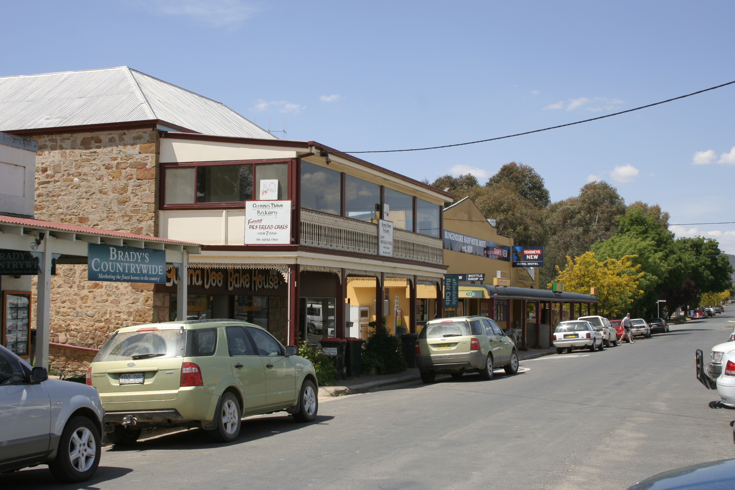
Bungendore is a town in the Queanbeyan Region of New South Wales, Australia, in Queanbeyan-Palerang Regional Council. It is on the Kings Highway near Lake George, the Molonglo River Valley and the Australian Capital Territory border. It has become a major tourist centre in recent years, popular with visitors from Canberra and some of it has heritage protection. It has expanded rapidly in recent years as a dormitory town of Canberra.
History[]
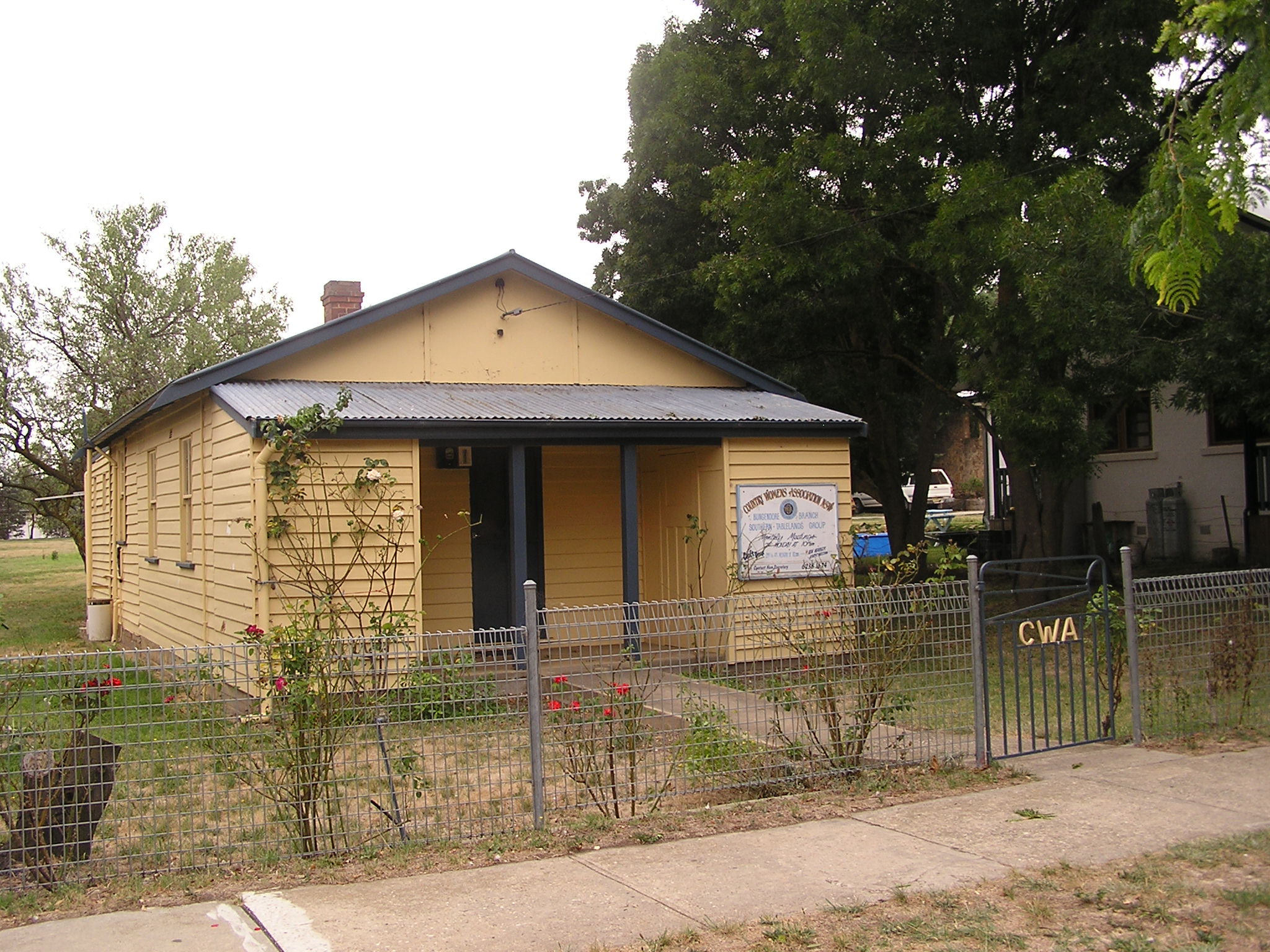
Country Women's Association

A disused rail loading platform and crane in Bungendore
Prior to European settlement, the area was occupied by the Ngarigo people. The first Europeans in the vicinity were members of the exploratory party of Dr Charles Throsby in 1820, who, along with Hamilton Hume, also originally explored the Braidwood area. In 1824, explorer Allan Cunningham passed through Bungendore. A year later, the first European settlers arrived. The mail service to Bungendore was introduced in 1837, enhancing the importance of the village and contributing to the proclamation of Bungendore as a "town" in the same year.
By 1848, 30 people populated the seven buildings in the town of Bungendore. When the railway arrived on 4 March 1885, the town began to grow more quickly.[2] New buildings appeared rapidly, such as churches, the courthouse/police station, two schools and the post office.
The first post office was built in Bungendore in 1840, an Anglican church c 1843, and the Bungendore Inn in 1847. The latter became a Cobb and Co staging post. By 1851, the population was 63. The 1850s saw at least two other hotels established. A flour mill was built in 1861, St Mary's Roman Catholic Church and two denominational schools in 1862, the courthouse in 1864 and a public school in 1868. In 1866, local crops grown were recorded as being wheat, oats, barley and potatoes. Tourism is now a major contributor to the economy.
The town remained a railhead from 1885 until the line reached Queanbeyan in 1887.[3] Partly because of the coming railway, the 1880s proved a boom period for the town and the population increased from 270 in 1881, to 700 by 1885. By then, Queanbeyan was emerging as the major town in the area.
In 1894, gold was discovered at Bywong. In 1901, Lake George and Bungendore were proposed as sites for the nation's capital city. This did not eventuate, as the drawcard of Lake George failed to impress the visiting Commissioners of the time.
By 1909 rabbit trapping had become an extremely valuable industry in the area around Bungendore. The town itself had a rabbit-freezing plant that employed 14 workers and over 250 trappers. In the year ending 31 July 1909, over 1.5 million rabbits were frozen at Bungendore.[4]
In 1992 journalist Ian McPhedran wrote that Bungendore's locals and business sector had developed a method of community cooperation superior to most other Australian small towns.[5]
On 29 January 2017 at the Werriwa Wiener Dash, an event held as part of the annual Bungendore Show, Bungendore set the record for the most number of Dachshunds in one place outside of a Dog Show with 154 dachshunds in attendance.[6]
Geography[]
Bungendore is quite near a hill known as Gibraltar Hill.[7] and is located close to the Great Dividing Range where it traverses the Butmaroo Range, some 10 km to the East, not far from the Butmaroo Homestead.
Capital Wind Farm[]


Capital Wind Farm, north of Bungendore
In 2008, following some community concerns[8] the Capital Wind Farm was established north of Bungendore along Lake George.
Railways[]

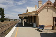
Bungendore railway station, used in the filming of The Year My Voice Broke and the Mick Jagger version of Ned Kelly
Bungendore railway station is served by three daily NSW TrainLink Xplorer services in each direction operating between Sydney and Canberra.[9]
References[]
- ^ Australian Bureau of Statistics (27 June 2017). "Bungendore (state suburb)". 2016 Census QuickStats. http://www.censusdata.abs.gov.au/census_services/getproduct/census/2016/quickstat/SSC10684. Retrieved 28 June 2017.
- ^ 1885 'Opening of the Railway from Tarago to Bungendore.', The Sydney Morning Herald (NSW : 1842 - 1954), 5 March, p. 5, viewed 17 February, 2012
- ^ 1887 'Queanbeyan Railway Opening.', Australian Town and Country Journal (NSW : 1870 - 1907), 10 September, p. 17, viewed 17 February, 2012,
- ^ New South Wales. State Labour Bureau (1906). Annual Report. p. 41. https://books.google.com/books?id=9OskAAAAYAAJ&pg=RA3-PA41. Retrieved 5 November 2012.
- ^ McPhedran, Ian (11 October 1992). "Big plans for Bungendore". The Canberra Times: p. 19. http://trove.nla.gov.au/newspaper/article/126948270.
- ^ Ellery, David (29 January 2017). "Sausage dogs on the run at Bungendore Show's second wiener dash". Canberra Times. http://www.canberratimes.com.au/nsw/werriwa-wiener-dash-claims-world-dachsund-record-20170129-gu0vxi.html. Retrieved 1 February 2017.
- ^ "Bungendore". Geographical Names Register (GNR) of NSW. Geographical Names Board of New South Wales. http://www.gnb.nsw.gov.au/place_naming/placename_search/extract?id=MajLlMZTTR. Retrieved 31 October 2012.
- ^ The Canberra Times 30 March 2006 - Fierce opposition to huge wind turbines 'scarring' Bungendore landscape Archived 12 August 2008 at the Wayback Machine
- ^ Template:Cite New South Wales transport timetables
Template:Localities in Queanbeyan–Palerang Regional Council
| |||||||||||
| This page uses content from the English language Wikipedia. The original content was at Bungendore. The list of authors can be seen in the page history. As with this Familypedia wiki, the content of Wikipedia is available under the Creative Commons License. |