| Main | Births etc |
|---|
| ||||||||||||||
| Bucks County, Pennsylvania | |||||
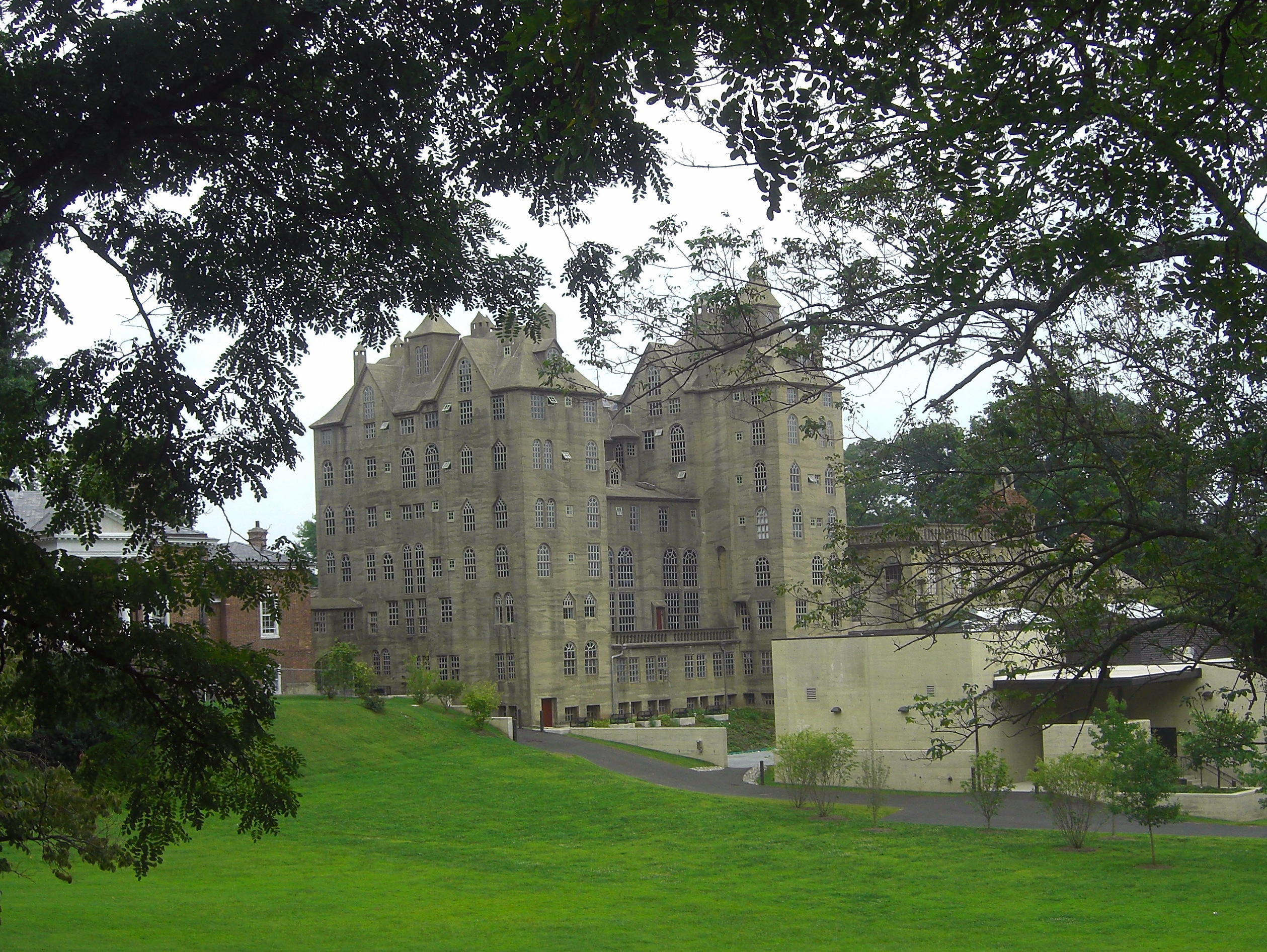
 Bucks County Administration Building
| |||||
| |||||
 Location in the state of Pennsylvania | |||||
 Pennsylvania's location in the U.S. | |||||
| Founded | November 1682 | ||||
|---|---|---|---|---|---|
| Named for | Buckinghamshire | ||||
| Seat | Doylestown | ||||
| Largest township | Bensalem | ||||
| Area - Total - Land - Water |
622 sq mi (1,611 km²) 604 sq mi (1,564 km²) 18 sq mi (47 km²), 2.8% | ||||
| PopulationEst. - (2019) - Density |
628,270 1,039/sq mi (401/km²) | ||||
| Congressional district | 1st | ||||
| Time zone | Eastern: UTC-5/-4 | ||||
| Website | www.buckscounty.gov | ||||
Footnotes:
| |||||

Script error: No such module "Mapframe". Bucks County is a county located in the Commonwealth of Pennsylvania. As of the 2020 census, the population was 628,270;[2] it is the fourth-most populous county in Pennsylvania. The county seat is Doylestown.[3] The county is named after the English county of Buckinghamshire or more precisely, its abbreviation.
Bucks County constitutes part of the northern boundary of the Philadelphia–Camden–Wilmington, PA–NJ–DE–MD Metropolitan Statistical Area, more commonly known as the Delaware Valley. It is located immediately northeast of Philadelphia and forms part of the southern tip of the eastern state border with New Jersey.
History[]
Founding[]

The Mercer Museum in Doylestown Borough
Bucks County is one of the three original counties created by colonial proprietor William Penn in 1682. Penn named the county after Buckinghamshire, the county in which he lived in England. He built a country estate, Pennsbury Manor, in Falls Township, Bucks County.
Some places in Bucks County were named after locations in Buckinghamshire, including Buckingham and Buckingham Township, named after the former county town of Buckinghamshire; Chalfont, named after Chalfont St Giles, the parish home of William Penn's first wife and the location of the Jordans Quaker Meeting House, where Penn is buried; Solebury Township, named after Soulbury, England; and Wycombe, named after the town of High Wycombe.
Bucks County was originally much larger than it is today. Northampton County was formed in 1752 from part of Bucks County, and Lehigh County was formed in 1812 from part of Northampton County.
American War of Independence[]
General George Washington and his troops camped in Bucks County as they prepared to cross the Delaware River to take Trenton, New Jersey, by surprise on the morning of December 26, 1776. Their successful attack on Britain's Hessian forces was a turning point in the American War of Independence. The town of Washington Crossing, Pennsylvania and Washington Crossing Historic Park were named to commemorate the event.
Geography[]
According to the U.S. Census Bureau, the county has a total area of 622 square miles (1,610 km2), of which 604 square miles (1,560 km2) is land and 18 square miles (47 km2) (2.8%) is water.[4]
The southern third of the county between Philadelphia and Trenton, New Jersey, often called Lower Bucks, resides in the Atlantic Coastal Plain, and is flat and near sea level, and the county's most populated and industrialized area. Bucks County shares a western border with Montgomery County, and also borders Philadelphia to the southwest, and Northampton and Lehigh Counties to the north. From north to south, it is linked to Warren, Hunterdon, Mercer and Burlington Counties in New Jersey by bridges.
Tohickon Creek and Neshaminy Creek are the largest tributaries of the Delaware in Bucks County. Tohickon Creek empties into the river at Point Pleasant and Neshaminy at Croydon (Bristol Township).
Adjacent counties[]
- Lehigh County (northwest)
- Northampton County (north)
- Warren County, New Jersey (northeast)
- Hunterdon County, New Jersey (northeast)
- Mercer County, New Jersey (east)
- Burlington County, New Jersey (southeast)
- Philadelphia County (south)
- Montgomery County (west)
Demographics[]
| Historical populations | |||
|---|---|---|---|
| Census | Pop. | %± | |
| 1790 | 25,216 | ||
| 1800 | 27,496 | 9.0% | |
| 1810 | 32,371 | 17.7% | |
| 1820 | 37,842 | 16.9% | |
| 1830 | 45,745 | 20.9% | |
| 1840 | 48,107 | 5.2% | |
| 1850 | 56,091 | 16.6% | |
| 1860 | 63,578 | 13.3% | |
| 1870 | 64,336 | 1.2% | |
| 1880 | 68,656 | 6.7% | |
| 1890 | 70,615 | 2.9% | |
| 1900 | 71,190 | 0.8% | |
| 1910 | 76,530 | 7.5% | |
| 1920 | 82,476 | 7.8% | |
| 1930 | 96,727 | 17.3% | |
| 1940 | 107,715 | 11.4% | |
| 1950 | 144,620 | 34.3% | |
| 1960 | 308,567 | 113.4% | |
| 1970 | 410,056 | 32.9% | |
| 1980 | 479,211 | 16.9% | |
| 1990 | 541,174 | 12.9% | |
| 2000 | 597,635 | 10.4% | |
| 2010 | 625,249 | 4.6% | |
| U.S. Decennial Census[5] 1790-1960[6] 1900-1990[7] 1990-2000[8] 2010-2019[2] | |||
As of the 2010 census, there were 625,249 people. The population density was 1,034.7 people per square mile. The racial makeup of the county was 86.6% Non-Hispanic white, 3.9% Black or African American, 0.3% Native American, 4.1% Asian (2.1% Indian, 1.1% Chinese, 0.7% Korean, 0.5% Filipino, 0.3% Vietnamese, 0.1% Japanese, 0.4% other Asian) 0.1% Pacific Islander, 1.7% were of two or more races, and 1.5% were of other races. 4.4% of the population were Hispanic or Latino of any race.
As of the census[9] of 2000, there were 218,725 households, and 160,981 families residing in the county. There were 225,498 housing units at an average density of 371 per square mile (143/km2). 20.1% were of German, 19.1% Irish, 14.0% Italian, 7.5% English and 5.9% Polish ancestry.
There were 218,725 households, out of which 35.30% had children under the age of 18 living with them, 61.20% were married couples living together, 8.80% had a female householder with no husband present, and 26.40% were non-families. 21.50% of all households were made up of individuals, and 8.10% had someone living alone who was 65 years of age or older. The average household size was 2.69 and the average family size was 3.17.
In the county, the population was spread out, with 25.70% under the age of 18, 7.00% from 18 to 24, 30.70% from 25 to 44, 24.30% from 45 to 64, and 12.40% who were 65 years of age or older. The median age was 38 years. For every 100 females there were 96.30 males. For every 100 females age 18 and over, there were 93.40 males.
The median income for a household in the county was $59,727, and the median income for a family was $68,727. Males had a median income of $46,587 versus $31,984 for females. The per capita income for the county was $27,430. About 3.10% of families and 4.50% of the population were below the poverty line, including 4.80% of those under age 18 and 5.50% of those age 65 or over.
Population growth[]
The 2013 population estimate of Bucks County Pennsylvania was 626,976. This ranked the county fourth in the state, well behind (more than 10%) the counties of Philadelphia with 1,553,165 (247% of Bucks), Allegheny with 1,231,527 (196%), Montgomery with 812,376 (130%), and well ahead of Delaware with 561,973 (89.6%).[2]
Growth began in the early 1950s, when William Levitt chose Bucks County for his second "Levittown". Levitt bought hundreds of acres of woodlands and farmland, and constructed 17,000 homes and dozens of schools, parks, libraries, and shopping centers. By the time the project ended, the population of Levittown had swelled to almost 74,000 residents. At the time, only whites could buy homes. This rule however, was soon overturned. Other planned developments included Croydon and Fairless Hills. This rapid sprawl continued until the mid-1960s.
In the 1970s, a second growth spurt began. This time, developers took land in townships that were mostly untouched. These included Middletown Township, Lower Makefield Township, Northampton Township and Newtown Township. Tract housing, office complexes, shopping centers, and sprawling parking lots continued to move more and more towards Upper Bucks, swallowing horse farms, sprawling forests, and wetlands. At this time, the Oxford Valley Mall was constructed in Middletown, which would become the business nucleus of the county.
Growth has somewhat stabilized since the 1990s, with smaller increases and less development. However, the main reason for this is not a lack of population growth, but loss of land. Lower Bucks now lacks large parcels of land to develop. Smaller residential and commercial projects must now be constructed. However, redevelopment of existing building sites is now a leading coalition in Lower Bucks. Many areas along the Delaware River have surpluses of abandoned industry, so many municipalities have granted building rights to luxury housing developers. Also, as the regions that began the suburban boom in Bucks, such as Levittown, begin to reach their 50th anniversaries, many commercial strips and other neglected structures are being torn down to be replaced with new shopping plazas and commercial chains. Also, with rising property values, areas with older construction are undergoing a renaissance. At the same time, Central and Upper Bucks are still seeing rapid growth, with many municipalities doubling their populations.
Economy[]
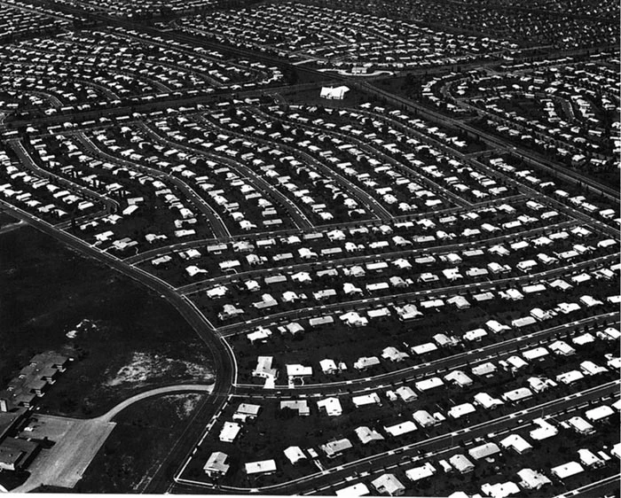
Levittown, aerial view, circa 1959
The boroughs of Bristol and Morrisville were prominent industrial centers along the Northeast Corridor during World War II. Suburban development accelerated in Lower Bucks in the 1950s with the opening of Levittown, Pennsylvania, the second such "Levittown" designed by William Levitt.
Among Bucks' largest employers in the twentieth century were U.S. Steel in Falls Township, and the Vulcanized Rubber & Plastics and Robertson Tile companies in Morrisville. Rohm and Haas continues to operate several chemical plants around Bristol. Waste Management operates a landfill in Tullytown that is the largest receptacle of out-of-state waste in the USA (receiving much of New York City's waste following the closure of Fresh Kills landfill in Staten Island, NY 40 miles (64 km) away).
Bucks is also experiencing rapid growth in biotechnology, along with neighboring Montgomery County. The Greater Philadelphia area consistently ranks in the top 10 geographic clusters for biotechnology and biopharma.[10] It is projected by 2020 that one out of four people in Bucks County will work in biotechnology.
List of notable Bucks County businesses[]
- 21st Century Media
- Alpha Card Services
- Burpee Seeds
- Byers' Choice Ltd.
- Carson Helicopters
- Charming Shoppes
- eGames, Inc.
- EPAM Systems
- GE Betz
- Hank's Root Beer
- Keystone Aircraft
- V. La Rosa and Sons Macaroni Company
- Lehigh Defense
- New Hope and Ivyland Railroad
- Questar Corporation
- Rita's Italian Ice
- West Coast Video
- Windowizards
Tourism[]
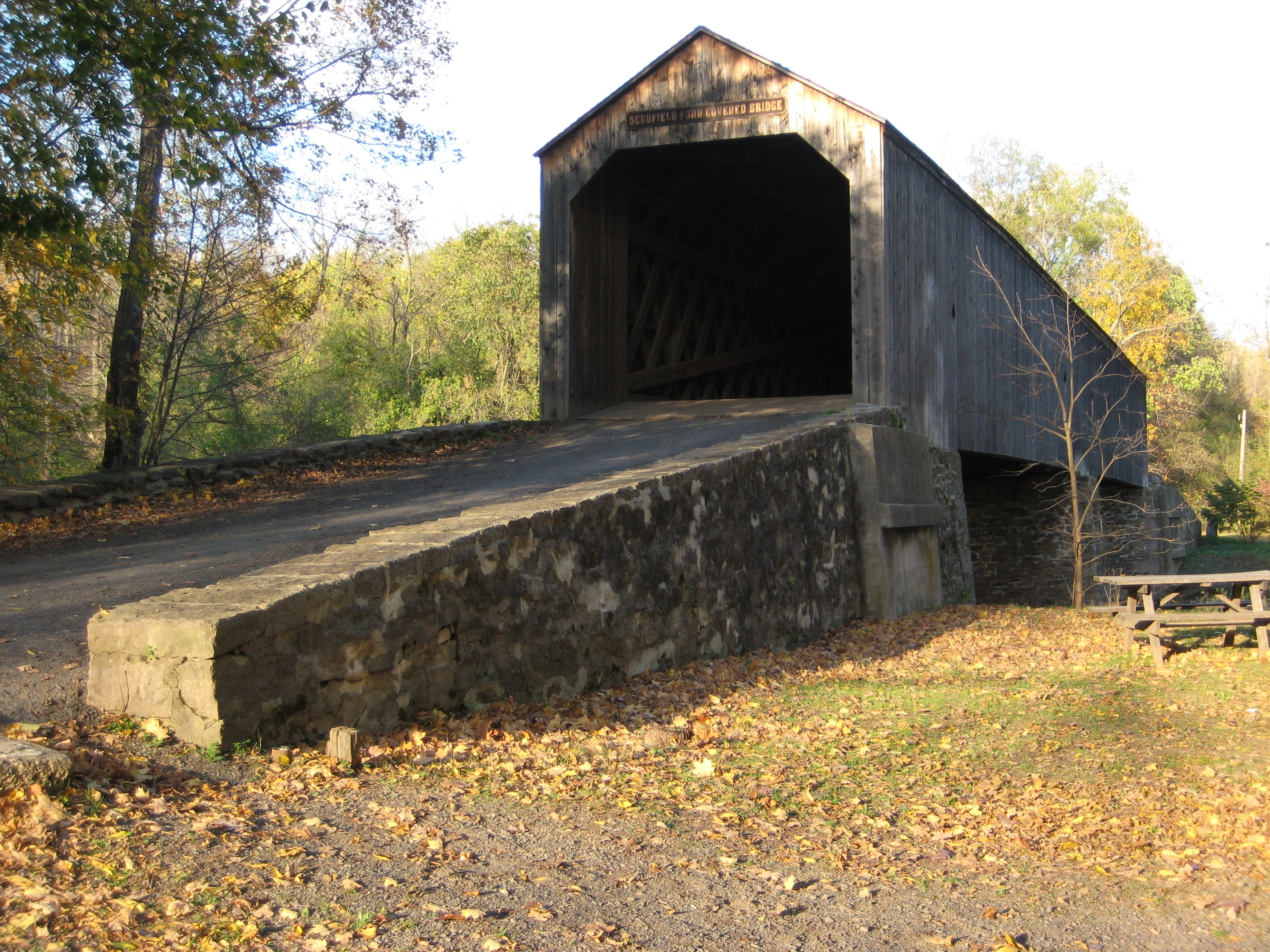

Bucks County is home to a number of covered bridges, 10 of which are still open to highway traffic and two others (situated in parks) are open to non-vehicular traffic. Shown here is the Schofield Ford Covered Bridge over the Neshaminy Creek in Tyler State Park.
Another important asset of the county is tourism. The county's northern regions (colloquially referred to as Upper Bucks) are renowned for their natural scenery, farmland, colonial history, and proximity to major urban areas (particularly Philadelphia, but New York City, Allentown, Reading and Atlantic City are also within a two-hour radius).
Bucks County is home to twelve covered bridges. Ten are still open to vehicular traffic. Two other bridges, both located in parks, are open only to non-vehicular traffic. All Bucks County bridges use the Town truss design. The Schofield Ford Bridge, in Tyler State Park, was reconstructed in 1997 from the ground up after arsonists destroyed the original in 1991.[11]
Popular attractions in Bucks County include the shops and studios of New Hope, Peddler's Village (in Lahaska), Washington Crossing Historic Park, New Hope Railroad, and Bucks County River Country. Rice's Market near Lahaska is a popular destination on Tuesday mornings. Quakertown Farmer's Market (locally called "Q-Mart") is a popular shopping destination on weekends. The county seat of Doylestown has the trifecta of concrete structures built by Henry Chapman Mercer, including the Moravian Pottery and Tile Works, the Mercer Museum and Fonthill, Mercer's personal home.


New Hope Railroad
Southern Bucks (colloquially referred to as Lower Bucks) is home to two important shopping malls, Neshaminy Mall and Oxford Valley Mall, and Sesame Place, a family theme park based on the Sesame Street television series. Also within Lower Bucks County is Parx Casino and Racing in Bensalem, a casino and thoroughbred horse racing track. The casino was built on the grounds of what was originally Philadelphia Park Racetrack. The complex includes the throughbred horse racing track, expansive casino, a dance club, numerous dining options, and the Xcite Center.
Education[]
Colleges and universities[]
- Bucks County Community College
- Delaware Valley University
- Cairn University in Langhorne
- Holy Family University in Newtown
- La Salle University in Newtown
- Strayer University in Trevose

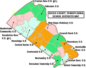
Map of Bucks County, Pennsylvania Public School Districts
Public school districts[]
- Bensalem Township School District
- Bristol Borough School District
- Bristol Township School District
- Centennial School District
- Central Bucks School District
- Council Rock School District
- Morrisville Borough School District
- Neshaminy School District
- New Hope-Solebury School District
- Palisades School District
- Pennridge School District
- Pennsbury School District
- Quakertown Community School District
- Souderton Area School District (also in Montgomery County)
The Bucks County public schools listed above are served by a regional educational service agency called the Bucks County Intermediate Unit #22 located in the county seat of Doylestown.
Public charter schools[]
There are 11 public cyber charter schools in Pennsylvania that are available for free statewide, to children K–12. See: Education in Pennsylvania.
- Bucks County Montessori Charter School
- Center Student Learning Charter School – Pennsbury
- School Lane Charter School
Private schools[]
- 27 Catholic grade schools (there are also the 27 parishes in Bucks County of the Archdiocese of Philadelphia)
- Abrams Hebrew Academy (K–8)
- Archbishop Wood Catholic High School
- Calvary Christian School
- Conwell-Egan Catholic High School
- George School
- Holy Family Regional Catholic School
- Holy Ghost Preparatory School (9–12 for boys)
- Newtown Friends School (PreK-8)
- Plumstead Christian School
- Quakertown Christian School
- Solebury School
- St. Katherine Drexel
- St. Michael the Archangel
- Trevose Day School
- United Friends School Quakertown[12]
- Villa Joseph Marie High School (9–12 for girls)
Community, junior and technical colleges[]
- Bucks County Community College
- Bucks County School of Beauty Culture
- Bucks County Technical High School
- Cairn University
- CHI Institute
- Delaware Valley University
- Holy Family University
- Middle Bucks Institute of Technology
- Pennco Tech
Arts and culture[]
Fine and performing arts[]
Many artists and writers based in New York City have called Bucks County home, settling mainly in the small stretch between Doylestown and New Hope and along the Delaware River. Notable residents have included Margaret Mead, Pearl S. Buck, Oscar Hammerstein II, Stephen Sondheim, Charlie Parker, Moss Hart, George S. Kaufman, James Michener, Dorothy Parker, S. J. Perelman, Stan and Jan Berenstain, Daniel Garber, Alfred Bester, Annie Haslam, and Jean Toomer. Bucks County has been the home of writer/musician James McBride, writer Eric Knight, Academy Award-winning film composer Joe Renzetti, musician Gene Ween of Ween, painter Christopher Wajda, photographer Michael Barone, and furniture designer George Nakashima. James Gould Cozzens lived in Lambertville, New Jersey, just across the river from Bucks County, and used Doylestown as the model for the setting of two novels; he is considered a Bucks County artist. Allen Saalburg relocated to Bucks County in 1947, and named his press after the canal.[13]
The county boasts many local theater companies, including the long-established and recently reopened Bucks County Playhouse in New Hope, Town and Country Players in Buckingham, ActorsNET in Morrisville, and the Bristol Riverside Theatre, a professional Equity theater in Bristol. The Bucks County Symphony, founded in 1953, performs in Doylestown throughout the year and the Bucks County Gilbert & Sullivan Society, founded in 2009, performs a Gilbert & Sullivan operetta with full orchestra each June.
The Wild River Review, an online magazine that publishes in-depth reporting, works of literature, art, visual art, reviews, interviews, and columns by and about contemporary artists, photographers, and writers, is based out of Doylestown.
Literature[]
The seemingly autobiographical novel The Fires of Spring by James Michener takes place in and around Doylestown.
Popular culture[]
Alecia Moore, more commonly known as Pink, was born in Doylestown, as was motion picture writer and director Stefan Avalos. Three American Idol contestants live in Bucks County: Justin Guarini, who was born in Atlanta, but moved to Bucks County; Jordan White, who was born in Cranford, New Jersey and moved to Bucks County, and Anthony Fedorov, who was born in Ukraine and was from Trevose, in Lower Southampton Township. Singer/actress Irene Molloy and classical tenor David Gordon were born in Doylestown. Musician Asher Roth was born in Morrisville. The Tony Award-winning Broadway play Vanya and Sonia and Masha and Spike is set in the county. The main members of the rock band Ween are from New Hope.[14]
Film[]
M. Night Shyamalan's 2002 film Signs, starring Mel Gibson, was filmed and takes place in Bucks County. The town scenes were filmed on State Street in Newtown Borough, and the drugstore scene was filmed at Burns' Pharmacy on Pennsylvania Avenue in Morrisville. The house was built on farmland privately owned and leased to Delaware Valley College in Doylestown Township. A stage set for some interior shots was created in a warehouse on State Road in Bensalem Township. Shyamalan's film Lady in the Water was shot across the street from the Bloomsdale section of Bristol Township. In addition, Shyamalan's 2008 film, The Happening, was filmed in Upper Bucks County, including Plumsteadville.[15][16]
With the exception of the footage filmed in the New Jersey Pine Barrens, all of The Last Broadcast was shot in Bucks County (though the name was changed).
A short scene from Stephen King's The Stand is based in Pipersville.
The producer Fred Bauer, the director Steve Rash and composer Joseph Renzetti of The Buddy Holly Story all live in Bucks County, where the film was conceived, and written by Bob Gittler.
Although filmed in California, one of Steven Spielberg's earliest films, Something Evil, is set in Bucks County.
The film Law Abiding Citizen, starring Gerard Butler and Jamie Foxx, was filmed partially in New Hope.[17]
The NBC pilot episode for Outlaw, starring Jimmy Smits, filmed in the Andalusia section of Bensalem Township March 22–23, 2010.[18][19]
The feature film The Discoverers[20] was filmed in a variety of locations in Bucks County, including Croydon, Bristol, Newtown, New Hope, and Tyler State Park.[20][21]
The Central Bucks West football team was followed during the 1999 season for the documentary The Last Game. It was directed by T. Patrick Murray and Alex Weinress.[22]
The County Fair scene in Charlotte's Web was filmed at the Southampton Days fair in Southampton, Bucks County.
The 1942 film George Washington Slept Here was set chiefly in Bucks County, although most of the filming took place in the studio.
Safe, starring Jason Statham, filmed at the Parx Casino and Racing in Bensalem Township.[23]
Bucks County has been mentioned multiple times on the popular Freeform TV series Pretty Little Liars.
Media[]
Local print publications include Bucks County Courier Times, The Intelligencer, The Advance of Bucks County, Bucks County Herald, Bucks County Town and Country Living, Radius Magazine, Yardley Voice, Morrisville Times, Newtown Gazette, Northampton Herald, Langhorne Ledger, Lower Southampton Spirit, New Hope News, Doylestown Observer, Warwick Journal, Fairless Focus. Online news publications are Levittown Now, NewtownPANow, Bucks Happening, New Hope Free Press. WBCB-AM is a local radio news station.
Sports[]
Rugby league[]
The Bucks County Sharks rugby league team played in the AMNRL from 1997 to 2010 season.[24] They returned to play in the AMNRL in 2011, until the league's fold in 2014, when they subsequently joined the USARL.[25]
Little League[]
The county has a considerable history of producing Little League baseball contenders. Since its inception in 1947, four of the seven Pennsylvania teams to compete in the Little League World Series in Williamsport, Pennsylvania have come from Bucks County: Morrisville (1955), Levittown American (1960 and 1961), and Council Rock-Newtown (2005). Two of these squads, Morrisville and Levittown (1960), went on to win the World Series title. In 2007, Council Rock Northampton won the PA State championship, and lost in the finals of regionals.
PIAA[]
The county is a part of PIAA's District I, and has seen many schools capture multiple state titles.
American Legion Baseball[]
In 1996, Yardley Western Post 317 won the American Legion National Championship.
Bristol Legion Post 382 recently won the 2011 American Legion State Championship.
Horse racing[]
- Parx Casino and Racing (formerly Philadelphia Park Racetrack and Keystone Racetrack), formerly the home of Triple Crown contender Smarty Jones, is in Bensalem.
Parks and recreation[]
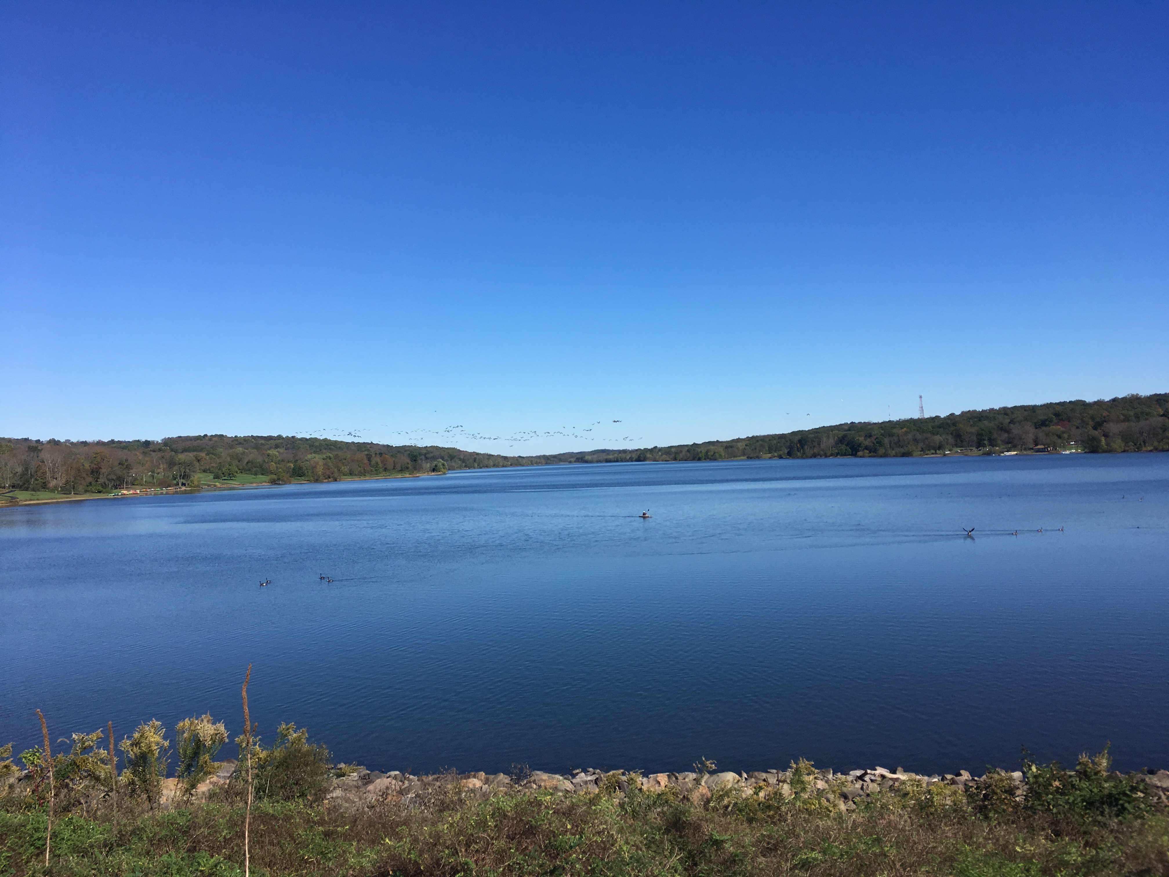
Pennsylvania state parks[]


Neshaminy Creek in Tyler State Park
There are six Commonwealth-owned parks in Bucks County:
- Five are owned and operated by the Pennsylvania Bureau of State Parks, part of the Pennsylvania Department of Conservation and Natural Resources (DCNR).
- Delaware Canal State Park
- Neshaminy State Park
- Nockamixon State Park
- Ralph Stover State Park
- Tyler State Park
- Bucks County Parks and Recreation operates an 18-bed youth hostel in the Nockamixon State Park Weisel estate. The hostel is part of Hostelling International USA.[26]
- Washington Crossing Historic Park, a 500 acres (200 ha) site operated by the Pennsylvania Historical and Museum Commission, is part of Washington's Crossing, a U.S. National Historic Landmark area. The park is headquartered in the village of Washington Crossing located in Upper Makefield Township. It marks the location of George Washington's crossing of the Delaware River during the American Revolutionary War.
County parks[]

Lake Galena in Peace Valley Park
- Core Creek Park
- Dark Hollow Park
- Lake Towhee Park
- Peace Valley Park
- Playwicki Park
- Ringing Rocks Park
- Silver Lake Park
- Tinicum Park
- Tohickon Valley Park
- Bucks County Horse Park
Historic properties[]
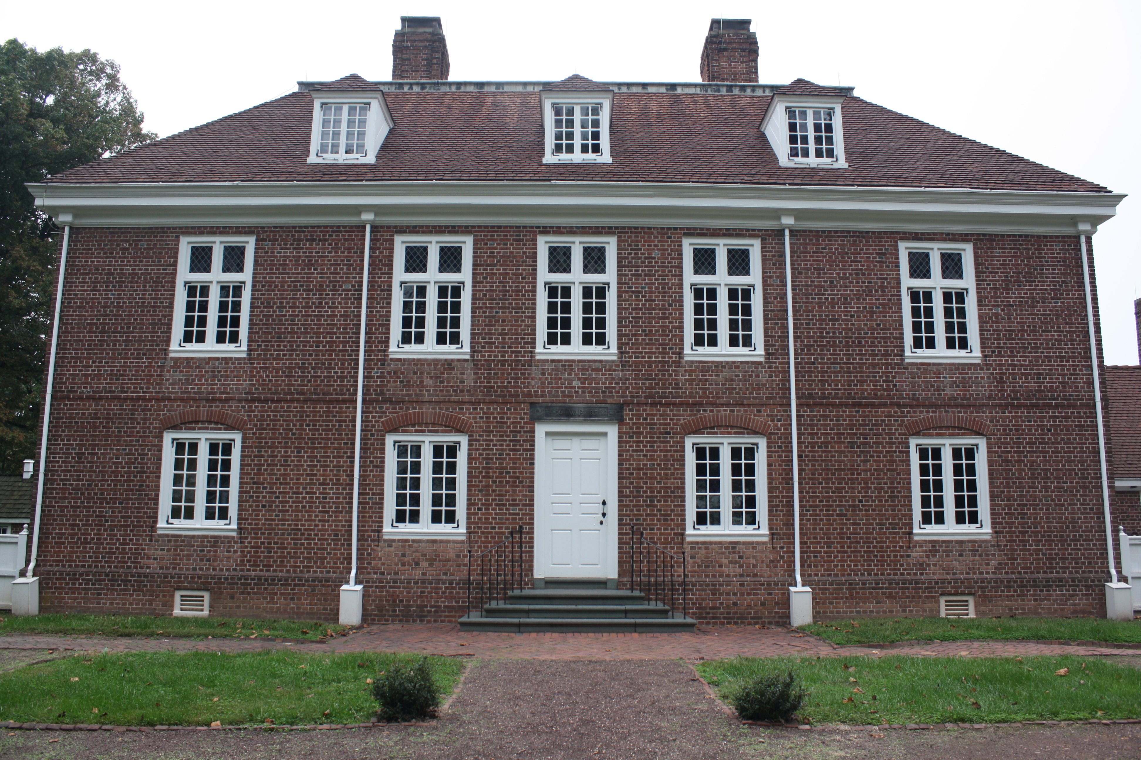

Pennsbury Manor
- County owned
- Moravian Pottery and Tile Works
- Stover-Myers Mill; Erwin Stover House
- Moland House an old stone farmhouse built around 1750 located in Warwick Township, and served as the headquarters for General George Washington during the American Revolutionary War from August 10, 1777 until August 23, 1777.
- Pennsbury Manor house and grounds, the American home of William Penn, founder and first Governor of Pennsylvania, administered by the Pennsylvania Historical and Museum Commission in association with The Pennsbury Society and are open to the public.[27]
County recreation sites[]
- Frosty Hollow Tennis Center
- Core Creek Tennis Center
- Oxford Valley Golf Course
- Oxford Valley Pool
- Tohickon Valley Pool
- Weisel Hostel
- Peace Valley Boat Rental
- Core Creek Boat Rental
County Nature Centers[]
- Bucks County Audubon Society's Honey Hollow Environmental Education Center
- Churchville Nature Center
- Peace Valley Nature Center
- Silver Lake Nature Center
- Clark Nature Center
Transportation[]
Airports[]
- Public airports administered by the Bucks County Airport Authority
- Doylestown Airport
- Quakertown Airport, also a Civil Air Patrol facility
- Van Sant Airport and Park, formerly owned and administered by the Bucks County Department of Parks and Recreation
- Private Airports
- Pennridge Airport, owned by Pennridge Development Ent. Inc but open to public use for general aviation
- Sterling Aviation Heliport, privately owned and public heliport and helicopter repair facility located in Croydon, PA next to Neshaminy State Park.
Public transportation[]
- Amtrak's Northeast Corridor line runs through the southern portion of the county. Select daily Northeast Regional and Keystone Service trains in each direction stop at the Cornwells Heights station in Bensalem.
- SEPTA
- City Division and Suburban Division bus routes across Southeastern Bucks
- Regional Rail's Lansdale/Doylestown, Trenton, Warminster and West Trenton lines
- TMA Bucks's Rushbus – only parts of South and Central Bucks County
- Bucks County Transport or BCT – a paratransit and ridesharing service
- Doylestown Dart provides public transportation around the Doylestown area.
Major highways[]
 I-95
I-95- Template:Jct/2
- I-295
- Template:Jct/2
- US 1
- US 1 Bus.
- US 13
- US 202
- US 202 Bus.
- [[Template:Infobox road/PA/link PA|PA 32]]
- [[Template:Infobox road/PA/link PA|PA 63]]
- [[Template:Infobox road/PA/link PA|PA 113]]
- [[Template:Infobox road/PA/link PA|PA 132]]
- [[Template:Infobox road/PA/link PA|PA 152]]
- [[Template:Infobox road/PA/link PA|PA 179]]
- [[Template:Infobox road/PA/link PA|PA 212]]
- [[Template:Infobox road/PA/link PA|PA 213]]
- [[Template:Infobox road/PA/link PA|PA 232]]
- [[Template:Infobox road/PA/link PA|PA 263]]
- [[Template:Infobox road/PA/link PA|PA 309]]
- [[Template:Infobox road/PA/link PA|PA 313]]
- [[Template:Infobox road/PA/link PA|PA 332]]
- [[Template:Infobox road/PA/link PA|PA 412]]
- [[Template:Infobox road/PA/link PA|PA 413]]
- [[Template:Infobox road/PA/link PA|PA 513]]
- [[Template:Infobox road/PA/link PA|PA 532]]
- [[Template:Infobox road/PA/link PA|PA 563]]
- [[Template:Infobox road/PA/link PA|PA 611]]
- [[Template:Infobox road/PA/link PA|PA 663]]
Politics and government[]
| Year | Republican | Democratic | Third party | |||
|---|---|---|---|---|---|---|
| No. | % | No. | % | No. | % | |
| 2020 | 187,367 | 47.16% | 204,712 | 51.53% | 5,212 | 1.31% |
| 2016 | 164,361 | 47.64% | 167,060 | 48.42% | 13,621 | 3.95% |
| 2012 | 156,579 | 48.74% | 160,521 | 49.97% | 4,166 | 1.30% |
| 2008 | 150,248 | 45.08% | 179,031 | 53.71% | 4,045 | 1.21% |
| 2004 | 154,469 | 48.30% | 163,438 | 51.10% | 1,909 | 0.60% |
| 2000 | 121,927 | 46.29% | 132,914 | 50.46% | 8,581 | 3.26% |
| 1996 | 94,899 | 41.74% | 103,313 | 45.44% | 29,151 | 12.82% |
| 1992 | 94,584 | 38.06% | 97,902 | 39.40% | 56,021 | 22.54% |
| 1988 | 127,563 | 59.99% | 82,472 | 38.78% | 2,605 | 1.23% |
| 1984 | 130,119 | 63.25% | 74,568 | 36.25% | 1,032 | 0.50% |
| 1980 | 100,536 | 55.49% | 59,120 | 32.63% | 21,508 | 11.87% |
| 1976 | 85,628 | 50.69% | 79,838 | 47.26% | 3,457 | 2.05% |
| 1972 | 99,684 | 62.28% | 56,784 | 35.48% | 3,591 | 2.24% |
| 1968 | 69,646 | 48.63% | 57,634 | 40.24% | 15,931 | 11.12% |
| 1964 | 50,243 | 38.89% | 78,287 | 60.60% | 646 | 0.50% |
| 1960 | 67,501 | 53.95% | 57,177 | 45.70% | 438 | 0.35% |
| 1956 | 59,862 | 60.72% | 38,541 | 39.09% | 180 | 0.18% |
| 1952 | 40,753 | 62.38% | 24,301 | 37.20% | 275 | 0.42% |
| 1948 | 29,411 | 62.46% | 16,655 | 35.37% | 1,018 | 2.16% |
| 1944 | 25,634 | 58.62% | 17,823 | 40.76% | 270 | 0.62% |
| 1940 | 25,169 | 54.73% | 20,586 | 44.77% | 229 | 0.50% |
| 1936 | 23,860 | 48.80% | 24,159 | 49.41% | 876 | 1.79% |
| 1932 | 22,331 | 59.07% | 14,135 | 37.39% | 1,341 | 3.55% |
| 1928 | 28,421 | 76.47% | 8,446 | 22.72% | 301 | 0.81% |
| 1924 | 17,460 | 66.88% | 6,582 | 25.21% | 2,066 | 7.91% |
| 1920 | 14,130 | 65.17% | 6,867 | 31.67% | 684 | 3.15% |
| 1916 | 9,269 | 53.97% | 7,491 | 43.62% | 414 | 2.41% |
| 1912 | 5,452 | 32.00% | 6,773 | 39.75% | 4,812 | 28.24% |
| 1908 | 9,409 | 55.33% | 7,233 | 42.54% | 362 | 2.13% |
| 1904 | 9,572 | 57.73% | 6,719 | 40.52% | 290 | 1.75% |
| 1900 | 9,263 | 55.13% | 7,287 | 43.37% | 253 | 1.51% |
| 1896 | 9,798 | 57.61% | 6,685 | 39.31% | 524 | 3.08% |
| 1892 | 8,230 | 48.72% | 8,390 | 49.67% | 272 | 1.61% |
| 1888 | 8,584 | 49.11% | 8,642 | 49.44% | 253 | 1.45% |
| 1884 | 8,191 | 48.47% | 8,604 | 50.92% | 103 | 0.61% |
| 1880 | 8,385 | 49.19% | 8,627 | 50.61% | 35 | 0.21% |
As of January 2010, there were 430,557 registered voters in Bucks County.[29]
- Democratic: 191,567 (44.49%)
- Republican: 176,517 (41.00%)
- Other Parties: 62,473 (14.51%)
Like most of the Philadelphia suburbs, Bucks County was once a stronghold for the Republican Party. However, in recent years it has become more of a swing county, like Pennsylvania at large. In presidential elections, Bucks has been swept up in the overall Democratic trend that has swept the Philadelphia area, although the trend in Bucks has been somewhat less pronounced than in Delaware and Montgomery. It has gone Democratic in every presidential election since 1992.
Until recently, Republicans still held most local offices. However, after Democratic gains in the 2018 elections, Republicans hold all but four state house seats covering portions of the county, while the Democrats and Republicans hold two state senate seats each. The Democrats and Republicans each hold four of the row offices. As in most suburban Philadelphia counties, Republicans tend to be conservative on fiscal matters and moderate on social and environmental matters.
All four statewide winners (Barack Obama for President, Rob McCord for Treasurer, Jack Wagner for Auditor General, and Tom Corbett for Attorney General) carried Bucks in November 2008. Earlier in 2008, Democrats took a plurality of registered voters. The GOP statewide candidates in the 2010 midterms, Tom Corbett for Governor and Pat Toomey for Senate, both won Bucks.
Bucks County is represented in U.S. Congress by PA's 1st congressional district![]() , (map) formerly numbered as the 8th District. While concerns about gerrymandering are on the rise, the 1st District remains one of the few districts in the United States that is almost fully encompassed by a single county. In order to comply with population requirements, the Bucks County-dominated 1st Congressional district also includes slightly over 100,000 residents in the Hatboro-Horsham area of Montgomery County.
, (map) formerly numbered as the 8th District. While concerns about gerrymandering are on the rise, the 1st District remains one of the few districts in the United States that is almost fully encompassed by a single county. In order to comply with population requirements, the Bucks County-dominated 1st Congressional district also includes slightly over 100,000 residents in the Hatboro-Horsham area of Montgomery County.
The executive government is run by a three-seat board of commissioners, one member of which serves as chairperson. Commissioners are elected through at-large voting and serve four-year terms. In cases of vacancy, a panel of county judges appoints members to fill seats. The current commissioners are Charles H. Martin (R) (Chairman), Robert G. Loughery (R) (Vice-Chairman), and Diane M. Ellis-Marseglia (D). The current terms expire in January 2016.[30]
In 2012, four county employees were sentenced for compensating public employees for political work.[31]
In the 2016 elections, Democrats Hillary Clinton (President), Josh Shapiro (Attorney General), and Joe Torsella (State Treasurer) won Bucks County while Republicans Pat Toomey (U.S. Senate), Brian Fitzpatrick (U.S. Representative), and John Brown (Auditor General) won Bucks County in theirs.[32]
County commissioners[]
- Diane Ellis-Marseglia, Chair, Democratic
- Bob Harvie, Democratic
- Gene DiGirolamo, Republican
Other county offices[]
| Office | Official | Party | Term ends |
|---|---|---|---|
| Clerk of Courts | Brian Munroe | Democratic | 2023 |
| Controller | Neale Dougherty | Democratic | 2021 |
| Coroner | Meredith Buck | Democratic | 2023 |
| Treasurer | Kris Ballerini | Democratic | 2023 |
| District Attorney | Matthew Weintraub | Republican | 2021 |
| Prothonotary | Judi Reiss | Democratic | 2021 |
| Recorder of Deeds | Robin Robinson | Democratic | 2021 |
| Register of Wills | Linda Bobrin | Democratic | 2023 |
| Sheriff | Milton "Milt" Warrell | Democratic | 2021 |
State Senate[]
| District | Senator | Party |
|---|---|---|
| 6 | Robert M. Tomlinson | Republican |
| 10 | Steve Santarsiero | Democratic |
| 12 | Maria Collett | Democratic |
| 24 | Bob Mensch | Republican |
State House of Representatives[]
| District | Representative | Party |
|---|---|---|
| 18 | Kathleen C. Tomlinson | Republican |
| 29 | Meghan Schroeder | Republican |
| 31 | Perry Warren | Democratic |
| 140 | John Galloway | Democratic |
| 141 | Tina Davis | Democratic |
| 142 | Frank Farry | Republican |
| 143 | Shelby Labs | Republican |
| 144 | Todd Polinchock | Republican |
| 145 | Craig Staats | Republican |
| 178 | Wendi Thomas | Republican |
United States House of Representatives[]
| District | Representative | Party |
|---|---|---|
| 1 | Brian Fitzpatrick | Republican |
United States Senate[]
| Senator | Party |
|---|---|
| Bob Casey | Democratic |
| Pat Toomey | Republican |
Communities[]

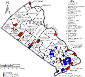
Map of Bucks County, Pennsylvania with Municipal Labels showing Boroughs (red), Townships (white), and Census-designated places (blue).
Under Pennsylvania law, there are four types of incorporated municipalities: cities, boroughs, townships, and, in at most two cases, towns. The most populous borough in the county is Morrisville with 10,023 as of the 2000 census. The following boroughs and townships are located in Bucks County:
Boroughs[]
- Bristol
- Chalfont
- Doylestown (county seat)
- Dublin
- Hulmeville
- Ivyland
- Langhorne
- Langhorne Manor
- Morrisville
- New Britain
- New Hope
- Newtown
- Penndel
- Perkasie
- Quakertown
- Richlandtown
- Riegelsville
- Sellersville
- Silverdale
- Telford (lies partly in Montgomery County)
- Trumbauersville
- Tullytown
- Yardley
Townships[]
- Bedminster
- Bensalem
- Bridgeton
- Bristol
- Buckingham
- Doylestown
- Durham
- East Rockhill
- Falls
- Haycock
- Hilltown
- Lower Makefield
- Lower Southampton
- Middletown
- Milford
- New Britain
- Newtown
- Nockamixon
- Northampton
- Plumstead
- Richland
- Solebury
- Springfield
- Tinicum
- Upper Makefield
- Upper Southampton
- Warminster
- Warrington
- Warwick
- West Rockhill
- Wrightstown
Census-designated places[]
Census-designated places are geographical areas designated by the U.S. Census Bureau for the purposes of compiling demographic data. They are not actual jurisdictions under Pennsylvania law. Other unincorporated communities, such as villages, may be listed here as well.
- Brittany Farms-The Highlands
- Churchville
- Cornwells Heights
- Croydon
- Eddington
- Fairless Hills
- Feasterville
- Levittown
- Milford Square
- Newtown Grant
- Plumsteadville
- Richboro
- Spinnerstown
- Trevose
- Village Shires
- Warminster Heights
- Woodbourne
- Woodside
Unincorporated communities[]
- Almont
- Andalusia
- Applebachsville
- Aquetong
- Argus
- Bedminster
- Blooming Glen
- Brick Tavern
- Bryn Gweled
- Buckingham
- Bucksville
- California
- Carversville
- Center Bridge
- Danboro
- Dolington
- Durham
- Elephant
- Erwinna
- Eureka
- Fallsington
- Ferndale
- Finland
- Forest Grove
- Fountainville
- Furlong
- Gallows Hill
- Gardenville
- Geryville‡
- Hagersville
- Harriman
- Harrow
- Hartsville
- Highland Park
- Highton
- Hillside Village
- Hilltop
- Hilltown
- Hinkletown
- Holicong
- Holland
- Hood
- Jamison
- Johnsville
- Kintnersville
- Kulps Corner
- Lahaska
- Line Lexington‡
- Lodi
- Loux Corner (Hilltown)
- Lumberville
- Maple Beach
- Mechanicsville
- Mount Pleasant
- Neshaminy Falls
- Newville
- Oakford
- Ottsville
- Oxford Valley
- Paletown
- Passer
- Penns Park
- Pineville
- Pipersville
- Pleasant Valley
- Point Pleasant
- Revere
- Rushland
- Shelly
- Solebury
- Southampton
- Springtown
- Strawntown
- Uhlerstown
- Unionville‡
- Upper Black Eddy
- Washington Crossing
- White Horse
- Wrightstown
- Wycombe
- Zionhill
‡This populated place also has portions in an adjacent county or counties
Historic Communities[]
- Tohickon, located under modern Lake Nockamixon
Police Agencies and Services[]
Population ranking[]
The population ranking of the following table is based on the 2010 census of Bucks County.[33]
† county seat
| Rank | City/Town/etc. | Municipal type | Population (2010 Census) |
|---|---|---|---|
| 1 | Levittown | CDP | 52,983 |
| 2 | Croydon | CDP | 9,950 |
| 3 | Bristol | Borough | 9,726 |
| 4 | Quakertown | Borough | 8,979 |
| 5 | Morrisville | Borough | 8,728 |
| 6 | Perkasie | Borough | 8,511 |
| 7 | Fairless Hills | CDP | 8,466 |
| 8 | † Doylestown | Borough | 8,380 |
| 9 | Richboro | CDP | 6,563 |
| 10 | Telford (lies partially in Montgomery County) | Borough | 4,872 |
| 11 | Sellersville | Borough | 4,249 |
| 12 | Churchville | CDP | 4,128 |
| 13 | Warminster Heights | CDP | 4,124 |
| 14 | Chalfont | Borough | 4,009 |
| 15 | Village Shires | CDP | 3,949 |
| 16 | Woodbourne | CDP | 3,851 |
| 17 | Brittany Farms-The Highlands | CDP | 3,695 |
| 18 | Newtown Grant | CDP | 3,620 |
| 19 | Trevose | CDP | 3,550 |
| 20 | New Britain | Borough | 3,152 |
| 21 | Feasterville | CDP | 3,074 |
| 22 | Plumsteadville | CDP | 2,637 |
| 23 | New Hope | Borough | 2,528 |
| 24 | Yardley | Borough | 2,434 |
| 25 | Woodside | CDP | 2,425 |
| 26 | Penndel | Borough | 2,328 |
| 27 | Newtown | Borough | 2,248 |
| 28 | Dublin | Borough | 2,158 |
| 29 | Eddington | CDP | 1,906 |
| 30 | Tullytown | Borough | 1,872 |
| 31 | Spinnerstown | CDP | 1,826 |
| 32 | Langhorne | Borough | 1,622 |
| 33 | Langhorne Manor | Borough | 1,442 |
| 34 | Cornwells Heights | CDP | 1,391 |
| 35 | Richlandtown | Borough | 1,327 |
| 36 | Ivyland | Borough | 1,041 |
| 37 | Hulmeville | Borough | 1,003 |
| 38 | Trumbauersville | Borough | 974 |
| 39 | Milford Square | CDP | 897 |
| 40 | Silverdale | Borough | 871 |
| 41 | Riegelsville | Borough | 868 |
Climate[]
Piedmont Region[]
According to the Trewartha climate classification system, the Piedmont (United States) section of Bucks County, which is located roughly northwest of U.S. Route 1, has a Temperate Continental Climate with hot and slightly humid summers, cold winters and year-around precipitation (Dcao). Dcao climates are characterized by at least one month having an average mean temperature ≤ 32.0 °F (0 °C), four to seven months with an average mean temperature ≥ 50.0 °F (10 °C), at least one month with an average mean temperature ≥ 72.0 °F (22 °C) and no significant precipitation difference between seasons. According to the Köppen climate classification system, the climate is a hot-summer, wet all year, humid continental climate (Dfa). During the summer months in the Piedmont, episodes of extreme heat and humidity can occur with heat index values > 102 °F (39 °C). The average wettest month is July which corresponds with the annual peak in thunderstorm activity. During the winter months, episodes of extreme cold and wind can occur with wind chill values < −16 °F (−27 °C). The plant hardiness zone at Haycock Mountain, elevation 968 ft (295 m), is 6b with an average annual extreme minimum air temperature of −4.6 °F (−20 °C).[34] The average seasonal (Nov-Apr) snowfall total is between 26 and 36 inches (66 and 91 cm) depending on elevation and distance from the Atlantic Ocean. The average snowiest month is February which correlates with the annual peak in nor'easter activity. Some areas of the Piedmont farther south and along the river below New Hope are in hardiness zone 7a, as is the Atlantic Coastal Plain region of Bucks.
| Climate data for Haycock Twp. Elevation: 735 ft (224 m). 1981-2010 Averages (1981-2018 Records) | |||||||||||||
|---|---|---|---|---|---|---|---|---|---|---|---|---|---|
| Month | Jan | Feb | Mar | Apr | May | Jun | Jul | Aug | Sep | Oct | Nov | Dec | Year |
| Record high °F (°C) | 69.9 (21.1) |
77.8 (25.4) |
86.8 (30.4) |
93.1 (33.9) |
93.9 (34.4) |
94.5 (34.7) |
101.4 (38.6) |
98.6 (37.0) |
96.3 (35.7) |
88.9 (31.6) |
79.6 (26.4) |
73.7 (23.2) |
101.4 (38.6) |
| Average high °F (°C) | 37.3 (2.9) |
41.1 (5.1) |
49.1 (9.5) |
61.3 (16.3) |
71.0 (21.7) |
79.2 (26.2) |
83.5 (28.6) |
81.9 (27.7) |
75.2 (24.0) |
64.1 (17.8) |
53.4 (11.9) |
41.7 (5.4) |
61.7 (16.5) |
| Daily mean °F (°C) | 28.4 (−2.0) |
31.4 (−0.3) |
38.7 (3.7) |
49.9 (9.9) |
59.7 (15.4) |
68.4 (20.2) |
72.8 (22.7) |
71.4 (21.9) |
64.3 (17.9) |
53.3 (11.8) |
43.7 (6.5) |
33.2 (0.7) |
51.4 (10.8) |
| Average low °F (°C) | 19.5 (−6.9) |
21.7 (−5.7) |
28.4 (−2.0) |
38.4 (3.6) |
48.3 (9.1) |
57.7 (14.3) |
62.1 (16.7) |
60.9 (16.1) |
53.4 (11.9) |
42.5 (5.8) |
34.0 (1.1) |
24.7 (−4.1) |
41.1 (5.1) |
| Record low °F (°C) | −13.9 (−25.5) |
−6.5 (−21.4) |
0.7 (−17.4) |
15.9 (−8.9) |
31.4 (−0.3) |
39.4 (4.1) |
45.4 (7.4) |
40.2 (4.6) |
33.8 (1.0) |
22.7 (−5.2) |
9.8 (−12.3) |
−3.5 (−19.7) |
−13.9 (−25.5) |
| Precipitation inches (mm) | 3.54 (89.9) |
2.89 (73.4) |
3.74 (95) |
4.25 (108) |
4.24 (107.7) |
4.34 (110.2) |
5.11 (129.8) |
4.12 (104.6) |
4.45 (113) |
4.56 (115.8) |
3.83 (97.3) |
4.20 (106.7) |
49.27 (1,251.5) |
| % humidity | 68.6 | 64.5 | 60.7 | 58.9 | 64.0 | 70.4 | 69.9 | 72.5 | 73.4 | 71.7 | 69.6 | 70.1 | 67.9 |
| Source: PRISM[35] | |||||||||||||
| Climate data for Doylestown, Pennsylvania | |||||||||||||
|---|---|---|---|---|---|---|---|---|---|---|---|---|---|
| Month | Jan | Feb | Mar | Apr | May | Jun | Jul | Aug | Sep | Oct | Nov | Dec | Year |
| Average high °F (°C) | 39 (4) |
43 (6) |
52 (11) |
63 (17) |
74 (23) |
82 (28) |
87 (31) |
85 (29) |
77 (25) |
66 (19) |
55 (13) |
44 (7) |
63.9 (17.7) |
| Average low °F (°C) | 24 (−4) |
25 (−4) |
33 (1) |
42 (6) |
52 (11) |
61 (16) |
66 (19) |
65 (18) |
57 (14) |
45 (7) |
37 (3) |
29 (−2) |
44.7 (7.0) |
| Precipitation inches (mm) | 3.94 (100.1) |
2.87 (72.9) |
4.24 (107.7) |
3.85 (97.8) |
4.81 (122.2) |
3.61 (91.7) |
4.72 (119.9) |
4.34 (110.2) |
4.66 (118.4) |
3.35 (85.1) |
3.74 (95) |
3.80 (96.5) |
47.93 (1,217.4) |
| Source: Weather Channel[36] | |||||||||||||
Atlantic Coastal Plain Region[]
According to the Trewartha climate classification system, the Atlantic coastal plain section of Bucks County, which is located roughly southeast of U.S. Route 1 has a Temperate Oceanic Climate with hot and slightly humid summers, cool winters and year-around precipitation (Doak). Doak climates are characterized by all months having an average mean temperature > 32.0 °F (0 °C), four to seven months with an average mean temperature ≥ 50.0 °F (10 °C), at least one month with an average mean temperature ≥ 72.0 °F (22 °C) and no significant precipitation difference between seasons. According to the Köppen climate classification, this region has a humid subtropical climate (Cfa). During the summer months in the Atlantic Coastal Plain, episodes of extreme heat and humidity can occur with heat index values > 110 °F (43 °C). The average wettest month is July which corresponds with the annual peak in thunderstorm activity. During the winter months, episodes of extreme cold and wind can occur with wind chill values < −7 °F (−22 °C). The plant hardiness zone in Andalusia, Bensalem Twp, elevation 16 ft (5 m), is 7a with an average annual extreme minimum air temperature of 3.0 °F (−16 °C).[34] The average seasonal (Nov-Apr) snowfall total is between 24 and 26 inches (61 and 66 cm) depending on elevation and distance from the Atlantic Ocean. The average snowiest month is February which correlates with the annual peak in nor'easter activity.
| Climate data for Andalusia, Bensalem Twp. Elevation: 16 ft (5 m). 1981-2010 Averages (1981-2018 Records) | |||||||||||||
|---|---|---|---|---|---|---|---|---|---|---|---|---|---|
| Month | Jan | Feb | Mar | Apr | May | Jun | Jul | Aug | Sep | Oct | Nov | Dec | Year |
| Record high °F (°C) | 72.5 (22.5) |
78.7 (25.9) |
87.7 (30.9) |
94.1 (34.5) |
96.1 (35.6) |
97.5 (36.4) |
103.5 (39.7) |
101.3 (38.5) |
99.1 (37.3) |
89.6 (32.0) |
81.8 (27.7) |
76.6 (24.8) |
103.5 (39.7) |
| Average high °F (°C) | 41.0 (5.0) |
44.4 (6.9) |
52.6 (11.4) |
63.9 (17.7) |
73.7 (23.2) |
82.9 (28.3) |
86.9 (30.5) |
85.5 (29.7) |
78.7 (25.9) |
67.3 (19.6) |
56.4 (13.6) |
45.4 (7.4) |
65.0 (18.3) |
| Daily mean °F (°C) | 33.4 (0.8) |
36.0 (2.2) |
43.3 (6.3) |
53.8 (12.1) |
63.3 (17.4) |
72.8 (22.7) |
77.4 (25.2) |
76.0 (24.4) |
68.9 (20.5) |
57.3 (14.1) |
47.6 (8.7) |
37.8 (3.2) |
55.7 (13.2) |
| Average low °F (°C) | 25.6 (−3.6) |
27.6 (−2.4) |
34.1 (1.2) |
43.6 (6.4) |
52.9 (11.6) |
62.7 (17.1) |
67.8 (19.9) |
66.4 (19.1) |
59.1 (15.1) |
47.3 (8.5) |
38.9 (3.8) |
30.3 (−0.9) |
46.4 (8.0) |
| Record low °F (°C) | −7.4 (−21.9) |
−0.6 (−18.1) |
5.7 (−14.6) |
19.5 (−6.9) |
35.2 (1.8) |
44.4 (6.9) |
51.0 (10.6) |
45.4 (7.4) |
38.8 (3.8) |
27.6 (−2.4) |
15.0 (−9.4) |
1.6 (−16.9) |
−7.4 (−21.9) |
| Precipitation inches (mm) | 3.52 (89.4) |
2.73 (69.3) |
4.23 (107.4) |
3.88 (98.6) |
4.20 (106.7) |
4.18 (106.2) |
4.97 (126.2) |
4.34 (110.2) |
4.14 (105.2) |
3.71 (94.2) |
3.46 (87.9) |
3.93 (99.8) |
47.29 (1,201.2) |
| % humidity | 64.2 | 60.9 | 56.1 | 56.5 | 60.7 | 62.8 | 64.1 | 66.2 | 66.8 | 66.9 | 65.5 | 66.4 | 63.1 |
| Source: PRISM[35] | |||||||||||||
| Climate data for Newbold Channel, Falls Twp, Delaware River Water Temperature | |||||||||||||
|---|---|---|---|---|---|---|---|---|---|---|---|---|---|
| Month | Jan | Feb | Mar | Apr | May | Jun | Jul | Aug | Sep | Oct | Nov | Dec | Year |
| Daily mean °F (°C) | 37 (3) |
37 (3) |
44 (7) |
53 (12) |
63 (17) |
74 (23) |
81 (27) |
80 (27) |
73 (23) |
60 (16) |
48 (9) |
40 (4) |
58 (14) |
| Source: NOAA[37] | |||||||||||||
Ecology[]
According to the A. W. Kuchler U.S. potential natural vegetation types, Bucks County, Pennsylvania would have a dominant vegetation type of Appalachian Oak (104) with a dominant vegetation form of Eastern Hardwood Forest (25).[38]
Notable people[]
- Josh Adams, currently professional football running back for the New York Jets born in Warrington, Pennsylvania
- Charles Albright, (1830–1880), United States Congressman; born in Bucks County[39]
- Lavoy Allen (1989–), NBA G player for the Northern Arizona Suns
- Stan and Jan Berenstain, writers and illustrators best known for creating the children's book series The Berenstain Bears
- Christy Altomare, Actress and singer-songwriter, best known for originating the role of Anya in the Broadway musical Anastasia
- Jacob Jennings Brown (1775 – 1828), Commanding General of the United States Army
- Pearl S. Buck (1892–1973), author and Nobel Prize for Literature recipient; lived near Dublin in Hilltown Twp.
- Sabrina Carpenter (1999–), actress in Girl Meets World
- Brandon Cottom (1992-), NFL player for the Seattle Seahawks; attended high school at Council Rock High School North
- Ulric Dahlgren (1842-1864), Union Army Colonel, unsuccessful raid on Richmond, Virginia started the Dahlgren Affair
- Charles Dera (1978), Pornographic film actor and professional martial artist
- Charles Ellet, Jr. (1810-1862), Civil Engineer and Union Army officer
- Mary Jane Fonder, Criminal convicted of killing a fellow church member[40]
- William Edgar Geil, Minister
- Chad I Ginsburg, guitarist of CKY
- Justin Guarini, singer/actor, and contestant on American Idol
- Roy M. Gulick (1904 - 1976), Major General and Quartermaster of the Marine Corps
- Oscar Hammerstein II, Oscar and Tony Award-winning writer, theatrical producer, and (usually uncredited) theatre director of musicals
- Samuel Hartsel (1834–1918), Colorado ranching pioneer; born in Bucks County
- Annie Haslam (1947–), lead singer of the progressive rock group Renaissance
- Michael Hurley, singer and guitarist
- Paul Hipp, Tony nominated actor, filmmaker, musician, artist. Raised in Warminster.
- Maureen Johnson (1973–), author of young adult fiction
- Patrick Kerney, former NFL defensive lineman; grew up in Newtown
- Richard Kind, actor, Spin City and Mad About You
- Eric Knight, writer of Lassie
- Michael Levin (1984–2006), American-born Israeli soldier who died in the 2006 Lebanon War
- Saige Martin, first openly LGBT person and first Latino person to serve on the Raleigh City Council
- James McBride, writer and musician whose compositions have been recorded by a variety of other musicians
- Matthew McGurk, United States Army Officer; talent manager; music producer
- Margaret Mead (1901–1978), anthropologist; raised near Doylestown
- Henry Chapman Mercer (1856–1930), archaeologist, artifact collector, tile-maker, and designer of poured concrete structures; Doylestown resident
- James Michener (1907–1997), author; Pulitzer Prize for Fiction recipient; lived in Doylestown
- Matt Millen (1958-), former National Football League linebacker and executive; lives on a farm in Durham
- David Miscavige (1960– ), Leader of the Church of Scientology
- Jamie Moyer (1962– ), starting pitcher in Major League Baseball (Philadelphia Phillies); born in Sellersville
- Dorothy Parker, writer, best known for her wit, wisecracks, and sharp eye for 20th-century urban foibles
- Rembrandt Peale (1778–1860), portrait painter and museum keeper
- S. J. Perelman, humorist, author, and screenwriter; best known for his humorous short pieces written over many years for The New Yorker
- Christina Perri (1986-), Singer/songwriter
- Pink (1979– ), singer; real name Alecia Moore; born in Doylestown
- Justin Pugh, former NFL offensive lineman; attended high school at Council Rock High School South in Council Rock School District
- Leon Redbone, singer/songwriter and guitarist
- Joe Renzetti (1941– ), Academy Award-winning film composer; musical arranger of many hit records; session musician
- Allen Rosenberg (born 1931), rower and rowing coach
- Asher Roth, platinum-certified hip-hop artist
- Dean Sabatino, drummer for the punk band Dead Milkmen; Pennridge High School graduate
- Liev Schrieber actor, titular protagonist of Ray Donovan; Paternal ancestral home.[41]
- Bryan Scott, NFL free safety; Bucks County native; attended Central Bucks East High School
- Paul Simon, musician; owned a farm in Bucks County[42][43]
- Steve Slaton, former NFL running back; from Levittown; attended Conwell-Egan Catholic High School in Fairless Hills
- Andrew Jackson Smith (1815–1897), Union army general
- Hiram N. Smith (1817-1890), Wisconsin State Assemblyman
- Ezra Stone (1917–1994), actor and director
- Superheaven, alternative rock/grunge band formed in 2008 (formerly known as Daylight)
- Brianna Taylor, cast member of The Real World: Hollywood; born in Warwick, lives in Warminster
- Troy Vincent, former NFL cornerback; lives in Lower Makefield and attended Pennsbury High School
- Dean Ween, pseudonym for Mickey Melchiondo of the band Ween
- Gene Ween, pseudonym for Aaron Freeman of the band Ween
- Jordan White, singer/songwriter and lyricist, contestant on American Idol
Official seal[]
The traditional seal of Bucks County, Pennsylvania takes its design from the inspiration of the county's founder, William Penn. The center of the seal consists of a shield from the Penn family crest with a tree above and a flowering vine surrounding it in symmetric flanks. The seal has a gold-colored background and a green band denoting Penn as the county's first proprietor and governor. In 1683, Penn's council decreed that a tree and vine be incorporated into the emblem to signify the county's abundance of woods. The seal was used in its official capacity until the Revolutionary War. The county government has since used the official Pennsylvania state seal for official documents. Today, the Bucks County seal's use is largely ceremonial. It appears on county stationery and vehicles as a symbol of the county's heritage. The gold emblem is also the centerpiece of the official Bucks County flag, which has a blue background and gold trim.
See also[]
- National Register of Historic Places listings in Bucks County, Pennsylvania
References[]
- ^ "PHMC Historical Markers Search" (Searchable database). Pennsylvania Historical and Museum Commission. Commonwealth of Pennsylvania. http://www.portal.state.pa.us/portal/server.pt/community/pennsylvania_historical_marker_program/2539/search_for_historical_markers.
- ^ a b c "State & County QuickFacts". United States Census Bureau. http://quickfacts.census.gov/qfd/states/42/42017.html.
- ^ "Find a County". National Association of Counties. http://www.naco.org/Counties/Pages/FindACounty.aspx.
- ^ "2010 Census Gazetteer Files". United States Census Bureau. August 22, 2012. http://www2.census.gov/geo/docs/maps-data/data/gazetteer/counties_list_42.txt.
- ^ "U.S. Decennial Census". United States Census Bureau. https://www.census.gov/programs-surveys/decennial-census.html.
- ^ "Historical Census Browser". University of Virginia Library. http://mapserver.lib.virginia.edu.
- ^ Forstall, Richard L., ed (March 24, 1995). "Population of Counties by Decennial Census: 1900 to 1990". United States Census Bureau. https://www.census.gov/population/cencounts/pa190090.txt.
- ^ "Census 2000 PHC-T-4. Ranking Tables for Counties: 1990 and 2000". United States Census Bureau. April 2, 2001. https://www.census.gov/population/www/cen2000/briefs/phc-t4/tables/tab02.pdf.
- ^ "U.S. Census website". United States Census Bureau. https://www.census.gov.
- ^ [1]
- ^ Waymarking GPS page about history of Schofield Ford Bridge Retrieved October 13, 2010
- ^ "Home". http://www.unitedfriendsschool.org/.
- ^ Crowther, Prudence. "When the Delay is the Gratification: Allen Saalburg," Art in Print Vol. 7 No. 4 (November–December 2017), 31.
- ^ "The Man Who Was Gene Ween, Back From The Bottom". https://www.npr.org/2014/08/17/340395204/the-man-who-was-gene-ween-back-from-the-bottom.
- ^ "The Happening Movie Blog". http://thehappeningmovie.blogspot.com/2007_09_16_archive.html.
- ^ "Party, too, was a real happening". September 25, 2007. http://www.mnightfans.com/party-too-was-a-real-happening/.
- ^ Net, Gerard Butler Dot. "Gerard Butler dot Net - Press Room - Latest News". http://www.gerardbutler.net/news/news_main.php?Action=Full&NewsID=3885.
- ^ [2]
- ^ "Another day on the set for film-industry locals". http://www.philly.com/philly/entertainment/20100330_Another_day_on_the_set_for_film-industry_locals.html.
- ^ a b "The Discoverers Movie". http://www.discoverersmovie.com.
- ^ "Inqlings: Indie film bringing yuks to Bucks". http://www.philly.com/inquirer/columnists/michael_klein/20101017_Inqlings__Indie_film_bringing_yuks_to_Bucks.html.
- ^ "The Last Game (TV Movie 2002)". https://www.imdb.com/title/tt0337661/.
- ^ "Archives - Philly.com". http://articles.philly.com/2010-12-09/news/25292327_1_beanie-sigel-radio-activity-new-morning-show.
- ^ "Archived copy". http://www.americanrugbynews.com/artman/publish/rugby_league/Pier_40_Action.shtml.
- ^ "Archived copy". http://www.usarl.com/2015/01/usa-rugby-league-season-v-announced-with-14-teams/.
- ^ [3] Archived October 20, 2011, at the Wayback Machine
- ^ "Pennsbury Manor official website". http://www.pennsburymanor.org/.
- ^ Leip, David. "Dave Leip's Atlas of U.S. Presidential Elections". http://uselectionatlas.org/RESULTS.
- ^ "Home". http://www.dos.state.pa.us/elections/lib/elections/055_voter_registration_statistics/currentstats/currentvotestats.xls.
- ^ "2009 Board of Commissioners". Official website of Bucks County. http://www.buckscounty.org/government/commissioners/index.aspx.
- ^ "Fourth Bucks official sentenced in political corruption case," by Bill Reed, Philadelphia Inquirer, February 29, 2012
- ^ "Bucks Elections". http://buckscountyvotes.org/.
- ^ "2010 U.S. Census website". United States Census Bureau. https://www.census.gov/programs-surveys/decennial-census/decade.2010.html.
- ^ a b "USDA Interactive Plant Hardiness Map". United States Department of Agriculture. https://planthardiness.ars.usda.gov/PHZMWeb/InteractiveMap.aspx.
- ^ a b "PRISM Climate Group, Oregon State University". http://prism.oregonstate.edu/explorer/.
- ^ Average weather for Doylestown Weather Channel Retrieved 2 September 2019
- ^ "Water Temperature Table of All Coastal Regions". https://www.nodc.noaa.gov/dsdt/cwtg/all_meanT.html.
- ^ "U.S. Potential Natural Vegetation, Original Kuchler Types, v2.0 (Spatially Adjusted to Correct Geometric Distortions)". https://databasin.org/datasets/1c7a301c8e6843f2b4fe63fdb3a9fe39.
- ^ Who Was Who in America, Historical Volume, 1607–1896. Marquis Who's Who. 1967.
- ^ McEvoy, Colin; Olanoff, Lynn (2012-02-28) (in en). Love Me Or Else: The True Story of a Devoted Pastor, a Fatal Jealousy, and the Murder that Rocked a Small Town. Macmillan. ISBN 9780312540821. https://books.google.com/books?id=hysKaQj4-2wC&q=Born&pg=PA229.
- ^ "Tell Schreiber Biography". IMDb. https://www.imdb.com/name/nm0775277/bio.
- ^ "Ocala Star-Banner - Google News Archive Search". https://news.google.com/newspapers?nid=1356&dat=19691130&id=84VPAAAAIBAJ&pg=3996,4963152&hl=en.
- ^ "Paul Simon: The Rolling Stone Interview". https://www.rollingstone.com/music/features/paul-simon-19700528.
External links[]
| Wikivoyage has a travel guide for Bucks County. |
- Bucks County Government official website
- Visit Bucks County (official website of county's tourism promotion agency)


| |||||||||||||||||||||||

| ||||||||||||||||
|