| ||||||||||||||
| Buchanan County, Iowa | |
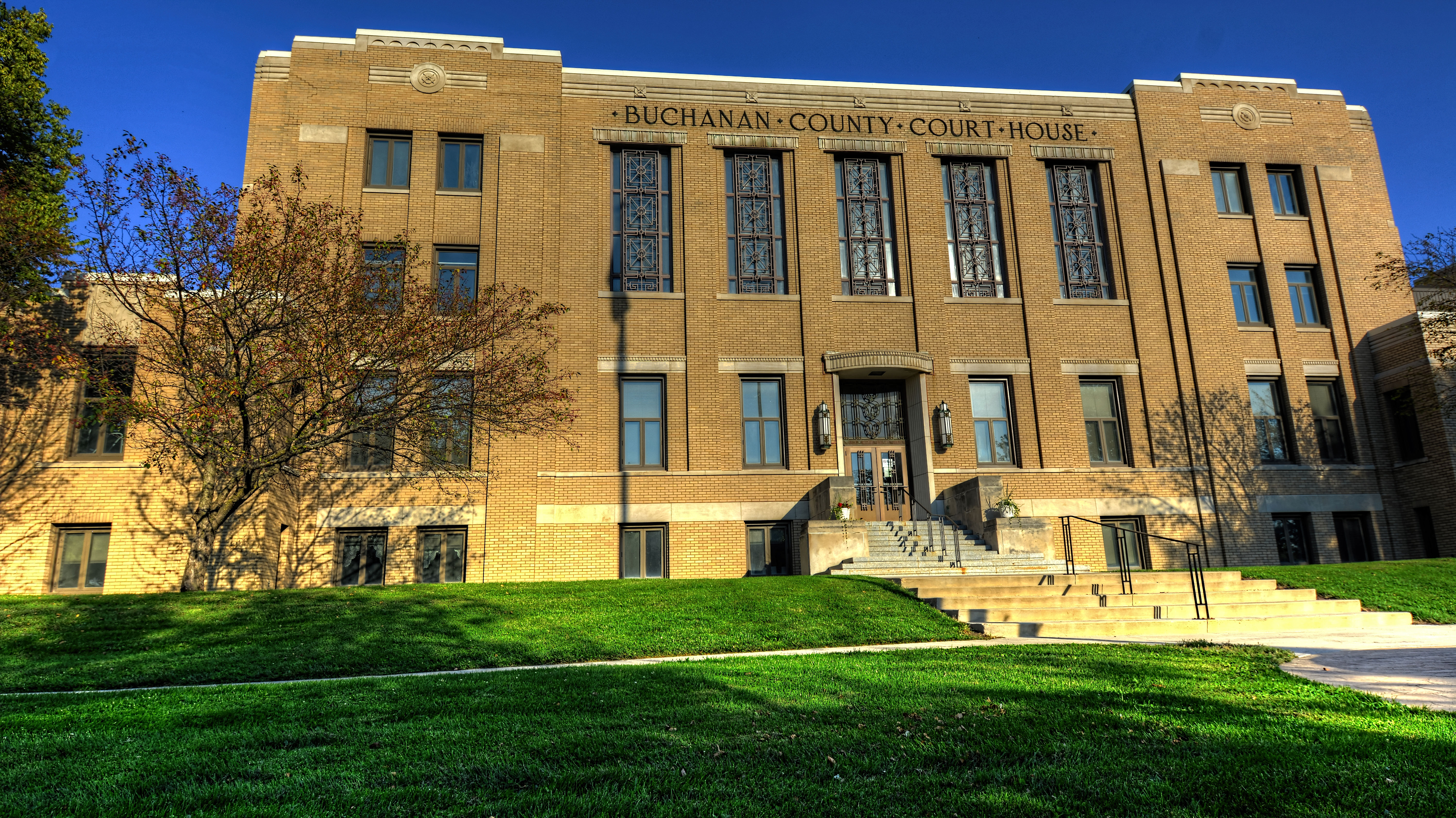 Buchanan County Courthouse
| |
 Location in the state of Iowa | |
 Iowa's location in the U.S. | |
| Founded | 1837 |
|---|---|
| Named for | James Buchanan |
| Seat | Independence |
| Largest city | Independence |
| Area - Total - Land - Water |
573 sq mi (1,484 km²) 571 sq mi (1,479 km²) 2.1 sq mi (5 km²), 0.4 |
| Population - (2020) - Density |
20,565 |
| Congressional district | 1st |
| Time zone | Central: UTC-6/-5 |
| Website | www.buchanancountyiowa.org |


Wapsipinicon River Bridge
Buchanan County is a county located in the U.S. state of Iowa. As of the 2020 census, the population was 20,565.[1] Its county seat is Independence.[2] The county was created in 1837 and was named in honor of Senator James Buchanan, the 15th President of the United States.
History[]
Buchanan County was formed on December 21, 1837, from parts of Dubuque County. It was named after US Senator James Buchanan, who would later go on to be President of the United States.
Geography[]
According to the U.S. Census Bureau, the county has a total area of 573 square miles (1,480 km2), of which 571 square miles (1,480 km2) is land and 2.1 square miles (5.4 km2) (0.4%) is water.[3]
Major highways[]
 Interstate 380
- U.S. Route 20
- Iowa Highway 27
- Iowa Highway 150
- Iowa Highway 187
- Iowa Highway 281
Adjacent counties[]
- Clayton County (northeast)
- Fayette County (north)
- Delaware County (east)
- Linn County (southeast)
- Benton County (southwest)
- Black Hawk County (west)
- Bremer County (northwest)
Demographics[]
| Historical populations | |||
|---|---|---|---|
| Census | Pop. | %± | |
| 1850 | 517 | ||
| 1860 | 7,906 | 1,429.2% | |
| 1870 | 17,034 | 115.5% | |
| 1880 | 18,546 | 8.9% | |
| 1890 | 18,997 | 2.4% | |
| 1900 | 21,427 | 12.8% | |
| 1910 | 19,748 | −7.8% | |
| 1920 | 19,890 | 0.7% | |
| 1930 | 19,550 | −1.7% | |
| 1940 | 20,991 | 7.4% | |
| 1950 | 21,927 | 4.5% | |
| 1960 | 22,293 | 1.7% | |
| 1970 | 21,746 | −2.5% | |
| 1980 | 22,900 | 5.3% | |
| 1990 | 20,844 | −9.0% | |
| 2000 | 21,093 | 1.2% | |
| 2010 | 20,958 | −0.6% | |
| U.S. Decennial Census[4] 1790-1960[5] 1900-1990[6] 1990-2000[7] 2010-2020[8] | |||


Population of Buchanan County from US census data
2020 census[]
The 2020 census recorded a population of 20,565 in the county, with a population density of 35.9886/sq mi (13.8953/km2). 97.06% of the population reported being of one race. 94.13% were non-Hispanic White, 0.35% were Black, 1.64% were Hispanic, 0.14% were Native American, 0.25% were Asian, 0.06% were Native Hawaiian or Pacific Islander and 3.43% were some other race or more than one race. There were 8,886 housing units of which 8,198 were occupied.[1]
2010 census[]
The 2010 census recorded a population of 20,958 in the county, with a population density of 36.70/sq mi (14.172/km2). There were 8,968 housing units, of which 8,161 were occupied.[9]
2000 census[]


2000 Census Age Pyramid for Buchanan County
As of the census[10] of 2000, there were 21,093 people, 7,933 households, and 5,672 families residing in the county. The population density was 37 people per square mile (14/km2). There were 8,697 housing units at an average density of 15 per square mile (6/km2). The racial makeup of the county was 98.41% White, 0.27% Black or African American, 0.21% Native American, 0.40% Asian, 0.16% from other races, and 0.54% from two or more races. 0.62% of the population were Hispanic or Latino of any race.
There were 7,933 households, out of which 34.50% had children under the age of 18 living with them, 60.70% were married couples living together, 7.40% had a female householder with no husband present, and 28.50% were non-families. 24.70% of all households were made up of individuals, and 12.50% had someone living alone who was 65 years of age or older. The average household size was 2.61 and the average family size was 3.13.
In the county, the population was spread out, with 28.60% under the age of 18, 8.10% from 18 to 24, 26.30% from 25 to 44, 22.50% from 45 to 64, and 14.50% who were 65 years of age or older. The median age was 36 years. For every 100 females there were 98.70 males. For every 100 females age 18 and over, there were 94.40 males.
The median income for a household in the county was $38,036, and the median income for a family was $45,421. Males had a median income of $30,212 versus $22,356 for females. The per capita income for the county was $18,405. About 6.80% of families and 9.40% of the population were below the poverty line, including 12.90% of those under age 18 and 7.60% of those age 65 or over.
Communities[]
Cities[]
- Aurora
- Brandon
- Fairbank
- Hazleton
- Independence
- Jesup
- Lamont
- Quasqueton
- Rowley
- Stanley
- Winthrop
Unincorporated communities[]
- Bryantsburg
- Doris
- Gatesville
- Littleton
- Monti
- Otterville
- Shady Grove
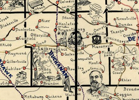
This detail of Galbraith's 1897 Rail Service Map of Iowa shows Buchanan County towns of the time. It is a pictorial map rather than a technical map: Shady Grove, for example, is shown next to a man lying under a tree; Masonville is shown next to a Masonic symbol. Some of the towns' locations are slightly altered to make room for the illustrations. Several of these towns, including Hamerville, Vista, Kier, Middlefield, Newtonville, and Castleville no longer exist. A few are nearly ghost towns.
A number of historic communities in Buchanan County once appeared on state maps, but no longer exist. Hamerville was located east of Brandon at the intersection of Highway 150. Today, the site is the location of three farmhouses. Vista, once located between Brandon and Independence, appeared on maps frequently until the 1950s. This site is not even accessed by paved road. Kier, between Fairbank and Littleton, appeared on many maps in the 19th century and early 20th century. The area is now settled by Amish. Several towns named Middlefield existed southeast of Winthrop, but none are populated today. Newtonville was located a few miles south of Monti. The houses at Castleville were later moved to Aurora. Wise, once located between Independence and Jesup just north of Highway 939, was a train-stop between the 1920s and the 1950s. Little remains at the site. Kiene was founded in 1911 between Quasqueton and Monti, but was empty by 1955. Few or even no houses remain at any of these sites.
Townships[]
Buchanan County is divided into sixteen townships:
- Buffalo
- Byron
- Cono
- Fairbank
- Fremont
- Hazleton
- Homer
- Jefferson
- Liberty
- Madison
- Middlefield
- Newton
- Perry
- Sumner
- Washington
- Westburg
Population ranking[]
The population ranking of the following table is based on the 2020 census of Buchanan County.[1]
† county seat
| Rank | City/Town/etc. | Municipal type | Population (2020 Census) |
|---|---|---|---|
| 1 | † Independence | City | 6,064 |
| 2 | Jesup (partially in Black Hawk County) | City | 2,508 |
| 3 | Fairbank (partially in Fayette County) | City | 1,111 |
| 4 | Winthrop | City | 823 |
| 5 | Hazleton | City | 713 |
| 6 | Quasqueton | City | 570 |
| 7 | Lamont | City | 429 |
| 8 | Brandon | City | 341 |
| 9 | Rowley | City | 270 |
| 10 | Aurora | City | 169 |
| 11 | Stanley (partially in Fayette County) | City | 81 |
Amish community[]
Buchanan County is home to the Hazleton Old Order Amish settlement, founded in 1914, that in 1987 had to six church districts (congregations) with an estimated population of about 1,200 Amish. The Buchanan Amish affiliation is named after Buchanan County.[11]
Politics[]
| Year | Republican | Democratic | Third party | |||
|---|---|---|---|---|---|---|
| No. | % | No. | % | No. | % | |
| 2020 | 6,420 | 59.59% | 4,169 | 38.70% | 185 | 1.72% |
| 2016 | 5,510 | 53.75% | 3,970 | 38.72% | 772 | 7.53% |
| 2012 | 4,450 | 42.24% | 5,911 | 56.11% | 174 | 1.65% |
| 2008 | 4,139 | 40.02% | 6,050 | 58.50% | 153 | 1.48% |
| 2004 | 4,797 | 45.79% | 5,608 | 53.54% | 70 | 0.67% |
| 2000 | 4,092 | 43.49% | 5,045 | 53.61% | 273 | 2.90% |
| 1996 | 3,043 | 34.00% | 4,997 | 55.83% | 911 | 10.18% |
| 1992 | 3,313 | 34.32% | 4,166 | 43.15% | 2,175 | 22.53% |
| 1988 | 3,495 | 42.00% | 4,778 | 57.42% | 48 | 0.58% |
| 1984 | 4,965 | 54.25% | 4,129 | 45.12% | 58 | 0.63% |
| 1980 | 5,041 | 53.50% | 3,605 | 38.26% | 776 | 8.24% |
| 1976 | 4,794 | 51.98% | 4,258 | 46.17% | 171 | 1.85% |
| 1972 | 5,277 | 58.32% | 3,609 | 39.89% | 162 | 1.79% |
| 1968 | 4,541 | 52.35% | 3,670 | 42.31% | 463 | 5.34% |
| 1964 | 3,187 | 36.12% | 5,621 | 63.71% | 15 | 0.17% |
| 1960 | 5,179 | 54.90% | 4,251 | 45.07% | 3 | 0.03% |
| 1956 | 5,512 | 61.01% | 3,513 | 38.88% | 10 | 0.11% |
| 1952 | 6,431 | 67.81% | 3,019 | 31.83% | 34 | 0.36% |
| 1948 | 4,310 | 50.57% | 4,127 | 48.42% | 86 | 1.01% |
| 1944 | 4,653 | 54.69% | 3,841 | 45.15% | 14 | 0.16% |
| 1940 | 5,630 | 54.61% | 4,649 | 45.10% | 30 | 0.29% |
| 1936 | 4,734 | 47.85% | 5,025 | 50.79% | 135 | 1.36% |
| 1932 | 4,401 | 46.33% | 5,004 | 52.67% | 95 | 1.00% |
| 1928 | 5,885 | 65.36% | 3,099 | 34.42% | 20 | 0.22% |
| 1924 | 5,459 | 63.10% | 1,780 | 20.58% | 1,412 | 16.32% |
| 1920 | 6,334 | 79.20% | 1,600 | 20.01% | 63 | 0.79% |
| 1916 | 3,000 | 61.79% | 1,808 | 37.24% | 47 | 0.97% |
| 1912 | 1,271 | 26.93% | 1,866 | 39.54% | 1,582 | 33.52% |
| 1908 | 2,552 | 55.76% | 1,889 | 41.27% | 136 | 2.97% |
| 1904 | 2,798 | 60.93% | 1,545 | 33.65% | 249 | 5.42% |
| 1900 | 2,958 | 56.95% | 2,053 | 39.53% | 183 | 3.52% |
| 1896 | 2,865 | 55.30% | 2,233 | 43.10% | 83 | 1.60% |
| 1892 | 2,498 | 51.86% | 2,166 | 44.97% | 153 | 3.18% |
| 1888 | 2,343 | 54.37% | 1,880 | 43.63% | 86 | 2.00% |
| 1884 | 2,216 | 53.33% | 1,923 | 46.28% | 16 | 0.39% |
| 1880 | 2,156 | 55.51% | 1,208 | 31.10% | 520 | 13.39% |
See also[]
- National Register of Historic Places listings in Buchanan County, Iowa
References[]
- ^ a b c "2020 Census State Redistricting Data". United states Census Bureau. https://www2.census.gov/programs-surveys/decennial/2020/data/01-Redistricting_File--PL_94-171/Iowa/.
- ^ "Find a County". National Association of Counties. http://www.naco.org/Counties/Pages/FindACounty.aspx.
- ^ "US Gazetteer files: 2010, 2000, and 1990". United States Census Bureau. February 12, 2011. https://www.census.gov/geographies/reference-files/time-series/geo/gazetteer-files.html.
- ^ "U.S. Decennial Census". United States Census Bureau. https://www.census.gov/programs-surveys/decennial-census.html.
- ^ "Historical Census Browser". University of Virginia Library. http://mapserver.lib.virginia.edu.
- ^ "Population of Counties by Decennial Census: 1900 to 1990". United States Census Bureau. https://www.census.gov/population/cencounts/ia190090.txt.
- ^ "Census 2000 PHC-T-4. Ranking Tables for Counties: 1990 and 2000". United States Census Bureau. https://www.census.gov/population/www/cen2000/briefs/phc-t4/tables/tab02.pdf.
- ^ "State & County QuickFacts". United States Census Bureau. http://quickfacts.census.gov/qfd/states/19/19019.html.
- ^ "Population and Housing Occupancy Status: 2010 - State -- County". United States Census Bureau American FactFinder. http://factfinder.census.gov/faces/tableservices/jsf/pages/productview.xhtml?pid=DEC_10_PL_GCTPL2.ST05&prodType=table.
- ^ "U.S. Census website". United States Census Bureau. https://www.census.gov.
- ^ Hazleton Old Order Amish Settlement (Hazleton, Iowa, USA) at Global Anabaptist Mennonite Encyclopedia Online
- ^ Leip, David. "Dave Leip's Atlas of U.S. Presidential Elections". http://uselectionatlas.org/RESULTS.
External links[]

|
Bremer County | Fayette County | Clayton County |
|
| Black Hawk County | Delaware County | |||
 Buchanan County, Iowa | ||||
| Benton County | Linn County |
| ||||||||||||||
|
| This page uses content from the English language Wikipedia. The original content was at Buchanan County, Iowa. The list of authors can be seen in the page history. As with this Familypedia wiki, the content of Wikipedia is available under the Creative Commons License. |