| Main | Births etc |
|---|
| Brandenburg | |||
|---|---|---|---|
| — State of Germany — | |||
|
|||
 |
|||
| Coordinates: | |||
| Country | Germany | ||
| Capital | Potsdam | ||
| Government | |||
| • Minister-President | Matthias Platzeck (SPD) | ||
| • Governing parties | SPD |
||
| • Votes in Bundesrat | 4 (of 69) | ||
| Area | |||
| • Total | 29,478.63 km2 (11,381.76 sq mi) | ||
| Population (2010-12-31)[1] | |||
| • Total | 2,503,273 | ||
| • Density | 85/km2 (220/sq mi) | ||
| Time zone | CET (UTC+1) | ||
| • Summer (DST) | CEST (UTC+2) | ||
| ISO 3166 code | DE-BB | ||
| GDP/ Nominal | € 48 billion (2005) | ||
| NUTS Region | DE4 | ||
| Website | brandenburg.de | ||

Brandenburg (![]() listen (help·info); Lower Sorbian: Bramborska; Upper Sorbian: Braniborska) is one of the sixteen federal-states of Germany. It lies in the east of the country and is one of the new federal states that were re-created in 1990 upon the reunification of the former West Germany and East Germany. The capital is Potsdam. Brandenburg surrounds but does not include the national capital and city-state of Berlin.
listen (help·info); Lower Sorbian: Bramborska; Upper Sorbian: Braniborska) is one of the sixteen federal-states of Germany. It lies in the east of the country and is one of the new federal states that were re-created in 1990 upon the reunification of the former West Germany and East Germany. The capital is Potsdam. Brandenburg surrounds but does not include the national capital and city-state of Berlin.
Originating in the medieval Northern March, the Margraviate of Brandenburg grew to become the core of the kingdom, later Free State of Prussia. The eastern third of historic Brandenburg (Ostbrandenburg/Neumark) was ceded to Poland in 1945.
History[]
  History of Brandenburg and Prussia | |||
| Northern March pre-12th century |
Old Prussians pre-13th century | ||
| Margraviate of Brandenburg 1157–1618 (1806) |
Ordensstaat 1224–1525 | ||
| Duchy of Prussia 1525–1618 |
Royal (Polish) Prussia 1466–1772 | ||
| Brandenburg-Prussia 1618–1701 | |||
| Kingdom in Prussia 1701–1772 | |||
| Kingdom of Prussia 1772–1918 | |||
| Free State of Prussia 1918–1933 |
Klaipėda Region (Lithuania) 1920-39 / 1945-present | ||
| Free State of Prussia 1933–1947 | |||
| Brandenburg (Germany) 1947–1952 / 1990–present |
Recovered Territories (Poland) 1918/45-present |
Kaliningrad Oblast (Russia) 1945-present | |
In late medieval and early modern times, Brandenburg was one of seven electoral states of the Holy Roman Empire, and, along with Prussia, formed the original core of the German Empire, the first unified German state. Governed by the Hohenzollern dynasty from 1415, it contained the future German capital Berlin. After 1618 the Margraviate of Brandenburg and the Duchy of Prussia were combined to form Brandenburg-Prussia, which was ruled by the same branch of the House of Hohenzollern. In 1701 the state was elevated as the Kingdom of Prussia. Franconian Nuremberg and Ansbach, Swabian Hohenzollern, the eastern European connections of Berlin, and the status of Brandenburg's ruler as prince-elector together were instrumental in the rise of that state.
Early Middle Ages[]
Brandenburg is situated in territory known in antiquity as Magna Germania, which reached to the Vistula river. By the 7th century, Slavic peoples are believed to have settled in the Brandenburg area. The Slavs expanded from the east, possibly driven from their homelands in present-day Ukraine and perhaps Belarus by the invasions of the Huns and Avars. They relied heavily on river transport. The two principal Slavic groups in the present-day area of Brandenburg were the Hevelli in the west and the Sprevane in the east.
Beginning in the early 10th century, Henry the Fowler and his successors conquered territory up to the Oder River. Slavic settlements such as Brenna[2] (Brandenburg an der Havel), Budusin[3] (Bautzen), and Chośebuz[4] (Cottbus) came under imperial control through the installation of margraves. Their main function was to defend and protect the eastern marches. In 948 Emperor Otto I established margraves to exert imperial control over the pagan Slavs west of the Oder River. Otto founded the Bishoprics of Brandenburg and Havelberg. The Northern March was founded as a northeastern border territory of the Holy Roman Empire. However, a great uprising of Wends drove imperial forces from the territory of present-day Brandenburg in 983. The region returned to the control of Slavic leaders.
12th century[]


Eisenhard Castle in Belzig
During the 12th century the Ottonian German kings and emperors re-established control over the mixed Slav-inhabited lands of present-day Brandenburg, although some Slavs like the Sorbs in Lusatia adapted to Germanization while retaining their distinctiveness. The Roman Catholic Church brought bishoprics which, with their walled towns, afforded protection from attacks for the townspeople. With the monks and bishops, the history of the town of Brandenburg an der Havel, which was the first center of the state of Brandenburg, began. In 1134, in the wake of a German crusade against the Wends, the German magnate Albert the Bear was granted the Northern March by the Emperor Lothar III. He formally inherited the town of Brandenburg and the lands of the Hevelli from their last Wendish ruler, Pribislav, in 1150. After crushing a force of Sprevane who occupied the town of Brandenburg in the 1150s, Albert proclaimed himself ruler of the new Margraviate of Brandenburg. Albert, and his descendants the Ascanians, then made considerable progress in conquering, colonizing, Christianizing, and cultivating lands as far east as the Oder. Within this region, Slavic and German residents intermarried. During the 13th century the Ascanians began acquiring territory east of the Oder, later known as the Neumark (see also Altmark).
Late Middle Ages[]
In 1320 the Brandenburg Ascanian line came to an end, and from 1323 up until 1415 Brandenburg was under the control of the Wittelsbachs of Bavaria, followed by the Luxembourg dynasty. Under the Luxembourgs, the Margrave of Brandenburg gained the status of a prince-elector of the Holy Roman Empire. In 1415, the Electorate of Brandenburg was granted by Emperor Sigismund to the House of Hohenzollern, which would rule until the end of World War I. The Hohenzollerns established their capital in Berlin, by then the economic center of Brandenburg.
16th and 17th centuries[]
Brandenburg converted to Protestantism in 1539 in the wake of the Protestant Reformation, and generally did quite well in the 16th century, with the expansion of trade along the Elbe, Havel, and Spree Rivers. The Hohenzollerns expanded their territory by acquiring the Duchy of Prussia in 1618, the Duchy of Cleves (1614) in the Rhineland, and territories in Westphalia. The result was a sprawling, disconnected country known as Brandenburg-Prussia that was in poor shape to defend itself during the Thirty Years' War.
Beginning near the end of that devastating conflict, however, Brandenburg enjoyed a string of talented rulers who expanded their territory and power in Europe. The first of these was Frederick William, the so-called "Great Elector", who worked tirelessly to rebuild and consolidate the nation. He moved the royal residence to Potsdam.
Kingdom of Prussia and united Germany[]


Sanssouci Palace, the former summer palace of Frederick the Great, today a World Heritage site
When Frederick William died in 1688, he was followed by his son Frederick, third of that name in Brandenburg. As the lands that had been acquired in Prussia were outside the boundaries of the Holy Roman Empire, Frederick assumed (as Frederick I) the title of "King in Prussia" (1701). Although his self-promotion from margrave to king relied on his title to the Duchy of Prussia, Brandenburg was still the most important portion of the kingdom. However, this combined state is known as the Kingdom of Prussia.
Brandenburg remained the core of the Kingdom of Prussia, and it was the site of the kingdom's capitals, Berlin and Potsdam. When Prussia was subdivided into provinces in 1815, the territory of the Margraviate of Brandenburg became the Province of Brandenburg. In 1881, the City of Berlin was separated from the Province of Brandenburg. However, industrial towns ringing Berlin lay within Brandenburg, and the growth of the region's industrial economy brought an increase in the population of the province. The Province of Brandenburg had an area of 39,039 km2 (15,073 sq mi) and a population of 2.6 million (1925). After World War II, the Neumark, the part of Brandenburg east of the Oder-Neisse Line, was transferred to Poland; and its native German population expelled. The remainder of the province became a state in East Germany when Prussia was dissolved in 1947. The State of Brandenburg was completely dissolved in 1952 by the Socialist government of East Germany.
East Germany and reunified Germany[]
In 1952, the East German government divided Brandenburg among several Bezirke or districts. (See Administrative division of the German Democratic Republic). Most of Brandenburg lay within the Potsdam, Frankfurt (Oder), or Cottbus districts, but parts of the former province passed to the Schwerin, Neubrandenburg and Magdeburg districts (town Havelberg). East Germany relied heavily on lignite (the lowest grade of coal) as an energy source, and lignite strip mines marred areas of southeastern Brandenburg. The industrial towns surrounding Berlin were important to the East German economy, while rural Brandenburg remained mainly agricultural.
The present State of Brandenburg was re-established on 14 October 1990.[5] The newly elected Landtag of Brandenburg first met on 26 October 1990.[6] As in other former parts of East Germany, the lack of modern infrastructure and exposure to West Germany's competitive market economy brought widespread joblessness and economic difficulty. In the recent years, however, Brandenburg's infrastructure has been modernized and joblessness has slowly declined.
In 1995, the governments of Berlin and Brandenburg proposed to merge the states in order to form a new state with the name of "Berlin-Brandenburg". The merger was rejected in a plebiscite in 1996 - while West Berliners voted for a merger, East Berliners and Brandenburgers voted against it.
Geography[]
Brandenburg is bordered by Mecklenburg-Vorpommern in the north, Poland in the east, the Freistaat Sachsen in the south, Saxony-Anhalt in the west, and Lower Saxony in the northwest.
The Oder River forms a part of the eastern border, the Elbe River a portion of the western border. The main rivers in the state itself are the Spree and the Havel. In the southeast, there is a wetlands region called the Spreewald; it is the northernmost part of Lusatia, where the Sorbs, a Slavic people, still live. These areas are bilingual, i.e., German and Sorbian are both used.
Protected areas[]
Brandenburg is known for its well-preserved natural environment and its ambitious natural protection policies which began in the 1990s. 15 large protected areas were designated following Germany's reunification. Each of them is provided with state-financed administration and a park ranger staff, who guide visitors and work to ensure nature conservation. Most protected areas have visitor centers.
National parks
- Lower Oder Valley National Park (106 km²)
Biosphere reserves


The Spreewald, a biosphere reserve by UNESCO
- Spreewald Biosphere Reserve (474 km2/183 sq mi)
- Schorfheide-Chorin Biosphere Reserve (1.291 km2/0.50 sq mi)
- River Landscape Elbe-Brandenburg Biosphere Reserve (533 km2/206 sq mi)
Nature parks
- Barnim Nature Park (750 km2/290 sq mi)
- Dahme-Heideseen Nature Park (594 km2/229 sq mi)
- High Fläming Nature Park (827 km2/319 sq mi)
- Märkische Schweiz Nature Park (204 km2/79 sq mi)
- Niederlausitzer Heidelandschaft Nature Park (490 km2/189 sq mi)
- Niederlausitzer Landrücken Nature Park (580 km2/224 sq mi)
- Nuthe-Nieplitz Nature Park (623 km2/241 sq mi)
- Schlaube Valley Nature Parke (225 km2/87 sq mi)
- Uckermark Lakes Nature Park (895 km2/346 sq mi)
- Westhavelland Nature Park (1.315 km2/0.51 sq mi)
- Stechlin-Ruppiner Land Nature Park (1.080 km2/0.42 sq mi)
Religion[]
Evangelical Church in Germany 17.8 %,[7] Catholic Church 3.1 %.[8]
Political subdivisions[]
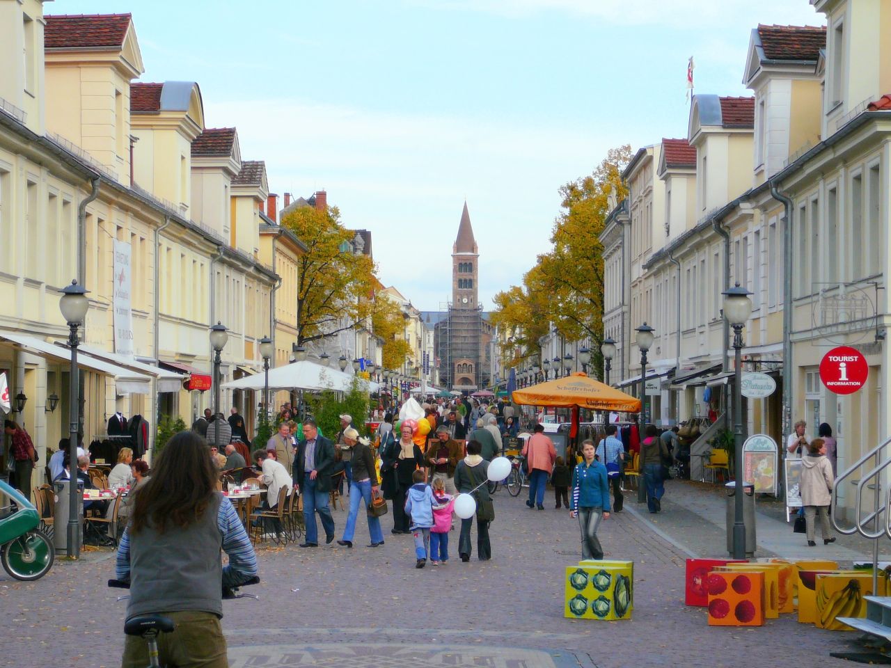

The capital, Potsdam

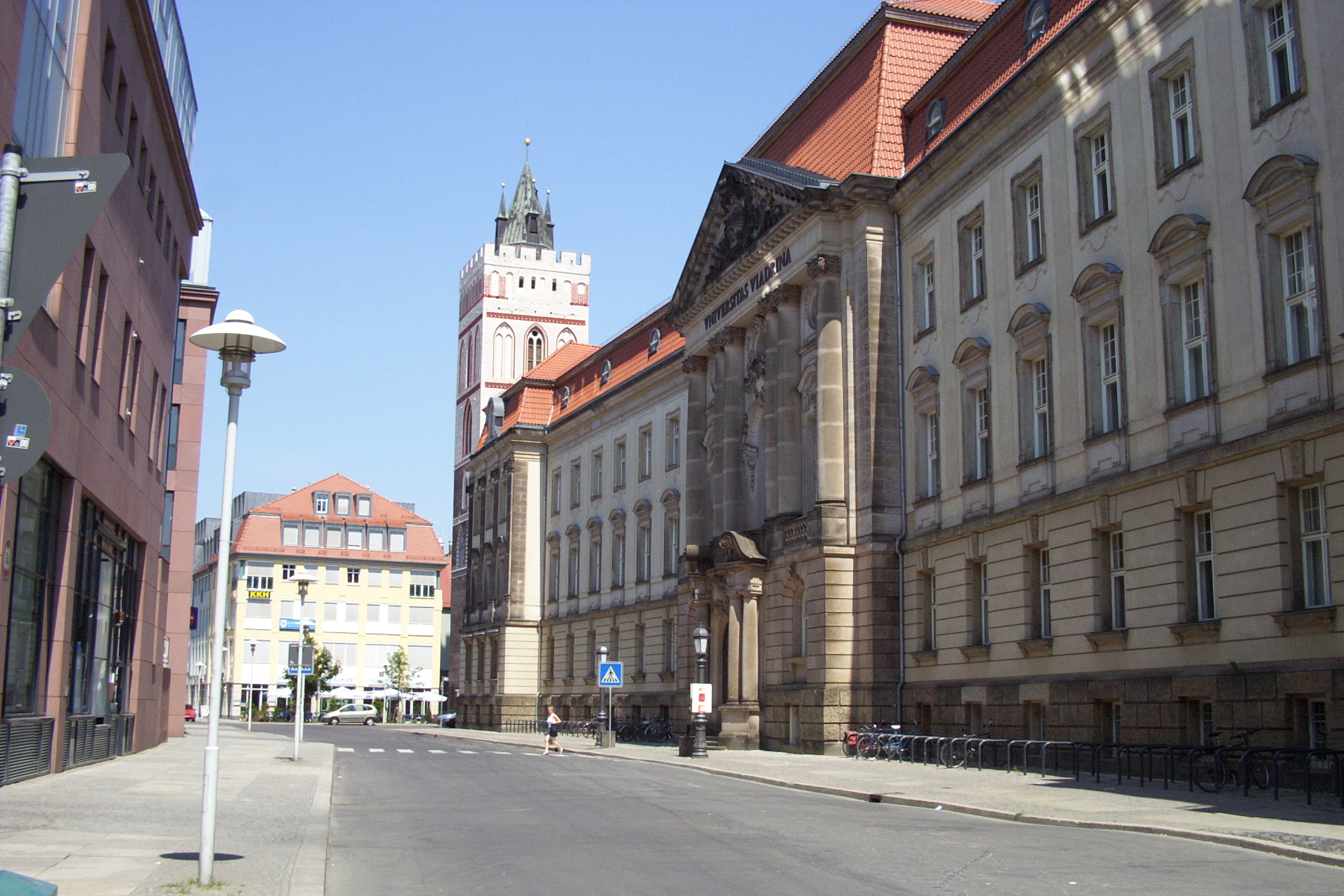

Viadrina European University in Frankfurt (Oder)
Brandenburg is divided into 14 rural districts (Landkreise):
|
|

and 4 urban districts (kreisfreie Städte):
- Brandenburg an der Havel
- Cottbus
- Frankfurt (Oder)
- Potsdam
Government[]


Matthias Platzeck
- For earlier rulers, see List of rulers of Brandenburg
- 1947 - 1949: Karl Steinhoff (SED, formerly SPD)
- 1949 - 1952: Rudolf Jahn (SED)
- 1990 - 2002: Manfred Stolpe (SPD)
- since 2002: Matthias Platzeck (SPD)
September 2009 state election[]
Template:Brandenburg state election, 2009
References[]
- ^ "Bevölkerung im Land Brandenburg am am 30. Dezember 2010 nach amtsfreien Gemeinden, Ämtern und Gemeinden. Gebietsstand: 31.12.2010" (in German). Amt für Statistik Berlin-Brandenburg. 31 December 2010. http://www.statistik-berlin-brandenburg.de//Publikationen/OTab/2011/OT_A01-04-00_124_201012_BB.pdf.
- ^ Barford, Paul M. (2001). The Early Slavs: Culture and Society in Early Medieval Eastern Europe. Ithaca: Cornell University Press. pp. 421. ISBN 0801439779.
- ^ Institut für Sorbische Volksforschung in Bautzen (1962). Lětopis Instituta za serbski ludospyt. Bautzen: Domowina.
- ^ Room, Adrian (2006). Placenames of the World. Jefferson: McFarland & Company. pp. 433. ISBN 0786422483.
- ^ Ländereinführungsgesetz (1990)
- ^ [1]
- ^ EKD http://www.ekd.de/download/kirchenmitglieder_2007.pdf
- ^ chiesa cattolica http://www.dbk.de/imperia/md/content/kirchlichestatistik/bev-kath-l__nd-2008.pdf
External links[]
| Wikisource has the text of the 1921 Collier's Encyclopedia article Brandenburg. |
- Official website (German)
- Brandenburg Tourist Board
- Historical Landscape Brandenburg (German)
| |||||||||||||

| ||||||||
Template:Silesia topics
| This page uses content from the English language Wikipedia. The original content was at Brandenburg. The list of authors can be seen in the page history. As with this Familypedia wiki, the content of Wikipedia is available under the Creative Commons License. |