| Main | Births etc |
|---|
| Boorowa | |
 Boorowa Court House | |

Boorowa | |
| Population: | 1070 [1] |
| Established: | 1843 |
| Postcode: | 2586 |
| Coordinates: | [2]Coordinates: [2] |
| LGA: | Boorowa Council |
| State District: | Burrinjuck |
| Federal Division: | Hume |
Boorowa is a farming town in the South West Slopes of New South Wales, Australia.[3] At the 2006 census, Boorowa had a population of 1,070 people.[1] It is located in a valley 243 km west of Sydney and 487 m above sea-level. The local government area surrounding the town, known as Boorowa Council, has a strong agricultural and mining base.
History[]
Prior to European settlement the area is thought to have been occupied by the Wiradjuri or Gandangara Indigenous Australians. It is believed that the name 'Burrowa', the original spelling, derives from the local aboriginal language and refers to a native bird the Plains Turkey.
The first European to travel through what is now Boorowa Shire was surveyor George Evans, in 1815. Unofficial occupation of the district began in 1821 with Irishmen Rodger Corcoran and Ned Ryan, both former convicts who had received their 'ticket of leave' from the Governor. The first land grant in the general area was issued to Thomas Icely in 1829. A mill was operating on the future town site of Boorowa by 1837, along with an inn and several houses.
Governor Gipps proposed the creation of a village named 'Burrowa' in 1842, to be located 9 km north-east of the present site at Kings Plains which had been surveyed in 1828. However, that spot proved unsuitable and the village was established on its present site in 1843. The early years in the district saw lawlessness and mayhem as a result of long running boundary disputes, theft of livestock and arson, even murders; the cause being remoteness and lack of law and order. Bushrangers roamed the surrounding unsettled wild mountainous land, making raids into the town and stations of the district.[4]

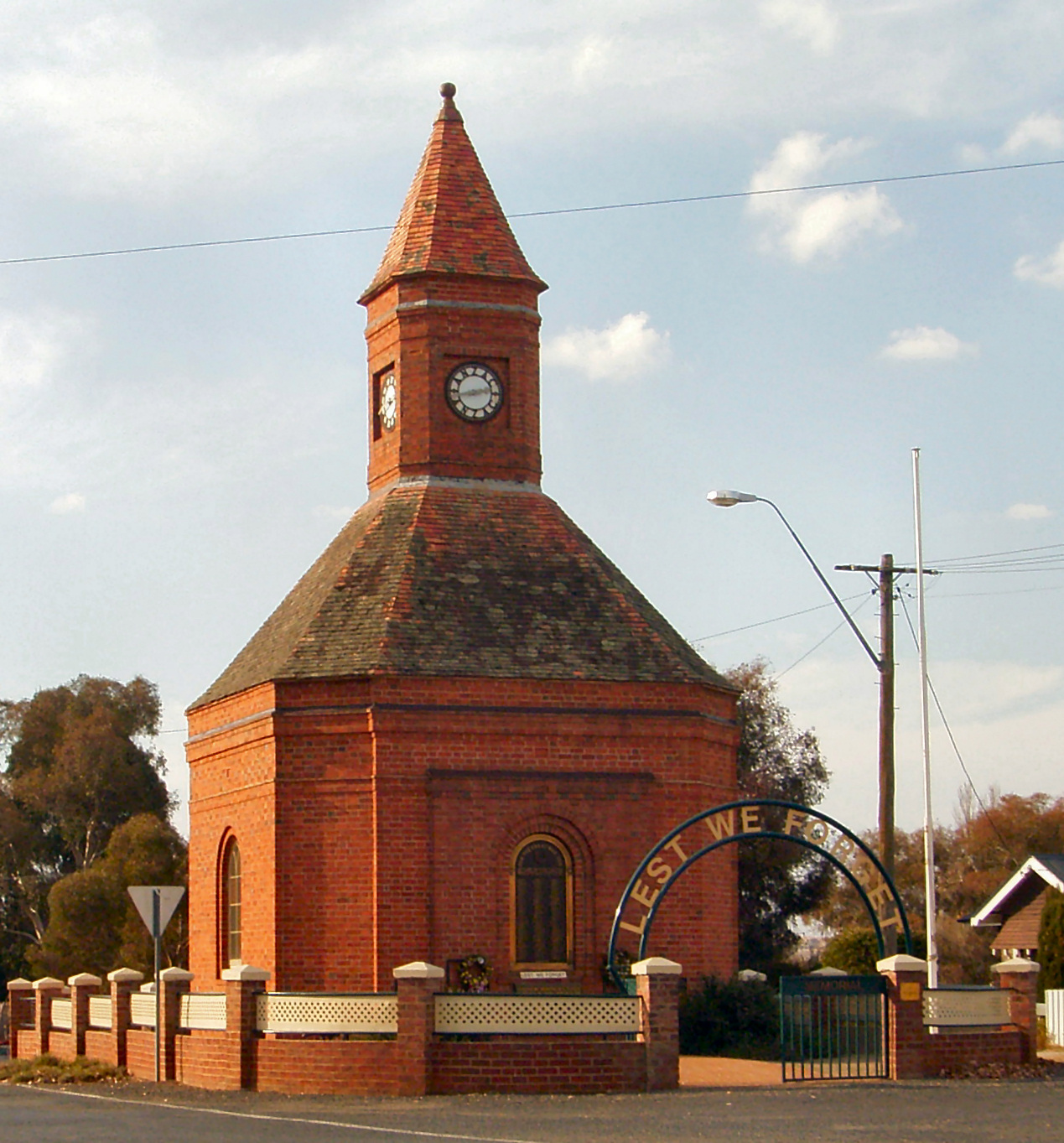
Anzac War Memorial, Marsden Street Boorowa, built in 1933
Squatters took up large tracts of land Boorowa area but the introduction of the Robertson Land Acts in 1861 resulted in a new land grab where large numbers of settlers, particularly 'ticket of leave' men, applied for a 'selection' of land with low cost land parcels available.
The district was given over to farming, although it received a push along when gold was found at Carcoar, Browns Creek and Kings Plains. Gold mines were established although copper and iron were also extracted. Samuel Marsden's copper mine operated until 1900.
Railway[]
Boorowa residents and the local member of parliament lobbied the Government to direct the new southern main line progressing towards Goulburn to pass through the town but the towns of Yass and Murrumburrah won the debate. The next best option was a branch line to the town and this lobbying lasted 40 years before the line was eventually constructed, opening for traffic on 10 October 1914.
The arrival of the railway in 1874 spurred on development and Burrowa's name was then changed to "Boorowa". Boorowa replaced Carcoar as the major service centre to local farmlands. It became a municipality in 1888. By the turn of the century a butter factory and freezing works were major employers in the town. Passenger trains ceased in 1980 and the Boorowa railway line from Galong to Boorowa closed in 1987.[5]
Infrastructure[]
The main infrastructure achievements over the 180 years that connected Boorowa to the rest of the Colony included the first Post Office and mail service in 1835, the electric telegraph in 1866, voice telephone in 1906, electric street lighting in the 1920s by the towns own generator, later the town and consumers were connected to the Burrinjuck Hydro electricity system in 1938.[5]
Environment[]
The town is located on the Boorowa River, a tributary of the Lachlan River. The Murrumbidgee River drains the southern portion of the Boorowa district. The soil in the area is rich volcanic soil washed down over millennia from an extinct volcano known as Mt Canemumbola.[5]
Events[]
- Boorowa's agricultural show is held in March.
- October long weekend - The "Running of the Sheep" down the main street of Boorowa during the Irish Woolfest.
Gallery[]
")
")
")
")
")
")
Footnotes[]
- ^ a b Australian Bureau of Statistics (25 October 2007). "Boorowa (Urban Centre/Locality)". 2006 Census QuickStats. http://www.censusdata.abs.gov.au/ABSNavigation/prenav/LocationSearch?collection=Census&period=2006&areacode=UCL112200&producttype=QuickStats&breadcrumb=PL&action=401. Retrieved 20 June 2009.
- ^ "Boorowa". Gazetteer of Australia online. Geoscience Australia, Australian Government. http://www.ga.gov.au/bin/gazd01?rec=39628. Retrieved 20 December 2009.
- ^ Boorowa Council's Community/Social Plan 2005 - 2010, 14 June 2006, p. 20, http://www.boorowa.nsw.gov.au/files/1379/File/Socialplanasat14june06.pdf
- ^ Lloyd, Helen, ‘160years’, Boorowa-over 160 years of white settlement, written by Helen V Lloyd, Toveloam Pty Ltd Press, 1990.
- ^ a b c "Boorowa-Argyle Country". Website. http://www.argylecounty.com.au/towns/boorowa.html. Retrieved 2012-01-24.
External links[]
 Media related to Boorowa, New South Wales at Wikimedia Commons
- Boorowa Shire Council web site
- Boorowa tourist information
- Boorowa Irish Woolfest
| |||||||||||
| This page uses content from the English language Wikipedia. The original content was at Boorowa. The list of authors can be seen in the page history. As with this Familypedia wiki, the content of Wikipedia is available under the Creative Commons License. |