| Main | Births etc |
|---|
| Blacksburg, Virginia | |
|---|---|
| — Town — | |
 |
|
 |
|
 |
|
| Coordinates: Coordinates: | |
| Country | United States |
| State | Virginia |
| County | Montgomery |
| Founded | 1798 |
| Government | |
| • Mayor | Ron Rordam |
| Area | |
| • Town | 19.89 sq mi (50.2 km2) |
| • Land | 19.89 sq mi (50.1 km2) |
| • Water | 0.04 sq mi (0.0 km2) 0.10% |
| Elevation | 2,080 ft (633 m) |
| Population (2010)[1] | |
| • Town | 42,620 |
| • Density | 2,142.5/sq mi (849.0/km2) |
| • Metro | 159,587 |
| Time zone | EST (UTC-5) |
| • Summer (DST) | EDT (UTC-4) |
| ZIP codes | 24060–24063 |
| Area code(s) | 540 |
| FIPS code | 51-07784[2] |
| GNIS feature ID | 1498405[3] |
| Website | http://www.blacksburg.gov/ |
Blacksburg is an incorporated town in Montgomery County, Virginia, United States, with a population of 42,620 at the 2010 census.
Blacksburg, Christiansburg, and Radford are the three principal jurisdictions of the Blacksburg-Christiansburg-Radford Metropolitan Statistical Area which encompasses those jurisdictions and all of Montgomery, Pulaski, and Giles counties for statistical purposes. The MSA has an estimated population of 159,587 [4] and is currently one of the faster-growing MSAs in Virginia. Blacksburg is dominated economically and demographically by the presence of Virginia Tech (Virginia Polytechnic Institute and State University), a Virginia land-grant university.
The town and Virginia Tech campus have a long tradition of safety and living satisfaction, despite the Virginia Tech shootings that occurred on April 16, 2007. In 2011, Businessweek named Blacksburg the "Best Place in the U.S. to Raise Kids".[5] Also in 2011, readers of Southern Living named Blacksburg the "Best College Town in the South".[6] Its public transportation system, Blacksburg Transit, which also connects to the neighboring town of Christiansburg, has repetitively received recognition for the quality of its service.[7] Blacksburg High School, which in 2013 unveiled its new state-of-the-art building,[8] is often ranked among the top schools of the nation for its academics, but its Soccer, Track, and Cross Country teams are also among the top in the state.
History[]
European discovery, founding (1671–1771)[]
In the mid-1600s, English colonists were still uncertain of what lay beyond the Allegheny Mountains, whose topography and possession by native inhabitants, Tutelo-speaking tribes, were a barrier to expanded settlement by the Colony of Virginia. Abraham Wood, who commanded Fort Henry on the frontier (now the site of Petersburg, Virginia), and operated an Indian trading post nearby, organized several expeditions to explore farther west. A passage over the ridge was finally found in 1671 when explorers Batts and Fallam, sent by Wood, reached the present-day location of Blacksburg, Virginia. Their expedition followed Stroubles Creek, through the current locations of the town and campus of Virginia Tech to what they named Wood's River.
They reported the area inhabited by the Monacan and Moneton, Siouan groups, but the Virginia legislature had authorized Wood to claim it. Accordingly, on September 17, 1671, the Batts and Fallam party claimed all of the lands comprising the river's drainage basin for King Charles II. However, the region was not yet open to English patent, and in 1700, Seneca warriors overran the entire area, driving out the Siouans. As early as 1718, the Iroquois had agreed to sell the parts they had conquered east of the Blue Ridge to the Virginia Colony. However, following another cession at the 1744 Treaty of Lancaster, there was a dispute over whether the new boundary was the Alleghenies or the Ohio River. The site of Blacksburg lay just within this disputed zone.
By the 1740s, the Wood's River Land Company, represented by Col. James Patton, gained a large tract of land within present-day southwest Virginia. Part of the tract became Montgomery County and Pulaski County and was sold to Virginian, Anglo-Irish, Scots-Irish, and English settlers as a reward for their services during the Spanish-Indian Wars and other wars. The Draper and Ingles families were among those who built their homes between present location of the campus and the subdivision of Hethwood. This came to become known as Draper's Meadow by 1748.
Because of its strategic location between the Indian nations, who alternately were allies of the French and British as it suited them, plus its location through gaps into the Alleghenies further west, the area's development was viewed with increasing apprehension by the French and their Indian allies. In July 1755, during the French and Indian War, hostile Shawnee Indians equipped and armed by France attacked the frontier outpost at Draper's Meadow, then still consisting of a small encampment with around twenty pioneer settlers. About four settlers were killed in the attacks, and five were taken captive to Kentucky by the Shawnee, among them Mary Draper Ingles, who later escaped. The memorial to Draper's Meadow massacre was dedicated on a bridge located near Duck Pond. By the end of the war, Draper's Meadow was deserted.[9][10]
By the Treaty of Easton (1758), and again by the Royal Proclamation of 1763, the Allegheny ridge separating the Mississippi and Chesapeake watersheds was made the official boundary between the colony and native peoples. It remained so until 1768, when native claims to the land including Blacksburg were cleared by the Treaty of Hard Labour with the Cherokee, and the Treaty of Fort Stanwix with the Six Nations. The Shawnee finally abandoned their claim to this territory in 1774 following Dunmore's War.
The Black family (1772–1797)[]
Samuel Black, whose family settled in Staunton, Virginia, bought 600 acres (2.4 km2) of land in the Draper’s Meadow area for his sons John and William in 1772. Smithfield Plantation, built in approximately 1774 by Col. William Preston,[10] sits on the original Draper's Meadow site, which is near the Duck Pond on the Virginia Tech campus.
When Samuel Black died in 1792, the land was evenly divided into two sections by his sons. The road now known as Draper Road is the dividing line between the sections. John Black's property covered the majority of the central campus of Virginia Tech, and William Black's property became most of the central downtown area of modern day Blacksburg.
In 1797, William laid out a small grid of streets and lots—16 blocks in all—on a portion of his land. The original town was limited to the area bounded by present-day Draper Road, Jackson Street, Wharton Street, and Clay Street.[9] The town logo contains 16 small squares that create a larger square, representing the original 16 square blocks that were a part of Black's design.
Blacksburg's establishment (1798–1870)[]
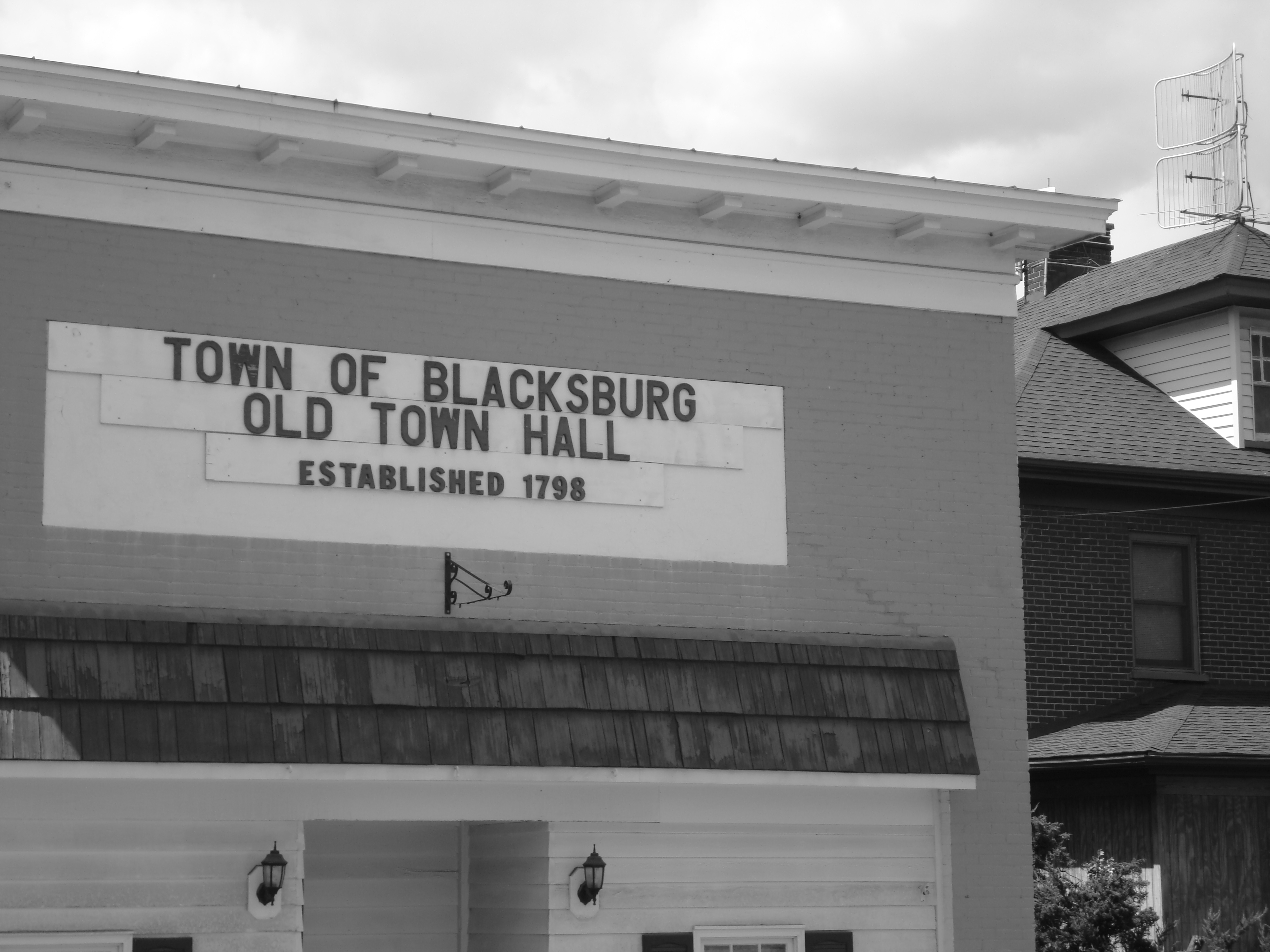

Blacksburg's old town hall


The downtown Post Office in Blacksburg
After Black petitioned the state legislature to establish a town at the site, the official establishment and founding of Blacksburg, Virginia was January 13, 1798 on the thirty-eight and three-quarter acre tract that he laid out. The following August 4, he signed over the deed to the town trustees.[9] The town was named after him in his honor.
In 1801, a log cabin was built, which went on to be the home of the future colonel of the 28th Virginia Infantry, Robert Preston[11] and two Virginia governors. The cabin, now known as "Solitude," is the oldest building on the Virginia Tech campus.[12]
According to records of the Post Office Department of the National Archives and Records Administration, the post office was established as "BLACKSBURGH" on April 8, 1827. The name was changed to the current spelling (without the "h") in 1893.[13]
Even though the Methodists had built two cabins to worship in since the town's founding, they did not build a more permanent structure until 1830, when a brick church was constructed.[14] The Presbyterians were the next Christian denomination to build a church within Blacksburg's limits. In 1848 they built their first brick building[15] at 117 South Main Street. Though still standing, this building has not been used as a church for many years.[14] It was once South Main Café,[16] but is currently Cabo Fish Taco.[17] It is also the oldest building on Main Street.[15] The Baptists founded the third oldest church in the town in 1852.[14]
In 1832, Westview Cemetery was established from a few acres of land that were deeded to trustees.[14]
One of the first educational establishments started here was the Blacksburg Female Academy in 1840.[16] The Olin and Preston Institute (re-charted as Preston and Olin Institute in 1869) was a Methodist-sponsored academy established in 1851.[18]
The first bank in Montgomery County, Blacksburg Savings Institution, was established in 1849.[16] The first newspaper published in Blacksburg was the Montgomery Messenger. Its first issue was released in 1869.[18]
Incorporation, modernization (1871–1951)[]
In 1871, the village that became known as Blacksburg was incorporated[13] and Thomas W. Jones became the first mayor.[19]
One year later, the Virginia Agricultural and Mechanical College opened its doors on October 2, 1872 with a faculty of three members.[13] The college grew and became known as Virginia Polytechnic Institute and State University, which shortly afterward became informally referred to as Virginia Tech.
A fire-fighting unit was organized within the university in 1899.[14] The town bought its first fire truck 43 years later.[16] The Blacksburg First Aid and Life Saving Crew was founded in 1951 and renamed Blacksburg Volunteer Rescue Squad in as another addition to the growing amount of emergency services.[16]
The first automobile came through the town in 1901. Three years later the train entered Blacksburg from Christiansburg using the Virginia Anthracite & Coal Railroad, which later became known as the "Huckleberry."[20] Traffic in Blacksburg increased sufficiently enough that by January 1913 the town voted against allowing cows to continue to roam in town. The first filling station was opened in 1919 and at the time was the only one between Roanoke, Virginia and Bluefield, West Virginia.[20] The town's first landing strip was built in 1929 and was 1,800 feet (548.64 m) in length. The grass landing strip was given airport status in 1931 and later became Virginia Tech Airport. Local buses began to make their rounds for the first time in 1947.[16]
The town's first theater was built in 1909. It was a precursor to the Lyric Theatre on College Avenue.[21]
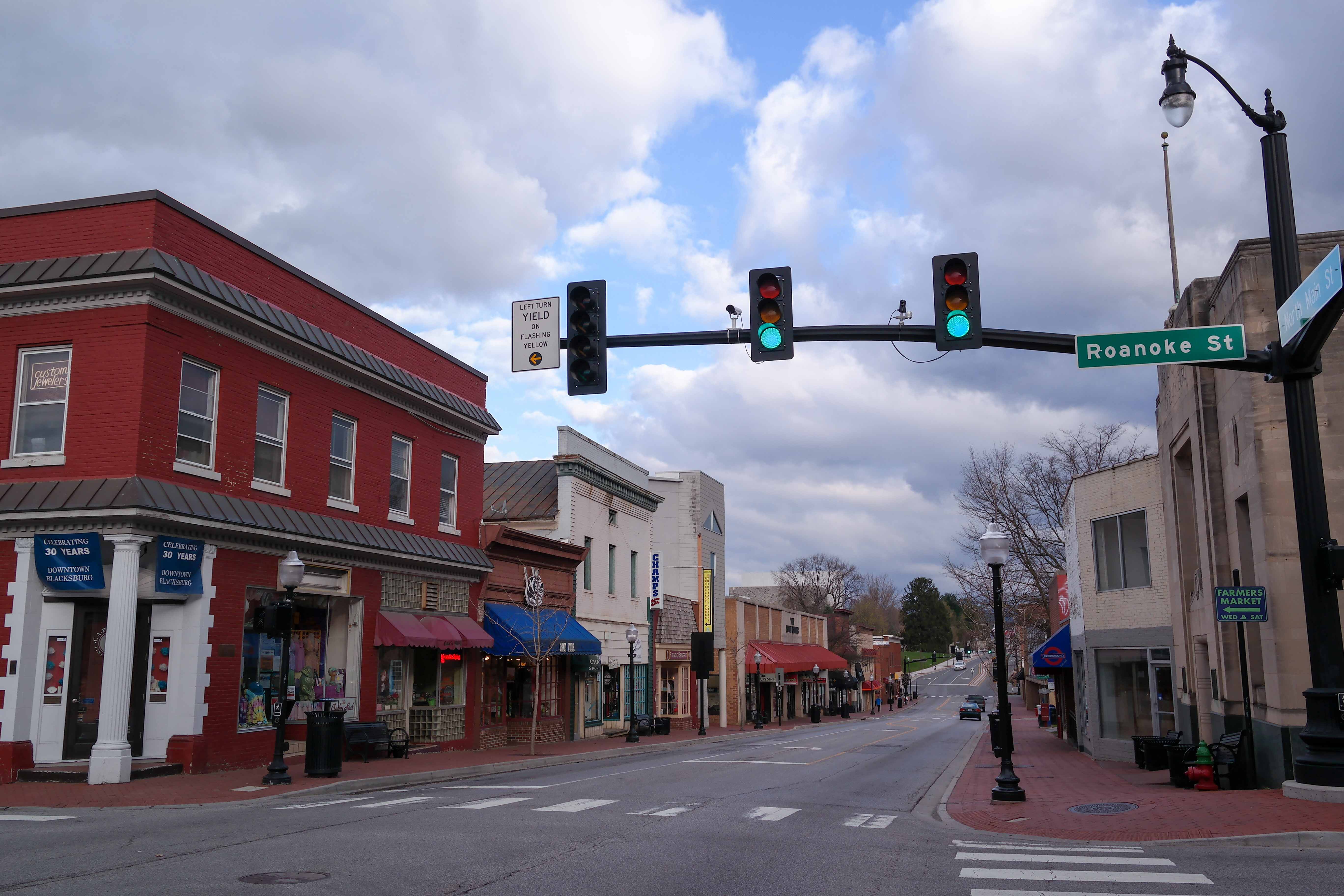
In the spring of 1935, Main Street was strung with ten street lights from Roanoke Street northward to the top of the hill, where it now intersects the Alumni Mall. By October the town's second stoplight was installed on Main Street at Roanoke Street and was synchronized with the original one at Main and College.[20] The establishment of official law enforcement began in 1937 when Officer Dave "Highpockets" Sumner became the first Blacksburg police officer. The first police car was purchased nine years later.[16]
Compulsory education and commercialization (1952–1992)[]

Main Street
Blacksburg experienced a boost of compulsory education during the second half of the 20th century. Even though there had been a place for secondary education somewhere in town since 1906, it was not until 1952 when the first official location for Blacksburg High School was built on South Main and Eheart Streets which became the eventual site of Blacksburg Middle School. That same year, all high schools in Montgomery County began operating on a twelve-grade basis which is still county policy to this day.[22]
The Margaret J. Beeks Elementary School and the Gilbert F. Linkous Elementary School were both completed in 1963 and Harding Avenue Elementary School was built in 1972.[16] Two years later, in 1974, Blacksburg High School moved its location to Patrick Henry Drive after 20 years of issues with overcrowding in its previous location.[22]
Jack Goodwin was appointed the first chief of police by the Blacksburg Town Council in 1954. Jan Olinger was made the first female police officer in 1976.[16]
1958 marked the beginning of the end for the railroad that came to be known as the "Huckleberry." Passenger service came to an end on July 25. On June 30, 1966 the last freight train arrived at the Blacksburg depot. Within 24 hours, the depot was closed, the empty cars were picked up, and the tracks were immediately removed.[20] After years of effort by the citizens of the town a trail was constructed on the former railroad right-of-way and, after years of construction, funding and planning issues the Huckleberry Trail was opened to the public on December 1, 1998. 190 years after its original construction, the newly renovated Smithfield Plantation house was re-opened in 1964.[16]
The amount of commercialization in the area began to increase in the mid-1960s. An important opening that occurred was the Corning Glass Works (now called Corning Incorporated) facility in 1964 which is located south of Blacksburg. The Blacksburg Municipal Building on South Main Street was constructed in 1969.[16] Terrace View apartments, the first large student complex, was built in 1970. The Blacksburg Branch of the Montgomery County Library was opened the same year. Ten years later, it was moved into the facility that used to house the Blacksburg Lumber Company on Draper Road. In 1971, Blacksburg ratified a new charter and Montgomery Regional Hospital was built. The University Mall shopping center opened that year as well. During 1981, the Blacksburg Community Center opened. It cost the town $1.2 million to build.[16] By 1988, the New River Valley Mall, located in the neighboring town of Christiansburg, was opened[20] and the Virginia Tech Corporate Research Center had its first ground-breaking ceremony.[18]
After construction of Virginia's portion of Interstate 81 began in 1957, it took about nine years until the segment that ran alongside the town was opened in November 1965.[23] About half that amount of time passed before the U.S. Route 460 bypass opened in 1969.[16]
In the 1970s, Virginia Tech was annexed into the town and other land area was also brought in. The population grew from 9,000 people to 30,000 during this decade. Replacing the old public bus system, Blacksburg Transit began running in 1983.[24]
Information age (1993–present)[]
Blacksburg is the site of the Blacksburg Electronic Village or BEV, conceived as a computer networking project of Virginia Tech in 1991 and officially born in 1993 as a way to link the town together using the Internet. This project quickly ushered the town into what is being called the Information Age.
In 1994, Montgomery County Public Schools completed construction of Kipps Elementary School at 2801 Prices Fork Road. [16] By this time, Blacksburg had five elementary schools, a middle school, and a high school.[22] A newly renovated Blacksburg branch library was opened in 1996.[16]
After 24 years of abandonment and six years of planning and construction, the first phase of the Huckleberry Trail built on the old Huckleberry railbed opened in 1996. The second phase of construction was completed in 1998.[16]
On July 8, 1997, ground was broken for the experimental "Smart Road" project. The second phase of construction was completed in 2002.[25] The road is currently closed to the public and used as a research test bed for the Virginia Tech Transportation Institute. A National Weather Service office is located in Blacksburg and serves most of southwestern Virginia, southeast West Virginia, and northwest North Carolina.
In 2003, the new building for Blacksburg Middle School students opened on Prices Fork Road adjacent to the property housing Kipps Elementary School.
On April 16, 2007, Seung-Hui Cho shot 32 people dead and injured an additional 17 in the Virginia Tech shooting before committing suicide. The massacre is the deadliest mass shooting on a college campus since the Texas Clock Tower Massacre in 1966, and also the deadliest mass shooting committed by a lone gunman in U.S. history.
On February 13, 2010 following a snowstorm which dropped two feet of snow on the area, the gymnasium roof on the previously occupied Blacksburg High School suffered a catastrophic structural failure and collapsed, causing structural damage to other areas of the school. The school building was condemned and students attended night school on a split schedule with the Blacksburg Middle School students at their school for the remainder of the year. It was determined that repair costs would exceed $18 million and would not be feasible given the age of the school; it was decided not to repair the building. Before the school year of 2013-14 Blacksburg High School was operating on a normal schedule out of the Blacksburg Middle School building on 3109 Prices Fork Road, and the middle schoolers were going to school in the old Christiansburg Middle School. The original Blacksburg High School building was vacant until it was demolished in the Summer of 2011. The newly constructed school building of Blacksburg High School which opened for the 2013 fall semester is located at 3401 Bruin Lane, behind the current Blacksburg Middle School and Bill Brown Football Stadium. [8]
Geography[]


Overlooking Blacksburg
According to the United States Census Bureau, the town has a total area of 19.89 square miles (51.5 km2) of which 19.89 square miles (51.5 km2) is land and 0.04 square miles (0.10 km2), or 0.10%, is water. Blacksburg is situated atop the Eastern Continental Divide at 2,080 feet (634 m) above sea level. It is the 15th largest municipality[26] and the largest town in the commonwealth of Virginia.[27] The Eastern Continental Divide traverses the Virginia Tech Montgomery Executive Airport.
The tallest building in Blacksburg is Slusher Tower, a twelve story residence hall on the Virginia Tech campus. The building with the highest elevation is actually Lee Hall, another residence hall, which until May 17, 2009 was home to the transmitter of campus radio station WUVT. The tower for WUVT now sits atop Price Mountain.[28]
Climate[]
Due to its elevation, the climate of Blacksburg is either classified as mountain temperate or humid continental (Köppen Cfb or Dfb, respectively). Summers are warm and humid, although significantly cooler than low-elevation places within the state, with only 4.4 days of 90 °F (32 °C)+ highs annually, and winters are generally cool to cold with occasional intervening warm periods and 9 nights of sub-10 °F (−12 °C) lows. Monthly mean temperatures range from 31.5 °F (−0.3 °C) in January to 71.2 °F (21.8 °C) in July. Snowfall averages 25.4 inches (65 cm) per season and generally occurs from December to March.
| Climate data for Blacksburg, Virginia (1981–2010 normals, extremes 1952–present) | |||||||||||||
|---|---|---|---|---|---|---|---|---|---|---|---|---|---|
| Month | Jan | Feb | Mar | Apr | May | Jun | Jul | Aug | Sep | Oct | Nov | Dec | Year |
| Record high °F (°C) | 75 (24) |
75 (24) |
85 (29) |
95 (35) |
90 (32) |
95 (35) |
99 (37) |
99 (37) |
96 (36) |
88 (31) |
82 (28) |
75 (24) |
99 (37) |
| Average high °F (°C) | 41.5 (5.3) |
44.9 (7.2) |
53.3 (11.8) |
63.3 (17.4) |
71.4 (21.9) |
78.9 (26.1) |
82.2 (27.9) |
81.4 (27.4) |
75.3 (24.1) |
65.4 (18.6) |
55.5 (13.1) |
43.8 (6.6) |
63.2 (17.3) |
| Average low °F (°C) | 21.4 (−5.9) |
23.6 (−4.7) |
29.8 (−1.2) |
38.2 (3.4) |
47.2 (8.4) |
56.5 (13.6) |
60.1 (15.6) |
58.7 (14.8) |
51.0 (10.6) |
39.3 (4.1) |
31.0 (−0.6) |
23.8 (−4.6) |
40.1 (4.5) |
| Record low °F (°C) | −18 (−28) |
−12 (−24) |
2 (−17) |
14 (−10) |
23 (−5) |
30 (−1) |
41 (5) |
36 (2) |
22 (−6) |
13 (−11) |
0 (−18) |
−10 (−23) |
−18 (−28) |
| Precipitation inches (mm) | 3.08 (78.2) |
2.81 (71.4) |
3.64 (92.5) |
3.48 (88.4) |
4.33 (110) |
4.00 (101.6) |
4.26 (108.2) |
3.59 (91.2) |
3.10 (78.7) |
2.78 (70.6) |
2.87 (72.9) |
2.95 (74.9) |
40.89 (1,038.6) |
| Snowfall inches (cm) | 8.1 (20.6) |
7.5 (19.1) |
3.7 (9.4) |
0.7 (1.8) |
0 (0) |
0 (0) |
0 (0) |
0 (0) |
0 (0) |
0 (0) |
.5 (1.3) |
4.9 (12.4) |
25.4 (64.5) |
| Avg. precipitation days (≥ 0.01 in) | 10.7 | 10.6 | 11.3 | 12.2 | 13.5 | 11.4 | 12.7 | 10.5 | 8.9 | 8.6 | 9.1 | 10.6 | 130.1 |
| Avg. snowy days (≥ 0.1 in) | 3.6 | 4.2 | 2.0 | 0.6 | 0 | 0 | 0 | 0 | 0 | 0 | 0.7 | 2.6 | 13.7 |
| Source: NOAA[29] | |||||||||||||
Transportation[]
Blacksburg is served primarily by US 460 and I-81, both major arteries for travel in the region. The two roads, together with State Route 114, US 11, and State Route 8 provide the major highway infrastructure for the developing area. The Virginia Tech Transportation Institute is currently working with the Virginia Department of Transportation to build the Virginia Smart Road which will connect Blacksburg directly to I-81, thus significantly decreasing the travel time between Blacksburg and its larger metro neighbor, Roanoke. The road, together with the current US 460, will create a loop around Blacksburg, thus alleviating current traffic congestion on US 460 and aiding further development of the area.
Blacksburg Transit (BT) provides bus transportation primarily to and from the campus of Virginia Tech. Students and faculty ride the BT fare free with a flat payment included in the cost of tuition. Virginia Tech subsidizes BT for this service. Transportation is available to anyone for a fee, and during special events the service is often free. Blacksburg Transit also offers shuttle service to non-students on Virginia Tech Football game days for a $5.00 fee to be transported from outlying parking areas to the stadium.[30]
The Smart Way Bus, a regional commuter bus service operated by Valley Metro (Roanoke), provides connecting service between Virginia Tech, downtown Blacksburg, Christiansburg, Virginia, the Roanoke Regional Airport, Roanoke, Virginia, and Lynchburg, Virginia where riders can transfer to Amtrak. Fare is $4.00 one way.
Uhaul Car Share, a subsidiary of U-Haul, offers a carsharing service around the Virginia Tech campus. The Virginia Tech Montgomery Executive Airport serves Blacksburg and the Virginia Tech campus for general aviation.
Demographics[]
| Historical populations | |||
|---|---|---|---|
| Census | Pop. | %± | |
| 1880 | 688 | ||
| 1900 | 768 | ||
| 1910 | 875 | 13.9% | |
| 1920 | 1,095 | 25.1% | |
| 1930 | 1,406 | 28.4% | |
| 1940 | 2,133 | 51.7% | |
| 1950 | 3,358 | 57.4% | |
| 1960 | 7,070 | 110.5% | |
| 1970 | 9,384 | 32.7% | |
| 1980 | 30,638 | 226.5% | |
| 1990 | 34,590 | 12.9% | |
| 2000 | 39,573 | 14.4% | |
| 2010 | 42,620 | 7.7% | |
| Est. 2014 | 43,985 | [31] | 11.1% |
As of the census[2] of 2000, there were 39,573 people, 13,162 households, and 4,777 families residing in the town. The population density was 2,044.2 people per square mile (789.2/km²). There were 13,732 housing units at an average density of 709.4 per square mile (273.9/km²). The racial makeup of the town was 84.39% White, 4.39% African American, 0.11% Native American, 7.80% Asian, 0.06% Pacific Islander, 0.90% from other races, and 2.36% from two or more races. Hispanic or Latino of any race were 2.32% of the population.
There were 13,162 households out of which 16.3% had children under the age of 18 living with them, 28.7% were married couples living together, 5.3% had a female householder with no husband present, and 63.7% were non-families. 26.6% of all households were made up of individuals and 3.7% had someone living alone who was 65 years of age or older. The average household size was 2.37 and the average family size was 2.79.
In the town the population was spread out with 9.7% under the age of 18, 57.4% from 18 to 24, 18.9% from 25 to 44, 9.2% from 45 to 64, and 4.9% who were 65 years of age or older. The median age was 22 years. For every 100 females there are 127.0 males. For every 100 females age 18 and over, there were 129.7 males.
The median income for a household in the town was $22,513, and the median income for a family is $51,810. Males had a median income of $37,129 versus $24,321 for females. The per capita income for the town is $13,946. About 15.9% of families and 43.2% of the population were below the poverty line, including 23.7% of those under the age of 18 and 6.1% ages 65 or older.
The Metropolitan Statistical Area (MSA), which includes the town of Christiansburg, the independent city of Radford, and all of Montgomery, Pulaski, and Giles counties has an estimated population of 157,614 and is currently one of the faster-growing MSAs in Virginia.
About 87% of the town's residents have in-home Internet access with 65% using a broadband connection.[26] Eighty-five percent of the community has a college education,[26] seventy percent of which were graduates of Virginia Tech.
Economy[]
The Virginia Tech Corporate Research Center is home to several companies of varying sizes including Honeywell, and the National Weather Service which maintains its Southwestern Virginia headquarters there. The town is also home to MOOG, a major contractor for the defense department and the health care industry and Rackspace, who acquired locally based Mailtrust/Webmail.us in 2007. The town and county continue to recruit major industry to the area. Due to its close proximity to Virginia Tech and Radford University, Blacksburg is an ideal location for developing high tech industry.
Top employers[]
According to Blacksburg's 2012 Comprehensive Annual Financial Report,[33] the top employers in the city are:
| # | Employer | # of Employees |
|---|---|---|
| 1 | Virginia Tech | 14,688 |
| 2 | Virginia Tech Corporate Research Center | 2,200 |
| 3 | Moog | 1,168 |
| 4 | Montgomery Regional Hospital | 537 |
| 5 | Federal-Mogul | 330 |
| 6 | United Pet Group | 240 |
| 7 | Wolverine Advanced Materials | 175 |
| 8 | Luna Innovations | 92 |
| 9 | NanoSonic | 69 |
| 10 | VTLS | 60 |
Notable people[]
- Marc Edwards, civil engineering/environmental engineer and professor
- John B. Floyd, Governor of Virginia, U.S. Secretary of War, and Confederate general in the American Civil War
- Patri Friedman, activist and theorist of political economy
- Nikki Giovanni, poet
- Marjorie Glicksman Grene, philosopher
- Henry Lee Lucas, criminal
- Thomas M. Price, American architect
- Bob Roop, American heavyweight Greco-Roman wrestler
- Eric Schmidt, former Google CEO
- Brandon Stokley, NFL wide receiver for the Denver Broncos
- Wild Nothing, indie dream pop act
- Josh Kaufman, Season 6 winner of NBC's vocal competition show The Voice[34]
- Engine Down, rock band
- Frank Beamer, Head Football Coach Virginia Tech
- Marty Smith, ESPN TV Reporter/Radio Host/Writer
Points of interest[]


Blacksburg is the home of Virginia Tech
- 16 Squares[35]
- Alexander Black House [36]
- Armory Art Gallery
- Blacksburg Farmers Market[37]
- Caboose Park Recreation
- Edward Via College of Osteopathic Medicine
- Hahn Horticulture Garden
- Huckleberry Trail
- Lyric Theatre[38]
- Smithfield Plantation
- Virginia Polytechnic Institute and State University (Virginia Tech)
Annual town events[]
Downtown Blacksburg during the annual Gobblerfest street fair.
- The International Street Fair & Parade held in Blacksburg takes place on the first Saturday of every April. Over 110 countries are represented by the student body of Virginia Tech and individuals from the community during the festival. College Avenue is closed for food and craft booths and the stage features an eclectic mix of melodies and musical performances from around the world.[39]
- Steppin' Out, the town's first annual street festival, has taken place on the first Friday and Saturday of every August since 1976 when it was known as the Deadwood Days Summer Festival.[16] The festival's name was changed in 1980. Steppin' Out features over 150 artists and crafts people from around the United States selling unique handcrafted items, local merchants holding final clearance sidewalk sales, local restaurants selling food through outdoor vending, multiple stages for live performances, and fun for the entire family. The area from North Main Street and Alumni Mall (sometimes even more to the north) to South Main Street and Roanoke Street and Draper Road and Lee Street is designated for the festival. The Draper Mile Run, which was started in 1982, is a one-mile (1.6 km) road race for runners of all ages that is held annually during the first evening of the festival.[40]
- Summer Solstice Fest takes place on the Saturday afternoon/evening closest to the solstice. Downtown Blacksburg Inc. organizes the event, which includes live music, vendors, a dog parade and 5k race.
References[]
- ^ "U.S. Census Bureau, State & County QuickFacts: Blacksburg (town), Virginia". Quickfacts.census.gov. http://quickfacts.census.gov/qfd/states/51/5107784.html. Retrieved January 2, 2013.
- ^ a b "American FactFinder". United States Census Bureau. http://factfinder2.census.gov. Retrieved 2008-01-31.
- ^ "US Board on Geographic Names". United States Geological Survey. 2007-10-25. http://geonames.usgs.gov. Retrieved 2008-01-31.
- ^ "Table 1. Annual Estimates of the Population of Metropolitan and Micropolitan Statistical Areas: April 1, 2000 to July 1, 2008 (CBSA-EST2008-01)" (CSV). 2008 Population Estimates. United States Census Bureau, Population Division. March 19, 2009. http://www.census.gov/popest/metro/tables/2009/CBSA-EST2009-01.xls. Retrieved October 19, 2011.
- ^ "Virginia Town is Best Place in the U.S. to Raise Kids". Businessweek. November 15, 2011. http://www.businessweek.com/lifestyle/virginia-town-is-best-place-in-the-us-to-raise-kids-11152011.html. Retrieved September 19, 2012.
- ^ "Around the College Town: Blacksburg – Southern Pigskin: The Leading Name in Southern College Football Coverage". Southern Pigskin. http://www.southernpigskin.com/ACC/view/around-the-college-town-blacksburg. Retrieved September 19, 2012.
- ^ "The Voice of Public Transportation in Virginia". Virginia Transit Association. http://www.vatransit.com/files/awards/index.htm. Retrieved November 9, 2013.
- ^ a b "Blacksburg High School Dedication". WSLS10. October 6, 2013. http://www.wsls.com/story/23622019/blacksburg-high-school-dedication. Retrieved November 9, 2013.
- ^ a b c "Blacksburg: A Brief Early History | Virginia Tech". Vt.edu. http://www.vt.edu/where_we_are/blacksburg/blacksburg-history.html. Retrieved January 2, 2013.
- ^ a b Historic Smithfield: History and Research Resources
- ^ Robert Preston papers
- ^ "Solitude". Spec.lib.vt.edu. http://spec.lib.vt.edu/archives/solitude. Retrieved January 2, 2013.
- ^ a b c "Virginia Tech's 125th Anniversary: Blacksburg Was Incorporated Year Before Virginia Tech Opened Doors". Spec.lib.vt.edu. http://spec.lib.vt.edu/bicent/recoll/altman76.htm. Retrieved January 2, 2013.
- ^ a b c d e "A Special Place for 200 Years: Blacksburg Social Life and Customs". Spec.lib.vt.edu. http://spec.lib.vt.edu/bicent/recoll/histbook/bodell.htm. Retrieved January 2, 2013.
- ^ a b Blacksburg Presbyterian: BPC History.
- ^ a b c d e f g h i j k l m n o p q "Blacksburg Bicentennial: Timeline". Spec.lib.vt.edu. October 26, 1998. http://spec.lib.vt.edu/bicent/timeline/bburtime.htm. Retrieved January 2, 2013.
- ^ "New River Valley Dining Guide – Blacksburg Restaurants in Blacksburg Virginia". Nrvdining.com. http://www.nrvdining.com/content/view/12/26/#mexican. Retrieved January 2, 2013.
- ^ a b c "A Special Place for 200 Years: Business and Industry in Blacksburg". Spec.lib.vt.edu. http://spec.lib.vt.edu/bicent/recoll/histbook/chapter10.htm. Retrieved January 2, 2013.
- ^ a b c d e "A Special Place For 200 Years: Blacksburg Transported". Spec.lib.vt.edu. http://spec.lib.vt.edu/bicent/recoll/histbook/chapter7.htm. Retrieved January 2, 2013.
- ^ "History of Lyric". Spec.lib.vt.edu. http://spec.lib.vt.edu/specgen/lyr/lyrhist.htm. Retrieved January 2, 2013.
- ^ a b c "A Special Place for 200 Years: Blacksburg Educates Its Children". Spec.lib.vt.edu. http://spec.lib.vt.edu/bicent/recoll/histbook/educat.htm. Retrieved January 2, 2013.
- ^ "Economic Development History of Interstate 81 in Virginia". Fhwa.dot.gov. http://www.fhwa.dot.gov/planning/econDev/i81va.htm. Retrieved January 2, 2013.
- ^ "Blacksburg Transit – BT History". Btransit.org. http://www.btransit.org/cms.php/general_info/history.html. Retrieved January 2, 2013.
- ^ "History of the Smart Road". Virginiadot.org. http://www.virginiadot.org/projects/constsal-smartrdhistory.asp. Retrieved January 2, 2013.
- ^ a b c Campus & Town Guide: Virginia Tech and the Town of Blacksburg.
- ^ "Welcome to Blacksburg! | Virginia Tech". Vt.edu. http://www.vt.edu/where_we_are/blacksburg. Retrieved January 2, 2013.
- ^ "WUVT to Operate at Reduced Power Starting Sunday". Wuvt.vt.edu. http://www.wuvt.vt.edu/News/Latest/WUVT-Operating-at-Reduced-Power-Starting-Sunday-May-18. Retrieved January 2, 2013.
- ^ "Station Name: VA BLACKSBURG NWSO". National Oceanic and Atmospheric Administration. ftp://ftp.ncdc.noaa.gov/pub/data/normals/1981-2010/products/station/USC00440766.normals.txt. Retrieved 2013-03-14.
- ^ "Town of Blacksburg, VA : Game Day Service: Football". Blacksburg.gov. August 23, 2012. http://www.blacksburg.gov/index.aspx?page=1018. Retrieved September 19, 2012.
- ^ "Annual Estimates of the Resident Population for Incorporated Places: April 1, 2010 to July 1, 2014". http://www.census.gov/popest/data/cities/totals/2014/SUB-EST2014.html. Retrieved June 4, 2015.
- ^ "Census of Population and Housing". Census.gov. http://www.census.gov/prod/www/decennial.html. Retrieved June 4, 2015.
- ^ City of Blacksburg CAFR
- ^ NBC's The Voice Official Website
- ^ "Community Design Assistance Center". http://www.cdac.arch.vt.edu/16Squares.html.
- ^ Gangloff, Mike (August 6, 2014). "Welcome back, Black House, Blacksburg says". The Roanoke Times. http://www.roanoke.com/news/local/blacksburg/welcome-back-black-house-blacksburg-says/article_9942dcf0-eca9-52e5-b4d7-1576fae5d544.html. Retrieved 3 June 2015.
- ^ "Blacksburg renovates its farmers market". The Roanoke Times. May 23, 2009. http://www.roanoke.com/webmin/opinion/blacksburg-renovates-its-farmers-market/article_15131dc8-2784-5d2d-8a7f-3fd87506e703.html.
- ^ "Lyric Theatre website". Thelyric.com. April 2, 2011. http://www.thelyric.com/. Retrieved January 2, 2013.
- ^ "Events". Downtownblacksburg.com. http://www.downtownblacksburg.com/events.html. Retrieved January 2, 2013.
- ^ "Steppin' Out". Downtownblacksburg.com. http://www.downtownblacksburg.com/steppinout.html. Retrieved January 2, 2013.
External links[]
| ||||||||||||||||||||

| |||||||

| This page uses content from the English language Wikipedia. The original content was at Blacksburg, Virginia. The list of authors can be seen in the page history. As with this Familypedia wiki, the content of Wikipedia is available under the Creative Commons License. |