| ||||||||||||||
| Balasore | |
|---|---|
| — District — | |
 |
|
| Nickname(s): Granary of Orissa | |
 |
|
| Coordinates: Coordinates: | |
| Country | |
| State | Orissa |
| Headquarters | Balasore |
| Area | |
| • Total | 3,634 km2 (1,403 sq mi) |
| Elevation | 90.08 m (295.54 ft) |
| Population (2011) | |
| • Total | 2,317,419 |
| • Rank | 4 |
| • Density | 609/km2 (1,580/sq mi) |
| Languages | |
| • Official | Oriya, Hindi, English |
| Time zone | IST (UTC+5:30) |
| PIN | 756 xxx |
| Telephone code | 06782 |
| Vehicle registration | OD-01 |
| Coastline | 81 kilometres (50 mi) |
| Nearest city | Bhubaneswar |
| Sex ratio | 957 ♂/♀ |
| Literacy | 80.66% |
| Climate | Aw (Köppen) |
| Precipitation | 1,583 millimetres (62.3 in) |
| Avg. summer temperature | 43.1 °C (109.6 °F) |
| Avg. winter temperature | 10.6 °C (51.1 °F) |
| Website | baleswar.nic.in |
| General Information | |
|---|---|
| Subdivisions: | 2 |
| Blocks: | 12 |
| Towns: | 4 |
| Municipalities: | 1 |
| N.A.C.: | 3 |
| Tehsils: | 7 |
| Grama panchayat: | 289 |
| Villages: | 2971 |
| Coast line: | 81 km |
Balasore District, also known as Baleswar District or Baleshwar District, is an administrative district of Orissa state in eastern India. The lingua franca is Oriya. The coastal district is known for its beautiful mountains and famous temples. Balasore is a place of scenic beauty and a major tourist attraction, also because of its historical monuments and temples. There are a few hill ranges in the region too.
It is now a launch station for sounding rockets on the east coast of India in Orissa state at 21°18' N and 86°36' E. Balasore has been in use since 1989, but unlike Sriharikota, it is not used for launching satellites. The rocket launching site at Balasore is situated in a place called Chandipur located on the Bay of Bengal. The Interim Test Range in Chandipur, Balasore is responsible for carrying out tests for various missiles such as Agni, Prithvi, Trishul etc.
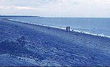
Balasore Railway Station falls en route on the main line connecting Chennai to Kolkata. Road connectivity wise, National Highway-5 runs through Balasore. It is 212 km north-east of Bhubaneswar by road. Chandipur-on-sea is a sea resort famous for its mile long shallow beaches. Chandipur on sea is one of the shallowest sea beaches in the world. It is a unique beach, the tide comes to the shore only four times a day, at determined intervals. Among other tourist attractions is the 18th century kshirochora-gopinath temple, famous for its mythological story, how the temple was built there.
Birthplace of linguist and novelist Fakir Mohan Senapati, considered to be the saviour of modern Oriya language and an eminent freedom fighter. Also birthplace of famous Oriya poet Kabibar Radhanath Roy.
History[]
Balasore district was a part of the ancient Kalinga and later became a territory of Toshala or Utkal, till the death of Mukunda Dev. It was annexed by Mughals in 1568 and remained as a part of their suzerainty up to 1750-51. Subsequently, the Marathas of Nagpur occupied this part of Orissa and it came under the dominion of the Maratha Rajas. In 1803, this part was ceded to The British East India Company through the Treaty of Deogaon and it became a part of Bengal Presidency until 1912. But the first English Settlement came into existence in Balasore region in 1634 while Shah Jahan was the emperor at Delhi. The region was an early trading port for British, French and Dutch ships in the early age of Enlightenment and became a colonial part of first Danish India and later British India. The first of English factories was established in this region in 1640. During this period Dutch and Danish settlements were also found in this region.
Balasore as a separate district was created in October 1828 while it was in the Bengal Presidency. With the creation of Bihar province, Orissa was diverted along with Balasore district from Bengal to Bihar. With the creation of Orissa as a separate State on 1 April 1936, Balasore became an integral part of Orissa State. The national movement of independence surged ahead with the visit of Mahatma Gandhi in 1921. Inchudi Salt Revolution (Lavana Satyagrah) and Srijang Satyagrah for non-payment of Revenue Tax are famous as part of the struggle for freedom movement. Praja Andolan was initiated against the ruler of Nilagiri State. In January 1948, the state of Nilagiri was merged with the state of Orissa and became a part of Balasore district. On 3 April 1993, Bhadrak Sub-division became a separate district.
In the early 17th century, Balasore was an important trading destination in the eastern coastline of India. Inhabitants of the place sailed to distant ports in south-east Asia, especially to Lacadive and Maldives islands for trade and culture. Copper coins excavated from Bhograi and statues of Lord Buddha unearthed from places like Avana, Kupari, Basta & Ajodhya signify the existence of Buddhism in Balasore which was popular during the rule of Bhoumakar dynasty. The statues of Lord Mahavira found at Jaleswar, Balasore & Avana date back to the 10-11th century and show the existence of Jainism in the region.
Geography[]
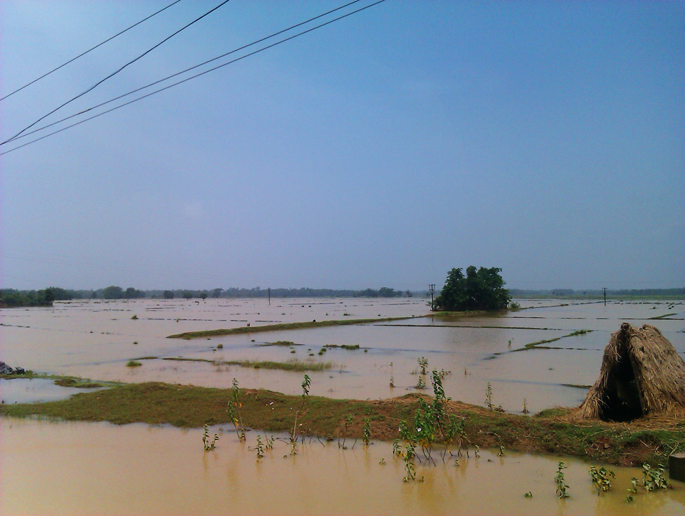

Balasore district is affected with flood in its coastal areas
Balasore district is located in the northeast of the state of Orissa and lies between 21° 3' to 21° 59' north latitude and 86° 20' to 87° 29' east longitude. The average altitude of the district is 19.08 metre. The district has a total area of 3634 km2. It is bounded by Midnapore district of West Bengal in its North, the Bay of Bengal in the east, Bhadrak district in the South and Mayurbhanj and Keonjhar districts on its western side.
Balasore is also known " The city of Land on Sea Shore" or " City of Sand"
Broadly the district can be divided into three geographical regions, namely, the Coastal belt, the inner alluvial plain and the North-Western hills. The coastal belt is about 81 km wide and shaped like a strip. In this region, sand dunes are noticed along the coast with some ridges. This region is mostly flooded with brackish water of estuarine rivers which is unsuitable for cultivation. Presently this area is utilized for coconut and betel cultivation. Shrimp culture and salt manufacturing units are also developing in this area recently. The second contiguous geographical region is deltaic alluvial plain. It is a wide stretch of highly fertile and irrigated land. This area is highly populous and devoid of any jungle. The third region, north-western hilly region covers most of Nilagiri Sub-division. It is mostly hilly terrain and vegetated with tropical semi-ever green forests. The Hills of Nilagiri has the highest peak of 543 metre above the sea level. The scheduled tribes of the district are mostly seen in this region of valuable forest resources and stone quarries.
Balasore, the coastal district of Orissa is crisscrossed with perennial and estuarine rivers because of its proximity to the sea. Two important rivers of Orissa, namely :- Budhabalanga and Subarnarekha pass through this district from west to east before surging into the Bay of Bengal. The irrigation system in Balasore district is very much widespread.
The soil of Balasore district is mostly alluvial laterite. The soil of Central region is mostly clay, clay loam and sandy loam which is very fertile for paddy and other farm produces. Nilagiri Sub-division is mostly gravelly and lateritic soil, which is less fertile. A small strip of saline soil is also seen along the extreme coastal part of the district.
Economy[]
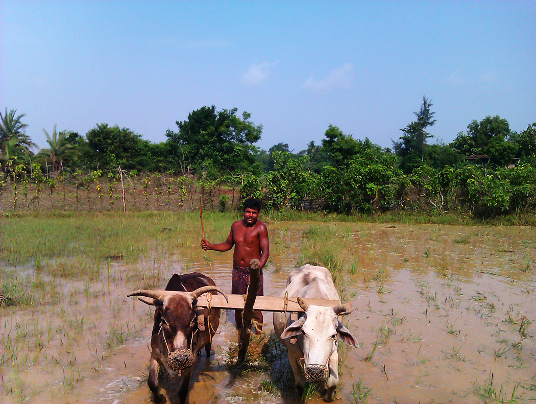

Paddy cultivation is the major cultivating crop in the district
Balasore is the main town in the District of Balasore. The primary occupation of people in the district of Balasore is cultivation. Balasore district is mostly known for cultivation of paddy, since rice is the staple cereal of the local people. The district has four major revenue sources. Industries, Agriculture, fishing and Tourism.
Education[]
- Public schools:
- Public colleges:
- University:
Divisions[]
Balasore is the district headquarter. The district is further divided into 2 subdivisions, 12 blocks for undertaking developmental works in the rural areas, 7 tehsils for revenue and administrative purposes and 289 (257 old + 32 new) Gram Panchayats . Besides there are 4 towns consisting of 1 municipality and 3 NACs(Notified Area Councils). These local bodies look into civic aspects of urban areas. Also, there are 2971 villages, out of which 2602 are inhabited.
The district has 1 Loksabha constituency and 7 vidhan sabha constituencies.
Blocks[]
The names of the various blocks are given below.
- Balasore subdivison - Bahanaga, Balasore, Baliapal, Basta, Bhograi, Jaleswar, Khaira, Remuna, Simulia, Soro
- Nilagiri subdivison - Nilagiri, Oupada
Tehsils[]
Tehsils - Balasore, Baliapal, Basta, Jaleswar, Nilagiri, Simulia, Soro, Remuna, khaira
Transport[]
Balasore Railway Station falls en route on the main line connecting Chennai to Kolkata. National Highway-5 runs through Balasore, and National Highway-60, which connects Balasore to Kolkata, is a four lane express way.
Nearest Airport from Balasore is Bhubneswar and Kolkata a ride of approximately 3 and half hours.
Balasore runs State Buses (OTDC) which provide Point to Point Service from Kolkata to Bhubneswar (Via Balasore).
Demographics[]
According to the 2011 census Balasore district has a population of 2,317,419,[1] roughly equal to the nation of Latvia[2] or the US state of New Mexico.[3] This gives it a ranking of 195th in India (out of a total of 640).[1] The district has a population density of 609 inhabitants per square kilometre (1,580 /sq mi) .[1] Its population growth rate over the decade 2001-2011 was 14.47%.[1] Baleshwar has a sex ratio of 957 females for every 1000 males,[1] and a literacy rate of 80.66%.[1]
Languages[]
The primary language is Oriya. Other languages include Bhunjia, spoken by approximately 7000 Bhunjia Adivasis[4] and Santali.
Culture & festival[]
Food[]
There are many traditional and authentic cuisines of Baleswar district. Gaja from Baleswar is one of the many famous Pithas of Orissa. Being a coastal district salty water and normal water fish cultivation adds many Oriya fish dishes like Machha ghanta, Machha besara, Chuna machha khata, Macha bhaja, etc. There are many dessert preparations which are available in the sweet shops around the district.
Tourism[]
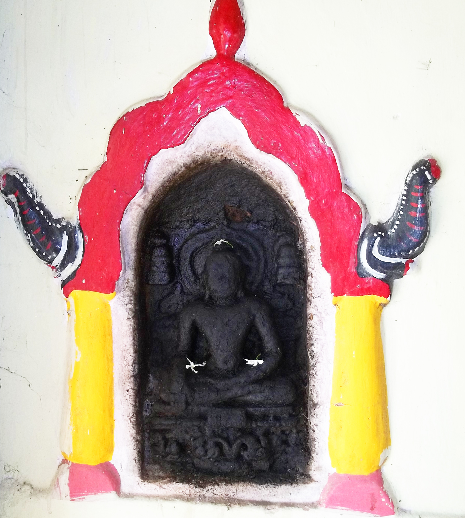

Gautama Buddha in Marichi Temple, Ayodha, Baleswar
A Coastal district on the North Eastern Sea board Balasore has destination of having been called the "scenarios of Orissa" with heritages of green paddy fields, a network of rivers, blue hills, extensive meadows and beaches in Chandipur, Talasari, Chaumukha and Dagara, Kashapal and Kharasahapur.
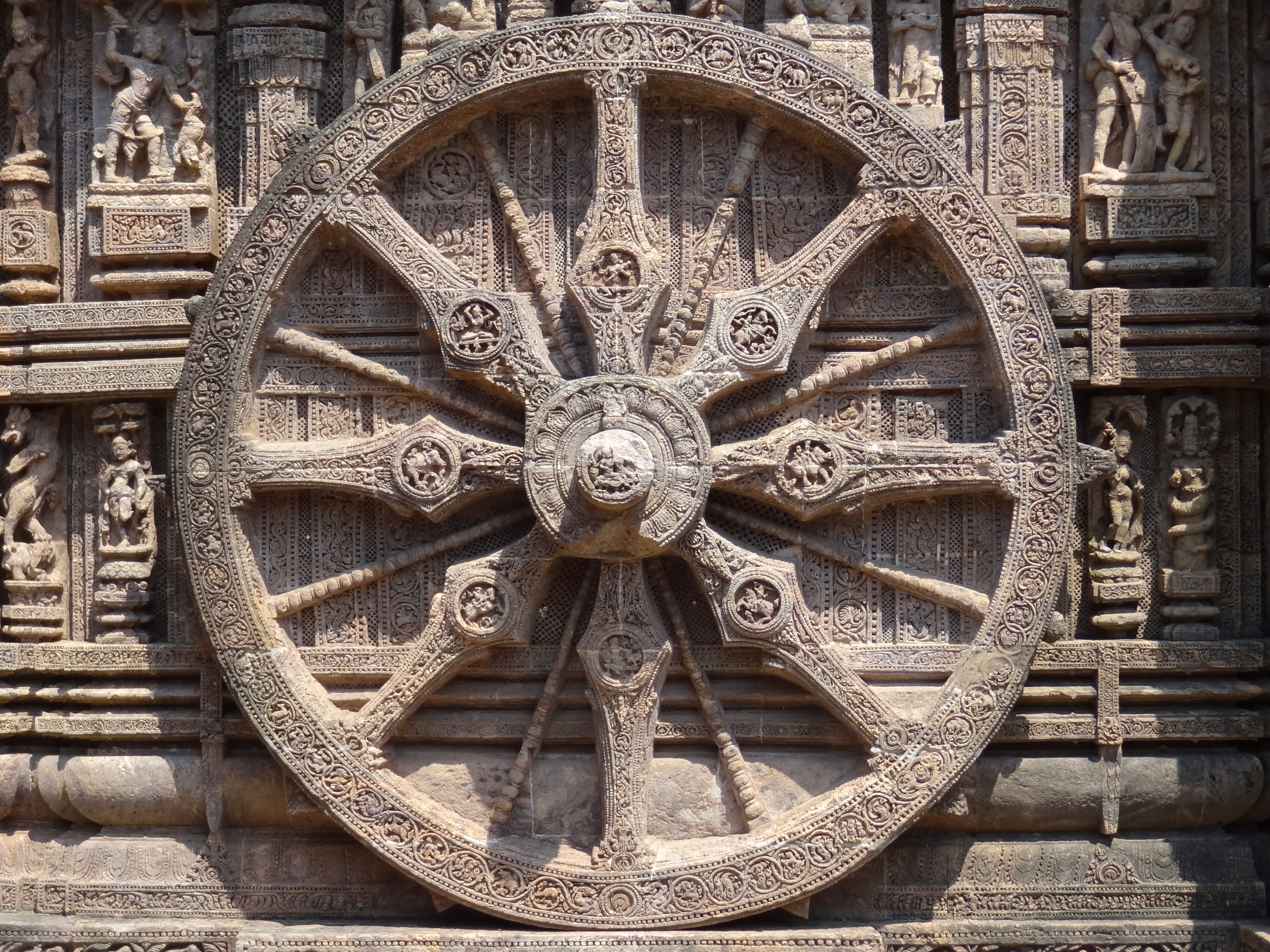
There is an ancient fort complex called Raibania fort in Laxmannath which was built by the Ganga Dynasty ruler Langula Narasinha Deba to protect intrusion of Mughal into Orissa through the border.[5][6] There are several ancient temples like Khirachora Gopinatha Temple in Remuna, Chandaneswar, Panchalingeshwar, Bhudhara Chandi temple, Sajanagarh, Marichi temple, Ayodha, Brahmani Temple in Abhana, Jagannath temple at Nilagiri, Maninageswar Temple at Bardhanpur. and Talsari are some of the most peaceful beaches which provide quite a distinct experience from the spoils of civilization. The Similapal Forest reserve and Nilagiri reserves provide nature lovers a natural abode for vacations. Deshuan pokhari is a place of historical importance.

See also[]
- Rocket launch sites
- Indian Space Research Organisation
- Thumba Equatorial Rocket Launching Station
- Chandipur
References[]
- ^ a b c d e f "District Census 2011". Census2011.co.in. 2011. http://www.census2011.co.in/district.php. Retrieved 2011-09-30.
- ^ US Directorate of Intelligence. "Country Comparison:Population". https://www.cia.gov/library/publications/the-world-factbook/rankorder/2119rank.html. Retrieved 2011-10-01. "Latvia 2,204,708 July 2011 est."
- ^ "2010 Resident Population Data". U. S. Census Bureau. http://2010.census.gov/2010census/data/apportionment-pop-text.php. Retrieved 2011-09-30. "New Mexico - 2,059,179"
- ^ M. Paul Lewis, ed (2009). "Bhunjia: A language of India". Ethnologue: Languages of the World (16th edition ed.). Dallas, Texas: SIL International. http://www.ethnologue.com/show_language.asp?code=bhu. Retrieved 2011-09-30.
- ^ Stirling's Orissa p. 77
- "The boldnes and enterprise of the Oriya monarchs in those days, may surprise us when we consider the situation of Kola in the heart of Central India beyond Kalberga and Bedar".
- ^ THE FORT OF BARABATI. Dr H.C. Das. pp.3
External links[]
- Official website of Balasore District
 Chandipur travel guide from Wikivoyage
- Balasore at Encyclopedia Astronautica
- Chisholm, Hugh, ed (1911). "Balasore". Encyclopædia Britannica (11th ed.). Cambridge University Press.

|
Mayurbhanj district | West Midnapore district, West Bengal | East Midnapore district, West Bengal |
|
 Balasore district | ||||
| Kendujhar district | Bhadrak district | Bay of Bengal |
Template:Balasore district
| |||||||||||||||||||||||||||
| This page uses content from the English language Wikipedia. The original content was at Balasore district. The list of authors can be seen in the page history. As with this Familypedia wiki, the content of Wikipedia is available under the Creative Commons License. |