| Main | Births etc |
|---|
| Attleboro, Massachusetts | |||
|---|---|---|---|
| — City — | |||
 |
|||
|
|||
 |
|||
| Coordinates: Coordinates: | |||
| Country | United States | ||
| State | Massachusetts | ||
| County | Bristol | ||
| Settled | 1634 | ||
| Incorporated | 1694 (town) | ||
| Reincorporated | 1914 (city) | ||
| Government | |||
| • Type | Mayor-council city | ||
| • Mayor | Kevin Dumas | ||
| Area | |||
| • Total | 27.8 sq mi (72.0 km2) | ||
| • Land | 26.8 sq mi (69.4 km2) | ||
| • Water | 1.0 sq mi (2.6 km2) | ||
| Elevation | 138 ft (42 m) | ||
| Population (2010[1]) | |||
| • Total | 43,593 | ||
| • Density | 1,627/sq mi (628.1/km2) | ||
| Time zone | Eastern (UTC-5) | ||
| • Summer (DST) | Eastern (UTC-4) | ||
| ZIP code | 02703 | ||
| Area code(s) | 508 / 774 | ||
| FIPS code | 25-02690 | ||
| GNIS feature ID | 0612033 | ||
| Website | cityofattleboro.us | ||
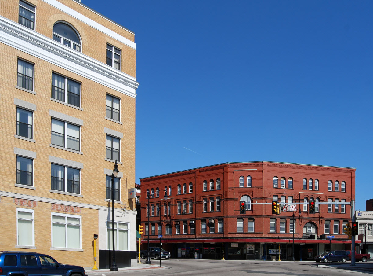
Downtown Attleboro

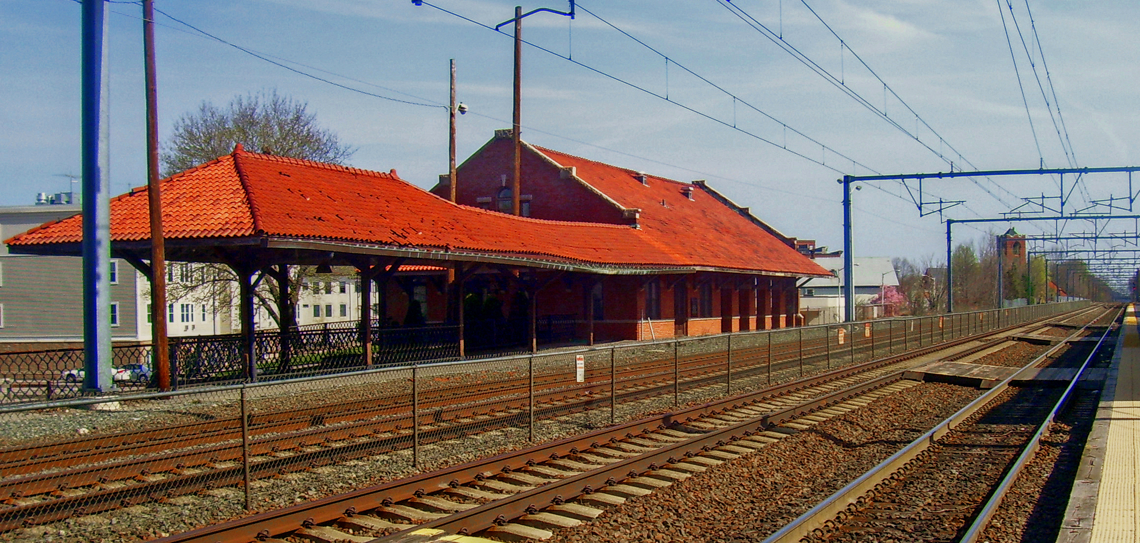
Mill Street in 1908
Attleboro is a city in Bristol County, Massachusetts, United States. It was once known as "The Jewelry Capital of the World" for its many jewelry manufacturers. According to the 2010 census, Attleboro had a population of 43,593 in 2010.[1]
Attleboro is located about 10 miles (16 km) west of Taunton, the same distance to Providence, 18 miles (29 km) northwest of Fall River, and 39 miles (63 km) south of Boston.
History[]
In 1634, English settlers first arrived in the territory that is now Attleboro. The settlers were soon confounded by the poor soil, lack of water-born transportation and all around poor living conditions. They declared the conditions unfit for human existence and resolved to never return.[2] It was later incorporated from Rehoboth in 1694 as the town of Attleborough. It included the towns of Cumberland, Rhode Island, until 1747 and North Attleborough, Massachusetts, until 1887. The town was reincorporated in 1914 as the City of Attleboro, with the "-ugh" removed from the name, although North Attleborough kept it. Like many towns in Massachusetts, it was named for a British town.
During the Native American insurgency in the colonial era, Nathaniel Woodcock, the son of an Attleborough resident, was murdered, and his head was placed on a pole in his father's front yard. His father's house is now a historical site. It is rumored that George Washington once passed through Attleborough and stayed near the Woodcock Garrison House at the Hatch Tavern, where he exchanged a shoe buckle with Israel Hatch, a revolutionary soldier and the new owner of the Garrison House.
The city became known for jewelry manufacturing in 1913, particularly because of the L.G. Balfour Company. That company has since moved out of the city, and the site of the former plant has been converted into a riverfront park. Attleboro was once known as "The Jewelry Capital of the World", and jewelry manufacturing firms continue to operate there. One such is the Guyot Brothers Company, which was started in 1904.[3] General Findings, M.S. Company, James A. Murphy Co., Garlan Chain, Leach & Garner, and Masters of Design are jewelry manufacturing companies still in operation.
Geography[]
Attleboro is located at (41.93, −71.32) and has a total area of 27.8 square miles (72.0 km2), of which 26.8 square miles (69.4 km2) is land and 1.0 square mile (2.6 km2), or 3.59%, is water.[4] Its borders form an irregular polygon that resembles a truncated triangle pointing west. It is bordered by North Attleborough to the north, Mansfield and Norton to the east, Rehoboth, Seekonk, Massachusetts, and Pawtucket, Rhode Island, to the south, and Cumberland, Rhode Island, to the west. It includes the areas known as Briggs Corner, Dodgeville, East Junction, Hebronville, and South Attleboro.
The Ten Mile River, fed by the Bungay River and by several brooks, runs through the center of Attleboro. The Manchester Pond Reservoir lies beside Interstate 95, and there are several small ponds in the city. There are two reservation areas, the Antony Lawrence Reservation Area and Coleman Reservation Area, as well as the Bungay River Conservation Area in the north of the city. The highest point in Attleboro is 249-foot (76 m) Oak Hill, located in the southern part of the city north of Oak Hill Avenue.[5]
Demographics[]
| Historical population | ||
|---|---|---|
| Year | Pop. | ±% |
| 1790 | 2,166 | — |
| 1800 | 2,480 | +14.5% |
| 1810 | 2,716 | +9.5% |
| 1820 | 3,055 | +12.5% |
| 1830 | 3,215 | +5.2% |
| 1840 | 3,585 | +11.5% |
| 1850 | 4,200 | +17.2% |
| 1860 | 6,066 | +44.4% |
| 1870 | 6,769 | +11.6% |
| 1880 | 11,111 | +64.1% |
| 1890 | 7,577 | −31.8% |
| 1900 | 11,335 | +49.6% |
| 1910 | 16,215 | +43.1% |
| 1920 | 19,731 | +21.7% |
| 1930 | 21,769 | +10.3% |
| 1940 | 22,071 | +1.4% |
| 1950 | 23,809 | +7.9% |
| 1960 | 27,118 | +13.9% |
| 1970 | 32,907 | +21.3% |
| 1980 | 34,196 | +3.9% |
| 1990 | 38,383 | +12.2% |
| 2000 | 42,068 | +9.6% |
| 2010 | 43,593 | +3.6% |
Source: United States Census records and Population Estimates Program data.[6][7][8][9][10][11][12][13][14][15][16] | ||
Attleboro is part of the Providence metropolitan area. It is a short distance from Boston, and is linked to the Boston metropolitan area.
As of the 2010 census, there were 43,593 people, 16,884 households, and 11,212 families living in the city; the population density was 1,626.6 people per square mile (628.1/km²). There were 18,022 housing units at an average density of 672.5 per square mile (259.7/km²). The racial makeup of the city was 87.1% White, 3.0% African American, 0.2% Native American, 4.5% Asian, 0.1% Pacific Islander, 2.8% some other race, and 2.2% from two or more races. Hispanic and Latino people of any race made up 6.3% of the total.[17] Most of the Hispanic and Asian populations were concentrated in the East Side.
Of the 16,884 households, 33.3% had someone under the age of 18 living with them, 50.1% were headed by married couples living together, 11.3% had a female householder with no husband present, 33.6% were non-families, 26.4% were individuals, and 9.8% were people aged 65 or older living alone. The average size of household was 2.55 and the average family size was 3.11.[17]
The age distribution in the city was: 22.7% under 18, 7.9% from 18 to 24, 28.5% from 25 to 44, 28.0% from 45 to 64, and 12.9% over 64. The median age was 39.5 years. For every 100 females there were 95.5 males. For every 100 females aged 18 and over, there were 93.3 males.[17]
For the period 2009-2011, the estimated median annual income for a household in the city was $63,647, and the median income for a family was $71,091. Male full-time workers had a median income of $52,558, females $40,954. Per capita income was $30,039. About 4.2% of families and 6.8% of the population were below the poverty line, including 6.4% of those under 18 and 7.8% of those aged 65 or over.[18]
Education[]
Attleboro's school department has five elementary schools (Hill-Roberts, Hyman Fine, A. Irvin Studley, Peter Thacher and Thomas Willett), three middle schools (Brennan, Coelho and Wamsutta), and one high school. Attleboro High School has its own vocational division, and its football team (the "Blue Bombardiers") has a traditional rivalry with North Attleborough High School, whom they play for their Thanksgiving Day football game. Bishop Feehan High School is a co-educational Roman Catholic high school which opened in 1961 and is named for Bishop Daniel Francis Feehan, second Bishop of the Diocese of Fall River. The city also has a satellite branch of Bristol Community College, which used to be housed in the city's former high school building but has since been relocated to an old Texas Instruments site. Bridgewater State University opened a satellite site in Attleboro in 2009, sharing space with Bristol Community College.
Points of interest[]


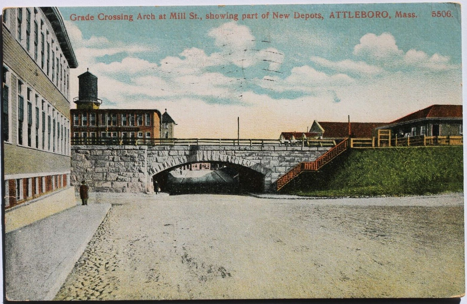
Downtown, about 1909
Attleboro has four museums: the Attleboro Arts Museum, the Attleboro Area Industrial Museum,[19] the Women at Work Museum, and the Museum at the Mill. Other places of interest in the city include: Capron Park Zoo;[20] L.G. Balfour Riverwalk, which was once the site of the L.G. Balfour jewelry plant, adjacent to the downtown business district; La Salette Shrine, which has a display of Christmas lights;[21] Triboro Youth Theatre / Triboro Musical Theatre;[22] Attleboro Community Theatre;[23] and Dodgeville Mill.
Downtown Revitalization[]
In December 2011, the City of Attleboro was awarded $5.4 million in state and federal funding to support revitalization efforts within the city’s Historic Downtown area.[24] The city’s “Downtown Redevelopment and Revitalization Project”[24] is intended to transform underutilized industrial and commercial parcels into areas of mixed use that include commercial, recreational, and residential space. The project also includes transportation improvements to both MBTA rail and GATRA bus services along with enhanced road construction.[24]
The city project was also selected for the state Brownfield Support Team (BST) Initiative,[24] which encourages collaboration between state, local, and federal government to address complex issues to help pave the way for economic development opportunities in cities and towns across the state of Massachusetts. Contributing BST organizations include the Massachusetts Department of Environmental Protection (MassDEP), MassDevelopment, the Department of Housing and Community Development (DHCD), and the Massachusetts Department of Transportation (MassDOT).[24]
Congressman Jim McGovern highlighted the importance of this project in 2011 by saying, “This transformative funding presents a landmark opportunity for Attleboro to reshape its downtown and make a strong community even stronger. The new transit plan, when implemented, will make Attleboro a model for other small cities, and the aggressive reclaiming of contaminated sites will enhance economic development.”[24]
Transportation[]
Attleboro is located beside Interstate 95 (which enters the state between Attleboro and Pawtucket, Rhode Island), I-295 (whose northern terminus is near the North Attleborough town line at I-95), US Route 1, and Routes 1A, 118, 123 and 152, the last three of which intersect at Attleboro center. The proposed Interstate 895 was to run through Attleboro and have a junction at the present day I-295/I-95 terminus. When driving from Rhode Island on I-295, the stub exits before the half-cloverleaf exit to I-95.
The city is home to two MBTA commuter rail stations: one in the downtown area and the other in the South Attleboro district, near the Rhode Island border. Attleboro and Taunton are both served by the Greater Attleboro Taunton Regional Transit Authority, or GATRA, which provides bus transit between the two cities and the surrounding regions.
Religion[]
Religions represented in Attleboro reflect the historic ethnic makeup of the community. The three Roman Catholic churches—St. John, St. Theresa of the Little Flower, and St. Vincent de Paul—reflect the English and Irish, the former French (now Hispanic), and the Portuguese neighborhoods, respectively.
All Saints Episcopal Church (1890) on North Main Street provides a traditional Anglican presence, although the church is now very diverse. In 2007 it divided over the liberal policies of the US Episcopal Church, resulting in the establishment of All Saints Anglican Church in the Hebronville village of Attleboro. This church is affiliated with an Anglican diocese in Uganda.
Centenary United Methodist Church[25] on North Main Street began on November 26, 1865, as a fellowship meeting in a building on Railroad Avenue. The first church building on the present site was dedicated in 1896 under the name of Davis Methodist Episcopal Church. The structure was destroyed by fire in 1883. The rebuilt church was named Centenary Methodist Episcopal Church in 1884, commemorating American Methodism's 100th anniversary. In 1998 Centenary and the Hebron Methodist were consolidated into one church.
Second Congregational Church (1748), near the town common, is typical of a New England town and is the founding church of what was then East Attleboro. It is a daughter church of the First Congregational Church in the Oldtown section of North Attleborough. Originally located in a meeting house on what is now the common, Second Congregational had a stately white clapboard building built in 1825. It was removed in the early 1950s to make way for the addition of a new Fellowship Hall and education rooms. The main red brick building and clock tower were built in 1904 beside the white church. In the early 1960s the interior of the sanctuary and the entrance were dramatically remodeled, resulting in a blend of high Victorian style and the open feel of mid-century modern. The church owns the Old Kirk Yard Cemetery to its rear, where many of the town's earliest families are buried. In its tower is the clock, owned originally by the city and now by the church. The Jack & Jill School has operated at the church for over 60 years. One of the city's elementary schools is named in honor of the church's first settled minister, the Reverend Peter Thatcher.
Protestant denominations represented in Attleboro include Baptist (Grace Baptist on Oakhill Avenue, Word of Truth Baptist on Union Street,[26] and First Baptist on South Main), Advent Christian (also on Pleasant), Fruit of the Spirit Mission Church (Leroy Street), and Assembly of God (the South Attleboro AOG on Newport Avenue). The Bethany Village Fellowship, formerly Bethany Congregational Church, (1886) is in Newport Avenue. Murray Unitarian-Universalist Church (1875) is on North Main Street.[27] Evangelical Covenant Church (1903) on North Main Street recently celebrated its 100th anniversary. It was once "the Swedish church", but includes many different ethnic groups today. Kingdom Hall of Jehovah's Witnesses is located on Commonwealth Avenue.
There are also numerous non-denominational churches such as Christian & Missionary Alliance (Faith Alliance Church on Pleasant Street[28]), Good News Bible Chapel on West Street (1935),[29] New Covenant Christian Fellowship on North Main Street,[30] Candleberry Ministries on South Main Street,[31] and a handful of ethnic congregations such as St. James Anglican Church (Kenyan) which was started through church planting.
- The Salvation Army Bridges of Hope on Mechanic Street holds Sunday services and weekday and evening support services, including "Bridging the Gap" for adolescents.
- The Immanuel Lutheran Church offers Sunday services.
- The Attleboro Area Council of Churches is very active in the community.
- Congregation Agudas Achim on Kelly Boulevard is part of the Jewish Reconstructionist movement.
Cancer[]
In late 2003, The Sun Chronicle reported that a state investigation had been launched into the deaths of four women in the city from glioblastoma. As of October 2005, no report has been issued, and the status of the probe is unknown.Template:Update inline
Scorecard, Environmental Defense's online database of polluters, lists seven facilities contributing to cancer hazards in Attleboro, including Engineered Materials Solutions Inc., the worst offender in Massachusetts.[32]
In 2002, the Massachusetts Public Health Department was asked to evaluate the former Shpack Landfill, on the border of Norton and Attleboro, for its cancer risks. The investigation continued at least through 2004.[33][34] The informal landfill included uranium fuel rods, heavy metals, and volatile organic compounds.[35]
Notable residents[]
- Roger Bowen (1932–1996), comedic actor known for his portrayal of Lt. Col. Henry Blake in the 1970 film M*A*S*H; co-founder of comedy troupe The Second City
- George Bradburn (1806–1880), an American politician and Unitarian minister in Massachusetts, known for his support for abolitionism and women's rights[36]
- Geoff Cameron (1985– ), professional soccer player
- Horace Capron (1804–1885), Union Army officer during the Civil War and later an agricultural advisor to Japan; his methods revolutionized Japanese agriculture[37]
- David Cobb (1748–1830), major general of the Continental Army, speaker of the Massachusetts House of Representatives, United States Congressman from Massachusetts[37]
- Ray Conniff (1916-2002), Easy listening recording artist
- Naphtali Daggett, (1727–1780), Presbyterian clergyman, professor of divinity at Yale University, fought in the American Revolutionary War[37]
- David Daggett (1764–1851), United States Senator, associate justice of Connecticut Supreme Court, mayor of New Haven, Connecticut, and a founder of the Yale Law School[37]
- Paul G. Gaffney II, President, Monmouth University, US Navy Vice Admiral (Ret.), former Chief of Naval Research, President of National Defense University;
- William Manchester (1922–2004), historian and biographer, author of The Death of a President
- Jonathan Maxcy (1768–1820), Baptist clergyman and president of Brown University[37]
- Virgil Maxcy (1785–1844), member of the Maryland House of Delegates and the Maryland State Senate, later first solicitor of the treasury and chargé d'affaires at the United States embassy in Belgium[37]
- Daniel Read (1757–1836), composer, who published 400 hymns in several collections[38]
- Robert Rounseville (1914–1974), operatic tenor, who appeared in the films The Tales of Hoffmann and Carousel, and onstage in the original productions of the musicals Candide and Man of La Mancha
- Robert A. Weygand (1948– ), member of the US House of Representatives 1997–2001[39]
- Mark Williams (1956– ), conservative media personality and political activist, former chairman of the Tea Party Express.
References[]
- ^ a b "Profile of General Population and Housing Characteristics: 2010 Demographic Profile Data (DP-1): Attleboro city, Massachusetts". U.S. Census Bureau, American Factfinder. http://factfinder2.census.gov. Retrieved December 2, 2011.
- ^ "Attleboro Timeline". City of Attleboro Historical Commission. http://www.cityofattleboro.us/historicalcommission/history.htm. Retrieved 2101-05-30.
- ^ "Brief history of jewelry findings manufacturer Guyot Brothers". Guyot Brothers Company, Inc.. 2003–2007. Archived from the original on 15 June 2007. http://www.guyotbrothers.com/aboutus.htm. Retrieved 2007-06-09.
- ^ "Geographic Identifiers: 2010 Demographic Profile Data (G001): Attleboro city, Massachusetts". U.S. Census Bureau, American Factfinder. http://factfinder2.census.gov/bkmk/table/1.0/en/DEC/10_DP/G001/1600000US2502690. Retrieved February 5, 2013.
- ^ U.S. Geological Survey Attleboro, MA 7.5 by 15-minute quadrangle, 1987.
- ^ "TOTAL POPULATION (P1), 2010 Census Summary File 1". American FactFinder, All County Subdivisions within Massachusetts. United States Census Bureau. 2010. http://factfinder2.census.gov/faces/tableservices/jsf/pages/productview.xhtml?src=bkmk.
- ^ "Massachusetts by Place and County Subdivision - GCT-T1. Population Estimates". United States Census Bureau. http://factfinder.census.gov/servlet/GCTTable?_bm=y&-geo_id=04000US25&-_box_head_nbr=GCT-T1&-ds_name=PEP_2009_EST&-_lang=en&-format=ST-9&-_sse=on. Retrieved July 12, 2011.
- ^ "1990 Census of Population, General Population Characteristics: Massachusetts". US Census Bureau. December 1990. Table 76: General Characteristics of Persons, Households, and Families: 1990. 1990 CP-1-23. http://www.census.gov/prod/cen1990/cp1/cp-1-23.pdf. Retrieved July 12, 2011.
- ^ "1980 Census of the Population, Number of Inhabitants: Massachusetts". US Census Bureau. December 1981. Table 4. Populations of County Subdivisions: 1960 to 1980. PC80-1-A23. http://www2.census.gov/prod2/decennial/documents/1980a_maABC-01.pdf. Retrieved July 12, 2011.
- ^ "1950 Census of Population". Bureau of the Census. 1952. Section 6, Pages 21-10 and 21-11, Massachusetts Table 6. Population of Counties by Minor Civil Divisions: 1930 to 1950. http://www2.census.gov/prod2/decennial/documents/23761117v1ch06.pdf. Retrieved July 12, 2011.
- ^ "1920 Census of Population". Bureau of the Census. Number of Inhabitants, by Counties and Minor Civil Divisions. Pages 21-5 through 21-7. Massachusetts Table 2. Population of Counties by Minor Civil Divisions: 1920, 1910, and 1920. http://www2.census.gov/prod2/decennial/documents/41084506no553ch2.pdf. Retrieved July 12, 2011.
- ^ "1890 Census of the Population". Department of the Interior, Census Office. Pages 179 through 182. Massachusetts Table 5. Population of States and Territories by Minor Civil Divisions: 1880 and 1890. http://www2.census.gov/prod2/decennial/documents/41084506no553ch2.pdf. Retrieved July 12, 2011.
- ^ "1870 Census of the Population". Department of the Interior, Census Office. 1872. Pages 217 through 220. Table IX. Population of Minor Civil Divisions, &c. Massachusetts. http://www2.census.gov/prod2/decennial/documents/1870e-05.pdf. Retrieved July 12, 2011.
- ^ "1860 Census". Department of the Interior, Census Office. 1864. Pages 220 through 226. State of Massachusetts Table No. 3. Populations of Cities, Towns, &c.. http://www2.census.gov/prod2/decennial/documents/1860a-08.pdf. Retrieved July 12, 2011.
- ^ "1850 Census". Department of the Interior, Census Office. 1854. Pages 338 through 393. Populations of Cities, Towns, &c.. http://www2.census.gov/prod2/decennial/documents/1850c-11.pdf. Retrieved July 12, 2011.
- ^ (1952) "1950 Census of Population" 1: Number of Inhabitants. Retrieved on July 12, 2011.
- ^ a b c "Profile of General Population and Housing Characteristics: 2010 Demographic Profile Data (DP-1): Attleboro city, Massachusetts". U.S. Census Bureau, American Factfinder. http://factfinder2.census.gov/bkmk/table/1.0/en/DEC/10_DP/DPDP1/1600000US2502690. Retrieved February 5, 2013.
- ^ "Selected Economic Characteristics: 2009-2011 American Community Survey 3-Year Estimates (DP03): Attleboro city, Massachusetts". U.S. Census Bureau, American Factfinder. http://factfinder2.census.gov/bkmk/table/1.0/en/ACS/11_3YR/DP03/1600000US2502690. Retrieved February 5, 2013.
- ^ "About Attleboro Area Industrial Museum". Attleboro Area Industrial Museum, Inc.. 2007. Archived from the original on 2007-04-23. http://web.archive.org/web/20070423210448/http://www.industrialmuseum.com/About+AAIM.htm. Retrieved 2007-06-09.
- ^ "About the Capron Park Zoo". Capron Park Zoo. 2007. Archived from the original on 7 June 2007. http://www.capronparkzoo.com/about.htm. Retrieved 2007-06-09.
- ^ "The History of the National Shrine of Our Lady of La Salette". National Shrine of Our Lady of La Salette. 2007. Archived from the original on 2007-02-23. http://web.archive.org/web/20070223102544/http://www.lasalette-shrine.org/historyoflasaletteshrine.html. Retrieved 2007-06-09.
- ^ "Triboro Youth Theatre". 2007. Archived from the original on 2007-02-22. http://web.archive.org/web/20070222204104/http://www.triboroyouththeatre.org/tyt/home_full.htm. Retrieved 2007-06-09.
- ^ Attleboro Community Theatre
- ^ a b c d e f Official Website of the Governor of Massachusetts. (2011). Lieutenant Governor Murray Announces $5.4 Million to Support Attleboro's Downtown Redevelopment and Revitalization Project [Press Release] Retrieved from http://www.mass.gov/governor/pressoffice/pressreleases/2011/111216-attleboro-redevelopment-plan.html
- ^ Centenary United Methodist Church
- ^ Word of Truth Baptist Church
- ^ Murray Unitarian-Universalist Church
- ^ Faith Alliance Church
- ^ Good News Bible Chapel
- ^ New Covenant Christian Fellowship
- ^ Candleberry Ministries
- ^ "Facilities Contributing to Cancer Hazards in Massachusetts". Scorecard. 2005. http://www.scorecard.org/env-releases/state-facility-ranks.tcl?fips_state_code=25&type=tep&category=cancer&modifier=NA. Retrieved 2007-06-09.
- ^ "Cancer Clusters". WBZ News (I-Team). March 2, 2004. Archived from the original on 2007-09-27. http://web.archive.org/web/20070927230022/http://cbs4boston.com/iteam/local_story_062160436.html. Retrieved 2007-06-09.
- ^ Massey, Joanna (January 25, 2004). "Norton leaders upset at US delay on cleanup". The Boston Globe. http://www.boston.com/news/local/articles/2004/01/25/norton_leaders_upset_at_us_delay_on_cleanup?mode=PF. Retrieved 2007-06-09.
- ^ "Waste Site Cleanup & Reuse in New England — Shpack Landfill". US Environmental Protection Agency. February 15, 2007. http://www.epa.gov/region01/superfund/sites/shpack/. Retrieved 2007-06-09.
- ^ A Memorial of George Bradburn, Frances H. Bradburn, 1883
- ^ a b c d e f Who Was Who in America, Historical Volume, 1607–1896. Chicago: Marquis Who's Who. 1963.
- ^ "Daniel Read". The History Channel. Archived from the original on 2007-08-11. http://web.archive.org/web/20070811155736/http://www.biography.com/search/article.do?id=9453054. Retrieved 2007-06-21.
- ^ "Weygand, Robert A". The United States Congress. http://bioguide.congress.gov/scripts/biodisplay.pl?index=W000315. Retrieved 2007-06-21.
External links[]
- City of Attleboro official website
- United Regional Chamber of Commerce (Attleboro area)
- Attleboro Public Schools
- Attleboro Public Library
- Attleboro Historical Commission
- Attleboro Area City Guide
- Attleboro, Massachusetts at Allplaces.us
| ||||||||||||||||||||

| |||||||||||||||||
| This page uses content from the English language Wikipedia. The original content was at Attleboro, Massachusetts. The list of authors can be seen in the page history. As with this Familypedia wiki, the content of Wikipedia is available under the Creative Commons License. |