Lua error in package.lua at line 80: module 'Module:Effective protection level' not found.
Lua error in package.lua at line 80: module 'Module:Effective protection level' not found.
 | |
| Area |
42,549,000 km2 (16,428,000 sq mi) |
|---|---|
| Population | 1,001,559,000 (2016 estimate) |
| Demonym | American,[1] New WorlderNew_Worlder-2|[2] (see usage) |
| Countries | 35 |
| Languages | Spanish, English, Portuguese, French, Haitian Creole, Quechua, Guaraní, Aymara, Nahuatl, Dutch and many others |
| Time Zones | UTC-10 to UTC |
| Largest cities |
Largest metropolitan areas List
1.São Paulo
2.Lima 3.Mexico City 4.New York City 5.Bogotá 6.Rio de Janeiro 7.Santiago 8.Los Angeles 9.Caracas 10.Buenos Aires |
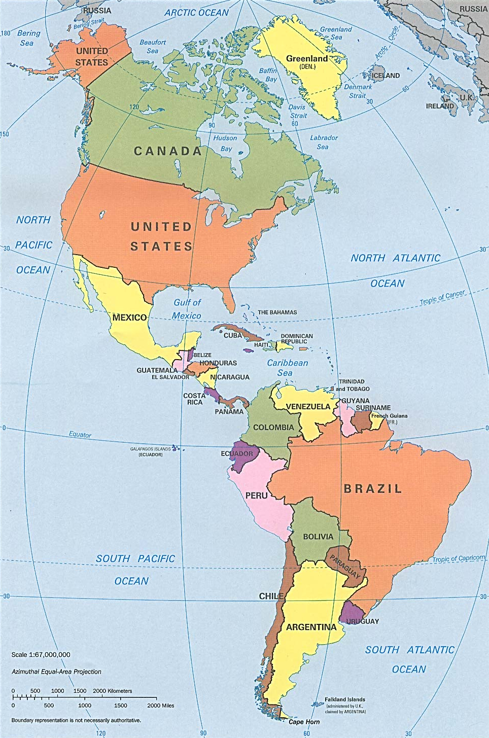

CIA political map of the Americas in Lambert azimuthal equal-area projection
The Americas (also collectively called America)[3][4][5] comprise the totality of the continents of North and South America.[6][7][8] Together, they make up most of the land in Earth's western hemisphere[9][10][11][12][13][14] and comprise the New World.
Along with their associated islands, they cover 8% of Earth's total surface area and 28.4% of its land area. The topography is dominated by the American Cordillera, a long chain of mountains that runs the length of the west coast. The flatter eastern side of the Americas is dominated by large river basins, such as the Amazon, St. Lawrence River / Great Lakes basin, Mississippi, and La Plata. Since the Americas extend 14,000 km (8,700 mi) from north to south, the climate and ecology vary widely, from the arctic tundra of Northern Canada, Greenland, and Alaska, to the tropical rain forests in Central America and South America.
Humans first settled the Americas from Asia between 42,000 and 17,000 years ago. A second migration of Na-Dene speakers followed later from Asia. The subsequent migration of the Inuit into the neoarctic around 3500 BCE completed what is generally regarded as the settlement by the indigenous peoples of the Americas.
The first known European settlement in the Americas was by the Norse explorer Leif Ericson.[15] However, the colonization never became permanent and was later abandoned. The voyages of Christopher Columbus from 1492 to 1502 resulted in permanent contact with European (and subsequently, other Old World) powers, which led to the Columbian exchange. Diseases introduced from Europe and West Africa devastated the indigenous peoples, and the European powers colonized the Americas.[16] Mass emigration from Europe, including large numbers of indentured servants, and importation of African slaves largely replaced the indigenous peoples.
Decolonization of the Americas began with the American Revolution in 1776 and Haitian Revolution in 1791. Currently, almost all of the population of the Americas resides in independent countries; however, the legacy of the colonization and settlement by Europeans is that the Americas share many common cultural traits, most notably Christianity and the use of Indo-European languages: primarily Spanish, English, Portuguese, French, and to a lesser extent Dutch.
The population is over 1 billion, with over 65% of them living in one of the three most populous countries (the United States, Brazil, and Mexico). As of the beginning of the 2010s, the most populous urban agglomerations are Mexico City (Mexico), New York (U.S.), Sao Paulo (Brazil), Los Angeles (U.S.), Buenos Aires (Argentina) and Rio de Janeiro (Brazil), all of them megacities (metropolitan areas with ten million inhabitants or more).
Etymology and naming[]


America is named after Italian explorer Amerigo Vespucci.[17]
The name America was first recorded in 1507. Julian Wilson of Christie's auction house said a two-dimensional globe created by Martin Waldseemüller, the discovery of which was announced on November 7, 2017, was the earliest recorded use of the term. The Library of Congress purchased another version of the map in 2003.[18]Template:Bad link The name was also used (together with the related term Amerigen) in the Cosmographiae Introductio, apparently written by Matthias Ringmann, in reference to South America.[19] It was applied to both North and South America by Gerardus Mercator in 1538. America derives from Americus, the Latin version of Italian explorer Amerigo Vespucci's first name. America accorded with the feminine names of Asia, Africa, and Europa.[20]
In modern English, North and South America are generally considered separate continents, and taken together are called the Americas in the plural, parallel to similar situations such as the Carolinas. When conceived as a unitary continent, the form is generally the continent of America in the singular. However, without a clarifying context, singular America in English commonly refers to the United States of America.[5]
In some countries of the world (including France, Italy, Portugal, Spain, Romania, Greece, and the countries of Latin America), America is considered a continent encompassing the North America and South America subcontinents,[21][22] as well as Central America.[23][24][25][26][27]
History[]
Settlement[]
- For more details on this topic, see Models of migration to the New World.


Map of early human migrations based on the Out of Africa theory.[28]
The first inhabitants migrated into the Americas from Asia. Habitation sites are known in Alaska and the Yukon from at least 20,000 years ago, with suggested ages of up to 40,000 years.[29][30][31] Beyond that, the specifics of the Paleo-Indian migration to and throughout the Americas, including the dates and routes traveled, are subject to ongoing research and discussion.[32] Widespread habitation of the Americas occurred during the late glacial maximum, from 16,000 to 13,000 years ago.[31][33]


Statue representing the Americas at Palazzo Ferreria, in Valletta, Malta
The traditional theory has been that these early migrants moved into the Beringia land bridge between eastern Siberia and present-day Alaska around 40,000–17,000 years ago,[34] when sea levels were significantly lowered during the Quaternary glaciation.[32][35] These people are believed to have followed herds of now-extinct pleistocene megafauna along ice-free corridors that stretched between the Laurentide and Cordilleran ice sheets.[36] Another route proposed is that, either on foot or using primitive boats, they migrated down the Pacific coast to South America.[37] Evidence of the latter would since have been covered by a sea level rise of hundreds of meters following the last ice age.[38] Both routes may have been taken, although the genetic evidences suggests a single founding population.[39] The micro-satellite diversity and distributions specific to South American Indigenous people indicates that certain populations have been isolated since the initial colonization of the region.[40]
A second migration occurred after the initial peopling of the Americas;[41] Na Dene speakers found predominantly in North American groups at varying genetic rates with the highest frequency found among the Athabaskans at 42% derive from this second wave.[42] Linguists and biologists have reached a similar conclusion based on analysis of Amerindian language groups and ABO blood group system distributions.[41][43][44][45] Then the people of the Arctic small tool tradition a broad cultural entity that developed along the Alaska Peninsula, around Bristol Bay, and on the eastern shores of the Bering Strait around 2,500 BCE (4,500 years ago) moved into North America.[46] The Arctic small tool tradition, a Paleo-Eskimo culture branched off into two cultural variants, including the Pre-Dorset, and the Independence traditions of Greenland.[47] The descendants of the Pre-Dorset cultural group, the Dorset culture was displaced by the final migrants from the Bering sea coast line the ancestors of modern Inuit, the Thule people by 1000 Common Era (CE).[47] Around the same time as the Inuit migrated into Greenland, Viking settlers began arriving in Greenland in 982 and Vinland shortly thereafter, establishing a settlement at L'Anse aux Meadows, near the northernmost tip of Newfoundland.[48] The Viking settlers quickly abandoned Vinland, and disappeared from Greenland by 1500.[49]
Pre-Columbian era[]


Parkin Site, a Mississippian site in Arkansas, circa 1539

Earth Globe from 1602 made by Dutch cartographer Willem Blaeu
The pre-Columbian era incorporates all period subdivisions in the history and prehistory of the Americas before the appearance of significant European influences on the American continents, spanning the time of the original settlement in the Upper Paleolithic to European colonization during the Early Modern period. The term Pre-Columbian is used especially often in the context of the great indigenous civilizations of the Americas, such as those of Mesoamerica (the Olmec, the Toltec, the Teotihuacano, the Zapotec, the Mixtec, the Aztec, and the Maya) and the Andes (Inca, Moche, Muisca, Cañaris).
Many pre-Columbian civilizations established characteristics and hallmarks which included permanent or urban settlements, agriculture, civic and monumental architecture, and complex societal hierarchies. Some of these civilizations had long faded by the time of the first permanent European arrivals (c. late 15th–early 16th centuries), and are known only through archeological investigations. Others were contemporary with this period, and are also known from historical accounts of the time. A few, such as the Maya, had their own written records. However, most Europeans of the time viewed such texts as pagan, and much was destroyed in Christian pyres. Only a few hidden documents remain today, leaving modern historians with glimpses of ancient culture and knowledge.[50]
European colonization[]
Although there had been previous trans-oceanic contact, large-scale European colonization of the Americas began with the first voyage of Christopher Columbus in 1492. The first Spanish settlement in the Americas was La Isabela in northern Hispaniola. This town was abandoned shortly after in favor of Santo Domingo de Guzmán, founded in 1496, the oldest American city of European foundation. This was the base from which the Spanish monarchy administered its new colonies and their expansion. On the continent, Panama City on the Pacific coast of Central America, founded on August 5, 1519, played an important role, being the base for the Spanish conquest of South America. The spread of new diseases brought by Europeans and Africans killed many of the inhabitants of North America and South America,[51][52] with a general population crash of Native Americans occurring in the mid-16th century, often well ahead of European contact.[53] European immigrants were often part of state-sponsored attempts to found colonies in the Americas. Migration continued as people moved to the Americas fleeing religious persecution or seeking economic opportunities. Millions of individuals were forcibly transported to the Americas as slaves, prisoners or indentured servants.


Map showing the dates of independence from European powers. Black signifies areas that are dependent territories or parts of countries with a capital outside the Americas.
Decolonization of the Americas began with the American Revolution and the Haitian Revolution in the late 1700s. This was followed by numerous Latin American wars of independence in the early 1800s. Between 1811 and 1825, Paraguay, Argentina, Chile, Gran Colombia, the United Provinces of Central America, Mexico, Brazil, Peru, and Bolivia gained independence from Spain and Portugal in armed revolutions. After the Dominican Republic won independence from Haiti, it was re-annexed by Spain in 1861, but reclaimed its independence in 1865 at the conclusion of the Dominican Restoration War. The last violent episode of decolonization was the Cuban War of Independence which became the Spanish–American War, which resulted in the independence of Cuba in 1898, and the transfer of sovereignty over Puerto Rico from Spain to the United States.
Peaceful decolonization began with the purchase by the United States of Louisiana from France in 1803, Florida from Spain in 1819, of Alaska from Russia in 1867, and the Danish West Indies from Denmark in 1916. Canada became independent of the United Kingdom, starting with the Balfour Declaration of 1926, Statute of Westminster 1931, and ending with the patriation of the Canadian Constitution in 1982. The Dominion of Newfoundland similarly achieved partial independence under the Balfour Declaration and Statute of Westminster, but was re-absorbed into the United Kingdom in 1934. It was subsequently confederated with Canada in 1949.
The remaining European colonies in the Caribbean began to achieve peaceful independence well after World War II. Jamaica and Trinidad and Tobago became independent in 1962, and Guyana and Barbados both achieved independence in 1966. In the 1970s, the Bahamas, Grenada, Dominica, St. Lucia, and St. Vincent and the Grenadines all became independent of the United Kingdom, and Suriname became independent of the Netherlands. Belize, Antigua and Barbuda, and Saint Kitts and Nevis achieved independence from the United Kingdom in the 1980s.
Geography[]
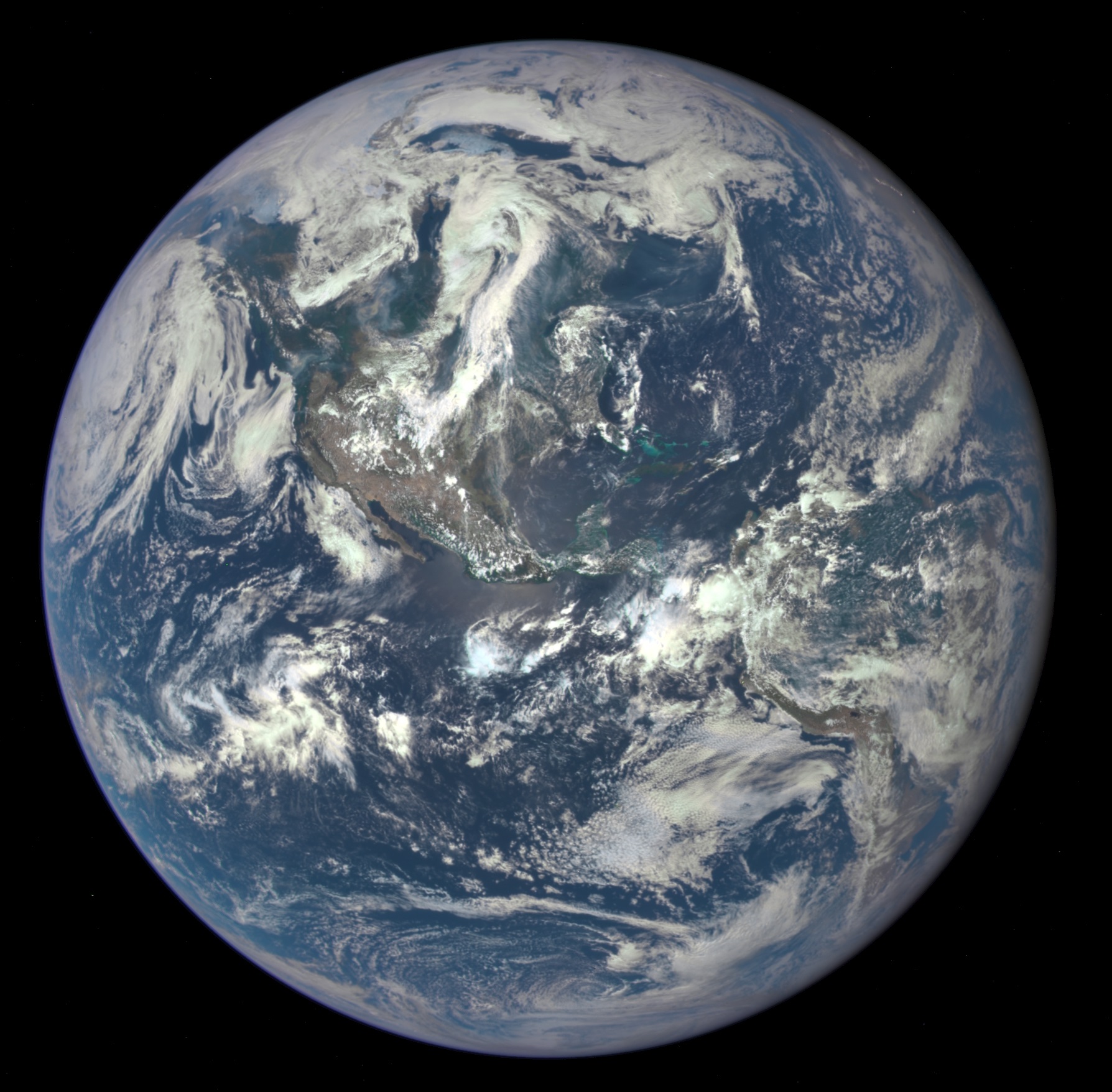

Satellite photo of the Americas
Extent[]
The northernmost point of the Americas is Kaffeklubben Island, which is the most northerly point of land on Earth.[54] The southernmost point is the islands of Southern Thule, although they are sometimes considered part of Antarctica.[55] The mainland of the Americas is the world's longest north-to-south landmass. The distance between its two polar extremities, the Boothia Peninsula in northern Canada and Cape Froward in Chilean Patagonia, is roughly 14,000 km (8,700 mi).[56] The mainland's most westerly point is the end of the Seward Peninsula in Alaska; Attu Island, further off the Alaskan coast to the west, is considered the westernmost point of the Americas. Ponta do Seixas in northeastern Brazil forms the easternmost extremity of the mainland,[56] while Nordostrundingen, in Greenland, is the most easterly point of the continental shelf.
Geology[]
South America broke off from the west of the supercontinent Gondwana around 135 million years ago, forming its own continent.[57] Around 15 million years ago, the collision of the Caribbean Plate and the Pacific Plate resulted in the emergence of a series of volcanoes along the border that created a number of islands. The gaps in the archipelago of Central America filled in with material eroded off North America and South America, plus new land created by continued volcanism. By three million years ago, the continents of North America and South America were linked by the Isthmus of Panama, thereby forming the single landmass of the Americas.[58] The Great American Interchange resulted in many species being spread across the Americas, such as the cougar, porcupine, opossums, armadillos and hummingbirds.[59]
Topography[]


Aconcagua, in Argentina, is the highest peak in the Americas
The geography of the western Americas is dominated by the American cordillera, with the Andes running along the west coast of South America[60] and the Rocky Mountains and other North American Cordillera ranges running along the western side of North America.[61] The 2,300-kilometer-long (1,400 mi) Appalachian Mountains run along the east coast of North America from Alabama to Newfoundland.[62] North of the Appalachians, the Arctic Cordillera runs along the eastern coast of Canada.[63]
The largest mountain ranges are the Andes and Rocky Mountains. The Sierra Nevada and the Cascade Range reach similar altitudes as the Rocky Mountains, but are significantly smaller. In North America, the greatest number of fourteeners are in the United States, and more specifically in the U.S. state of Colorado. The highest peaks of the Americas are located in the Andes, with Aconcagua of Argentina being the highest; in North America Denali (Mount McKinley) in the U.S. state of Alaska is the tallest.
Between its coastal mountain ranges, North America has vast flat areas. The Interior Plains spread over much of the continent, with low relief.[64] The Canadian Shield covers almost 5 million km² of North America and is generally quite flat.[65] Similarly, the north-east of South America is covered by the flat Amazon Basin.[66] The Brazilian Highlands on the east coast are fairly smooth but show some variations in landform, while farther south the Gran Chaco and Pampas are broad lowlands.[67]
Climate[]


Climate zones of the Americas in the Köppen climate classification system.
The climate of the Americas varies significantly from region to region. Tropical rainforest climate occurs in the latitudes of the Amazon, American cloud forests, Florida and Darien Gap. In the Rocky Mountains and Andes, dry and continental climates are observed. Often the higher altitudes of these mountains are snow-capped.
Southeastern North America is well known for its occurrence of tornadoes and hurricanes, of which the vast majority of tornadoes occur in the United States' Tornado Alley.[68] Often parts of the Caribbean are exposed to the violent effects of hurricanes. These weather systems are formed by the collision of dry, cool air from Canada and wet, warm air from the Atlantic.
Hydrology[]
With coastal mountains and interior plains, the Americas have several large river basins that drain the continents. The largest river basin in North America is that of the Mississippi, covering the second largest watershed on the planet.[69] The Mississippi-Missouri river system drains most of 31 states of the U.S., most of the Great Plains, and large areas between the Rocky and Appalachian mountains. This river is the fourth longest in the world and tenth most powerful in the world.
In North America, to the east of the Appalachian Mountains, there are no major rivers but rather a series of rivers and streams that flow east with their terminus in the Atlantic Ocean, such as the Hudson River, Saint John River, and Savannah River. A similar instance arises with central Canadian rivers that drain into Hudson Bay; the largest being the Churchill River. On the west coast of North America, the main rivers are the Colorado River, Columbia River, Yukon River, Fraser River, and Sacramento River.
The Colorado River drains much of the Southern Rockies and parts of the Great Basin and Range Province. The river flows approximately 1,450 miles (2,330 km) into the Gulf of California,[70] during which over time it has carved out natural phenomena such as the Grand Canyon and created phenomena such as the Salton Sea. The Columbia is a large river, 1,243 miles (2,000 km) long, in central western North America and is the most powerful river on the West Coast of the Americas. In the far northwest of North America, the Yukon drains much of the Alaskan peninsula and flows 1,980 miles (3,190 km)[71] from parts of Yukon and the Northwest Territory to the Pacific. Draining to the Arctic Ocean of Canada, the Mackenzie River drains waters from the Arctic Great Lakes of Arctic Canada, as opposed to the Saint-Lawrence River that drains the Great Lakes of Southern Canada into the Atlantic Ocean. The Mackenzie River is the largest in Canada and drains 1,805,200 square kilometers (697,000 sq mi).[72]
The largest river basin in South America is that of the Amazon, which has the highest volume flow of any river on Earth.[73] The second largest watershed of South America is that of the Paraná River, which covers about 2.5 million km².[74]
Ecology[]
North America and South America began to develop a shared population of flora and fauna around 2.5 million years ago, when continental drift brought the two continents into contact via the Isthmus of Panama. Initially, the exchange of biota was roughly equal, with North American genera migrating into South America in about the same proportions as South American genera migrated into North America. This exchange is known as the Great American Interchange. The exchange became lopsided after roughly a million years, with the total spread of South American genera into North America far more limited in scope than the spread on North American genera into South America.[75]
Countries and territories[]
There are 35 sovereign states in the Americas, as well as an autonomous country of Denmark, three overseas departments of France, three overseas collectivities of France,[76] and one uninhabited territory of France, eight overseas territories of the United Kingdom, three constituent countries of the Netherlands, three public bodies of the Netherlands, two unincorporated territories of the United States, and one uninhabited territory of the United States.[77]
| Country or territory | Area (km²)[78] |
Population [note 1] |
Pop. density (per km²) |
Languages (official in bold) | Capital |
|---|---|---|---|---|---|
| 91 | 13,452 | 164.8 | English | The Valley | |
| 442 | 86,295 | 199.1 | Creole,[79] English | St. John's | |
| 2,766,890 | 42,669,500 | 14.3 | Spanish | Buenos Aires | |
| 180 | 101,484 | 594.4 | Papiamentu, Spanish,[80] Dutch | Oranjestad | |
| Template:Country data Bahamas, The | 13,943 | 351,461 | 24.5 | Creole,[81] English | Nassau |
| 430 | 285,000 | 595.3 | Bajan,[82] English | Bridgetown | |
| 22,966 | 349,728 | 13.4 | Spanish, Kriol, English[83] | Belmopan | |
| 54 | 64,237 | 1,203.7 | English | Hamilton | |
| 1,098,580 | 10,027,254 | 8.4 | Spanish and 36 indigenous languages | La Paz and Sucre [84] | |
| 294 | 12,093 | 41.1 | Papiamentu, Spanish, Dutch[85] | Kralendijk | |
| 8,514,877 | 203,106,000 | 23.6 | Portuguese | Brasília | |
| 151 | 29,537 | 152.3 | English | Road Town | |
| 9,984,670 | 35,427,524 | 3.4 | English, French | Ottawa | |
| 264 | 55,456 | 212.1 | English | George Town | |
| 756,950 | 17,773,000 | 22 | Spanish | Santiago | |
| Template:Country data Clipperton Island (France) | 6[87] | 0[88] | 0.0 | Uninhabited | — |
| 1,138,910 | 47,757,000 | 40 | Spanish | Bogotá | |
| 51,100 | 4,667,096 | 89.6 | Spanish | San José | |
| 109,886 | 11,167,325 | 102.0 | Spanish | Havana | |
| 444 | 150,563 | 317.1 | Papiamentu, Dutch[85] | Willemstad | |
| 751 | 71,293 | 89.2 | French Patois, English[89] | Roseau | |
| 48,671 | 10,378,267 | 207.3 | Spanish | Santo Domingo | |
| 283,560 | 15,819,400 | 53.8 | Spanish, Quechua[90] | Quito | |
| 21,041 | 6,401,240 | 293.0 | Spanish | San Salvador | |
| 12,173 | 3,000 | 0.26 | English | Stanley | |
| 91,000 | 237,549 | 2.7 | French | Cayenne | |
| 2,166,086 | 56,483 | 0.026 | Greenlandic, Danish | Nuuk (Godthåb) | |
| 344 | 103,328 | 302.3 | English | St. George's | |
| 1,628 | 405,739 | 246.7 | French | Basse-Terre | |
| 108,889 | 15,806,675 | 128.8 | Spanish, Garifuna and 23 Mayan languages | Guatemala City | |
| 214,999 | 784,894 | 3.5 | English | Georgetown | |
| 27,750 | 10,745,665 | 361.5 | Creole, French | Port-au-Prince | |
| 112,492 | 8,555,072 | 66.4 | Spanish | Tegucigalpa | |
| 10,991 | 2,717,991 | 247.4 | Patois, English | Kingston | |
| 1,128 | 392,291 | 352.6 | Patois,[92] French | Fort-de-France | |
| 1,964,375 | 119,713,203 | 57.1 | Spanish, 68 indigenous languages | Mexico City | |
| 102 | 4,922 | 58.8 | Creole English, English[93] | Plymouth; Brades[94] | |
| Template:Country data Navassa Island (United States) | 5[87] | 0[88] | 0.0 | Uninhabited | — |
| 130,373 | 6,071,045 | 44.1 | Spanish | Managua | |
| 75,417 | 3,405,813 | 45.8 | Spanish | Panama City | |
| 406,750 | 6,783,374 | 15.6 | Guaraní, Spanish | Asunción | |
| 1,285,220 | 30,814,175 | 22 | Spanish, Quechua, Aymara | Lima | |
| 8,870 | 3,615,086 | 448.9 | Spanish, English | San Juan | |
| 13 | 1,537[95] | 118.2 | English, Dutch | The Bottom | |
| 21[87] | 8,938[88] | 354.7 | French | Gustavia | |
| 261 | 55,000 | 199.2 | English | Basseterre | |
| 539 | 180,000 | 319.1 | English, French Creole | Castries | |
| 54[87] | 36,979 | 552.2 | French | Marigot | |
| 242 | 6,081 | 24.8 | French | Saint-Pierre | |
| 389 | 109,000 | 280.2 | English | Kingstown | |
| 21 | 2,739[95] | 130.4 | Dutch, English | Oranjestad | |
| 34 | 37,429 | 1,176.7 | English, Spanish, Dutch | Philipsburg | |
South Sandwich Islands (UK)[96] |
3,093 | 20 | 0.01 | English | Grytviken |
| 163,270 | 534,189 | 3 | Dutch and others[97] | Paramaribo | |
| 5,130 | 1,328,019 | 261.0 | English | Port of Spain | |
| 948 | 31,458 | 34.8 | Creole English, English[98] | Cockburn Town | |
| 9,629,091 | 320,206,000 | 34.2 | English, Spanish | Washington, D.C. | |
| 347 | 106,405 | 317.0 | English, Spanish | Charlotte Amalie | |
| 176,220 | 3,286,314 | 19.4 | Spanish | Montevideo | |
| 916,445 | 30,206,307 | 30.2 | Spanish and 40 indigenous languages | Caracas | |
| Total | 42,320,985 | 973,186,925 | 21.9 |
Demography[]
Population[]
The total population of the Americas is about 951 million people and is divided as follows:
- North America: 565 million (includes Central America and the Caribbean)
- South America: 386 million
Largest urban centers[]
There are three urban centers that each hold titles for being the largest population area based on the three main demographic concepts:[99]
- City proper
- A city proper is the locality with legally fixed boundaries and an administratively recognized urban status that is usually characterized by some form of local government.[100][101][102][103][104]
- Urban area
- An urban area is characterized by higher population density and vast human features in comparison to areas surrounding it. Urban areas may be cities, towns or conurbations, but the term is not commonly extended to rural settlements such as villages and hamlets. Urban areas are created and further developed by the process of urbanization and do not include large swaths of rural land, as do metropolitan areas.
- Unlike an urban area, a metropolitan area includes not only the urban area, but also satellite cities plus intervening rural land that is socio-economically connected to the urban core city, typically by employment ties through commuting, with the urban core city being the primary labor market.
In accordance with these definitions, the three largest population centers in the Americas are: Mexico City, anchor to the largest metropolitan area in the Americas; New York City, anchor to the largest urban area in the Americas; and São Paulo, the largest city proper in the Americas. All three cities maintain Alpha classification and large scale influence. Mexico City is the largest city in the Americas and the Western Hemisphere and Northern Hemisphere.
")
")
")
| Country | City | City Population | Metro Area Population |
|---|---|---|---|
| Mexico City | 8,864,000[105] | 22,300,000[106] | |
| São Paulo | 12,038,175[107] | 21,742, 939[108] | |
| New York City | 8,405,837[109] | 19,949,502[110] | |
| Buenos Aires | 2,776,138[111] | 15,024,000[112] | |
| Los Angeles | 3,928,864[113] | 13,131,431[114] |
Ethnology[]
The population of the Americas is made up of the descendants of four large ethnic groups and their combinations.
- The Indigenous peoples of the Americas, being Amerindians, Inuit, and Aleuts.
- Those of European ancestry, mainly Spanish, British and Irish, Portuguese, German, Italian, French, Polish, Dutch, Russians and Scandinavians.
- Those of African ancestry, mainly of West African descent.
- Asians, that is, those of Eastern, South, and Southeast Asian ancestry.
- Mestizos (Metis people in Canada), those of mixed European and Amerindian ancestry.
- Mulattoes, people of mixed African and European ancestry.
- Zambos (Spanish) or Cafusos (Portuguese), those of mixed African and Amerindian ancestry.
The majority of the population live in Latin America, named for its predominant cultures, rooted in Latin Europe (including the two dominant languages, Spanish and Portuguese, both Romance languages), more specifically in the Iberian nations of Portugal and Spain (hence the use of the term Ibero-America as a synonym). Latin America is typically contrasted with Anglo-America, where English, a Germanic language, is prevalent, and which comprises Canada (with the exception of francophone Canada rooted in Latin Europe [France]—see Québec and Acadia) and the United States. Both countries are located in North America, with cultures deriving predominantly from Anglo-Saxon and other Germanic roots.
Religion[]
The most prevalent faiths in the Americas are as follows:
- Christianity (86 percent)[115]
- Roman Catholicism: Practiced by 69 percent[116] of the Latin American population, 81 percent[116] in Mexico and 61 percent[116] in Brazil whose Roman Catholic population of 123 million is the greatest of any nation's; approximately 24 percent of the United States' population[117] and about 39 percent of Canada's.[118]
- Protestantism: Practiced mostly in the United States, where half of the population are Protestant, Canada, with slightly more than a quarter of the population, and Greenland; there is a growing contingent of Evangelical and Pentecostal movements in predominantly Catholic Latin America.[119]
- Eastern Orthodoxy: Found mostly in the United States (1 percent) and Canada; this Christian group is growing faster than many other Christian groups in Canada and now represents roughly 3 percent of the Canadian population.[118]
- Non-denominational Christians and other Christians (some 1,000 different Christian denominations and sects practiced in the Americas).
- Irreligion: About 12 percent, including atheists and agnostics, as well as those who profess some form of spirituality but do not identify themselves as members of any organized religion)
- Islam: Together, Muslims constitute about 1 percent of the North American population and 0.3 percent of all Latin Americans. It is practiced by 3 percent [118] of Canadians and 0.6 percent of the U.S. population.[117] Argentina has the largest Muslim population in Latin America with up to 600,000 persons, or 1.9 percent of the population.[120]
- Judaism (practiced by 2 percent of North Americans—approximately 2.5 percent of the U.S. population and 1.2 percent of Canadians[121]—and 0.23 percent of Latin Americans—Argentina has the largest Jewish population in Latin America with 200,000 members)[122]
Other faiths include Buddhism; Hinduism; Sikhism; Bahá'í Faith; a wide variety of indigenous religions, many of which can be categorized as animistic; new age religions and many African and African-derived religions. Syncretic faiths can also be found throughout the Americas.
| Country | Christians | Catholics | Protestants | None/Atheists/Agnostics | Others |
|---|---|---|---|---|---|
| 86.2% | 76.5% | 09.7% | 11.3% | 02.5% | |
| 95.3% | 73.7% | 21.6% | 03.7% | 01.0% | |
| 86.8% | 64.6% | 22.2% | 08.4% | 04.8% | |
| 62.6% | 38.7% | 23.9% | 28.5% | 08.9% | |
| 76.0% | 60.0% | 16.0% | 21.0% | 03.0% | |
| 93.9% | 80.3% | 13.6% | 05.2% | 01.7% | |
| 84.3% | 70.5% | 13.8% | 11.3% | 04.3% | |
| 87.1% | 68.3% | 18.8% | 10.6% | 02.2% | |
| 95.6% | 87.8% | 07.7% | 03.5% | 01.0% | |
| 75.5% | 45.8% | 29.7% | 24.3% | 01.2% | |
| 79.3% | 47.6% | 31.7% | 18.3% | 02.4% | |
| 83.0% | 47.9% | 35.1% | 14.3% | 02.7% | |
| 92.2% | 82.7% | 08.7% | 04.9% | 02.9% | |
| 81.1% | 54.3% | 26.8% | 16.8% | 02.1% | |
| 90.0% | 75.0% | 15.0% | 07.0% | 03.0% | |
| 96.8% | 90.4% | 06.4% | 01.4% | 01.8% | |
| 96.7% | 81.3% | 12.5% | 01.9% | 01.4% | |
| 58.2% | 47.1% | 11.1% | 40.4% | 1.5% | |
| 79.9% | 25.9% | 54.0% | 15.2% | 05.0% | |
| 89.0% | 72.0% | 17.0% | 08.0% | 03.0% |
Languages[]


Languages spoken in the Americas
Various languages are spoken in the Americas. Some are of European origin, others are spoken by indigenous peoples or are the mixture of various idioms like the different creoles.
The most widely spoken language in the Americas is Spanish.[139] The dominant language of Latin America is Spanish, though the most populous nation in Latin America, Brazil, speaks Portuguese. Small enclaves of French-, Dutch- and English-speaking regions also exist in Latin America, notably in French Guiana, Suriname, and Belize and Guyana respectively. Haitian Creole is dominant in the nation of Haiti, where French is also spoken. Native languages are more prominent in Latin America than in Anglo-America, with Nahuatl, Quechua, Aymara and Guaraní as the most common. Various other native languages are spoken with less frequency across both Anglo-America and Latin America. Creole languages other than Haitian Creole are also spoken in parts of Latin America.
The dominant language of Anglo-America is English. French is also official in Canada, where it is the predominant language in Quebec and an official language in New Brunswick along with English. It is also an important language in Louisiana, and in parts of New Hampshire, Maine, and Vermont. Spanish has kept an ongoing presence in the Southwestern United States, which formed part of the Viceroyalty of New Spain, especially in California and New Mexico, where a distinct variety of Spanish spoken since the 17th century has survived. It has more recently become widely spoken in other parts of the United States because of heavy immigration from Latin America. High levels of immigration in general have brought great linguistic diversity to Anglo-America, with over 300 languages known to be spoken in the United States alone, but most languages are spoken only in small enclaves and by relatively small immigrant groups.
The nations of Guyana, Suriname, and Belize are generally considered not to fall into either Anglo-America or Latin America because of their language differences from Latin America, geographic differences from Anglo-America, and cultural and historical differences from both regions; English is the primary language of Guyana and Belize, and Dutch is the primary language of Suriname.
Most of the non-native languages have, to different degrees, evolved differently from the mother country, but are usually still mutually intelligible. Some have combined, however, which has even resulted in completely new languages, such as Papiamento, which is a combination of Portuguese, Spanish, Dutch (representing the respective colonizers), native Arawak, various African languages, and, more recently English. The lingua franca Portuñol, a mixture of Portuguese and Spanish, is spoken in the border regions of Brazil and neighboring Spanish-speaking countries.[140] More specifically, Riverense Portuñol is spoken by around 100,000 people in the border regions of Brazil and Uruguay. Because of immigration, there are many communities where other languages are spoken from all parts of the world, especially in the United States, Brazil, Argentina, Canada, Chile, Costa Rica and Uruguay—very important destinations for immigrants.[141][142][143]
Terminology[]
Template:Subdivisions of the Americas
English[]
Speakers of English generally refer to the landmasses of North America and South America as the Americas, the Western Hemisphere, or the New World.[144] The adjective American may be used to indicate something pertains to the Americas,[1] but this term is primarily used in English to indicate something pertaining to the United States.[1][145][146] Some non-ambiguous alternatives exist, such as the adjective Pan-American,[147] or New Worlder as a demonym for a resident of the closely related New World.New_Worlder-2|[2] Use of America in the hemispherical sense is sometimes retained, or can occur when translated from other languages.[148] For example, the Association of National Olympic Committees (ANOC) in Paris maintains a single continental association for "America", represented by one of the five Olympic rings.[149]
American linguist H.L. Mencken said, " The Latin-Americans use Norteamericano in formal writing, but, save in Panama, prefer nicknames in colloquial speech."[150] To avoid "American" one can use constructed terms in their languages derived from "United States" or even "North America".[146][151][152] In Canada, its southern neighbor is often referred to as "the United States", "the U.S.A.", or (informally) "the States", while U.S. citizens are generally referred to as "Americans".[146] Most Canadians resent being referred to as "Americans".[146]
Spanish[]
In Spanish, América is a single continent composed of the subcontinents of América del Sur and América del Norte, the land bridge of América Central, and the islands of the Antillas. Americano or americana in Spanish refers to a person from América in a similar way that europeo or europea refers to a person from Europa. The terms sudamericano/a, centroamericano/a, antillano/a and norteamericano/a can be used to more specifically refer to the location where a person may live.
Citizens of the United States of America are normally referred to by the term estadounidense (rough literal translation: "United Statesian") instead of americano or americana which is discouraged,[153][154] and the country's name itself is officially translated as Estados Unidos de América (United States of America), commonly abbreviated as Estados Unidos (EEUU).[154] Also, the term norteamericano (North American) may refer to a citizen of the United States. This term is primarily used to refer to citizens of the United States, and less commonly to those of other North American countries.[153]
Portuguese[]
In Portuguese, América[155] is a single continent composed of América do Sul (South America), América Central (Central America) and América do Norte (North America).[156] It can be ambiguous, as América can be used to refer to the United States of America, but is avoided in print and formal environments.[157][158]
French[]
In French the word américain may be used for things relating to the Americas; however, similar to English, it is most often used for things relating to the United States. Panaméricain may be used as an adjective to refer to the Americas without ambiguity.[159] French speakers may use the noun Amérique to refer to the whole landmass as one continent, or two continents, Amérique du Nord and Amérique du Sud. In French, Amérique is also used to refer to the United States, making the term ambiguous. Similar to English usage, les Amériques or des Amériques is used to refer unambiguously to the Americas.
Dutch[]
In Dutch, the word Amerika mostly refers to the United States.[160][161] Although the United States is equally often referred to as de Verenigde Staten ("the United States") or de VS ("the US"), Amerika relatively rarely refers to the Americas, but it is the only commonly used Dutch word for the Americas. This often leads to ambiguity; and to stress that something concerns the Americas as a whole, Dutch uses a combination, namely Noord- en Zuid-Amerika (North and South America).
Latin America is generally referred to as Latijns Amerika or Midden-Amerika for Central America.
The adjective Amerikaans is most often used for things or people relating to the United States. There are no alternative words to distinguish between things relating to the United States or to the Americas. Dutch uses the local alternative for things relating to elsewhere in the Americas, such as Argentijns for Argentine, etc.
Multinational organizations[]
The following is a list of multinational organizations in the Americas.
- Alliance for Progress
- American Capital of Culture
- Andean Community of Nations
- Association of Caribbean States
- Bank of the South
- Bolivarian Alternative for the Americas
- Caribbean Community
- CARICOM Single Market and Economy
- Central American Common Market
- Central American Parliament
- Community of Latin American and Caribbean States
- Contadora Group
- Free Trade Area of the Americas
- Latin American Free Trade Agreement
- Latin American Parliament or (Parlatino)
- List of Parliamentary Speakers in the Americas in 1984
- Mercosur or Mercosul
- North American Free Trade Agreement
- North Atlantic Treaty Organization
- Organization of American States
- Organisation of Eastern Caribbean States
- Organization of Ibero-American States
- Pan American Sports Organization
- Regional Security System
- Rio Group
- School of the Americas
- Summit of the Americas
- Union of South American Nations
- YOA Orchestra of the Americas
Economy[]
| Rank | Country | GDP (nominal, Peak Year) millions of USD [162] |
Peak Year |
|---|---|---|---|
| 1 | 20,412,870 | 2018 | |
| 2 | 2,613,859 | 2011 | |
| 3 | 1,842,627 | 2013 | |
| 4 | 1,314,390 | 2014 | |
| 5 | 642,464 | 2015 | |
| 6 | 380,170 | 2013 | |
| 7 | 334,069 | 2011 | |
| 8 | 280,269 | 2018 | |
| 9 | 231,567 | 2018 | |
| 10 | 105,035 | 2016 |
| Rank | Country | GDP (PPP, Peak Year) millions of USD |
Peak Year |
|---|---|---|---|
| 1 | 20,412,870 | 2018 | |
| 2 | 3,388,962 | 2018 | |
| 3 | 2,571,680 | 2018 | |
| 4 | 1,847,081 | 2018 | |
| 5 | 959,528 | 2018 | |
| 6 | 750,276 | 2018 | |
| 7 | 554,247 | 2013 | |
| 8 | 476,815 | 2018 | |
| 9 | 450,148 | 2018 | |
| 10 | 254,865 | 2015 |
The U.S. has the fastest-growing economy in the Americas according to a 2016 study conducted by the International Monetary Fund (IMF),[163][164] and has the highest GDP per capita in the Americas as well.[164][163] Countries in the northern part of the Americas tend to have healthier and stronger economies than countries in the southern part of the Americas.[164][163]
In 2016, five to seven countries in the southern part of the Americas had weakening economies in decline, compared to only three countries in the northern part of the Americas.[164][163] Haiti has the lowest GDP per capita in the Americas, although its economy was growing slightly as of 2016.[164][163]
See also[]
- Amerrique Mountains
- British North America
- Columbia (name)
- Conquistadors
- Ethnic groups in Central America
- French America
- La Merika
- List of conflicts in the Americas
- List of former sovereign states
- Middle America (Americas)
- Monarchies in the Americas
- New Sweden
- Northern America
- Pan-Americanism
- Southern Cone
Notes[]
- ^ See List of countries by population for references.
- ^ Includes the states of Hawaii and Alaska which are both separated from the US mainland, with Hawaii is distant from the North American landmass in the Pacific Ocean and therefore more commonly associated with the other territories of Oceania while Alaska is located between Canada and Asia (Russia).
References[]
- ^ a b c "American". Oxford English Dictionary (3rd ed.). Oxford University Press. September 2005. http://oed.com/search?searchType=dictionary&q=American.
- ^ New_Worlder_2-0|a New_Worlder_2-1|b "New Worlder". Oxford English Dictionary (3rd ed.). Oxford University Press. September 2005. http://oed.com/search?searchType=dictionary&q=New+Worlder.
- ^ See for example: america – Definition from the Merriam-Webster Online Dictionary. Retrieved on January 27, 2008; "dictionary.reference.com america". Dictionary.com. The American Heritage Dictionary of the English Language, Fourth Edition. Houghton Mifflin Company, 2004. Accessed: January 27, 2008.
- ^ Marjorie Fee and Janice MacAlpine, Oxford Guide to Canadian English Usage (2008) page 36 says "In Canada, American is used almost exclusively in reference to the United States and its citizens." Others, including The New Zealand Oxford Dictionary, The Canadian Oxford Dictionary, The Australian Oxford Dictionary and The Concise Oxford English Dictionary all specify both the Americas and the United States in their definition of "American".
- ^ a b "America." The Oxford Companion to the English Language (ISBN 0-19-214183-X). McArthur, Tom, ed., 1992. New York: Oxford University Press, p. 33: "[16c: from the feminine of Americus, the Latinized first name of the explorer Amerigo Vespucci (1454–1512). The name America first appeared on a map in 1507 by the German cartographer Martin Waldseemüller, referring to the area now called Brazil]. Since the 16c, a name of the western hemisphere, often in the plural Americas and more or less synonymous with the New World. Since the 18c, a name of the United States of America. The second sense is now primary in English: ... However, the term is open to uncertainties: ..."
- ^ Webster's New World College Dictionary, 2010 by Wiley Publishing, Inc., Cleveland, Ohio.
- ^ Merriam Webster dictionary. Merriam-Webster, Incorporated. 2013. http://www.merriam-webster.com/dictionary/america. Retrieved March 23, 2016.
- ^ "continent n. 5. a." (1989) Oxford English Dictionary, 2nd edition. Oxford University Press ; "continent1 n." (2006) The Concise Oxford English Dictionary, 11th edition revised. (Ed.) Catherine Soanes and Angus Stevenson. Oxford University Press; "continent1 n." (2005) The New Oxford American Dictionary, 2nd edition. (Ed.) Erin McKean. Oxford University Press; "continent [2, n] 4 a" (1996) Webster's Third New International Dictionary, Unabridged. ProQuest Information and Learning ; "continent" (2007) Encyclopædia Britannica. Retrieved January 14, 2007, from Encyclopædia Britannica Online.
- ^ "Western Hemisphere", Merriam-Webster's Geographical Dictionary (3rd ed.), Springfield, MA: Merriam-Webster, 2001, p. 1294, "The part of the Earth comprising North and South America and surrounding waters; longitudes 20°W and 160°E are often considered its boundaries"
- ^ O'Neal, Mary, ed (2011). The Chambers Dictionary (12 ed.). London: Chambers Harrap Publishers, Ltd.. p. 1780. ISBN 978-0-550-10237-9. "This dictionary was written with the British speaker of English in mind. ... The Western Hemisphere is the half of the world that includes North America and South America"
- ^ The World Book Dictionary. Chicago: World Book, Inc. 2003. p. 2377. ISBN 0-7166-0299-7. http://www.worldbook.com. "Western Hemisphere, the half of the world that includes North and South America."
- ^ The American Heritage College Dictionary (Fourth ed.). Boston: Houghton Mifflin Harcourt. 2010. p. 1557. ISBN 978-0-618-83595-9. "Western Hemisphere The half of the earth comprising North America, Central America, and South America"
- ^ Stevenson, Angus; Lindberg, Christine A., eds (2010). New Oxford American Dictionary (Third ed.). New York: Oxford University Press. p. 1963. "The Half of the earth that contains the Americas"
- ^ Webster's New World College Dictionary (Fifth ed.). Boston: Houghton Mifflin Harcourt. 2014. ISBN 978-0-544-16606-6. "Western Hemisphere that half of the earth which includes North & South America"
- ^ "Leif Erikson (11th century)". BBC. http://www.bbc.co.uk/history/historic_figures/erikson_leif.shtml. Retrieved November 20, 2011.
- ^ Taylor, Alan (2001). American Colonies. New York: Penguin Books. ISBN 9780142002100.
- ^ "Cartographer Put 'America' on the Map 500 years Ago". USA Today. Associated Press (Washington, D.C.). April 24, 2007. https://www.usatoday.com/news/nation/2007-04-24-america-turns-500_N.htm?csp=34. Retrieved November 30, 2008.
- ^ Lawless, Jill (November 7, 2017). "Oldest map to use word 'America' up for sale". News and Record. Associated Press. http://www.greensboro.com/ap/us_world/ap-exclusive-oldest-map-to-use-word-america-up-for/article_3ba3260c-d094-55de-add8-8673ca32c92e.html. Retrieved November 30, 2017.
- ^ John R. Hebert, "The Map That Named America: Library Acquires 1507 Waldseemüller Map of the World" ([1]), Information Bulletin, Library of Congress
- ^ Toby Lester, "Putting America on the Map", Smithsonian, 40:9 (December 2009)
- ^ "The Continents of the World". nationsonline.org. http://www.nationsonline.org/oneworld/continents.htm. Retrieved September 2, 2016. "Africa, the Americas, Antarctica, Asia, Australia together with Oceania, and Europe are considered to be Continents."
- ^ "Map And Details Of All 7 Continents". worldatlas.com. http://www.worldatlas.com/aatlas/infopage/contnent.htm. Retrieved September 2, 2016. "In some parts of the world students are taught that there are only six continents, as they combine North America and South America into one continent called the Americas."
- ^ "CENTRAL AMERICA". central-america.org. http://central-america.org/. Retrieved September 18, 2016. "Central America is not a continent but a subcontinent since it lies within the continent America."
- ^ "Six or Seven Continents on Earth" (in English). http://geography.about.com/od/learnabouttheearth/qt/qzcontinents.htm. Retrieved December 18, 2016. "In Europe and other parts of the world, many students are taught of six continents, where North and South America are combined to form a single continent of America. Thus, these six continents are Africa, America, Antarctica, Asia, Australia, and Europe."
- ^ "Continents" (in English). http://www.worldometers.info/geography/continents/. Retrieved December 18, 2016. "six-continent model (used mostly in France, Italy, Portugal, Spain, Romania, Greece, and Latin America) groups together North America+South America into the single continent America."
- ^ "AMÉRIQUE" (in French). http://www.universalis.fr/encyclopedie/amerique-structure-et-milieu-geographie/. Retrieved December 18, 2016.
- ^ "America" (in Italian). http://www.treccani.it/enciclopedia/america_%28Dizionario-di-Storia%29/. Retrieved December 18, 2016.
- ^ Burenhult, Göran (2000). Die ersten Menschen. Weltbild Verlag. ISBN 3-8289-0741-5.
- ^ "Introduction". Government of Canada. Parks Canada. 2009. Archived from the original on April 24, 2011. https://web.archive.org/web/20110424103401/http://www.pc.gc.ca/eng/docs/r/pfa-fap/sec1.aspx. Retrieved January 9, 2010. "Canada's oldest known home is a cave in Yukon occupied not 12,000 years ago like the U.S. sites, but at least 20,000 years ago"
- ^ "Pleistocene Archaeology of the Old Crow Flats". Vuntut National Park of Canada. 2008. Archived from the original on October 22, 2008. https://web.archive.org/web/20081022085345/http://yukon.taiga.net/vuntutrda/archaeol/info.htm. Retrieved January 10, 2010. "However, despite the lack of this conclusive and widespread evidence, there are suggestions of human occupation in the northern Yukon about 24,000 years ago, and hints of the presence of humans in the Old Crow Basin as far back as about 40,000 years ago."
- ^ a b "Journey of mankind". Brad Shaw Foundation. http://www.bradshawfoundation.com/journey/. Retrieved November 17, 2009.
- ^ a b "Atlas of the Human Journey-The Genographic Project". National Geographic Society.. 1996–2008. Archived from the original on May 1, 2011. https://web.archive.org/web/20110501094643/https://genographic.nationalgeographic.com/genographic/atlas.html?era=e003. Retrieved October 6, 2009.
- ^ (1997) "A single and early migration for the peopling of the Americas supported by mitochondrial DNA sequence data". Proceedings of the National Academy of Sciences of the United States of America 94 (5): 1866–71. DOI:10.1073/pnas.94.5.1866. PMID 9050871.
- ^ Wells, Spencer; Read, Mark (2002) (Digitised online by Google books). The Journey of Man – A Genetic Odyssey. Random House. pp. 138–140. ISBN 0-8129-7146-9. https://books.google.com/books?id=WAsKm-_zu5sC&lpg=PP1&dq=The%20Journey%20of%20Man&pg=PA138#v=onepage&q&f=true. Retrieved November 21, 2009.
- ^ Fitzhugh, Drs. William; Goddard, Ives; Ousley, Steve; Owsley, Doug; Stanford, Dennis. "Paleoamerican". Smithsonian Institution Anthropology Outreach Office. Archived from the original on January 5, 2009. https://web.archive.org/web/20090105215737/http://www.si.edu/Encyclopedia_SI//nmnh/origin.htm. Retrieved January 15, 2009.
- ^ "The peopling of the Americas: Genetic ancestry influences health". Scientific American. http://www.physorg.com/news169474130.html. Retrieved November 17, 2009.
- ^ (1979) "Alternate Migration Corridors for Early Man in North America" 44 (1): 55–69. DOI:10.2307/279189.
- ^ "68 Responses to "Sea will rise 'to levels of last Ice Age'"". Center for Climate Systems Research, Columbia University. Archived from the original on October 27, 2009. http://www.realclimate.org/index.php/archives/2009/01/sea-will-rise-to-levels-of-last-ice-age/. Retrieved November 17, 2009.
- ^ Ledford, Heidi (January 8, 2009). "Earliest Americans took two paths". Nature. DOI:10.1038/news.2009.7.
- ^ "Summary of knowledge on the subclades of Haplogroup Q". Genebase Systems. 2009. http://64.40.115.138/file/lu/6/52235/NTIyMzV9K3szNTc2Nzc=.jpg?download=1. Retrieved November 22, 2009.
- ^ a b Meltzer, David J. (May 27, 2009). First Peoples in a New World: Colonizing Ice Age America. University of California Press. p. 146. ISBN 978-0-520-25052-9. https://books.google.com/books?id=Rnc-bg2voI8C&pg=PA146.
- ^ Reich, David (August 16, 2012). "Reconstructing Native American population history". Nature 488 (7411): 370–374. DOI:10.1038/nature11258. PMID 22801491.
- ^ Lyovi, Anatole (1997). An introduction to the languages of the world. Oxford University Press. p. 309. ISBN 0-19-508115-3. https://books.google.com/?id=y6Y-L4ogfhIC&pg=PA309&dq=Indigenous+languages+of+the+Americas&q=. Retrieved March 25, 2010.
- ^ Mithun, Marianne (1990). "Studies of North American Indian Languages". Annual Review of Anthropology 19 (1): 309–330. DOI:10.1146/annurev.an.19.100190.001521.
- ^ Vajda, Edward (2010). "A Siberian link with Na-Dene languages" 5.
- ^ Fagan, Brian M. (2005). Ancient North America: The Archaeology of a Continent. (4 ed.). New York: Thames & Hudson Inc.. pp. 390, p396. ISBN 0-500-28148-3.
- ^ a b T. Kue Young; Peter Bjerregaard (June 28, 2008). Health Transitions in Arctic Populations. University of Toronto Press. p. 121. ISBN 978-0-8020-9401-8. https://books.google.com/books?id=uTim7CZnKGEC&pg=PA121.
- ^ "Vinland". Canadian Museum of Civilization. Archived from the original on November 10, 2010. https://web.archive.org/web/20101110020418/http://www.civilization.ca/cmc/education/teacher-resources/oracles/archaeology/rmcghee/vinland.
- ^ "The Norse settlers in Greenland – A short history". Greenland Guide – The Official Travel Index. http://www.greenland-guide.gl/leif2000/history.htm.
- ^ Mann, Charles C. (2005). 1491: New Revelations of the Americas Before Columbus. New York: Knopf. ISBN 978-1-4000-4006-3. OCLC 56632601.
- ^ Thornton, Russell (1997). "Aboriginal North American Population and Rates of Decline, c.a. A.D. 1500–1900". Current Anthropology 38 (2): 310–315. DOI:10.1086/204615.
- ^ Crosby, Alfred W. (April 1976). "Virgin Soil Epidemics as a Factor in the Aboriginal Depopulation in America". David and Mary Quarterly 33 (2): 289–299. DOI:10.2307/1922166.
- ^ Dobyns, Henry F. (1993). "Disease Transfer at Contact". Annual Review of Anthropology 22 (1): 273–291. DOI:10.1146/annurev.an.22.100193.001421.
- ^ Burress, Charles (June 17, 2004). "Romancing the north Berkeley explorer may have stepped on ancient Thule". San Francisco Chronicle. http://sfgate.com/cgi-bin/article.cgi?file=/chronicle/archive/2004/06/17/BAG4J779M31.DTL&type=science.
- ^ "South Georgia and the South Sandwich Islands, Antarctica – Travel". Archived from the original on February 19, 2015. https://web.archive.org/web/20150219114729/http://www.coolantarctica.com/Travel/south_georgia_south_sandwich_islands.htm.
- ^ a b "America". The World Book Encyclopedia. 1. World Book, Inc. 2006. pp. 407. ISBN 0-7166-0106-0.
- ^ Story, Brian C. (September 28, 1995). "The role of mantle plumes in continental breakup: case histories from Gondwanaland". Nature 377 (6547): 301–309. DOI:10.1038/377301a0.
- ^ "Land bridge: How did the formation of a sliver of land result in major changes in biodiversity". Public Broadcasting Corporation. Archived from the original on October 11, 2007. https://web.archive.org/web/20071011111949/http://www.pbs.org/wnet/nature/andes/bridge.html.
- ^ "Panama: Isthmus that Changed the World". NASA Earth Observatory. Archived from the original on August 2, 2007. https://web.archive.org/web/20070802015424/http://earthobservatory.nasa.gov/Newsroom/NewImages/images.php3?img_id=16401. Retrieved July 1, 2008.
- ^ "Andes Mountain Range". http://www.blueplanetbiomes.org/andes.htm. Retrieved September 8, 2014.
- ^ "Rocky Mountains". Archived from the original on July 14, 2007. https://web.archive.org/web/20070714142008/http://biology.usgs.gov/s%2Bt/SNT/noframe/wm146.htm.
- ^ "Appalachian Mountains". Ohio History Central. Archived from the original on May 1, 2007. https://web.archive.org/web/20070501041411/http://www.ohiohistorycentral.org/entry.php?rec=2067.
- ^ "Arctic Cordillera". evergreen.ca. http://www.evergreen.ca/nativeplants/learn-more/arctic-cordillera.php.
- ^ "Interior Plains Region". Archived from the original on August 9, 2013. https://web.archive.org/web/20130809003610/http://vulcan.wr.usgs.gov/LivingWith/VolcanicPast/Notes/interior_plains_region.html. Retrieved September 8, 2014.
- ^ "Natural History of Quebec". http://redpath-museum.mcgill.ca/Qbp/Natural%20History/nat_hist.html. Retrieved September 8, 2014.
- ^ "Strategy". Amazon Conservation Association. Archived from the original on April 3, 2007. https://web.archive.org/web/20070403082802/http://www.amazonconservation.org/home/strategy.html.
- ^ "South America images". http://www2.jpl.nasa.gov/srtm/southAmerica.htm. Retrieved September 8, 2014.
- ^ Perkins, Sid (May 11, 2002). "Tornado Alley, USA". Science News. pp. 296–298. Archived from the original on August 25, 2006. https://web.archive.org/web/20060825011156/http://www.sciencenews.org/articles/20020511/bob9.asp. Retrieved May 29, 2011.
- ^ "Mississippi River". Archived from the original on July 15, 2007. https://web.archive.org/web/20070715014306/http://biology.usgs.gov/s%2Bt/SNT/noframe/ms137.htm.
- ^ Kammerer, J.C.. "Largest Rivers in the United States". United States Geological Survey. http://pubs.usgs.gov/of/1987/ofr87-242/. Retrieved July 2, 2010.
- ^ "Yukoninfo.com". Yukoninfo.com. http://www.yukoninfo.com/yukonriver/. Retrieved January 30, 2012.
- ^ "Mackenzie River". Encyclopædia Britannica. Archived from the original on November 18, 2008. https://web.archive.org/web/20081118141110/http://www.britannica.com/eb/article-9110728. Retrieved September 8, 2014.
- ^ "Greatest Places: Notes: Amazonia". http://www.greatestplaces.org/notes/amazon.htm.
- ^ "Great Rivers Partnership – Paraguay-Parana". Archived from the original on January 5, 2011. https://web.archive.org/web/20110105102114/http://www.nature.org/wherewework/greatrivers/samerica/.
- ^ Webb, S. David (1991). "Ecogeography and the Great American Interchange". Paleobiology 17.
- ^ "Les Collectivités". Ministère des Outre-Mer. http://www.outre-mer.gouv.fr/?les-collectivites.html. Retrieved August 30, 2012.
- ^ "Composition of macro geographical (continental) regions, geographical sub-regions, and selected economic and other groupings". United Nations Department of Economic and Social Affairs. September 20, 2011. http://unstats.un.org/unsd/methods/m49/m49regin.htm. Retrieved August 30, 2012.
- ^ Unless otherwise noted, land area figures are taken from (2008) "Demographic Yearbook—Table 3: Population by sex, rate of population increase, surface area and density" (PDF). Retrieved on October 14, 2010.
- ^ Kras, Sara Louise (2008). Antigua and Barbuda. Marshall Cavendish. p. 95. ISBN 0-7614-2570-5.
- ^ "Aruba Census 2010 Languages spoken in the household". Central Bureau of Statistics. http://www.cbs.aw/cbs/manageDocument.do?dispatch=view&id=1621.
- ^ Lewis, Paul M. (2009). "Languages of Bahamas". Dallas: Ethnologue. http://www.ethnologue.com/show_country.asp?name=BS.
- ^ Paul M. Lewis, ed (2009). "Languages of Barbados". Dallas: Ethnologue: Languages of the World. http://www.ethnologue.com/show_country.asp?name=BB.
- ^ "Belize 2000 Housing and Population Census". Belize Central Statistical Office. 2000. http://celade.cepal.org/cgibin/RpWebEngine.exe/PortalAction?&MODE=MAIN&BASE=CPVBLZ2000&MAIN=WebServerMain.inl. Retrieved June 24, 2011.
- ^ La Paz is the administrative capital of Bolivia; Sucre is the judicial seat.
- ^ a b "Households by the most spoken language in the household Population and Housing Census 2001". Central Bureau of Statistics. http://www.cbs.cw/index.php?option=com_content&view=article&id=103:households-by-the-most-spoken-language-in-the-household&catid=48:household-characteristics&Itemid=82.
- ^ Includes Easter Island in the Pacific Ocean, a Chilean territory frequently reckoned in Oceania. Santiago is the administrative capital of Chile; Valparaíso is the site of legislative meetings.
- ^ a b c d Land area figures taken from "The World Factbook: 2010 edition". Government of the United States, Central Intelligence Agency. https://www.cia.gov/library/publications/the-world-factbook/fields/2147.html. Retrieved October 14, 2010.
- ^ a b c These population estimates are for 2010, and are taken from "The World Factbook: 2010 edition". Government of the United States, Central Intelligence Agency. https://www.cia.gov/library/publications/the-world-factbook/fields/2119.html. Retrieved October 14, 2010.
- ^ "Languages of Dominica". Dallas: Ethnologue: Languages of the World. 2009. http://www.ethnologue.com/show_country.asp?name=dm. Retrieved August 30, 2012.
- ^ Levinson, David (1998). Ethnic Groups Worldwide: A Ready Reference Handbook. Greenwood Publishing Group. p. 347. ISBN 1-57356-019-7.
- ^ Claimed by Argentina.
- ^ Paul M. Lewis, ed (2009). "Languages of Martinique". Dallas: Ethnologue. http://www.ethnologue.com/show_country.asp?name=mq.
- ^ Paul M. Lewis, ed (2009). "Languages of Montserrat". Dallas: Ethnologue. http://www.ethnologue.com/show_country.asp?name=MS.
- ^ Ongoing activity of the Soufriere Hills volcano beginning in July 1995 destroyed much of Plymouth; government offices were relocated to Brades. Plymouth remains the de jure capital.
- ^ a b Population estimates are taken from the Central Bureau of Statistics Netherlands Antilles. "Statistical information: Population". Government of the Netherlands Antilles. Archived from the original on July 6, 2011. https://web.archive.org/web/20110706074029/http://www.cbs.an/population/population_b2.asp. Retrieved October 14, 2010.
- ^ Claimed by Argentina; the South Georgia and the South Sandwich Islands in the South Atlantic Ocean are commonly associated with Antarctica (for its proximity) and have no permanent population, only hosting a periodic contingent of about 100 researchers and visitors.
- ^ Lewis, Paul (2009). "Languages of Suriname". Dallas, Texas: Ethnologue. http://www.ethnologue.com/show_country.asp?name=SR.
- ^ Lewis, M. Paul (2009). "Languages of Turks and Caicos Islands". Ethnologue: Languages of the World, Sixteenth edition. Dallas: SIL International. http://www.ethnologue.org.uk/show_country.asp?name=TC.
- ^ David E. Bloom, David Canning, Günther Fink, Tarun Khanna, Patrick Salyer. "Urban Settlement". Working Paper No. 2010/12. Helsinki: World Institute for Development Economics Research. Archived from the original on June 13, 2011. https://web.archive.org/web/20110613200208/http://www.wider.unu.edu/stc/repec/pdfs/wp2010/wp2010-12.pdf. Retrieved May 29, 2011.
- ^ Kästle, Klaus (August 31, 2009). "United States most populated cities". Nationsonline.org. Archived from the original on July 22, 2010. http://www.nationsonline.org/oneworld/most_pop_cities_usa.htm. Retrieved July 26, 2010.
- ^ "World Urbanization Prospects: The 2007 Revision Population Database". United Nations. Archived from the original on August 22, 2010. http://esa.un.org/unup/index.asp?panel=6. Retrieved July 26, 2010.
- ^ "United Nations Statistics Division – Demographic and Social Statistics". Millenniumindicators.un.org. http://millenniumindicators.un.org/unsd/demographic/sconcerns/densurb/densurbanNotes.htm. Retrieved July 26, 2010.
- ^ Demographic Yearbook 2005, Volume 57. United Nations. 2008. p. 756. ISBN 92-1-051099-2. https://books.google.com/?id=OwfGJtkpCbwC&pg=PA241&lpg=PA241&dq=locality+with+legally+fixed+boundaries+and+an+administratively+recognized+urban+status+that+is+usually+characterized+by+some+form+of+local+government#v=onepage&q=locality%20with%20legally%20fixed%20boundaries%20and%20an%20administratively%20recognized%20urban%20status%20that%20is%20usually%20characterized%20by%20some%20form%20of%20local%20government&f=false. Retrieved July 19, 2010.
- ^ United Nations. Dept. of Economic and Social Affairs (2002). Demographic yearbook, 2000. United Nations Publications, 2002. p. 23. ISBN 92-1-051091-7.
- ^ "Mexico City Population 2013". World Population Statistics. http://www.worldpopulationstatistics.com/mexico-city-population-2013/. Retrieved September 6, 2014.
- ^ "Proyecciones de la población de las zonas metropolitanas, 2010–2030" (in Spanish). Consejo Nacional de Población (CONAPO). http://www.conapo.gob.mx/work/models/CONAPO/Resource/1206/2/images/Proyecciones_de_Poblacion_ZM.xlsx. Retrieved January 9, 2016.
- ^ "Sao Paulo Population 2013". World Population Statistics. http://www.worldpopulationstatistics.com/sao-paulo-population-2013/. Retrieved September 6, 2014.
- ^ "Cidade de São Paulo chega a 12 milhões de habitantes" (in Portuguese). Estadao. http://sao-paulo.estadao.com.br/noticias/geral,cidade-de-sao-paulo-chega-a-12-milhoes-de-habitantes,10000072909.
- ^ "New York City Population Hits Record High". The Wall Street Journal. https://blogs.wsj.com/metropolis/2014/03/27/new-york-city-population-hits-record-high/. Retrieved September 6, 2014.
- ^ "Annual Estimates of the Resident Population: April 1, 2010 to July 1, 2013 – United States -- Metropolitan Statistical Area; and for Puerto Rico". Census Bureau. Archived from the original on August 15, 2014. https://web.archive.org/web/20140815134909/http://factfinder2.census.gov/faces/tableservices/jsf/pages/productview.xhtml?src=bkmk. Retrieved September 6, 2014.
- ^ "WebINDEC – Población / Censos / Censo 2010". http://www.censo2010.indec.gov.ar/preliminares/cuadro_totalpais.asp.
- ^ "World Urbanization Prospects – Population Division – United Nations". un.org. http://esa.un.org/unpd/wup/DataQuery/.
- ^ 1 Million Milestone US Census Bureau
- ^ Data Access and Dissemination Systems (DADS). "American FactFinder – Results". census.gov. Archived from the original on August 15, 2014. https://web.archive.org/web/20140815134909/http://factfinder2.census.gov/faces/tableservices/jsf/pages/productview.xhtml?src=bkmk.
- ^ "Global Christianity". Pew. http://www.pewforum.org/2011/12/19/global-christianity-exec/.
- ^ a b c "2014 Religion in Latin America". http://www.pewforum.org/2014/11/13/religion-in-latin-america/. Retrieved November 16, 2014.
- ^ a b "United States". CIA World Factbook. Central Intelligence Agency. November 16, 2010. https://www.cia.gov/library/publications/the-world-factbook/geos/us.html. Retrieved November 30, 2010.
- ^ a b c d "Religions in Canada—Census 2011". Statistics Canada/Statistique Canada. http://www.statcan.gc.ca/daily-quotidien/130508/dq130508b-eng.htm?HPA.
- ^ "The World Today – Catholics faced with rise in Protestantism". Australia: ABC. April 19, 2005. http://www.abc.net.au/worldtoday/content/2005/s1348759.htm. Retrieved October 5, 2010.
- ^ "Argentina". International Religious Freedom Report. U.S. Department of State. 2006. https://www.state.gov/g/drl/rls/irf/2006/71446.htm. Retrieved September 1, 2009.
- ^ "Canadian Jewry Today: Portrait of a Community in the Process of Change – Ira Robinson". Jcpa.org. http://www.jcpa.org/cjc/cjc-robinson-06.htm. Retrieved October 5, 2010.
- ^ Segal, Naomi. "First Planeload of Jews Fleeing Argentina Arrives in Israel". Ujc.org. Archived from the original on February 1, 2008. https://web.archive.org/web/20080201175808/http://www.ujc.org/page.html?ArticleID=26170. Retrieved October 5, 2010.
- ^ Primera Encuesta sobre Creencias y Actitudes Religiosas en Argentina
- ^ "Cor ou Raça". Censo Demográfico 2010: Características gerais da população, religião e pessoas com deficiência. Instituto Brasileiro de Geografia e Estatística. 2010. ftp://ftp.ibge.gov.br/Censos/Censo_Demografico_2010/Caracteristicas_Gerais_Religiao_Deficiencia/tab1_2.pdf. Retrieved October 5, 2013.
- ^ "Encuesta - 2015" (in es). Plaza Publica Cadem. Archived from the original on February 7, 2017. https://web.archive.org/web/20170207182725/http://plazapublica.cl/wp-content/uploads/658799.pdf.
- ^ "Colombia". Vanderbilt.edu. http://www.vanderbilt.edu/lapop/colombia.php. Retrieved 17 January 2015.
- ^ "Las religiones en tiempos del Papa Francisco" (in Spanish) (PDF). Latinobarómetro. April 2014. p. 6. Archived from the original on May 10, 2015. https://web.archive.org/web/20150510104033/http://www.latinobarometro.org/latNewsShow.jsp. Retrieved April 4, 2015.
- ^ "2010 Report on International Religious Freedom – Dominican Republic". UNHCR. 17 November 2010. http://www.refworld.org/cgi-bin/texis/vtx/rwmain?page=country&category=&publisher=&type=&coi=DOM&rid=4562d94e2&docid=4cf2d0a087&skip=0. Retrieved 30 March 2011.
- ^ (Spanish) El 80% de ecuatorianos es católico
- ^ CID Gallup Poll Latinoamerica Archived 2016-03-07 at the Wayback Machine
- ^ Public Opinion Polls on Religious Affiliation in Guatemala.
- ^ Religion in Honduras - CID Gallup Poll 2007 US. State
- ^ inegi.org.mx Religiones 2010.pdf Archived October 21, 2015, at the Wayback Machine
- ^ "CONELA/PRLADES - 2010 - Nicaragua". http://www.prolades.com/conela/nicaragua-stats-2010-CONELA.pdf.
- ^ Dirección Técnica de Demografía y Estudios Sociales y Centro de Investigación y Desarrollo del INEI (original dead link: http://www.inei.gob.pe/Anexos/libro.pdf)
- ^ "Encuesta Nacional de Hogares Amplidada - 2006" (in es). National Institute of Statistics. INHA. Archived from the original on 27 September 2013. https://web.archive.org/web/20130927091848/http://www.ine.gub.uy/enha2006/flash/Flash%206_Religion.pdf. Retrieved 7 September 2013.
- ^ Carolyn Stewart, ACSD. "Religion - Publications - US Census Bureau". https://www.census.gov/prod/www/religion.htm.
- ^ "Informe sociográfico sobre la religión en Venezuela". http://www.gumilla.org/biblioteca/bases/biblo/texto/SIC2012745_211-222.pdf.
- ^ nationsonline.org, klaus kästle -. "Official Languages of the Americas and the Caribbean - Nations Online Project". http://www.nationsonline.org/oneworld/american_languages.htm.
- ^ (2006) "Too Close for Comfort? The Genesis of "Portuñol/Portunhol"". Selected Proceedings of the 8th Hispanic Linguistics Symposium: 1–22. Retrieved on November 26, 2010.
- ^ Juan Bialet Massé en su informe sobre "El estado de las clases obreras en el interior del país" Archived September 27, 2011, at the Wayback Machine
- ^ SOCIAL IDENTITY Marta Fierro Social Psychologist. Archived February 20, 2012, at the Wayback Machine
- ^ Etnicidad y ciudadanía en América Latina.
- ^ Burchfield, R. W. 2004. Fowler's Modern English Usage. (ISBN 0-19-861021-1) Oxford, UK: Oxford University Press; p. 48.
- ^ "American". The American Heritage Dictionary. Houghton Mifflin Harcourt. http://www.ahdictionary.com/word/search.html?q=american. Retrieved September 8, 2014.
- ^ a b c d "America." Oxford Guide to Canadian English Usage. (ISBN 0-19-541619-8) Fee, Margery and McAlpine, J., ed., 1997. Toronto: Oxford University Press; p. 36.
- ^ Pan-American – Definition from the Merriam Webster dictionary. http://www.merriam-webster.com/dictionary/pan-american.
- ^ Reader's Digest Oxford Complete Wordfinder. 1993. (ISBN 0-276-42101-9) New York, USA: Reader's Digest Association; p. 45.
- ^ The Olympic symbols. Archived July 31, 2010, at the Wayback Machine International Olympic Committee. 2002. Lausanne: Olympic Museum and Studies Centre. The five rings of the Olympic flag represent the five inhabited, participating continents: (Africa, America, Asia, Europe, and Oceania Archived July 31, 2010, at the Wayback Machine)."Archived copy". Archived from the original on August 22, 2011. https://web.archive.org/web/20110822175428/http://multimedia.olympic.org/pdf/en_report_1303.pdf. Retrieved February 4, 2009.
- ^ Mencken, H. L. (December 1947). "Names for Americans". American Speech 22 (4): 241–256. DOI:10.2307/486658. quote at p 243.
- ^ "American." The Oxford Companion to the English Language (ISBN 0-19-214183-X); McArthur, Tom, ed., 1992. New York: Oxford University Press, p. 35.
- ^ "Estados Unidos" (in Spanish). Diccionario panhispánico de dudas. Real Academia Española. October 2005. http://buscon.rae.es/dpdI/SrvltGUIBusDPD?lema=Estados%20Unidos. Retrieved November 30, 2010.
- ^ a b Diccionario panhispánico de dudas:Norteamérica. Real Academia Española. 2005. http://buscon.rae.es/dpdI/SrvltGUIBusDPD?lema=Norteam%E9rica.
- ^ a b Diccionario panhispánico de dudas: Estados Unidos. Real Academia Española. 2005. http://buscon.rae.es/dpd/srv/search?id=4EWtRO1VZD6v7sHSpo. "debe evitarse el empleo de americano para referirse exclusivamente a los habitantes de los Estados Unidos" ("the use of the term americano referring exclusively to the United States inhabitants must be avoided")
- ^ "Países da América". Brasil Escola. http://www.brasilescola.com/historia-da-america/paises-america.htm. Retrieved March 29, 2014.
- ^ "América". Mundo Educação. http://www.mundoeducacao.com/geografia/o-continente-americano.htm. Retrieved March 29, 2014.
- ^ "Estados Unidos". Itamaraty. Archived from the original on February 22, 2014. https://web.archive.org/web/20140222194657/http://www.itamaraty.gov.br/servicos-do-itamaraty/enderecos-de-consulados-estrangeiros-no-brasil/e/estados-unidos. Retrieved March 29, 2014.
- ^ "Estados Unidos". ESPN. Archived from the original on March 30, 2014. https://web.archive.org/web/20140330054909/http://espn.uol.com.br/time/estadosunidos. Retrieved March 29, 2014.
- ^ "panaméricain". Office québéqois de la langue français. 1978. http://gdt.oqlf.gouv.qc.ca/ficheOqlf.aspx?Id_Fiche=17571942. Retrieved November 22, 2013.
- ^ aadas.nl/
- ^ geheugenvannederland.nl
- ^ 2017 October WEO database
- ^ a b c d e International Monetary Fund (October 2016). "List of South American countries by GDP per capita". World Economic Outlook. International Monetary Fund. http://statisticstimes.com/economy/south-american-countries-by-gdp-per-capita.php.
- ^ a b c d e International Monetary Fund (October 2016). "List of North American countries by GDP per capita". World Economic Outlook. International Monetary Fund. http://statisticstimes.com/economy/north-american-countries-by-gdp-per-capita.php.
Further reading[]
- "Americas". The Columbia Gazetteer of the World Online. 2006. New York: Columbia University Press.
- "Americas". Encyclopædia Britannica, 15th ed. 1986. (ISBN 0-85229-434-4) Chicago: Encyclopædia Britannica, Inc.
- Burchfield, R. W. 2004. Fowler's Modern English Usage. ISBN 0-19-861021-1 Oxford University Press.
- Churchill, Ward A Little Matter of Genocide 1997 City Lights Books ISBN 0-87286-323-9
- Fee, Margery and McAlpine, J. 1997. Oxford Guide to Canadian English Usage. (ISBN 0-19-541619-8) Toronto: Oxford University Press.
- Kane, Katie Nits Make Lice: Drogheda, Sand Creek, and the Poetics of Colonial Extermination Cultural Critique, No. 42 (Spring, 1999), pp. 81–103 doi:10.2307/1354592
- Pearsall, Judy and Trumble, Bill., ed. 2002. Oxford English Reference Dictionary, 2nd ed. (rev.) (ISBN 0-19-860652-4) Oxford, UK: Oxford University Press.
- What's the difference between North, Latin, Central, Middle, South, Spanish and Anglo America? Geography at about.com.
External links[]
- United Nations population data by latest available Census: 2008–2009
- Organization of American States
- Council on Hemispheric Affairs
 "America and others". New International Encyclopedia. 1905.
| ||||||||||||||||||||||||||||||||||||||||||||||


| ||||||||||||||||||||||||||
| ||||||||||||||||||||||||||||||||||||
| ||||||||||||||||||||||||||||||||||||||||||


|