| Main | Births etc |
|---|
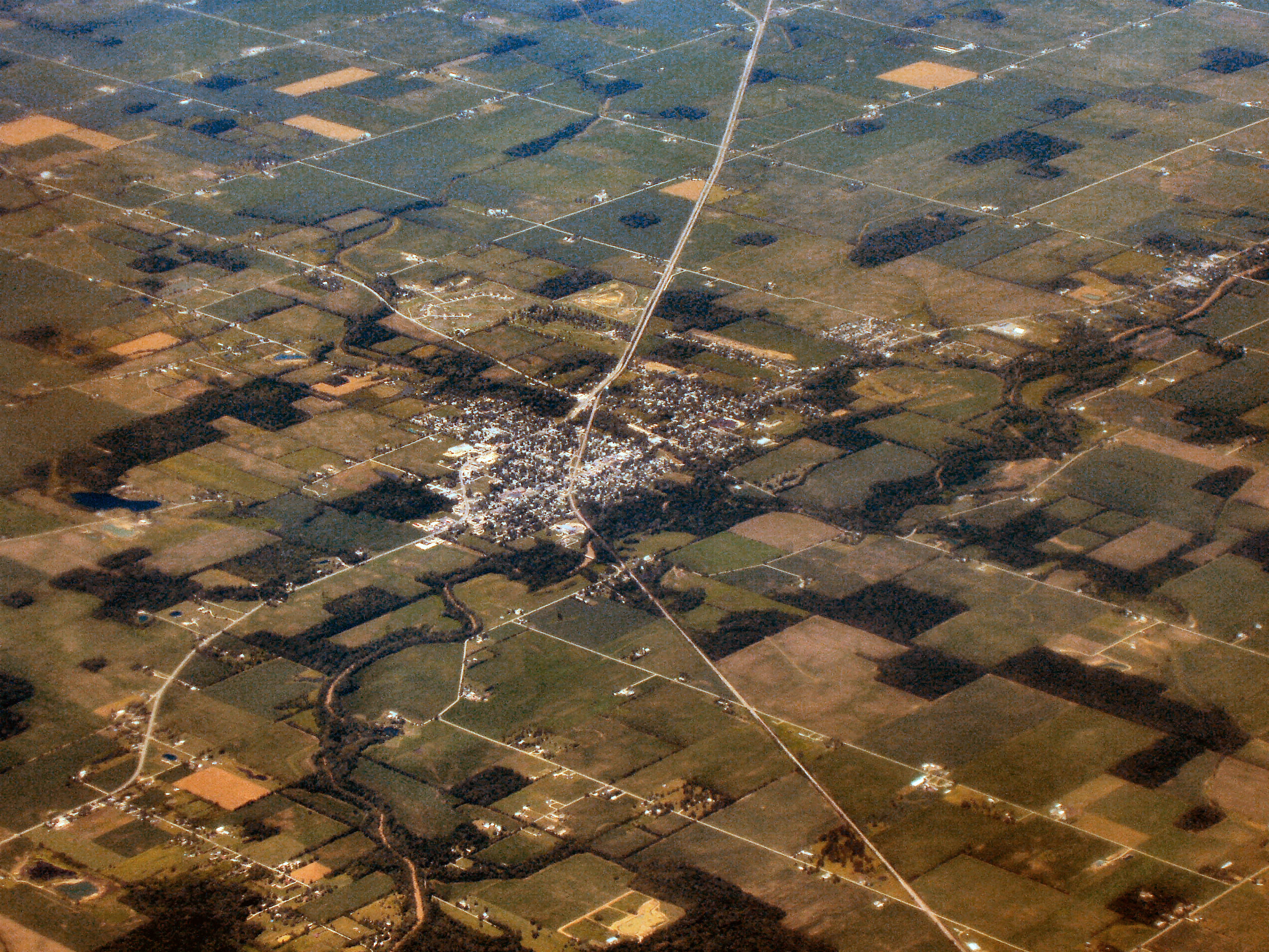
| Town of Albany, Indiana | |
|---|---|
| — Town — | |
 |
|
 |
|
| Coordinates: Coordinates: | |
| Country | United States |
| State | Indiana |
| Counties | Delaware, Randolph |
| Townships | Niles, Delaware |
| Area[1] | |
| • Total | 1.76 sq mi (4.56 km2) |
| • Land | 1.75 sq mi (4.53 km2) |
| • Water | 0.01 sq mi (0.03 km2) |
| Elevation[2] | 909 ft (277 m) |
| Population (2010)[3] | |
| • Total | 2,165 |
| • Estimate (2012)[4] | 2,148 |
| • Density | 1,237.1/sq mi (477.6/km2) |
| Time zone | EST (UTC−5) |
| • Summer (DST) | EST (UTC−5) |
| ZIP code | 47320 |
| Area code | 765 |
| FIPS code[2][5] | 18-00802 |
| GNIS ID[2][5] | 430041 |
Albany is a town in Delaware and Randolph counties in the U.S. state of Indiana, along the Mississinewa River. The population was 2,165 at the 2010 census. It is part of the Muncie, IN Metropolitan Statistical Area.
History[]
Albany was founded in 1833.[6] It was likely named after Albany, New York.[7]
Geography[]
Albany is located at (40.30, -85.24).[8]
According to the 2010 census, the town has a total area of 1.76 square miles (4.6 km2), of which 1.75 square miles (4.5 km2) (or 99.43%) is land and 0.01 square miles (0.026 km2) (or 0.57%) is water.[1]
Demographics[]
2010 census[]
As of the 2010 Census,[3] there were 2,165 people, 924 households, and 602 families residing in the town. The population density was 1,237.1 inhabitants per square mile (477.6 /km2). There were 1,060 housing units at an average density of 605.7 per square mile (233.9 /km2). The racial makeup of the town was 97.2% White, 0.6% African American, 0.2% Asian, 0.3% from other races, and 1.6% from two or more races. Hispanic or Latino of any race were 1.1% of the population.
There were 924 households of which 30.2% had children under the age of 18 living with them, 48.8% were married couples living together, 12.6% had a female householder with no husband present, 3.8% had a male householder with no wife present, and 34.8% were non-families. 30.7% of all households were made up of individuals and 12.9% had someone living alone who was 65 years of age or older. The average household size was 2.34 and the average family size was 2.92.
The median age in the town was 40.3 years. 24.8% of residents were under the age of 18; 7.7% were between the ages of 18 and 24; 24.3% were from 25 to 44; 27.8% were from 45 to 64; and 15.5% were 65 years of age or older. The gender makeup of the town was 47.5% male and 52.5% female.
2000 census[]
As of the 2000 Census,[9] there were 2,368 people, 958 households, and 646 families residing in the town. The population density was 1,434.2 people per square mile (554.1/km²). There were 1,038 housing units at an average density of 628.7 per square mile (242.9/km²). The racial makeup of the town was 98.44% White, 0.42% African American, 0.08% Native American, 0.04% Asian, 0.08% from other races, and 0.93% from two or more races. Hispanic or Latino of any race were 0.13% of the population.
There were 958 households out of which 30.8% had children under the age of 18 living with them, 53.8% were married couples living together, 10.3% had a female householder with no husband present, and 32.5% were non-families. 28.8% of all households were made up of individuals and 13.7% had someone living alone who was 65 years of age or older. The average household size was 2.39 and the average family size was 2.95.
In the town the population was spread out with 24.4% under the age of 18, 7.9% from 18 to 24, 28.2% from 25 to 44, 22.3% from 45 to 64, and 17.3% who were 65 years of age or older. The median age was 38 years. For every 100 females there were 83.4 males. For every 100 females age 18 and over, there were 83.1 males.
The median income for a household in the town was $33,314, and the median income for a family was $40,893. Males had a median income of $33,929 versus $24,286 for females. The per capita income for the town was $16,620. About 4.5% of families and 5.9% of the population were below the poverty line, including 7.9% of those under age 18 and 1.3% of those age 65 or over.
Car shows[]
Each summer Albany plays host to a series of "cruise-in" car show events at the McDonald's on the west side of the city. The events, hosted by the Crown City Cruisers car club from nearby Dunkirk, draw cars from all over the state of Indiana and many from nearby Ohio.
Notable persons[]
- Jim Davis, cartoonist of (Garfield); Davis and his company Paws, Inc. reside in Albany.
- James Grover McDonald (November 29, 1886 -– September 25, 1964), United States diplomat, League of Nations High Commissioner for Refugees Coming from Germany, and first U.S. Ambassador to Israel; Albany was his hometown.
References[]
- ^ a b "Places: Indiana". 2010 Census Gazetteer Files. United States Census Bureau. http://www.census.gov/geo/maps-data/data/docs/gazetteer/2010_place_list_18.txt. Retrieved 2012-04-21.
- ^ a b c "Feature ID 430041". Geographic Names Information System. United States Geological Survey. http://geonames.usgs.gov/apex/f?p=gnispq:3:::NO::P3_FID:430041. Retrieved June 28, 2014.
- ^ a b "American FactFinder". United States Census Bureau. http://factfinder2.census.gov/faces/nav/jsf/pages/index.xhtml. Retrieved 2012-12-11.
- ^ "Population Estimates". United States Census Bureau. http://www.census.gov/popest/data/cities/totals/2012/SUB-EST2012.html. Retrieved 2013-06-25.
- ^ a b "FIPS55 Data: Indiana". FIPS55 Data. United States Geological Survey. February 23, 2006. http://web.archive.org/web/20060618155833/http://geonames.usgs.gov/fips55/INfips55_delim.txt. Retrieved June 28, 2014.
- ^ Kemper, William Harrison (1908). A Twentieth Century History of Delaware County, Indiana, Volume 1. Lewis Publishing Company. pp. 98. http://books.google.com/books?id=Lx4VAAAAYAAJ&pg=PA98#v=onepage&q&f=false.
- ^ Baker, Ronald L. (October 1995). From Needmore to Prosperity: Hoosier Place Names in Folklore and History. Indiana University Press. p. 47. ISBN 978-0-253-32866-3. http://books.google.com/books?id=SXB5AAAAMAAJ. "Apparently the name was borrowed from Albany, New York."
- ^ "US Gazetteer files: 2010, 2000, and 1990". United States Census Bureau. 2011-02-12. http://www.census.gov/geo/www/gazetteer/gazette.html. Retrieved 2011-04-23.
- ^ "American FactFinder". United States Census Bureau. http://factfinder2.census.gov. Retrieved 2008-01-31.
External links[]
| ||||||||||||||||||||
| |||||||||||||||||||||||
| This page uses content from the English language Wikipedia. The original content was at Albany, Indiana. The list of authors can be seen in the page history. As with this Familypedia wiki, the content of Wikipedia is available under the Creative Commons License. |